Koppio South Australia | |||||||||||||||
---|---|---|---|---|---|---|---|---|---|---|---|---|---|---|---|
Coordinates | 34°25′18″S135°50′48″E / 34.4216°S 135.8467°E Coordinates: 34°25′18″S135°50′48″E / 34.4216°S 135.8467°E | ||||||||||||||
Population | 63 (2016 census) [1] | ||||||||||||||
Established | 1998 [2] | ||||||||||||||
Postcode(s) | 5607 [3] | ||||||||||||||
Time zone | ACST (UTC+9:30) | ||||||||||||||
• Summer (DST) | ACST (UTC+10:30) | ||||||||||||||
Location |
| ||||||||||||||
LGA(s) | District Council of Tumby Bay [2] | ||||||||||||||
Region | Eyre Western [4] | ||||||||||||||
County | Flinders [4] | ||||||||||||||
State electorate(s) | Flinders [5] | ||||||||||||||
Federal Division(s) | Grey [6] | ||||||||||||||
| |||||||||||||||
| |||||||||||||||
Footnotes | Locations [3] Adjoining localities [2] |
Koppio is a locality in the Australian state of South Australia located on the Eyre Peninsula about 256 kilometres (159 mi) west of the state capital of Adelaide and about 32 kilometres (20 mi) north of Port Lincoln, [3] and within the Tod River catchment area.[ citation needed ] While long-established agricultural activities dominate (including sheep, cattle and buffalo grazing and wheat cropping)[ citation needed ] the region is also prospective for graphite and iron ore. The Koppio Smithy Museum is a local tourist attraction replete with buildings and artifacts representing the early pioneer heritage of Eyre Peninsula.
South Australia is a state in the southern central part of Australia. It covers some of the most arid parts of the country. With a total land area of 983,482 square kilometres (379,725 sq mi), it is the fourth-largest of Australia's states and territories by area, and fifth largest by population. It has a total of 1.7 million people, and its population is the second most highly centralised in Australia, after Western Australia, with more than 77 percent of South Australians living in the capital, Adelaide, or its environs. Other population centres in the state are relatively small; Mount Gambier, the second largest centre, has a population of 28,684.
The Eyre Peninsula is a triangular peninsula in South Australia. It is bounded on the east by Spencer Gulf, the west by the Great Australian Bight, and the north by the Gawler Ranges.
Adelaide city centre is the innermost locality of Greater Adelaide, the capital city of South Australia. It is known by locals simply as "The City" or "Town" to distinguish it from Greater Adelaide and from the City of Adelaide. The locality is split into two key geographical distinctions: the city "square mile", bordered by North, East, South and West Terraces; and the section of the parklands south of the River Torrens which separates the built up part of the city from the surrounding suburbs and North Adelaide.
![]() | This section needs to be updated. (January 2018) |
Companies actively exploring the area early in the 21st century included Eyre Iron Pty Ltd (a joint venture of Centrex Metals Ltd) and Lincoln Minerals Ltd. [8] [9] Eyre Iron's proposed Fusion Magnetite Project was the most advanced prospective mine development project in the area. Graphite was first mined in the area in 1866. The Koppio Graphite Mine originally operated in the early 1900s and was revisited between 1941 and 1944. [10]
Centrex Metals Limited is an Australia-based resources exploration and mining company. It has interests in Western Australia and South Australia. The company's chairman is notable South Australian engineer and businessman, David Klingberg.
The Koppio Smithy Museum is a 1.0 hectare (2.5 acres) property managed by the National Trust of South Australia [11] which features a collection of early colonial buildings and heritage artifacts collected from across Eyre Peninsula. The entrance is via the old Smithy's cottage, constructed by Tom Brennand after he migrated to the region from Lochiel in 1903. [12] One of the museum's oddities is a replica World War I tank, which was abandoned in the sand dunes of Coffin Bay after its use in the feature film The Lighthorsemen. As of 2014, the museum is open to the public from 10 am until 5 pm Tuesday through Sunday and entry is $10 for adults and $4 for concessions. [13]
Lochiel is a small town in the Mid North of South Australia 125 km north of Adelaide. The town lies beside on the western edge of Lake Bumbunga and at the eastern foot of the Hummocks Range. The Augusta Highway, a section of Highway 1, runs on a strip between the township and the lake, which dwarves the former.
The Lighthorsemen is a 1987 Australian feature film about the men of a World War I light horse unit involved in Sinai and Palestine Campaign's 1917 Battle of Beersheeba. The film is based on a true story and most of the characters in the film were based on real people.
The museum includes the following exhibits: [12]
The Koppio Cemetery contains 36 plots, with the earliest grave dating from 1866. [14]
Koppio is located within the federal Division of Grey, the state electoral district of Flinders and the local government area of the District Council of Tumby Bay. [6] [5] [2]
The Division of Grey is an Australian electoral division in South Australia. The division was one of the seven established when the former Division of South Australia was redistributed on 2 October 1903 and is named for Sir George Grey, who was Governor of South Australia from 1841 to 1845.
Flinders is a single-member electoral district for the South Australian House of Assembly. It is named after explorer Matthew Flinders, who was responsible for charting most of the state's coastline. It is a 58,901 km² coastal rural electorate encompassing the Eyre Peninsula and the coast along the Nullarbor Plain, based in and around the city of Port Lincoln and contains the District Councils of Ceduna, Cleve, Elliston, Lower Eyre Peninsula, Streaky Bay and Wudinna; as well as the localities of Fowlers Bay, Nullarbor and Yalata in the Pastoral Unincorporated Area. The seat was expanded in 2002 to include a western strip of land all the way to the Western Australia border.
The Tumby Bay District Council is a local government area of South Australia covering an area of the North Eastern Eyre Peninsula. It was established in 1906, only six years after the town of Tumby Bay was established, when the district was severed from the former District Council of Lincoln to form the present council.
Thevenard is a port town 3 kilometres (1.9 mi) south-west of Ceduna, South Australia. It is named after nearby Cape Thevenard, which in turn had been named after Antoine-Jean-Marie Thévenard, a French admiral. At the 2006 census, Thevenard had a population of 776.
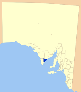
The City of Port Lincoln is a local government area located on the southern tip of the Eyre Peninsula in South Australia. It consists of one suburb - Port Lincoln. It is surrounded on land by the District Council of Lower Eyre Peninsula, which also has offices in Port Lincoln.
Ungarra is a small agricultural based town located on the Eyre Peninsula, in the Australian state of South Australia about 248 kilometres (154 mi) from the state's capital, Adelaide and around 80 kilometres (50 mi) north of Port Lincoln. At the 2006 census, Ungarra had a population of 241.
Karkoo is a small rural centre located 20 km to the north of Cummins in the centre of Eyre Peninsula, South Australia. It is located in an agricultural district where the main economic activities are cereal growing and sheep grazing, and most of the district's small population live on surrounding farms.
Wanilla is a locality in the Australian state of South Australia located on the southern end of Eyre Peninsula about 271 kilometres (168 mi) west of the state capital of Adelaide and about 25 kilometres (16 mi) north-west of the city of Port Lincoln.
Warramboo (wɔrˑræmˑbʉː) is a locality on Eyre Peninsula in the Australian state of South Australia 334 kilometres (208 mi) north-west of the state capital of Adelaide and about 26 kilometres (16 mi) south-east of the municipal seat of Wudinna. It is 189 kilometres (117 mi) north of Port Lincoln on the Tod Highway and is the north-western terminus of the wheat haulage lines radiating from Port Lincoln on the Eyre Peninsula railway. The railway line was built from 1907–1915 to develop the cereal industry. The grain silos are a distinctive local landmark of the town.
The County of Flinders is one of the 49 cadastral counties of South Australia. The county covers the southern part of the Eyre Peninsula “bounded on the north by a line connecting Point Drummond with Cape Burr, and on all other sides by the seacoast, including all islands adjacent to the main land.”
Murdinga is a locality in South Australia located on the Eyre Peninsula about 297 kilometres (185 mi) west of the state capital of Adelaide. The name reportedly stems from an Aboriginal word for "cold".
Campoona is a locality in the Australian state of South Australia located on Eyre Peninsula about 253 kilometres (157 mi) north-west of the state capital of Adelaide and about 18 kilometres (11 mi) north-west of the municipal seat in Cleve. The area is part of the territory of the Parnkalla Aboriginal Australians.
Tooligie is a small town in South Australia on the Eyre Peninsula about 290 kilometres west of the Adelaide city centre and about 84 kilometres north of the city of Port Lincoln.
Whites Flat is a rural locality in the Eyre and Western region of South Australia, situated within the District Council of Lower Eyre Peninsula. The boundaries for the locality were formally established in October 2003 for the long established local name; this had originally been named after pastoralist Samuel White.
Sleaford is a locality in the Australian state of South Australia located at the southern tip of the Eyre Peninsula overlooking the Great Australian Bight about 260 kilometres west of the state capital of Adelaide and about 17 kilometres west of the municipal seat of Port Lincoln.
Lincoln National Park is a locality located on the Jussieu Peninsula at the southern tip of the Eyre Peninsula in the Australian state of South Australia about 250 kilometres west of the state capital of Adelaide and about 13 kilometres south of the city of Port Lincoln.
Tulka is a locality in the Australian state of South Australia located on the southern tip of Eyre Peninsula overlooking the western end of the body of water known as Port Lincoln and which is located 259 kilometres west of the state capital of Adelaide and about 10 kilometres west of the city of Port Lincoln.
Uley is a locality in the Australian state of South Australia located at the southern tip of the Eyre Peninsula overlooking the body of water known as the Great Australian Bight about 273 kilometres (170 mi) west of the state capital of Adelaide and about 22 kilometres (14 mi) west of the city of Port Lincoln.
Kellidie Bay is a locality in the Australian state of South Australia located on the Eyre Peninsula in the state’s west overlooking parts of the body of water known as Coffin Bay about 290 kilometres (180 mi) west of the state capital of Adelaide and about 42 kilometres (26 mi) south-west of the municipal seat of Cummins.
Duck Ponds is a locality in the Australian state of South Australia located on the Eyre Peninsula in the state’s west about 258 kilometres (160 mi) west of the state capital of Adelaide, about 51 kilometres (32 mi) south of the municipal seat of Cummins and about 6 kilometres (3.7 mi) west of the city of Port Lincoln.
Brooker is a locality in the Australian state of South Australia located in the state’s west on Eyre Peninsula about 266 kilometres (165 mi) west of the state capital of Adelaide and about 38 kilometres (24 mi) north-west of the municipal seat in Tumby Bay.