Kunda, Estonia

Last updated
Kunda
Town
Kunda, tovarna.jpg
Kunda, domy v centru.jpg
Kunda 1.jpg
Kunda hydroelectric station.jpg
Kunda, nova tovarna.jpg
From left to right, clockwise: A cement factory, apartment buildings, the ruins of an old cement factory, a pulp mill, a hydroelectric power plant
Scandinavia location map.svg
Red pog.svg
Kunda
Location of Kunda in the Baltic Sea region
Estonia relief map (2005-2017).png
Red pog.svg
Kunda
Location in Estonia
Europe relief laea location map.jpg
Red pog.svg
Kunda
Location in Europe
Coordinates: 59°30′N26°32′E / 59.500°N 26.533°E / 59.500; 26.533
Country Estonia
County Lääne-Viru County
Municipality Viru-Nigula Parish
City statusMay 1, 1938
Area
  Total9.85 km2 (3.80 sq mi)
Population
 (2021) [1]
  Total2,865
  Rank 29th
  Density290/km2 (750/sq mi)
Time zone UTC+2 (EET)
  Summer (DST) UTC+3 (EEST)

Kunda is a town in the Viru-Nigula Parish of Estonia, located on the coast of the Gulf of Finland. Kunda is best known for its cement factory, port, and archaeological heritage. [2]

Contents

History

Evidence of some of the oldest prehistoric communities in Estonia—hunting, and fishing communities that existed around 6500 BC—were found near Kunda. This settlement gave the name to the Kunda culture.

The first written record of Kunda dates back to 1241, when it was mentioned as a village. In 1443 it was mentioned as a manor. [3]

Kunda was granted official borough rights on May 1, 1938.

Demographics

Ethnic composition 1922-2021
Ethnicity 1922 [4] 1934 [5] 1941 [6] 1959 [7] 1970 [8] 1979 [9] 1989 [9] 2000 [10] 2011 [11] 2021 [12]
amount%amount%amount%amount%amount%amount%amount%amount%amount%amount%
Estonians 210291.0172892.8143397.5276873.3340065.1294561.0251349.9228358.6217663.6204368.2
Russians 974.20774.13251.70--144227.6146830.4203740.4127832.8104130.480226.8
Ukrainians --00.00----1182.261342.781663.30--822.40551.84
Belarusians --------951.82921.91831.65--340.99260.87
Finns --90.4820.14--1021.951062.201042.06--371.08260.87
Jews 00.0000.0000.00--30.0620.0420.04--20.0600.00
Latvians --00.0010.07--20.04110.2340.08--50.1550.17
Germans 733.16331.77------40.0870.14--70.2030.10
Tatars --00.00------100.21130.26--10.0330.10
Poles --10.0500.00----140.29130.26--60.1850.17
Lithuanians --00.0000.00--80.1570.14140.28--110.3270.23
unknown10.0400.0030.2000.0000.0000.0000.00120.3110.0330.10
other371.60150.8150.34100826.7561.07350.72811.613268.36190.56210.70
Total2310100186310014691003776100522610048281005037100389910034221002997100.08

International relations

Twin towns — Sister cities

The former municipality of Kunda was twinned with:

Climate

Climate data for Kunda, Estonia (normals 1991–2020, extremes 1849–present)
MonthJanFebMarAprMayJunJulAugSepOctNovDecYear
Record high °C (°F)9.6
(49.3)
11.1
(52.0)
15.8
(60.4)
27.6
(81.7)
33.1
(91.6)
30.9
(87.6)
33.4
(92.1)
34.4
(93.9)
29.0
(84.2)
21.2
(70.2)
13.7
(56.7)
11.8
(53.2)
34.4
(93.9)
Mean daily maximum °C (°F)−1
(30)
−1.2
(29.8)
2.6
(36.7)
8.8
(47.8)
14.7
(58.5)
18.9
(66.0)
21.8
(71.2)
20.9
(69.6)
16.1
(61.0)
9.5
(49.1)
4.0
(39.2)
0.9
(33.6)
9.7
(49.5)
Daily mean °C (°F)−3.3
(26.1)
−4.0
(24.8)
−0.8
(30.6)
4.4
(39.9)
9.8
(49.6)
14.4
(57.9)
17.5
(63.5)
16.5
(61.7)
12.2
(54.0)
6.7
(44.1)
1.9
(35.4)
−1.1
(30.0)
6.2
(43.2)
Mean daily minimum °C (°F)−5.7
(21.7)
−6.7
(19.9)
−4
(25)
0.8
(33.4)
5.3
(41.5)
10.1
(50.2)
13.2
(55.8)
12.4
(54.3)
8.6
(47.5)
4.0
(39.2)
−0.2
(31.6)
−3.2
(26.2)
2.9
(37.2)
Record low °C (°F)−33.1
(−27.6)
−34.9
(−30.8)
−27.7
(−17.9)
−19
(−2)
−5.3
(22.5)
−0.2
(31.6)
2.9
(37.2)
2.7
(36.9)
−3.4
(25.9)
−10.6
(12.9)
−19.7
(−3.5)
−34.9
(−30.8)
−34.9
(−30.8)
Average precipitation mm (inches)38
(1.5)
29
(1.1)
27
(1.1)
29
(1.1)
41
(1.6)
68
(2.7)
61
(2.4)
76
(3.0)
54
(2.1)
61
(2.4)
52
(2.0)
38
(1.5)
573
(22.6)
Average precipitation days (≥ 1.0 mm)96776891111111110105
Average relative humidity (%)87858075727678808183868681
Source: Estonian Weather Service (precipitation days, 1971–2000) [14] [15] [16] [17] [18]

Notable people

Related Research Articles

<span class="mw-page-title-main">Pärnu</span> City in Estonia

Pärnu is the fourth-largest city in Estonia and third in terms of the ethnic Estonian population. Situated in southwest Estonia, Pärnu is located 128 kilometres (80 mi) south of the Estonian capital, Tallinn, and 176 kilometres (109 mi) west of Estonia's second-largest city, Tartu. The city sits off the coast of Pärnu Bay, an inlet of the Gulf of Riga, which is a part of the Baltic Sea. In the city, the Pärnu River drains into the Gulf of Riga.

<span class="mw-page-title-main">Saue</span> Town in Estonia

Saue is a town in north-western Estonia. It's the administrative centre of Saue Parish in Harju County.

<span class="mw-page-title-main">Rapla</span> Town in Estonia

Rapla is a town in central Estonia, the capital of Rapla County and the centre of Rapla Parish.

<span class="mw-page-title-main">Tapa, Estonia</span> Town in Estonia

Tapa is a town in Tapa Parish, Lääne-Viru County, Estonia, located at the junction of the country's Tallinn–Narva (west–east) and Tallinn–Tartu–Valga (north–south) railway lines. It is an important centre of transit for freight as well as rail passengers, a home to soldiers since the 1930s. Tapa also plays an important role in training young men and women in the Estonian Defense Forces, being nearby to Keskpolügoon. The Valgejõgi River passes Tapa on its northeastern side.

<span class="mw-page-title-main">Maardu</span> Town in Estonia

Maardu is a town and a municipality in Harju County, Estonia. It is part of Tallinn metropolitan area, located about 15 kilometres (9.3 mi) east of the capital city. The town covers an area of 22.76 km² and has a population of 16,170.

<span class="mw-page-title-main">Rakvere</span> Town in Estonia

Rakvere is a town in northern Estonia and the administrative centre of the Lääne-Viru maakond (county), 20 km south of the Gulf of Finland of the Baltic Sea. Rakvere is the 8th most populous urban area in Estonia. Rakvere has a total area of 10.75 square kilometres, and although about 15% of Rakvere is covered by forest, it is still the country's third most densely populated urban area. From the 13th century until the early 20th century, Rakvere was more widely known by its historical German name, Wesenberg(h).

<span class="mw-page-title-main">Jõhvi</span> Town in Estonia

Jõhvi is a town in northeastern Estonia, and the administrative seat of Ida-Viru County and Jõhvi Parish. The town is located about 50 km west of the Estonia–Russia international border.

<span class="mw-page-title-main">Keila</span> Town in Estonia

Keila is a town and an urban municipality in Harju County in north-western Estonia, 25 km (16 mi) southwest of Tallinn. Keila is also the location of administrative buildings of the surrounding Keila Parish, a rural municipality separate from the town itself.

<span class="mw-page-title-main">Võru</span> Town in Estonia

Võru is a town and a municipality in south-eastern Estonia. It is the capital of Võru County and the centre of Võru Parish.

<span class="mw-page-title-main">Loksa</span> Town in Estonia

Loksa is a town and municipality in Harju County, Estonia, most known for its shipping industry.

<span class="mw-page-title-main">Kärdla</span> Town in Estonia

Kärdla is the only town on the island of Hiiumaa, Estonia. It is the capital of Hiiu County and the administrative center of Hiiumaa Parish.

<span class="mw-page-title-main">Kallaste</span> Town in Estonia

Kallaste is a town in Peipsiääre Parish, Tartu County, Estonia. It is located on the western shore of Lake Peipus. Most of the population are Russians, 15% being Estonians.

<span class="mw-page-title-main">Jõgeva</span> Town in Estonia

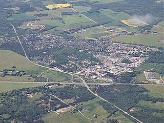
Jõgeva is a small town in Estonia with a population of around 5000 people. It is the capital of Jõgeva Parish and Jõgeva County.

<span class="mw-page-title-main">Paide</span> Town in Estonia

Paide is a town in Estonia and the capital of Järva County, one of the 15 counties of Estonia.

<span class="mw-page-title-main">Põltsamaa</span> Town in Estonia

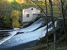
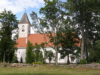
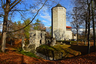
Põltsamaa is a town in Põltsamaa Parish, Jõgeva County, Estonia. The town stands on the Põltsamaa River, and it features a 13th-century castle.

<span class="mw-page-title-main">Türi</span> Town in Estonia

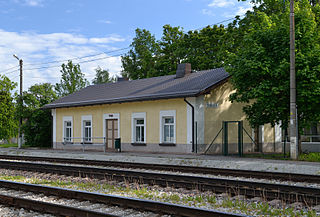
Türi is a town in Järva County, Estonia. It is the administrative centre of Türi Parish. Since 2000, Türi is known as the "spring capital" of Estonia. It has a railway station on the Tallinn - Viljandi railway line operated by Elron.

<span class="mw-page-title-main">Kiviõli</span> Town in Estonia

Kiviõli is an industrial town in Ida-Viru County, Estonia, established in 1922. The main industry in the town is oil shale mining, which gives the town its name.

<span class="mw-page-title-main">Põlva</span> Town in Estonia

Põlva is a town in southeastern Estonia, the capital of Põlva County, and the centre of Põlva Parish.

<span class="mw-page-title-main">Mustvee</span> Town in Estonia

Mustvee is a town in Mustvee Parish, Estonia. It lies on the shore of Lake Peipus in Jõgeva County. Its population of 1,600 is approximately half Estonian and half Russian. The name of Mustvee was first recorded in 1343 at the time of reign of Livonian order. It became a haven for Russian Old Believers after the Russian government declared them outlaws in 1658. Mustvee has held fairs for the past two centuries. Due to its position at the broadest part of the lake, this traditional fishing town is increasingly popular as a tourist centre. The new Harbour of Mustvee was opened 18 December 2014.

<span class="mw-page-title-main">Tamsalu</span> Town in Estonia

Tamsalu is a town in Tapa Parish, Lääne-Viru County, Estonia.

References

  1. "Population by sex, age group and place of residence after the 2017 administrative reform, 1 January". Statistics Estonia. Retrieved 2021-12-26.
  2. Kirss, Odette (1980). Kunda (in Estonian). Tallinn: Eesti Raamat. p. 5.
  3. "Kunda". Eesti Entsüklopeedia. Retrieved 28 January 2022.
  4. 1922 a. üldrahvalugemise andmed. Vihk IV, Viru maakond (tabelid). Eesti riikline statistika (in Estonian and French). Tallinn: Riigi Statistika Keskbüroo. 1924. pp. 12–13. hdl:10062/4451.
  5. Rahvastiku koostis ja korteriolud. 1.III 1934 rahvaloenduse andmed. Vihk II (in Estonian). Tallinn: Riigi Statistika Keskbüroo. 1935. pp. 47–53. hdl:10062/4439.
  6. Eesti Statistika : kuukiri 1942-03/04 (in German and Estonian). Tallinn: Riigi Statistika Keskbüroo. 1942. pp. 66–67.
  7. Katus, Kalev; Puur, Allan; Põldma, Asta; Sakkeus, Luule (1996). Rahvastiku ühtlusarvutatud sündmus- ja loendusstatistika: Lääne-Virumaa 1965-1990. Sari C (in Estonian and English). Tallinn: Eesti Kõrgkoolidevaheline Demouuringute Keskus. pp. 31–32. ISBN   9985-820-21-5.
  8. Население районов, городов и поселков городского типа Эстонской ССР : по данным Всесоюзной переписи населения на 15 января 1970 года (in Russian). Tallinn: Eesti NSV Statistika Keskvalitsus. 1972. p. 78.
  9. 1 2 Eesti Vabariigi maakondade, linnade ja alevite rahvastik: 1989. a. rahvaloenduse andmed: statistikakogumik. 1. osa: Rahvaarv rahvuse, perekonnaseisu, hariduse ja elatusallikate järgi. Tallinn: Statistikaamet. 1990. pp. 30, 35. ISBN   978-9949-71-932-7.
  10. 2000. aasta rahva ja eluruumide loendus (PDF) (in Estonian and English). Tallinn: Statistikaamet. 2001. p. 81. ISBN   9985-74-167-6.
  11. "RL0429: RAHVASTIK RAHVUSE, SOO, VANUSERÜHMA JA ELUKOHA JÄRGI, 31. DETSEMBER 2011". Estonian Statistical Database (in Estonian).
  12. "RL21429: RAHVASTIK RAHVUSE, SOO, VANUSERÜHMA JA ELUKOHA (HALDUSÜKSUS) JÄRGI, 31. DETSEMBER 2021". Estonian Statistical Database (in Estonian).
  13. "International co-operation of Gdynia". Gdynia.pl. Archived from the original on 2016-10-19.
  14. "Climate normals-Temperature". Estonian Weather Service. Retrieved 24 February 2021.
  15. "Climate normals-Precipitation". Estonian Weather Service. Retrieved 24 February 2021.
  16. "Climate normals-Humidity". Estonian Weather Service. Retrieved 24 February 2021.
  17. "Rekordid" (in Estonian). Estonian Weather Service. Retrieved 19 March 2021.
  18. "Kliimanormid-Sademed, õhuniiskus" (in Estonian). Estonian Weather Service. Archived from the original on 22 February 2012. Retrieved 24 February 2021.