Hachinohe is a city located in Aomori Prefecture, Japan. As of 1 August 2023, the city had an estimated population of 216,416 in 110,195 households, and a population density of 708 persons per km², making it Aomori Prefecture's second largest city by population. The city has a total area of 305.56 square kilometres (117.98 sq mi).
Kuji is a city in Iwate Prefecture, Japan. As of 3 March 2020, the city had an estimated population of 34,418 in 15,675 households, and a population density of 55 persons per km2. The total area of the city is 623.50 square kilometres (240.73 sq mi).

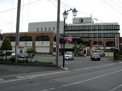
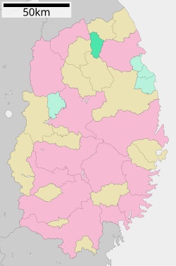
Ninohe is a city located in Iwate Prefecture, Japan. As of 31 March 2020, the city had an estimated population of 26,344, and a population density of 63 persons per km2 in 11,803 households. The total area of the city is 420.42 square kilometres (162.33 sq mi).

Shizukuishi is a town located in Iwate Prefecture, Japan. As of 31 March 2020, the town had an estimated population of 16,263 in 6354 households, and a population density of 27 persons per km². The total area of the town is 608.82 square kilometres (235.07 sq mi).

Kuzumaki is a town located in Iwate Prefecture, Japan. As of 1 January 2020, the town had an estimated population of 5,632, and a population density of 13 persons per km². The total area of the town is 434.96 square kilometres (167.94 sq mi). The town uses many alternative energy sources, producing a surplus of energy, including wind power and biomass.

Iwate is a town located in Iwate Prefecture, Japan. As of 29 February 2020, the town had an estimated population of 13,111, and a population density of 36 persons per km2 in 5455 households. The total area of the town is 360.46 square kilometres (139.17 sq mi).

Shiwa is a town in Iwate Prefecture, Japan. As of 31 March 2020, the town had an estimated population of 33,090, in 12338 households, and a population density of 134 persons per km². The total area of the town is 238.98 square kilometres (92.27 sq mi).

Iwaizumi is a town located in Iwate Prefecture, Japan. As of 31 March 2020, the town had an estimated population of 8,987, and a population density of 9.1 persons per km² in 4366 households. The total area of the town is 992.36 square kilometres (383.15 sq mi).

Tanohata is a village located in Iwate Prefecture, Japan. As of 1 May 2020, the village had an estimated population of 3,244, and a population density of 21 persons per km² in 1,398 households. The total area of the village is 156.19 square kilometres (60.31 sq mi).

Fudai is a village located in Iwate Prefecture, Japan. As of 1 June 2019, the village had an estimated population of 2,607, and a population density of 37.4 persons per km2 in 1,126 households. The total area of the village is 69.66 square kilometres (26.90 sq mi).

Karumai is a town located in Iwate Prefecture, Japan. As of 31 March 2020, the town had an estimated population of 8,895 in 3769 households, and a population density of 36 persons per km². The total area of the town is 245.82 square kilometres (94.91 sq mi).
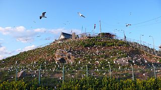
Noda is a village located in Iwate Prefecture, Japan. As of 31 March 2020, the village had an estimated population of 4,201, and a population density of 52 persons per km² in 1660 households. The total area of the village is 80.84 square kilometres (31.21 sq mi).

Kunohe District is a rural district located in Iwate Prefecture, Japan.

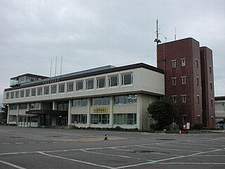
Ichinohe is a town located in Iwate Prefecture, Japan. As of 1 April 2020, the town had an estimated population of 12,053, and a population density of 40 persons per km² in 5645 households. The total area of the town is 300.03 square kilometres (115.84 sq mi).

Ninohe is a rural district located in Iwate Prefecture, Japan.

Takko is a town located in Aomori Prefecture, Japan. As of 31 January 2023, the town had an estimated population of 4,968 in 2097 households and a population density of 21 persons per km2 The total area of the town is 241.98 square kilometres (93.43 sq mi).

Nanbu is a town located in Aomori Prefecture, Japan. As of 1 March 2023, the town had an estimated population of 16,885 in 7466 households, and a population density of 110 persons per km2. The total area of the town is 153.12 square kilometres (59.12 sq mi).

Hashikami is a town located in Aomori Prefecture, Japan. As of 30 April 2022, the town had an estimated population of 13,012 in 6,039 households, and a population density of 140 persons per km2 The total area of the town is 94.01 square kilometres (36.30 sq mi).

Hirono is a town located in Iwate Prefecture, Japan. As of 1 June 2019, the town had an estimated population of 15,398, and a population density of 51 persons per km² in 6,858 households. The total area of the town is 302.92 square kilometres (116.96 sq mi).

Hachimantai is a city located in Iwate Prefecture, Japan. As of 1 April 2020, the city had an estimated population of 25,076, and a population density of 29 persons per km2 in 10,531 households. The total area of the city is 862.30 square kilometres (332.94 sq mi).