
The Faroe Islands is served by an internal transport system based on roads, ferries, and helicopters. As of the 1970s, the majority of the population centres of the Faroe Islands have been joined to a single road network, connected by bridges and tunnels.

Ánir, also Ánirnar is a village in the Faroe Islands on the northern island of Borðoy. In 2007 it had a population of 16, but with the expansion of the area with the new apartments above the old settlement the population has increased to 55 in 2013.
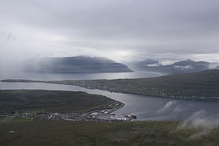
Haraldssund is a settlement in the Faroe Islands, situated on the island of Kunoy.

Klaksvík is the second largest town of the Faroe Islands behind Tórshavn. The town is located on Borðoy, which is one of the northernmost islands. It is the administrative centre of Klaksvík municipality.

Kalsoy is an island in the north-east of the Faroe Islands of Denmark between Eysturoy and Kunoy. The name means man island; by contrast with the parallel island to the east, Kunoy, the name of which means woman island.

Svínoy is an island in the north-east of the Faroe Islands, to the east of Borðoy and Viðoy. It takes its name from Old Norse, Svíney, meaning "Swine Isle". Svinoy also refers to a section of the ocean where North Atlantic water flows into the Norwegian Sea. There is a similarly named island, Swona, in the Orkney Islands.

Fugloy is the easternmost island in the Faroe Islands.
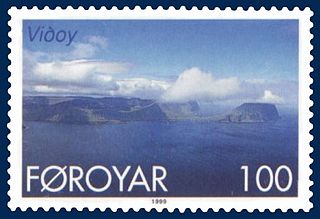
Viðoy is the northernmost island in the Faroe Islands, located east of Borðoy to which it is linked via a causeway. The name means wood island, despite the fact that no trees grow on the island; the name relates to the driftwood that floats in from Siberia and North America.
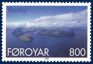
Borðoy is an island in the north-east of the Faroe Islands. Its name means 'headland island'. There are eight settlements: Klaksvík, Norðoyri, Ánir, Árnafjørður, Strond, Norðtoftir, Depil and Norðdepil.

Streymoy is the largest and most populated island of the Faroe Islands. The capital, Tórshavn, is located on its southeast coast. The name means "island of currents". It also refers to the largest region of the country that also includes the islands of Hestur, Koltur and Nólsoy.

Eysturoy is a region and the second-largest of the Faroe Islands, both in size and population.
Strond is a former village in the north of the town of Klaksvík on the sound of Haraldssund in the Faroe Islands.

The six islands in the northeast of the Faroe Islands are together referred to as Norðoyar, i.e. the Northern Isles. These Islands from west to east are Kalsoy, Kunoy, Borðoy, Viðoy, Svínoy and Fugloy. Klaksvík is the biggest settlement of the region. Norðoyar is sometimes spelled Norðoyggjar.

Viðareiði is the northernmost settlement in the Faroe Islands and lies on the Island of Viðoy, which belongs to the Norðoyar Region.

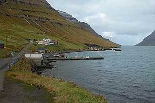
Norðdepil is a town on the east coast of the island of Borðoy in the Norðoyar Region of the Faroe Islands.

Skarð is an abandoned village on the east coast of the island of Kunoy in the Norðoyar region of the Faroes. Skarð means mountain pass.

The fauna of the Faroe Islands is characterized by the remote location of the islands in the North Atlantic Ocean. There are few terrestrial species, but an abundance of breeding seabirds and marine animals. Some subspecies and breeds are endemic. All land mammals were introduced by humans.
Norðtoftir is a small settlement on the Faroese island of Borðoy in the Hvannasund municipality. The 2023 population was 3. Its postal code is FO 736.

Anna Suffía Rasmussen, was a Faroese educator.
The Faroe Islands consist of 18 islands, several of which are deeply incised by fjords.


