
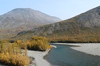
The Verkhoyansk Range is a mountain range in the Sakha Republic, Russia near the settlement of Verkhoyansk, well-known for its frigid climate. It is part of the East Siberian Mountains.

The Aldan is the second-longest right tributary of the Lena in the Sakha Republic in eastern Siberia. The river is 2,273 kilometres (1,412 mi) long, of which around 1,600 kilometres (990 mi) is navigable. It has a drainage basin of 729,000 square kilometres (281,000 sq mi).

Suntar-Khayata Range is a granite mountain range rising along the border of the Sakha Republic in the north with Amur Oblast and Khabarovsk Krai in the south.

The Allakh-Yun is a river in Sakha Republic and Khabarovsk Krai, Russia. It is a right tributary of the Aldan. It is 586 kilometres (364 mi) long, and has a drainage basin of 24,200 square kilometres (9,300 sq mi).

The Yudoma-Maya Highlands are a mountainous area in the Sakha Republic and Khabarovsk Krai, Far Eastern Federal District, Russia.

The Sette-Daban is a range of mountains in far North-eastern Russia. Administratively the range belongs partly to the Sakha Republic and partly to the Khabarovsk Krai of the Russian Federation. The area of the Sette-Daban is largely uninhabited. The R504 Kolyma Highway passes through the northern part of the range.

The South Siberian Mountains are one of the largest mountain systems of the Russian Federation. The total area of the system of mountain ranges is more than 1.5 million km². The South Siberian Mountains are located in the Siberian and Far Eastern Federal Districts of Russia, as well as partly in Mongolia. The territory of the mountain system is one of the Great Russian Regions.

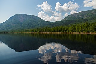
The East Siberian Mountains or East Siberian Highlands are one of the largest mountain systems of the Russian Federation. They are located between the Central Yakutian Lowland and the Bering Strait in Northeast Siberia. The area of the East Siberian Mountains has a very low population density. The territory of the mountain system is one of the Great Russian Regions.

The Tompo is a river in the Sakha Republic (Yakutia), Russia, a right tributary of the Aldan, part of the Lena basin. It has a length of 570 kilometres (350 mi) and a drainage basin area of 42,700 square kilometres (16,500 sq mi).
The Skalisty Range is a range of mountains in far North-eastern Russia, part of the East Siberian System. Administratively the mountain chain belongs to the Sakha Republic. The area of the range is remote and desolate. The R504 Kolyma Highway passes through the northern part of the range.
The Ulakhan-Bom is a range of mountains in far North-eastern Russia, a southern prolongation of the Verkhoyansk Range, part of the East Siberian System. Administratively the mountain chain belongs to the Sakha Republic.

The Dzhardzhan Range is a range of mountains in far North-eastern Russia. Administratively the range is part of the Sakha Republic, Russian Federation.

The Sunnagyn Range, also known as Aldan-Uchur, is a range of mountains in North-eastern Russia. Administratively the range is part of the Sakha Republic, Russian Federation.

The Timpton is a river in Sakha Republic (Yakutia), Russia. It is a right tributary of the Aldan River of the Lena basin. It has a length of 644 kilometres (400 mi) and a drainage basin area of 44,400 square kilometres (17,100 sq mi). There are no settlements near its banks except for Nagorny village.

The Khanda, also known as Belaya, is a river in the Sakha Republic (Yakutia), Russia, a right tributary of the Aldan, part of the Lena basin.

The Tyry is a river in the Sakha Republic (Yakutia), Russia, a right tributary of the Aldan, part of the Lena basin. It has a length of 327 kilometres (203 mi), a drainage basin area of 14,000 square kilometres (5,400 sq mi) and is the 8th longest tributary of the Aldan.
The Toko-Stanovik is a range of mountains in the Russian Far East. Administratively it belongs partly to Amur Oblast, the Sakha Republic (Yakutia) and Khabarovsk Krai of the Russian Federation.

The Olyokma-Chara Plateau is a mountainous area in the Sakha Republic and Irkutsk Oblast, Far Eastern Federal District, Russia. A small section is in Kalarsky District, northernmost Zabaykalsky Krai.

The Nuora is a river in the Sakha Republic (Yakutia), Russia, a right tributary of the Tumara, of the Aldan basin, part of the Lena basin. It has a length of 110 kilometres (68 mi) and a drainage basin area of 3,120 square kilometres (1,200 sq mi).
The Eastern Khandyga is a river in Tompo District, Yakutia, Russian Federation, a right tributary of the Aldan, part of the Lena basin. It has a length of 290 kilometres (180 mi) and a drainage basin area of 9,950 square kilometres (3,840 sq mi).


