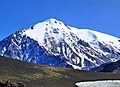
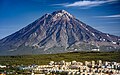
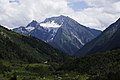
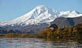
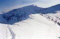
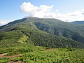
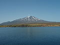
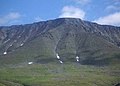
Peak Russian name Elevation Prominence Isolation Coordinates Range or Landform Federal subject Image Notes Zheltovsky [ 124] Желтовский m ft m ft km mi 51°34′36″N 157°19′42″E / 51.57667°N 157.32833°E / 51.57667; 157.32833 (Zheltovsky ) Eastern Ridge Kamchatka Peninsula Kamchatka Krai Stratovolcano Sietinden High Point [ 125] Сиетиндэнский Высокая точка m ft 69°26′19″N 129°28′12″E / 69.43861°N 129.47000°E / 69.43861; 129.47000 (Sietinden HP ) Sietinden Verkhoyansk Range Sakha Republic Highest of the Sietinden Range Nelgesin High Point [ 126] Нельгесинский Высокая точка m ft 65°59′21″N 135°51′58″E / 65.98917°N 135.86611°E / 65.98917; 135.86611 (Nelgesin HP ) Nelgesin Range Yana-Oymyakon Highlands Chersky Range Sakha Republic Highest of the Nelgesin Range Anik [ 127] Аник m ft m ft km mi 47°15′36″N 137°01′19″E / 47.26000°N 137.02194°E / 47.26000; 137.02194 (Anik ) Sikhote-Alin Khabarovsk Krai Primorsky Krai Highest peak of Primorsky Krai Golets Kropotkin [ 128] Голец Кропоткина m ft m ft km mi 53°43′37″N 117°33′30″E / 53.72694°N 117.55833°E / 53.72694; 117.55833 (Golets Kropotkina ) Muroy Range [ ru ] Olyokma-Stanovik Zabaykalsky Krai Olyokma-Stanovik Highlands HP Narodnaya [ 129] Народная m ft m ft km mi 65°02′10″N 60°06′45″E / 65.03611°N 60.11250°E / 65.03611; 60.11250 (Narodnaya ) Research Range Ural Mountains Khanty-Mansi Autonomous Okrug Komi Republic Highest peak of the Ural Mountains Iskhodnaya [ 130] Исходная m ft m ft km mi 67°48′59″N 178°17′19″E / 67.81639°N 178.28861°E / 67.81639; 178.28861 (Iskhodnaya ) Chantal Range Chukotka Mountains Chukotka Autonomous Okrug Highest peak of the Chukotka Mountains Gora Konus [ Wikidata ] [ 131] Гора Конус m ft m ft km mi 57°31′57″N 131°48′57″E / 57.53250°N 131.81583°E / 57.53250; 131.81583 (Gora Konus ) Khabarovsk Krai Oblachnaya [ ru ] [ 132] Облачная m ft m ft km mi 43°41′45″N 134°11′57″E / 43.69583°N 134.19917°E / 43.69583; 134.19917 (Oblachnaya ) Sikhote-Alin Primorsky Krai Second highest point in Primorsky Krai Chikurachki [ 133] Чикурачки m ft m ft km mi 50°19′24″N 155°27′39″E / 50.32333°N 155.46083°E / 50.32333; 155.46083 (Chikurachki ) Paramushir Kuril Islands Sakhalin Oblast Highest peak of Paramushir Oloy Range HP [ 134] Олойский Высокая точка m ft m ft km mi 66°01′30″N 163°14′12″E / 66.02500°N 163.23667°E / 66.02500; 163.23667 (Oloy HP ) Oloy Range Kolyma Highlands Chukotka Autonomous Okrug Highest peak of the Oloy Range Gora Dvukh Tsirkov [ 135] гора Двух Цирков m ft 67°30′58″N 168°07′15″E / 67.51611°N 168.12083°E / 67.51611; 168.12083 (Dvukh Tsirkov ) Ilirney Range Anadyr Highlands Chukotka Autonomous Okrug Highest peak of the Anadyr Highlands Pik Blokhin [ 136] Пик Блохина m ft m ft km mi 67°06′06″N 166°51′38″E / 67.10167°N 166.86056°E / 67.10167; 166.86056 (Pik Blokhin ) Anyuy Mountains East Siberian Mountains Chukotka Autonomous Okrug Highest peak of the Anyuy Mountains Fussa [ 137] Фусса m ft m ft km mi 50°16′03″N 155°14′51″E / 50.26750°N 155.24750°E / 50.26750; 155.24750 (Fussa ) Paramushir Kuril Islands Sakhalin Oblast Tyatya [ 138] Тятя m ft m ft km mi 44°21′12″N 146°15′23″E / 44.35333°N 146.25639°E / 44.35333; 146.25639 (Tyatya ) Kunashir Island Kuril Islands Sakhalin Oblast Highest peak of Kunashir Island Pik Sovetskoy Gvardii [ 139] Пик Советской Гвардии m ft m ft km mi 66°49′58″N 166°36′20″E / 66.83278°N 166.60556°E / 66.83278; 166.60556 (Pik Sovetskoy Gvardii ) Anyuy Mountains Chukotka Autonomous Okrug Second highest peak of the Anyuy Mountains Tryokhgolovy Golets [ 140] [ 141] Трёхголовый Голец 1,728 metres (5,669 ft) 53°51′54″N 107°52′29″E / 53.86500°N 107.87472°E / 53.86500; 107.87472 (Tryokhgolovy Golets ) Primorsky Range Irkutsk Oblast Highest in Primorsky Range Kontalaksky Golets [ 142] [ 141] Конталакский Голец 1,706 metres (5,597 ft) 53°54′47″N 115°41′35″E / 53.91306°N 115.69306°E / 53.91306; 115.69306 (Tryokhgolovy Golets ) Yablonoi Mountains Zabaykalsky Krai Highest in Yablonoi Mountains Kamen [ 143] Камень m ft m ft km mi 69°07′52″N 95°04′02″E / 69.13111°N 95.06722°E / 69.13111; 95.06722 (Kamen ) Putorana Central Siberian Plateau Krasnoyarsk Krai Highest peak of the Putorana and the Central Siberian Plateau Alkhanay [ ru ] [ 144] Алханай m ft m ft km mi 50°52′31″N 113°22′33″E / 50.87528°N 113.37583°E / 50.87528; 113.37583 (Alkhanay ) Mogoytuysky Range [ ru ] Zabaykalsky Krai Manaraga [ 145] Манарага m ft m ft km mi 65°02′52″N 59°45′46″E / 65.04778°N 59.76278°E / 65.04778; 59.76278 (Manaraga ) Subarctic Ural [ ru ] Ural Mountains Komi Republic Golets Chingikhan [ 146] [ 147] Голец Чингикан 1,644 metres (5,394 ft) 52°46′43″N 114°29′14″E / 52.77861°N 114.48722°E / 52.77861; 114.48722 (Golets Chingikhan ) Chersky Range (Transbaikalia) Zabaykalsky Krai Highest in Chesrky Range (TB) Yamantau [ 148] Ямантау m ft m ft km mi 54°15′18″N 58°06′17″E / 54.25500°N 58.10472°E / 54.25500; 58.10472 (Yamantau ) Southern Ural Ural Mountains Bashkortostan Highest peak in the Southern Ural Stokap [ ru ] [ 149] Стокап m ft m ft km mi 44°50′15″N 147°20′33″E / 44.83750°N 147.34250°E / 44.83750; 147.34250 (Stokap ) Bogatyr Ridge Iturup Kuril Islands Sakhalin Oblast Highest peak of Iturup Arga Ynnakh Khaya [ 150] Арга Ыннах Хая 1,622 metres (5,322 ft) 67°25′N 134°52′E / 67.417°N 134.867°E / 67.417; 134.867 (Arga Ynnakh Khaya ) Chersky Range Yakutia "Mother Mountain", important in Yakut culture Lopatina [ ru ] [ 151] Лопатина m ft m ft km mi 50°51′06″N 143°08′30″E / 50.85167°N 143.14167°E / 50.85167; 143.14167 (Lopatina ) Sakhalin Sakhalin Oblast Highest peak of Sakhalin Bogdan Khmelnitskiy [ ru ] [ 152] Богдан Хмельницкий m ft m ft km mi 45°20′15″N 147°55′13″E / 45.33750°N 147.92028°E / 45.33750; 147.92028 (Bogdan Khmelnitskiy ) Chirip Peninsula [ ru ] Iturup Kuril Islands Sakhalin Oblast Volcano Bolshoy Iremel [ 153] Большой Иремель m ft m ft km mi 54°31′13″N 58°50′33″E / 54.52028°N 58.84250°E / 54.52028; 58.84250 (Bolshoy Iremel ) Southern Ural Ural Mountains Bashkortostan Mustag [ ru ] [ 154] Мустаг m ft m ft km mi 53°00′35″N 87°57′47″E / 53.00972°N 87.96306°E / 53.00972; 87.96306 (Mustag ) Gornaya Shoriya Kemerovo Oblast Nevsky [ 155] Невский m ft m ft km mi 62°13′0″N 155°25′0″E / 62.21667°N 155.41667°E / 62.21667; 155.41667 (Nevskaya ) Omsukchan Range Kolyma Mountains Magadan Oblast Highest peak of the Kolyma Mountains Chirip [ 156] Чирип m ft m ft km mi 45°22′38″N 147°54′44″E / 45.37722°N 147.91222°E / 45.37722; 147.91222 (Chirip ) Chirip Peninsula [ ru ] Iturup Kuril Islands Sakhalin Oblast Volcano Konzhakovskiy Kamen [ 157] Конжаковский Камень m ft m ft km mi 59°37′54″N 59°08′06″E / 59.63167°N 59.13500°E / 59.63167; 59.13500 (Konzhakovskiy Kamen ) Northern Ural [ ru ] Ural Mountains Sverdlovsk Oblast Anyuyskiy [ 158] Анюйский 1,560 metres (5,120 ft) 67°05′44″N 165°18′54″E / 67.09556°N 165.31500°E / 67.09556; 165.31500 (Anyuyskiy ) Anyuy Mountains East Siberian Mountains Chukotka Autonomous Okrug Volcano Skalistaya [ 159] Скалистая m ft m ft km mi 59°04′03″N 151°31′54″E / 59.06750°N 151.53167°E / 59.06750; 151.53167 (Skalistaya ) Koni Peninsula Magadan Oblast Highest point of the Koni Peninsula Krusenstern [ 160] Крузенштерна m ft m ft km mi 75°10′38″N 58°26′12″E / 75.17722°N 58.43667°E / 75.17722; 58.43667 (Krusenstern ) Severny Island Novaya Zemlya Arkhangelsk Oblast Highest point of Severny Island and Novaya Zemlya Roman-Kosh [ 161] Роман-Кош m ft m ft km mi 44°36′47″N 34°14′36″E / 44.61306°N 34.24333°E / 44.61306; 34.24333 (Roman-Kosh ) Babugan Yayla [ ru ] Crimean Mountains Republic of Crimea [ g] Milna [ 162] Мильна m ft m ft km mi 46°48′53″N 151°47′12″E / 46.81472°N 151.78667°E / 46.81472; 151.78667 (Milna ) Simushir Kuril Islands Sakhalin Oblast Somma volcano Tatarinov [ ru ] [ 163] Татаринов m ft m ft km mi 50°18′20″N 155°27′18″E / 50.30556°N 155.45500°E / 50.30556; 155.45500 (Tatarinov ) Paramushir Kuril Islands Sakhalin Oblast Volcano Gora Belaya Gora [ Wikidata ] [ 164] Гора Белая Гора m ft m ft km mi 52°29′37″N 137°43′24″E / 52.49361°N 137.72333°E / 52.49361; 137.72333 (Gora Belaya Gora ) Khabarovsk Krai Kosvinsky Kamen [ 165] Косвинский камень m ft m ft km mi 59°30′58″N 59°03′41″E / 59.51611°N 59.06139°E / 59.51611; 59.06139 (Kosvinsky Kamen ) Northern Ural [ ru ] Ural Mountains Sverdlovsk Oblast Karymsky [ 166] Карымский m ft m ft km mi 54°02′52″N 159°26′32″E / 54.04778°N 159.44222°E / 54.04778; 159.44222 (Karymsky ) Kamchatka Peninsula Kamchatka Krai Most active volcano on the Kamchatka Peninsula Namai [ 167] Намай m ft 55°29′58.45″N 106°42′12.64″E / 55.4995694°N 106.7035111°E / 55.4995694; 106.7035111 (Namai ) Lena-Angara Plateau Irkutsk Oblast Highest in the Lena-Angara Plateau Payer [ ru ] [ 168] Пайер m ft m ft km mi 66°43′15″N 64°23′30″E / 66.72083°N 64.39167°E / 66.72083; 64.39167 (Payer ) Polar Ural Ural Mountains Yamalo-Nenets Autonomous Okrug Highest peak of the Polar Urals Ichigem Range HP [ 169] Ичигемский Высокая точка m ft m ft 63°18′31″N 165°33′54″E / 63.30861°N 165.56500°E / 63.30861; 165.56500 (Ichigem HP ) Ichigem Range , Koryak Highlands Kamchatka Krai Highest in the Ichigem Range Murun [ 170] Мурун m ft m ft 58°22′32″N 118°55′30″E / 58.37556°N 118.92500°E / 58.37556; 118.92500 (Murun ) Murun Massif Sakha Republic Highest in the Olyokma-Chara Plateau Maly Iremel [ 171] Малый Иремель m ft m ft km mi 54°33′10″N 58°53′50″E / 54.55278°N 58.89722°E / 54.55278; 58.89722 (Payer ) Southern Ural Ural Mountains Bashkortostan Sarychev [ 172] Вулкан Сарычев m ft m ft km mi 48°05′26″N 153°12′05″E / 48.09056°N 153.20139°E / 48.09056; 153.20139 (Sarychev ) Matua Kuril Islands Sakhalin Oblast Highest point of Matua Island Mount Studencheskaya [ 173] Гора Студенческая m ft m ft 49°15′16″N 132°18′28″E / 49.25444°N 132.30778°E / 49.25444; 132.30778 (Mount Studencheskaya ) Bureya Range Jewish Autonomous Oblast Highest point of the Jewish Autonomous Oblast Gora Ivao [ Wikidata ] [ 174] Гора Ивао m ft m ft km mi 45°45′18″N 149°40′16″E / 45.75500°N 149.67111°E / 45.75500; 149.67111 (Gora Ivao ) Ivao Group Urup Kuril Islands Sakhalin Oblast Highest peak of the Ivao Group Kyrganay High Point [ 175] Кырганайский Высокая точка m ft 67°55′N 167°0′E / 67.917°N 167.000°E / 67.917; 167.000 (Kyrganay ) Kyrganay Range Anadyr Highlands Chukotka Autonomous Okrug Highest of the Kyrganay Range Bolshoy Nurgush [ 176] Большой Нургуш m ft m ft 54°49′11″N 59°08′57″E / 54.81972°N 59.14917°E / 54.81972; 59.14917 (Nurgush ) Nurgush Southern Urals Chelyabinsk Oblast Highest point of Chelyabinsk Oblast Beshtau [ 177] Бештау m ft m ft km mi 44°05′53″N 43°01′20″E / 44.09806°N 43.02222°E / 44.09806; 43.02222 (Beshtau ) Pyatigorye Mountains [ ru ] Stavropol Krai Highest peak of the Pyatigorye Mountains. Prevo [ 178] Прево́ m ft m ft km mi 47°00′41″N 152°06′59″E / 47.01139°N 152.11639°E / 47.01139; 152.11639 (Prevo ) Simushir Kuril Islands Sakhalin Oblast Karpinsky [ 179] Карпинского m ft m ft km mi 50°08′52″N 155°22′22″E / 50.14778°N 155.37278°E / 50.14778; 155.37278 (Karpinsky ) Paramushir Kuril Islands Sakhalin Oblast Volcano Krenitsyn [ ru ] [ 180] Креницын m ft m ft km mi 49°21′08″N 154°42′32″E / 49.35222°N 154.70889°E / 49.35222; 154.70889 (Krenitsyn ) Tao-Rusyr Caldera Onekotan Kuril Islands Sakhalin Oblast Caldera Gora Zhima [ Wikidata ] [ 181] Гора Жима m ft m ft km mi 53°14′13″N 107°42′41″E / 53.23694°N 107.71139°E / 53.23694; 107.71139 (Gora Zhima ) Olkhon Island Academician Ridge Irkutsk Oblast Kharnaurdy-Keu [ ru ] [ 182] Харнаурды-Кеу m ft m ft km mi 67°34′27″N 65°59′12″E / 67.57417°N 65.98667°E / 67.57417; 65.98667 (Kharnaurdy-Keu ) Polar Ural Ural Mountains Yamalo-Nenets Autonomous Okrug Gora Pallasa [ ru ] [ 183] Гора Палласа m ft m ft km mi 52°07′17″N 113°01′42″E / 52.12139°N 113.02833°E / 52.12139; 113.02833 (Gora Pallasa ) Yablonoi Mountains Zabaykalsky Krai Ai-Petri [ 184] Ай-Петри m ft m ft km mi 44°27′04″N 34°03′10″E / 44.45111°N 34.05278°E / 44.45111; 34.05278 (Ai-Petri ) Crimean Mountains Republic of Crimea [ g] Berutarube [ 185] Берутарубе m ft m ft km mi 44°28′30″N 146°55′38″E / 44.47500°N 146.92722°E / 44.47500; 146.92722 (Berutarube ) Iturup Kuril Islands Sakhalin Oblast Stratovolcano Atsonupuri [ 186] Атсонупури m ft m ft km mi 44°48′26″N 147°07′39″E / 44.80722°N 147.12750°E / 44.80722; 147.12750 (Atsonupuri ) Iturup Kuril Islands Sakhalin Oblast Stratovolcano Demon [ 187] Демон m ft m ft km mi 45°30′38″N 148°52′08″E / 45.51056°N 148.86889°E / 45.51056; 148.86889 (Demon ) Iturup Kuril Islands Sakhalin Oblast Stratovolcano Yudychvumchorr [ 188] Юдычвумчорр m ft m ft km mi 67°43′07″N 33°26′02″E / 67.71861°N 33.43389°E / 67.71861; 33.43389 (Yudychvumchorr ) Khibiny Mountains Kola Peninsula Murmansk Oblast Highest point of the Khibiny Mountains Dzhutsa Vtoraya [ ru ] [ 189] Джуца Вторая m ft m ft km mi 43°55′28″N 42°59′10″E / 43.92444°N 42.98611°E / 43.92444; 42.98611 (Dzhutsa Vtoraya ) Pyatigorye Mountains [ ru ] Stavropol Krai Second highest peak of the Pyatigorye Mountains Mount Shchuchya [ 190] гора щучья m ft 67°37′25″N 170°08′40″E / 67.62361°N 170.14444°E / 67.62361; 170.14444 (Shchuchya ) Shchuchy Range Anadyr Highlands Chukotka Autonomous Okrug Highest of the Shchuchy Range Ekarma [ ru ] [ 191] Экарма m ft m ft km mi 48°56′51″N 153°56′31″E / 48.94750°N 153.94194°E / 48.94750; 153.94194 (Ekarma ) Ekarma Kuril Islands Sakhalin Oblast Highest point on Ekarma Island Ebeko [ 192] Эбеко m ft m ft km mi 50°41′20″N 156°00′54″E / 50.68889°N 156.01500°E / 50.68889; 156.01500 (Ebeko ) Paramushir Kuril Islands Sakhalin Oblast Somma volcano Severgin [ ru ] [ 193] Севергин m ft m ft km mi 49°07′05″N 154°31′10″E / 49.11806°N 154.51944°E / 49.11806; 154.51944 (Severgin ) Kharimkotan Kuril Islands Sakhalin Oblast Highest point of Kharimkotan Kukisvumchorr [ 194] Кукисвумчорр m ft m ft km mi 67°41′44″N 33°43′14″E / 67.69556°N 33.72056°E / 67.69556; 33.72056 (Kukisvumchorr ) Khibiny Mountains Kola Peninsula Murmansk Oblast Baransky [ 195] Баранский m ft m ft km mi 45°06′12″N 148°00′56″E / 45.10333°N 148.01556°E / 45.10333; 148.01556 (Baransky ) Grozny Group Iturup Kuril Islands Sakhalin Oblast Stratovolcano Gora Chubukulakh [ 196] Гора Чубукулах m ft 66°25′22″N 153°42′02″E / 66.42278°N 153.70056°E / 66.42278; 153.70056 (Chubukulakh ) Chubukulakh Range Yukaghir Highlands Sakha Republic Highest of the Yukaghir Highlands Taymyr High Point [ 197] Таймыр Высокая точка m ft m ft km mi 75°21′40″N 110°36′48″E / 75.36111°N 110.61333°E / 75.36111; 110.61333 (Tamyr High Point ) Byrranga Mountains Taymyr Peninsula Krasnoyarsk Krai Highest peak of the Byrranga Mountains Medvezhya [ 198] Медве́жий m ft m ft km mi 45°23′13″N 148°50′35″E / 45.38694°N 148.84306°E / 45.38694; 148.84306 (Medvezhya ) Iturup Kuril Islands Sakhalin Oblast Complex volcano Angvundaschorr [ 199] Ангвундасчорр m ft m ft km mi 67°49′52″N 34°31′40″E / 67.83111°N 34.52778°E / 67.83111; 34.52778 (Angvundaschorr ) Lovozero Massif Kola Peninsula Murmansk Oblast Oslyanka [ 200] Ослянка m ft m ft km mi 59°09′49″N 58°33′06″E / 59.16361°N 58.55167°E / 59.16361; 58.55167 (Oslyanka ) Basegi Range Middle Ural [ ru ] Ural Mountains Perm Krai Highest point of the Middle Ural Medvezhy Logovo [ 201] Гора Медвежье Логово m ft 69°51′31″N 171°16′34″E / 69.85861°N 171.27611°E / 69.85861; 171.27611 (Iskhodnaya ) Shelag Range Chukotka Mountains Chukotka Autonomous Okrug Highest peak of the Shelag Range Yenashimskiy Polkan [ Wikidata ] [ 202] Енашимский Полкан m ft m ft km mi 59°49′30″N 92°51′15″E / 59.82500°N 92.85417°E / 59.82500; 92.85417 (Yenashimskiy Polkan ) Yenisey Range Central Siberian Plateau Krasnoyarsk Krai Highest peak of Yenisey Range Holatchahl [ 203] Холатчахль m ft m ft km mi 61°45′18″N 59°25′21″E / 61.75500°N 59.42250°E / 61.75500; 59.42250 (Holatchahl ) Ural Mountains Komi Republic Sverdlovsk Oblast Dyatlov Pass incident Gora Sovetskaya [ 204] Советская Гора m ft m ft 71°05′49″N 179°21′24″W / 71.09694°N 179.35667°W / 71.09694; -179.35667 (Gora Sovetskaya ) Wrangel Island Chukotka Autonomous Okrug Highest point in Wrangel Island Ymiysky Range HP [ 125] Ымыйский кряж Высокая точка 1,045 metres (3,428 ft) 68°31′30″N 137°14′40″E / 68.52500°N 137.24444°E / 68.52500; 137.24444 (Nakson ) Ymiysky Range ,Chersky Range Sakha Republic Highest peak of the Ymiysky Range Nakson [ 205] Наксон 1,035 metres (3,396 ft) 65°46′0″N 95°37′0″E / 65.76667°N 95.61667°E / 65.76667; 95.61667 (Nakson ) Syverma ,Central Siberian Plateau Krasnoyarsk Krai Highest peak of the Syverma Plateau Nemo [ 206] Немо m ft m ft km mi 49°33′49″N 154°48′51″E / 49.56361°N 154.81417°E / 49.56361; 154.81417 (Nemo ) Onekotan Kuril Islands Sakhalin Oblast Stratovolcano 


