L'Erable, Illinois | |
|---|---|
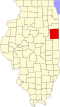
 Iroquois County's location in Illinois | |
 L'Erable L'Erable's location in Iroquois County | |
| Coordinates: 40°54′12″N87°50′49″W / 40.90333°N 87.84694°W | |
| Country | |
| State | |
| County | Iroquois County |
| Township | Ashkum Township |
| Elevation | 627 ft (191 m) |
| Time zone | UTC-6 (Central (CST)) |
| • Summer (DST) | UTC-5 (CDT) |
| ZIP code | 60927 |
| GNIS feature ID | 0411634 [1] |
L'Erable is an unincorporated community in Ashkum Township, Iroquois County, Illinois, United States.