
Vosges is an eastern department of France named after the Vosges mountain range. It consists of 17 cantons and 507 communes, of which 234 are rural, including the commune of Domrémy-la-Pucelle, where Joan of Arc was born.
The Vosges are a range of low mountains in Eastern France, near its border with Germany. Together with the Palatine Forest to the north on the German side of the border, they form a single geomorphological unit and low mountain range of around 8,000 km2 (3,100 sq mi) in area. It runs in a north-northeast direction from the Burgundian Gate to the Börrstadt Basin, and forms the western boundary of the Upper Rhine Plain.
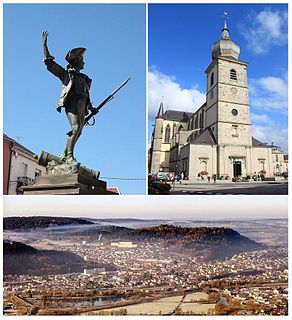
Remiremont is a town and commune in the Vosges department of northeastern France, situated in southern Grand Est. The town has been an abbatial centre since the 7th century, is an economic crossroads of the Moselle and Moselotte valleys, and is also a stepping stone for tourists wishing to explore the Vosges and neighbouring Alsace. Remiremont has got a police station, which covers the city and his suburban area. The fire station realizes more than 2000 interventions per year. Remiremont is also known as the La Belle des Vosges.

Apremont is a commune in the department of Ain in the Auvergne-Rhône-Alpes region of eastern France.

Chaveyriat is a commune in the Ain department in eastern France. It sits north of the D396 road, and is located 7 km north east of Neuville-les-Dames and 13 km west of Bourg-en-Bresse.

Saulxures-sur-Moselotte is a commune in the Vosges department in Grand Est in northeastern France.

The arrondissement of Saint-Dié-des-Vosges is an arrondissement of France in the Vosges department in the Grand Est région. It has 96 communes. Its population is 53,669 (2016), and its area is 1,458.2 km2 (563.0 sq mi).
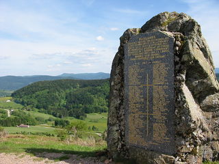
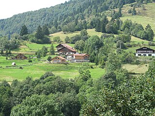
Basse-sur-le-Rupt is a commune in the Vosges department in Grand Est in northeastern France. Its inhabitants are called Bassurois. It is a mountainous commune of seven hamlets, crossed by the river Rupt. Its landmarks include Le Haut du Roc, Le Pierre des Communes, Le Piquante Pierre and the memorial of Le Croix des Moinats. Its historical industries were textiles, sawmills and granite.

Plainfaing is a commune in the Vosges department in Grand Est in northeastern France.

Frenelle-la-Grande is a commune in the Vosges department in Grand Est in northeastern France.
Bresse is an area and former province in eastern France.

Lac de Lispach is a lake in the commune of La Bresse, Vosges department, France. At an elevation of 909 m in the Vosges mountains, its surface area is 0.12 km².

The Moselotte is a river in Lorraine, in the French department of Vosges. It is a direct right tributary of the Moselle, and thus a sub-tributary of the Rhine.

Route des Crêtes is an 89 km (55 mi) road in the Vosges Mountains in eastern France, which passes through the Parc Naturel Régional des Ballons des Vosges. It connects Sainte-Marie-aux-Mines (north) with Cernay (south) and runs on the border of the departements of Haut-Rhin (68) and Vosges (88). Most of the route is at an elevation in excess of 950 m (3,117 ft), with the highest point being at the Col du Grand Ballon. The road is generally open from April to November, but most of the route is closed in the winter by snow.

The Col de la Schlucht is a mountain pass in the Vosges Mountains of France. On the west side lies the historical region of Lorraine, on the east side lies the historical region of Alsace.
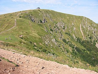
The Hohneck is, at 1,363 m (4,472 ft) the third highest summit of the Vosges Mountains and the highest point of Lorraine. On its summit stands a mountain hut, clearly visible in the distance. Nearby the mountain's top is located the ski resort of La Bresse Hohneck.

The Ballons des Vosges Regional Nature Park is a protected area of woodland, pasture, wetland, farmland and historical sites in the regions of Grand Est and Bourgogne-Franche-Comté in northeastern France. The area was officially designated as a regional natural park in 1989. 187 communes belonging to the departments of Haut-Rhin, Vosges, Haute-Saône and Territoire de Belfort are members of the park, which hosts 238,000 inhabitants. It is one of the largest and most populated French regional parks. A wide range of habitats available in the park benefit a variety of wildlife such as boreal owl, lynx, peregrine falcon, western capercaillie, Dianthus superbus, cranberry and Drosera.

The Kastelberg is the fourth highest summit of the Vosges Mountains. It is located on the former border between the French regions of Alsace and Lorraine.
The Communauté de communes des Hautes Vosges is an administrative association of rural communes in the Vosges department of eastern France. It was created on 1 January 2017 by the merger of the former Communauté de communes de Gérardmer-Monts et Vallées, Communauté de communes de la Haute Moselotte and Communauté de communes Terre de Granite. It consists of 22 communes, and has its administrative offices at Gérardmer.
The canton of La Bresse is an administrative division of the Vosges department, in northeastern France. It was created at the French canton reorganisation which came into effect in March 2015. Its seat is in La Bresse.


