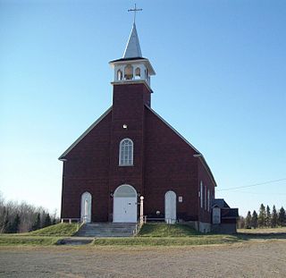
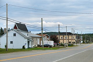
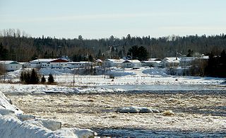
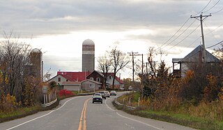
Lac-Saguay, Quebec

Last updated
Lac-Saguay
Village municipality
Lac-Saguay QC.JPG
Lac-Saguay Quebec location diagram.png
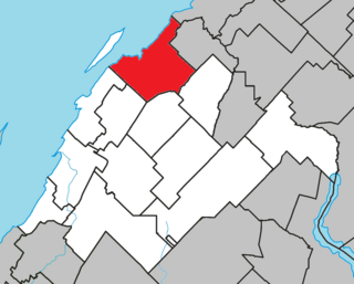
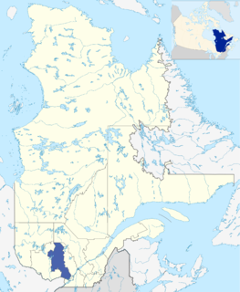
Location within Antoine-Labelle RCM
Canada Central Quebec location map.png
Red pog.svg
Lac-Saguay
Location in central Quebec
Coordinates: 46°30′N75°09′W / 46.500°N 75.150°W / 46.500; -75.150 Coordinates: 46°30′N75°09′W / 46.500°N 75.150°W / 46.500; -75.150 [1]
CountryFlag of Canada.svg  Canada
Province Flag of Quebec.svg  Quebec
Region Laurentides
RCM Antoine-Labelle
Constituted July 1, 1951
Government [2]
  Mayor Francine Asselin Bélisle
   Federal riding Laurentides—Labelle
   Prov. riding Labelle
Area [2] [3]
  Total 184.90 km2 (71.39 sq mi)
  Land 172.66 km2 (66.66 sq mi)
Population (2011) [3]
  Total 446
  Density 2.6/km2 (7/sq mi)
  Pop 2006-2011Decrease2.svg 9.3%
  Dwellings 445
Time zone EST (UTC−5)
  Summer (DST) EDT (UTC−4)
Postal code(s) J0W 1L0
Area code(s) 819
HighwaysQc117.svgTrans-Canada Highway shield.svg Route 117 (TCH)
Census profile 2479060 [3]
MAMROT info 79060 [2]
Toponymie info 144510 [1]
Website www.lacsaguay.qc.ca

Lac-Saguay is a village municipality in Antoine-Labelle Regional County Municipality in the Laurentides region of Quebec, Canada.

Antoine-Labelle Regional County Municipality Regional county municipality in Quebec, Canada

Antoine-Labelle is a regional county municipality located in the Laurentides region of Quebec, Canada. Its seat is Mont-Laurier. It is named for Antoine Labelle.

Laurentides Administrative region in Quebec, Canada

The Laurentides is a region of Quebec. While it is often called the Laurentians in English, the region includes only part of the Laurentian mountains. It has a total land area of 20,744.29 km2 (8,009.42 sq mi) and a 2011 census population of 555,614 inhabitants.

Quebec Province of Canada

Quebec is one of the thirteen provinces and territories of Canada. It is bordered to the west by the province of Ontario and the bodies of water James Bay and Hudson Bay; to the north by Hudson Strait and Ungava Bay; to the east by the Gulf of Saint Lawrence and the province of Newfoundland and Labrador; and to the south by the province of New Brunswick and the U.S. states of Maine, New Hampshire, Vermont, and New York. It also shares maritime borders with Nunavut, Prince Edward Island, and Nova Scotia. Quebec is Canada's largest province by area and its second-largest administrative division; only the territory of Nunavut is larger. It is historically and politically considered to be part of Central Canada.

Contents

Demographics

Population trend: [4]

Private dwellings occupied by usual residents: 216 (total dwellings: 445)

Mother tongue:

See also

Related Research Articles

Papineauville, Quebec Municipality in Quebec, Canada

Papineauville is a town and municipality in the Outaouais region of Quebec, Canada. It is the seat of the Papineau Regional County Municipality. In 2001 its population was 2247.

LIsle-Verte, Quebec Municipality in Quebec, Canada

L'Isle-Verte is a small municipality located along the south shore of the Saint Lawrence River, in the Rivière-du-Loup Regional County Municipality of the Bas-Saint-Laurent region, Quebec, Canada. The name of the village refers to Île Verte, a nearby island that is not within its municipal boundaries. Village and island are joined by a seasonal ferry.

Plaisance, Quebec Municipality in Quebec, Canada

Plaisance is a municipality in Papineau Regional County Municipality in western Quebec, Canada. The village is situated on the Ottawa River near the mouth of the Petite-Nation River, 70 km from Gatineau and 160 km from Montreal on Route 148.

Saint-Boniface, Quebec Municipality in Quebec, Canada

Saint-Boniface is a municipality in the Mauricie region of the province of Quebec in Canada.

Nominingue, Quebec Municipality in Quebec, Canada

Nominingue is a small village and municipality located 200 kilometres (120 mi) north of Montreal, Quebec, Canada, in the Laurentian Mountains. It was formerly called Lac-Nominingue, but changed name on September 16, 2000.

Saint-Pierre, Quebec Village municipality in Quebec, Canada

Saint-Pierre is a village municipality in Joliette Regional County Municipality in the Lanaudière region of Quebec, Canada.

Berry, Quebec Municipality in Quebec, Canada

Berry is a municipality in the Canadian province of Quebec, located in the Abitibi Regional County Municipality. The municipality had a population of 625 as of the Canada 2011 Census.

Saint-Félix-de-Dalquier, Quebec Municipality in Quebec, Canada

Saint-Félix-de-Dalquier is a municipality in the Canadian province of Quebec, located in the Abitibi Regional County Municipality.

Taschereau, Quebec Municipality in Quebec, Canada

Taschereau is a municipality in northwestern Quebec, Canada in the Abitibi-Ouest Regional County Municipality. It covers 265.62 km² and had a population of 981 as of the Canada 2011 Census.

Laforce, Quebec Municipality in Quebec, Canada

Laforce is a municipality in northwestern Quebec, Canada, in the Témiscamingue Regional County Municipality.

Angliers, Quebec Village municipality in Quebec, Canada

Angliers is a village in northwestern Quebec, Canada, in the Témiscamingue Regional County Municipality.

LAnge-Gardien, Outaouais, Quebec Municipality in Quebec, Canada

L'Ange-Gardien is a municipality in the Outaouais region of Quebec, Canada. It constitutes the easternmost part of Les Collines-de-l'Outaouais Regional County Municipality, north of the Buckingham Sector of the City of Gatineau.

Lochaber, Quebec Township municipality in Quebec, Canada

Lochaber is a township municipality in the Canadian province of Quebec, located within the Papineau Regional County Municipality. The township had a population of 409 in the Canada 2011 Census.

Amherst, Quebec Township municipality in Quebec, Canada

Amherst is a township municipality in the Canadian province of Quebec, located within Les Laurentides Regional County Municipality.

Sainte-Anne-du-Lac, Laurentides, Quebec Municipality in Quebec, Canada

Sainte-Anne-du-Lac is a municipality and village in the Laurentides region of Quebec, Canada, part of the Antoine-Labelle Regional County Municipality.

Labelle, Quebec Municipality in Quebec, Canada

Labelle is a village and municipality in the Laurentides region of Quebec, Canada, part of the Les Laurentides Regional County Municipality. Its large "L"-shaped territory surrounds Lake Labelle, and the village is located along the Rouge River and Route 117.

Lantier, Quebec Municipality in Quebec, Canada

Lantier is a village and municipality in the Laurentides region of Quebec, Canada, part of the Les Laurentides Regional County Municipality.

Saint-Roch-Ouest, Quebec Municipality in Quebec, Canada

Saint-Roch-Ouest is a municipality in Montcalm Regional County Municipality in the Lanaudière region of Quebec, Canada. Ouest is French for "west", indicating its position in relation to Saint-Roch-de-l'Achigan.

Sainte-Élisabeth, Quebec Parish municipality in Quebec, Canada

Sainte-Élisabeth is a parish municipality in the Lanaudière region of Quebec, Canada, part of the D'Autray Regional County Municipality.

Saint-Cuthbert, Quebec Municipality in Quebec, Canada

Saint-Cuthbert is a municipality in the Lanaudière region of Quebec, Canada, part of the D'Autray Regional County Municipality.

References