Lady's Island (South Carolina)

Last updated
Lady's Island
Pier on Lady's Island - panoramio.jpg
Pier on Lady's Island, July 2013
Nickname: 
Ladies Island
SCMap-doton-Beaufort.PNG
Location of Lady's Island, Beaufort, South Carolina
Coordinates: 32°23′0″N80°41′44″W / 32.38333°N 80.69556°W / 32.38333; -80.69556
Country United States
State South Carolina
County Beaufort
Elevation
17 ft (5 m)
Population
 (2010)
  Total12,570
Time zone UTC-5 (Eastern (EST))
  Summer (DST) UTC-4 (EDT)
ZIP codes
29907
Area code(s) 843, 854

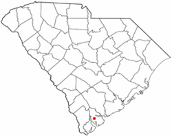
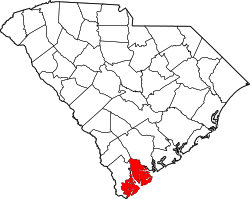
Lady's Island is a predominantly residential Sea Island located in Beaufort County, South Carolina. Small portions of the island are within the City of Beaufort, while the majority of the island remains unincorporated. [1] The South Carolina Highway 802, also known locally as Sams Point Road, serves as the principal highway for Lady's Island and provides the only access to Coosaw Island.

Contents

History

The Coosaw band of Native Americans lived in the high ground of Coosaw Point on Lady's Island. Decorative pottery shards and oyster shells are part of the history of where they prepared the oysters gathered from the Coosaw river. [2] Lady's Island was named in 1698, in honor of Lady Elizabeth Axtell Blake, wife of Joseph Blake, governor of colonial South Carolina. She and her mother, Lady Rebecca Axtell, owned Newington Plantation in present-day Summerville, South Carolina. The island is sometimes called Combachee, Combee, or Comber Island for the ACE Basin river that flows along its border. [3] [4]

During the American Civil War, Union forces occupied the islands under the direction of General T. W. Sherman. All of the plantations gave way to military occupation. the major post on Lady's Island was "Coosaw" or "Sams' fort on the northeastern point of the Island. At this time there were about 30 plantations on the Ladys' Island. [5]

The island was predominantly rural and agricultural in character for much of its history. In 1927, the first bridge connected downtown Beaufort with Lady's Island. As development of Beaufort and surrounding areas began in the last half of the 20th century, the island began to develop former plantation and timber tracts into residential subdivisions. [5] A second bridge connected Ladys Island with Port Royal in the 1980s.

Economy

The island is home to four public schools (two elementary, one middle, and one high school), Beaufort Academy, a K-12 private school, and Saint Peter's Catholic School, a K3-6 private Catholic school. Commercial development clustered at the intersection of S.C. Highway 802 and U.S. Highway 21 serves Lady's Island, Beaufort, and the surrounding Sea Islands of northern Beaufort County. The island is also the location of the Beaufort County Airport. Faith Communities located on the island include First Scots Presbyterian Church of Beaufort, St. John's Lutheran Church, Sea Island Presbyterian Church, St. Peter's Catholic Church, Meadowbrook Baptist Church, Unitarian Universalist Fellowship of Beaufort, Israelite Baptist Church, Grace Chapel AME Church, Lady's Island Baptist Church, Water's Edge New United Methodist Church, and Tidal Creek Fellowship.

Ecosystems

Lady's Island has three ecosystems: the maritime ecosystem of upland forest area, the estuarine ecosystem of deep water didal habitats, and the palustrine ecosystem of fresh water wetlands. [5]

Notable people

Related Research Articles

<span class="mw-page-title-main">Beaufort County, South Carolina</span> County in South Carolina, United States

Beaufort County is a county in the U.S. state of South Carolina. As of the 2020 census, its population was 187,117. Its county seat is Beaufort and its largest community is Hilton Head Island.

<span class="mw-page-title-main">Carteret County, North Carolina</span> County in North Carolina, United States

Carteret County is a county located in the U.S. state of North Carolina. As of the 2020 census, the population was 67,686. Its county seat is Beaufort. The county was created in 1722 as Carteret Precinct and gained county status in 1739. It was named for Sir George Carteret, one of the 17th century English Lords Proprietor, or for his descendant and heir John Carteret, 2nd Earl Granville.

<span class="mw-page-title-main">Beaufort, South Carolina</span> City in South Carolina, United States

Beaufort is a city in and the county seat of Beaufort County, South Carolina, United States. Chartered in 1711, it is the second-oldest city in South Carolina, behind Charleston. Beaufort is known as the "Queen of the Carolina Sea Islands". The city's population was 13,607 at the 2020 census. It is part of the Hilton Head Island–Bluffton metropolitan area.

<span class="mw-page-title-main">Bluffton, South Carolina</span> Town in South Carolina, United States

Bluffton is a town in southern Beaufort County, South Carolina, United States. The population as of the 2020 census was 27,716, an increase of over 120% since the 2010 census, making it the 17th-most populous municipality and one of the fastest growing municipalities in South Carolina. It is primarily located around U.S. Route 278, between Hilton Head Island and Interstate 95. The Lowcountry town's original one square mile area, now known as Old Town, is situated on a bluff along the May River. Bluffton is a primary town within the Hilton Head Island-Bluffton-Port Royal, SC Metropolitan Statistical Area.

<span class="mw-page-title-main">Port Royal, South Carolina</span> Town in South Carolina, United States

Port Royal is a town on Port Royal Island in Beaufort County, South Carolina, United States. The population was 14,220 at the 2020 census. It is part of the Hilton Head Island–Bluffton metropolitan area. Port Royal is home to Marine Corps Recruit Depot Parris Island and United States Naval Hospital Beaufort.

<span class="mw-page-title-main">Edisto Island</span> Unincorporated area in South Carolina, United States

Edisto Island is one of South Carolina's Sea Islands, the larger part of which lies in Charleston County, with its southern tip in Colleton County. Edisto Beach is in Colleton County, and the Charleston County part of the island is unincorporated.

<span class="mw-page-title-main">Sea Islands</span> Chain of barrier islands along the coast of South Carolina, Georgia and Florida

The Sea Islands are a chain of over a hundred tidal and barrier islands on the Atlantic Ocean coast of the Southeastern United States, between the mouths of the Santee and St. Johns rivers along South Carolina, Georgia and Florida. The largest is Johns Island, South Carolina. Sapelo Island is home to the Gullah people and all islands are acutely threatened by sea level rise due to climate change.

<span class="mw-page-title-main">Saint Helena Island (South Carolina)</span> Island in South Carolina, United States

St. Helena Island is a Sea Island in Beaufort County, South Carolina, United States. The island is connected to Beaufort by U.S. Highway 21. The island has a land area of about 64 sq mi (170 km2) and a population of 8,763 as of the 2010 census. It is included as part of the Hilton Head Island-Beaufort Micropolitan Area. The island is renowned for its rural Lowcountry character and being a major center of African-American Gullah culture and language. It is considered to be the geographic influence behind the children's television program Gullah Gullah Island.

<span class="mw-page-title-main">Daufuskie Island</span> Census-designated place in South Carolina, United States

Daufuskie Island, located between Hilton Head Island and Savannah, is the southernmost inhabited sea island in South Carolina. It is 5 miles (8 km) long by almost 2.5 miles (4.0 km) wide – approximate surface area of 8 square miles (21 km2). With over 3 miles (5 km) of beachfront, Daufuskie is surrounded by the waters of Calibogue Sound, the Intracoastal Waterway and the Atlantic Ocean. It was listed as a census-designated place in the 2020 census with a population of 557.

The Broad River is a tidal channel in Beaufort and Jasper counties, South Carolina. The channel flows between the mainland on the west and Port Royal and Parris islands on the east. The Coosawhatchie River flows into the Broad River at the head. It joins Coosaw River channel Northeast and continues Southeast to the Atlantic Ocean as Port Royal Sound.

<span class="mw-page-title-main">Wedgefield, South Carolina</span> Unincorporated community in South Carolina, United States

Wedgefield is an unincorporated community in the High Hills of Santee area in western Sumter County, South Carolina, United States. Wedgefield is also a Census Designated Place (CDP). Wedgefield was so named because its location was likened to a "wedge" into the High Hills of Santee. In the 18th and 19th centuries it was the location of many plantations, notably those of the Singleton family, which produced First Lady of the United States, Angelica Singleton Van Buren. Today the plantations are gone except for their cemeteries and Wedgefield is today noted as the location of a state park, a state forest and other recreational places. When the railroad came through in the 19th century, the commercial center of Wedgefield developed at the intersection of the railroad, Kings Highway and Wedgefield Road. It has its own post office with the Zip Code of 29168.

<span class="mw-page-title-main">High Hills of Santee</span>

The High Hills of Santee, sometimes known as the High Hills of the Santee, is a long, narrow hilly region in the western part of Sumter County, South Carolina. It has been called "one of the state's most famous areas". The High Hills of Santee region lies north of the Santee River and east of the Wateree River, one of the two rivers that join to form the Santee. It extends north almost to the Kershaw county line and northeasterly to include the former summer resort town of Bradford Springs. Since 1902 the town has been included in Lee County.

<span class="mw-page-title-main">South Carolina Highway 46</span> State highway in South Carolina

South Carolina Highway 46 (SC 46) is a 17.330-mile-long (27.890 km) state highway in Jasper and Beaufort counties in the Lowcountry region of South Carolina. It connects the rapidly growing communities of Hardeeville and Bluffton and serves as a parallel route to U.S. Route 278 (US 278).

<span class="mw-page-title-main">South Carolina Highway 802</span> State highway in South Carolina, United States

South Carolina Highway 802 (SC 802), is a 6.690-mile (10.767 km) state highway located entirely within Beaufort County, South Carolina. Also known locally as Sams Point Road, SC 802 serves as the principal arterial for Lady's Island and provides the only access to Coosaw Island.

<span class="mw-page-title-main">South Carolina Highway 128</span> State highway in South Carolina, United States

South Carolina Highway 128 (SC 128), is a 2.110-mile (3.396 km) state highway located entirely within Beaufort County, South Carolina. Also known locally as Savannah Highway, SC 128 serves as a principal arterial for the unincorporated Shell Point as well as providing a southern route serving Port Royal, Marine Corps Recruit Depot Parris Island, and the Sea Islands east of Beaufort.

<span class="mw-page-title-main">South Carolina Highway 280</span> Former state highway in South Carolina, United States

South Carolina Highway 280 was a state highway located entirely within Beaufort County, South Carolina. The entirety of the route was along Parris Island Gateway, which remains the name of the road despite the decommissioning of the route number. The entirety of SC 280 is now U.S. Highway 21.

Okatie is an unincorporated suburban community west of Hilton Head Island, located in Beaufort and Jasper counties, in the Lowcountry of South Carolina. Okatie takes its name from the nearby Okatee River, an estuary of the Port Royal Sound. The headquarters of the Beaufort-Jasper Water and Sewer Authority are located in Okatie, as are the Beaufort-Jasper Academy for Career Excellence and John Paul II Catholic High School.

<span class="mw-page-title-main">South Carolina Highway 462</span> State highway in South Carolina, United States

South Carolina Highway 462 (SC 462) is a 35.920-mile (57.808 km) primary state highway in the U.S. state of South Carolina. It serves as a circuitous routing through northern and eastern Jasper County.

<span class="mw-page-title-main">Laurel Hill Plantation (South Carolina)</span> US historic site

The Laurel Hill Plantation, also known as Laurel Hill Farm was a historic Southern plantation located on Lady's Island, Beaufort County, South Carolina. The area is now called Coosaw Point, a upscale community with clubhouse, pool, tennis courts, and dock. The area is known for its woodlands, parks, wetlands, and the Coosaw River.

References

  1. "LADY'S ISLAND". www.beaufortsc.org. Retrieved 2020-04-05.
  2. "THE HISTORY OF COOSAW POINT". www.coosawpoint.com. 2020-04-08.
  3. Rowland, Lawrence Sanders (1996). The History of Beaufort County, South Carolina: 1514-1861. South Carolina: University of South Carolina Press. p. 3. ISBN   9781570030901.
  4. "LADY'S ISLAND". www.scpictureproject.org. Retrieved 2020-04-05.
  5. 1 2 3 Trinkley, Michael (June 1999). "An Archaeological Survey of Phase 1 of the Walling Grove Plantation Development, Ladys Island, Beaufort, South Carolina" (PDF). Chicora Foundation. Beaufort, South Carolina. p. 17. Retrieved 2022-04-29.