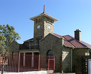
Mount Frere, officially KwaBhaca, is a town located in the Eastern Cape province, previously known as the Transkei region, of South Africa. KwaBhaca is situated between Kokstad and Mthatha along the N2 road about 100 km north east of Mthatha. It is administered by the Alfred Nzo District Municipality and the villages are ruled by the Tribal chief with intermediary borders.

The Sarah Baartman District Municipality, formerly the Cacadu District Municipality, is situated in the western part of the Eastern Cape province of South Africa, covering an area of 58,242 square kilometres. The area of the district municipality includes seven local municipalities. The seat is the city of Gqeberha, although Gqeberha is not itself in the district. As of 2011, the languages most spoken among the 388,201 inhabitants were Xhosa and Afrikaans. The district code is DC10.

Port Alfred is a small town with a population of just under 26,000 in the Eastern Cape province of South Africa. It is situated on the eastern seaboard of the country at the mouth of the Kowie River, almost exactly halfway between the larger cities of Gqeberha and East London and 30 kilometres (19 mi) east of Cannon Rocks.

Saron is a town in the Western Cape province of South Africa.

Barkly East is a town in Eastern Cape Province, South Africa, seat of the Joe Gqabi District Municipality, and 117 km by road E.S.E. of Aliwal North, lying in the mountainous area just south of Lesotho. The town lies at the southern tip of the Drakensberg on the Langkloofspruit, a tributary of the Kraai River which, in turn is a tributary of the Orange River at an elevation of 1 790 meter above sealevel. Barkly East is characterized by rugged mountains and green valleys. Snow falls in winter, and the hamlet of Rhodes is 60 km or an hour's drive from Barkly East on the R396. Both are within the boundaries of the Senqu Local Municipality.

Clanwilliam is a town in the Olifants River valley in the Western Cape, South Africa, about 200 kilometres (120 mi) north of Cape Town. It is located in, and the seat of, the Cederberg Local Municipality. As of 2011 Clanwilliam had a population of 7,674.

Pofadder is a small town in the Northern Cape province of South Africa. In spite of its small size, it is an important local centre in the region known in South Africa as Bushmanland. The surrounding districts are arid, sparsely populated, rugged and picturesque. There is little in the way of cropping and local farmers run sheep or goats for a living. As a tourist destination, it is not sufficiently spectacular to rival the spring flowers of the coastal regions of Namaqualand, but it has its attractions for biologists and conservationists and those with an interest in its remarkable diversity of often-tiny xerophytes and animal life. In recent years, the town economy has been boosted by the construction and operation of solar power stations.

Cookhouse is a small village located in Eastern Cape province, South Africa, some 170 kilometres (110 mi) north of Port Elizabeth and 24 kilometres (15 mi) east of Somerset East, on the west bank of the Great Fish River.

Ladismith is a town and agricultural centre in the western Little Karoo region of South Africa's Western Cape province.
In the colonial history of South Africa, the Glen Grey Act was an 1894 Act of the Parliament of the Cape Colony. Instigated by the government of Prime Minister Cecil John Rhodes, it established a system of individual land tenure and created a labour tax to force Xhosa men into employment on commercial farms or in industry. The act was so named because, although it was later extended to a larger area, it initially applied only in the Glen Grey district, a former name for the area around Lady Frere, east of Queenstown, in the Eastern Cape province of South Africa.
Mount Ayliff, officially eMaxesibeni, is a small town in the Eastern Cape province of South Africa, near that province's border with KwaZulu-Natal.

Elliot, also known as Khowa, is a town in Chris Hani District Municipality in the Eastern Cape province of South Africa, and lies 80 km south-west of Maclear and 65 km south-east of Barkly East on the R56 road.
Herschel is a settlement in Joe Gqabi District Municipality in the Eastern Cape province of South Africa.
Nqamakwe is a town in Amatole District Municipality in the Eastern Cape province of South Africa.
Ntabankulu, alternatively rendered as Tabankulu, is a town in Alfred Nzo District Municipality in the Eastern Cape province of South Africa. Village some 30 km east-south-east of Mount Frere and 50 km south-south-west of Kokstad.
Tsomo is a town in Chris Hani District Municipality in the Eastern Cape province of South Africa. The town is 45 km east of Qamata and 48 km west of Ndabakazi.
St Mark's, Eastern Cape is a town in Chris Hani District Municipality in the Eastern Cape province of South Africa. Village on the White Kei River, about 15 km west of Cofimvaba and 40 km north-east of Cathcart.

Alicedale is a small settlement in Sarah Baartman District Municipality in the Eastern Cape province of South Africa, situated on the banks of the Bushmans River.

Frere is a town in Inkosi Langalibalele Local Municipality in the KwaZulu-Natal province of South Africa. The city is named for Sir Henry Bartle Frere, Governor of Cape Colony from 1877 to 1880. The city was for a time the headquarters of Sir Redvers Buller during the Second Boer War. The town is 25 km east of Winterton.


