Lake Hanska Township, Brown County, Minnesota

Last updated

Lake Hanska Township
USA Minnesota location map.svg
Red pog.svg
Lake Hanska Township
Location within the state of Minnesota
Usa edcp location map.svg
Red pog.svg
Lake Hanska Township
Lake Hanska Township (the United States)
Coordinates: 44°8′56″N94°33′6″W / 44.14889°N 94.55167°W / 44.14889; -94.55167
Country United States
State Minnesota
County Brown
Area
  Total38.8 sq mi (100.5 km2)
  Land36.7 sq mi (95.1 km2)
  Water2.1 sq mi (5.3 km2)
Elevation
1,007 ft (307 m)
Population
 (2000)
  Total322
  Density8.8/sq mi (3.4/km2)
Time zone UTC-6 (Central (CST))
  Summer (DST) UTC-5 (CDT)
FIPS code 27-34442 [1]
GNIS feature ID0664678 [2]

Lake Hanska Township is a township in Brown County, Minnesota, United States. The population was 322 as of the 2000 census. [3]

Contents

History

Lake Hanska Township was organized in 1870. [4]

Geography

According to the United States Census Bureau, the township has a total area of 38.8 square miles (100 km2), of which 36.7 square miles (95 km2) is land and 2.1 square miles (5.4 km2) (5.31%) is water.

The city of Hanska is entirely within the township geographically but is a separate entity.

Lake

Adjacent townships

Cemeteries

The township includes the following cemeteries: Lake Hanska and Zion.

Demographics

As of the census [1] of 2000, there were 322 people, 124 households, and 91 families residing in the township. The population density was 8.8 people per square mile (3.4/km2). There were 135 housing units at an average density of 3.7/sq mi (1.4/km2). The racial makeup of the township was 98.76% White, 0.62% Asian, 0.31% from other races, and 0.31% from two or more races. Hispanic or Latino of any race were 1.24% of the population.

There were 124 households, out of which 32.3% had children under the age of 18 living with them, 65.3% were married couples living together, 4.0% had a female householder with no husband present, and 26.6% were non-families. 24.2% of all households were made up of individuals, and 7.3% had someone living alone who was 65 years of age or older. The average household size was 2.60 and the average family size was 3.11.

In the township the population was spread out, with 27.3% under the age of 18, 7.1% from 18 to 24, 27.0% from 25 to 44, 23.6% from 45 to 64, and 14.9% who were 65 years of age or older. The median age was 38 years. For every 100 females, there were 113.2 males. For every 100 females age 18 and over, there were 125.0 males.

The median income for a household in the township was $36,786, and the median income for a family was $38,750. Males had a median income of $32,188 versus $21,250 for females. The per capita income for the township was $17,652. None of the families and 1.2% of the population were living below the poverty line, including no under eighteens and none of those over 64.

Related Research Articles

<span class="mw-page-title-main">Watonwan County, Minnesota</span> County in Minnesota, United States

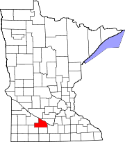
Watonwan County is a county in the U.S. state of Minnesota. As of the 2020 census, the population was 11,253. Its county seat is St. James.

<span class="mw-page-title-main">Brown County, Minnesota</span> County in Minnesota, United States

Brown County is a county in the U.S. state of Minnesota. As of the 2020 census, the population was 25,912. Its county seat is New Ulm. The county was formed in 1855 and organized in 1856.

Butternut Valley Township is a township in Blue Earth County, Minnesota, United States. The population was 382 as of the 2000 census.

Ceresco Township is a township in Blue Earth County, Minnesota, United States. The population was 255 as of the 2000 census.

Lincoln Township is a township in Blue Earth County, Minnesota, United States. The population was 227 as of the 2000 census.

Pleasant Mound Township is a township in Blue Earth County, Minnesota, United States. The population was 235 as of the 2000 census.

Albin Township is a township in Brown County, Minnesota, United States. The population was 329 at the 2000 census. Albin Township was organized in 1870.

Bashaw Township is a township in Brown County, Minnesota, United States. The population was 243 as of the 2010 census.

Cottonwood Township is a township in Brown County, Minnesota, United States. The population was 938 as of the 2000 census.

Linden Township is a township in Brown County, Minnesota, United States. The population was 343 as of the 2000 census.

Mulligan Township is a township in Brown County, Minnesota, United States. The population was 245 as of the 2000 census. Mulligan Township was organized in 1871.

Sigel Township is a township in Brown County, Minnesota, United States. The population was 432 as of the 2000 census. The township was first settled in 1856 and organized during the American Civil War in 1862, and was named in honor of German immigrant and Union Army general Franz Sigel.

Adrian Township is a township in Watonwan County, Minnesota. The population was 173 at the time of the 2000 census.

Antrim Township is a township in Watonwan County, Minnesota, United States. The population was 291 at the 2000 census.

Butterfield Township is a township in Watonwan County, Minnesota, United States. The population was 297 at the 2000 census.

Fieldon Township is a township in Watonwan County, Minnesota, United States. The population was 246 at the 2000 census.

Long Lake Township is a township in Watonwan County, Minnesota, United States. The population was 346 at the 2000 census.

<span class="mw-page-title-main">Madelia Township, Watonwan County, Minnesota</span> Township in Minnesota, United States

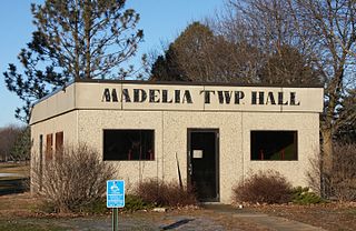
Madelia Township is a township in Watonwan County, Minnesota, United States. The population was 393 at the 2000 census.

Riverdale Township is a township in Watonwan County, Minnesota, United States. The population was 338 at the 2000 census.

South Branch Township is a township in Watonwan County, Minnesota, United States. The population was 303 at the 2000 census.

References

  1. 1 2 "U.S. Census website". United States Census Bureau . Retrieved January 31, 2008.
  2. "US Board on Geographic Names". United States Geological Survey. October 25, 2007. Retrieved January 31, 2008.
  3. "U.S. Census website" . Retrieved December 31, 2008.
  4. Upham, Warren (1920). Minnesota Geographic Names: Their Origin and Historic Significance. Minnesota Historical Society. p.  70.