Lamar Township, Clinton County, Pennsylvania

Last updated

Lamar Township,
Pennsylvania
Township
Appalachian Throughway.jpg
U.S. Route 220 as it passes through Lamar Township
Clinton County Pennsylvania incorporated and unincorporated areas Lamar township highlighted.svg
Location in Clinton County and the state of Pennsylvania.
Country United States
State Pennsylvania
County Clinton
Settled1800
Incorporated1817
Area
[1]
  Total41.00 sq mi (106.20 km2)
  Land40.89 sq mi (105.91 km2)
  Water0.11 sq mi (0.29 km2)
Population
 (2020) [2]
  Total2,600 Increase2.svg
  Estimate 
(2021) [2]
2,598
  Density62.51/sq mi (24.13/km2)
FIPS code 42-035-41112

Lamar Township is an American township that is located in Clinton County, Pennsylvania. The population was 2,600 at the time of the 2020 census. [2]

Contents

Geography

The township is located in southern Clinton County and includes the unincorporated community of Rote. Interstate 80 runs east–west through the township, with one interchange (Exit 178): U.S. Route 220, which leads north to Mill Hall and Lock Haven, the county seat.

According to the United States Census Bureau, Lamar Township has a total area of 41.0 square miles (106.2 km2), of which 40.9 square miles (105.9 km2) is land and 0.12 square miles (0.3 km2), or 0.27%, is water. [3]

Demographics

Historical population
CensusPop.Note
1980 2,384
1990 2,345−1.6%
2000 2,4504.5%
2010 2,5172.7%
2020 2,6003.3%
2021 (est.)2,598 [2] −0.1%
source: [4] [5]

As of the census [6] of 2000, there were 2,450 people, 901 households, and 718 families residing in the township.

The population density was 59.8 inhabitants per square mile (23.1/km2). There were 967 housing units at an average density of 23.6/sq mi (9.1/km2).

The racial makeup of the township was 99.10% White, 0.16% African American, 0.12% Native American, 0.16% Asian, and 0.45% from two or more races. Hispanic or Latino of any race were 0.37% of the population.

There were 901 households, out of which 32.4% had children under the age of eighteen living with them; 70.5% were married couples living together, 6.0% had a female householder with no husband present, and 20.2% were non-families. 16.8% of all households were made up of individuals, and 9.7% had someone living alone who was sixty-five years of age or older.

The average household size was 2.72 and the average family size was 3.05.

Within the township, the population was spread out, with 24.7% who were under the age of eighteen, 8.4% who were aged eighteen to twenty-four, 27.3% who were aged twenty-five to forty-four, 25.0% who were aged forty-five to sixty-four, and 14.6% who were sixty-five years of age or older. The median age was forty years.

For every one hundred females, there were 98.5 males. For every one hundred females who were aged eighteen or older, there were 95.1 males.

The median income for a household in the township was $35,332, and the median income for a family was $38,235. Males had a median income of $30,516 compared with that of $19,278 for females.

The per capita income for the township was $15,464.

Approximately 7.8% of families and 9.9% of the population were living below the poverty line, including 12.6% of those who were under the age of eighteen and 13.8% of those who were aged sixty-five or older.

Related Research Articles

<span class="mw-page-title-main">Hovey Township, Armstrong County, Pennsylvania</span> Township in Pennsylvania, United States

Hovey Township is a township which is located in far northern Armstrong County, Pennsylvania, United States. The population was seventy-four at the time of the 2020 census, a decrease from the figure of 97 tabulated in 2010.

<span class="mw-page-title-main">Burnside Township, Centre County, Pennsylvania</span> Township in Pennsylvania, United States

Burnside Township is a township in Centre County, Pennsylvania, United States. It is part of the State College, Pennsylvania Metropolitan Statistical Area. It is located approximately at 41°08′03″N77°09′58″W.

<span class="mw-page-title-main">Marion Township, Centre County, Pennsylvania</span> Township in Pennsylvania, United States

Marion Township is a township that is located in Centre County, Pennsylvania, United States. It is part of the State College, Pennsylvania Metropolitan Statistical Area.

<span class="mw-page-title-main">Knox Township, Clarion County, Pennsylvania</span> Township in Pennsylvania, United States

Knox Township is a township that is located in Clarion County, Pennsylvania, United States. As of the 2020 census, the township population was 997, a decrease from the figure of 1,036 that was tabulated in 2010.

<span class="mw-page-title-main">Licking Township, Clarion County, Pennsylvania</span> Township in Pennsylvania, United States

Licking Township is a township that is located in Clarion County, Pennsylvania, United States. The population was 575 at the time of the 2020 census, an increase from the figure of 536 tabulated in 2010.

<span class="mw-page-title-main">Limestone Township, Clarion County, Pennsylvania</span> Township in Pennsylvania, United States

Limestone Township is a township that is located in Clarion County, Pennsylvania, United States. The population was 1,877 at the time of the 2020 census, an increase from the figure of 1,858 tabulated in 2010.

<span class="mw-page-title-main">Piney Township, Clarion County, Pennsylvania</span> Township in Pennsylvania, United States

Piney Township is a township that is located in Clarion County, Pennsylvania, United States. The population was 398 at the time of the 2020 census, a decrease from the figure of 453 hat was tabulated in 2010.

<span class="mw-page-title-main">Pine Township, Clearfield County, Pennsylvania</span> Township in Pennsylvania, United States

Pine Township is a township that is located in Clearfield County, Pennsylvania, United States. The population was fifty-nine at the time of the 2020 census.

<span class="mw-page-title-main">Leidy Township, Clinton County, Pennsylvania</span> Township in Pennsylvania, United States

Leidy Township is a township that is located in Clinton County, Pennsylvania, United States. The population was 155 at the time of the 2020 census, down from 180 in 2010.

<span class="mw-page-title-main">Logan Township, Clinton County, Pennsylvania</span> Township in Pennsylvania, United States

Logan Township is a township that is located in Clinton County, Pennsylvania, United States. The population was 872 at the time of the 2020 census.

<span class="mw-page-title-main">Noyes Township, Clinton County, Pennsylvania</span> Township in Pennsylvania, United States

Noyes Township is a township that is located in Clinton County, Pennsylvania, United States. The population was 333 at the time of the 2020 census, a decline from the total of 357 that was counted in 2010.

<span class="mw-page-title-main">West Keating Township, Clinton County, Pennsylvania</span> Township in Pennsylvania, United States

West Keating Township is a township that is located in Clinton County, Pennsylvania, United States. The population was 16 at the time of the 2020 census, which was a decline from the figure of 29 that was tabulated in 2010.

<span class="mw-page-title-main">Pine Township, Columbia County, Pennsylvania</span> Township in Pennsylvania, United States

Pine Township is a township in Columbia County, Pennsylvania. It is part of Northeastern Pennsylvania. The population was 1,014 at the time of the 2020 census.

<span class="mw-page-title-main">Sugarloaf Township, Columbia County, Pennsylvania</span> Township in Pennsylvania, United States

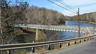
Sugarloaf Township is a township in Columbia County, Pennsylvania. It is part of Northeastern Pennsylvania.

<span class="mw-page-title-main">Upper Tyrone Township, Fayette County, Pennsylvania</span> Township in Pennsylvania, United States

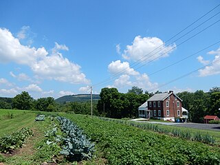
Upper Tyrone Township is a township that is located in Fayette County, Pennsylvania, United States. The population was 1,768 at the time of the 2020 census. It is served by the Southmoreland School District.

<span class="mw-page-title-main">Jenks Township, Forest County, Pennsylvania</span> Township in Pennsylvania, United States

Jenks Township is a township that is located in Forest County, Pennsylvania, United States. The population was 3,545 at the time of the 2020 census, down from 3,629 in 2010, a figure that was, in turn, an increase from 1,261 in 2000 with the opening of the SCI Forest penitentiary.

<span class="mw-page-title-main">Leacock Township, Lancaster County, Pennsylvania</span> Township in Pennsylvania, United States

Leacock Township is an American township that is located in east central Lancaster County, Pennsylvania. As of the 2020 census, the population of the township was 5,652, an increase over the figure of 5,220 tabulated in 2010.

<span class="mw-page-title-main">Union Township, Lawrence County, Pennsylvania</span> Township in Pennsylvania, United States

Union Township is a township in Lawrence County, Pennsylvania, United States. The population was 4,997 at the time of the 2020 census, a decline from the figure of 5,190 as of 2010.

<span class="mw-page-title-main">South Manheim Township, Schuylkill County, Pennsylvania</span> Township in Pennsylvania, United States

South Manheim Township is a township that is located in Schuylkill County, Pennsylvania, United States. The population was 2,751 at the time of the 2020 census.

<span class="mw-page-title-main">Stockdale, Pennsylvania</span> Borough in Pennsylvania, United States

Stockdale is a borough that is located in Washington County, Pennsylvania, United States. The population was 424 at the time of the 2020 census.

References

  1. "2016 U.S. Gazetteer Files". United States Census Bureau. Retrieved August 13, 2017.
  2. 1 2 3 4 Bureau, US Census. "City and Town Population Totals: 2020—2021". Census.gov. US Census Bureau. Retrieved August 7, 2022.
  3. "Geographic Identifiers: 2010 Census Summary File 1 (G001): Lamar township, Clinton County, Pennsylvania". U.S. Census Bureau, American Factfinder. Archived from the original on February 13, 2020. Retrieved May 18, 2015.
  4. "Clinton County Comprehensive Plan" (PDF). Clinton County, Pennsylvania. Archived from the original (PDF) on November 29, 2007. Retrieved September 19, 2007.
  5. "Population Change 1990–2000: Pennsylvania". Pennsylvania State Data Center. Archived from the original on November 17, 2007. Retrieved September 19, 2007.
  6. "U.S. Census website". United States Census Bureau . Retrieved January 31, 2008.

41°05′00″N77°30′00″W / 41.08333°N 77.50000°W / 41.08333; -77.50000