Lasserade | |
|---|---|
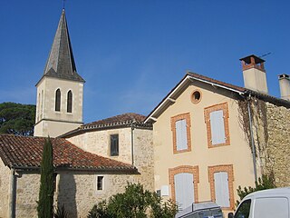
 The church in Lasserade | |
| Coordinates: 43°37′33″N0°03′51″E / 43.6258°N 0.0642°E Coordinates: 43°37′33″N0°03′51″E / 43.6258°N 0.0642°E | |
| Country | France |
| Region | Occitanie |
| Department | Gers |
| Arrondissement | Mirande |
| Canton | Pardiac-Rivière-Basse |
| Government | |
| • Mayor (2008–2014) | Jean-Pierre Laberou |
| Area 1 | 12.76 km2 (4.93 sq mi) |
| Population (2016-01-01) [1] | 211 |
| • Density | 17/km2 (43/sq mi) |
| Time zone | UTC+01:00 (CET) |
| • Summer (DST) | UTC+02:00 (CEST) |
| INSEE/Postal code | 32199 /32160 |
| Elevation | 120–204 m (394–669 ft) (avg. 180 m or 590 ft) |
| 1 French Land Register data, which excludes lakes, ponds, glaciers > 1 km2 (0.386 sq mi or 247 acres) and river estuaries. | |
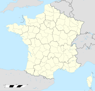
Lasserade is a commune in the Gers department in southwestern France.
The commune is a level of administrative division in the French Republic. French communes are analogous to civil townships and incorporated municipalities in the United States and Canada, Gemeinden in Germany, comuni in Italy or ayuntamiento in Spain. The United Kingdom has no exact equivalent, as communes resemble districts in urban areas, but are closer to parishes in rural areas where districts are much larger. Communes are based on historical geographic communities or villages and are vested with significant powers to manage the populations and land of the geographic area covered. The communes are the fourth-level administrative divisions of France.

The Gers is a department in the Occitanie region in the southwest of France named after the Gers River.
In the administrative divisions of France, the department is one of the three levels of government below the national level, between the administrative regions and the commune. Ninety-six departments are in metropolitan France, and five are overseas departments, which are also classified as regions. Departments are further subdivided into 334 arrondissements, themselves divided into cantons; the last two have no autonomy, and are used for the organisation of police, fire departments, and sometimes, elections.


