Leota Township, Nobles County, Minnesota

Last updated
Leota Township, Minnesota
USA Minnesota location map.svg
Red pog.svg
Leota Township, Minnesota
Location within the state of Minnesota
Usa edcp location map.svg
Red pog.svg
Leota Township, Minnesota
Leota Township, Minnesota (the United States)
Coordinates: 43°48′35″N95°59′31″W / 43.80972°N 95.99194°W / 43.80972; -95.99194 Coordinates: 43°48′35″N95°59′31″W / 43.80972°N 95.99194°W / 43.80972; -95.99194
Country United States
State Minnesota
County Nobles
Area
  Total36.2 sq mi (93.7 km2)
  Land36.2 sq mi (93.7 km2)
  Water0.0 sq mi (0.0 km2)
Elevation
1,640 ft (500 m)
Population
 (2000)
  Total463
  Density12.8/sq mi (4.9/km2)
Time zone UTC-6 (Central (CST))
  Summer (DST) UTC-5 (CDT)
ZIP code
56153
Area code(s) 507
FIPS code 27-36566 [1]
GNIS feature ID0664759 [2]

Leota Township is a township in Nobles County, Minnesota, United States. The population was 463 at the 2000 census. Within the township is the CDP of Leota.

Contents

Geography

Map of Leota Township - 1914 Leota Township, MN, 1914.jpg
Map of Leota Township - 1914
Homestead of Martin Kallemeyen, first Dutch settler in Leota Township Dutch Settlers, Leota, MN.jpg
Homestead of Martin Kallemeyen, first Dutch settler in Leota Township

According to the United States Census Bureau, the township has a total area of 36.2 square miles (93.7 km2), all land. The main geographic feature in Leota Townships is the Champepadan Creek.

Main highways include:

History

Leota Township was first settled by Dutch farmers who migrated northward from another Dutch Settlement in Orange City, Iowa. Organization of Leota Township was approved by the Nobles County Board on March 18, 1879. The first township meeting was held on April 5, 1879. The story has it that Leota was the name of a young Indian woman who figured in a romantic story familiar to W. G. Barnard, one of the township's first residents. However existence of such a story cannot be verified. If true, Leota Township (and the village of Leota) are the only place names in all of Nobles County that memorialize specific Native Americans. [3]

Demographics

As of the census [1] of 2000, there were 463 people, 191 households, and 147 families residing in the township. The population density was 12.8 people per square mile (4.9/km2). There were 204 housing units at an average density of 5.6/sq mi (2.2/km2). The racial makeup of the township was 99.14% White, 0.43% Asian, and 0.43% from two or more races. Hispanic or Latino of any race were 0.43% of the population.

There were 191 households, out of which 27.2% had children under the age of 18 living with them, 73.8% were married couples living together, 1.0% had a female householder with no husband present, and 23.0% were non-families. 23.0% of all households were made up of individuals, and 16.2% had someone living alone who was 65 years of age or older. The average household size was 2.42 and the average family size was 2.85.

In the township the population was spread out, with 23.8% under the age of 18, 4.5% from 18 to 24, 23.5% from 25 to 44, 23.3% from 45 to 64, and 24.8% who were 65 years of age or older. The median age was 44 years. For every 100 females, there were 100.4 males. For every 100 females age 18 and over, there were 96.1 males.

The median income for a household in the township was $31,818, and the median income for a family was $37,500. Males had a median income of $26,417 versus $23,750 for females. The per capita income for the township was $14,948. About 11.8% of families and 12.8% of the population were below the poverty line, including 20.2% of those under age 18 and 17.2% of those age 65 or over.

Politics

Leota Township is located in Minnesota's 1st congressional district, represented by Mankato educator Tim Walz, a Democrat. At the state level, Leota Township is located in Senate District 22, represented by Republican Doug Magnus, and in House District 22A, represented by Republican Joe Schomacker.

Local politics

Leota Township is represented by Nobles County Commissioner Gene Metz

Related Research Articles

Selma Township, Cottonwood County, Minnesota Township in Minnesota, United States

Selma Township is a township in Cottonwood County, Minnesota, United States. The population was 193 at the 2010 census.

Bigelow Township, Nobles County, Minnesota Township in Minnesota, United States

Bigelow Township is a township in Nobles County, Minnesota, United States. The population was 384 at the 2000 census.

Bloom Township, Nobles County, Minnesota Township in Minnesota, United States

Bloom Township is a township in Nobles County, Minnesota, United States. The population was 213 at the 2000 census.

Dewald Township, Nobles County, Minnesota Township in Minnesota, United States

Dewald Township is a township in Nobles County, Minnesota, United States. The population was 291 at the 2000 census.

Elk Township, Nobles County, Minnesota Township in Minnesota, United States

Elk Township is a township in Nobles County, Minnesota, United States. The population was 284 at the 2000 census.

Ellsworth, Minnesota City in Minnesota, United States

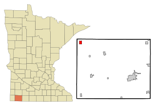
Ellsworth is a city in Nobles County, Minnesota, United States. The population was 463 at the 2010 census. The local school district is the Ellsworth Public School.

Hersey Township, Nobles County, Minnesota Township in Minnesota, United States

Hersey Township is a township in Nobles County, Minnesota, United States. The population was 257 at the 2000 census.

Larkin Township, Nobles County, Minnesota Township in Minnesota, United States

Larkin Township is a township in Nobles County, Minnesota, United States. The population was 218 at the 2000 census.

Leota, Minnesota Unincorporated community in Minnesota, US

Leota is a census-designated place (CDP) in Leota Township, Nobles County, Minnesota, United States. The population was 209 at the 2000 census.

Lismore Township, Nobles County, Minnesota Township in Minnesota, United States

Lismore Township is a township in Nobles County, Minnesota, United States. The population was 232 at the 2000 census.

Little Rock Township, Nobles County, Minnesota Township in Minnesota, United States

Little Rock Township is a township in Nobles County, Minnesota, United States. The population was 260 at the 2000 census.

Lorain Township, Nobles County, Minnesota Township in Minnesota, United States

Lorain Township is a township in Nobles County, Minnesota, United States. The population was 278 at the 2000 census.

Olney Township, Nobles County, Minnesota Township in Minnesota, United States

Olney Township is a township in Nobles County, Minnesota, United States. The population was 232 at the 2000 census.

Rushmore, Minnesota Town in Minnesota, United States

Rushmore is a town in Nobles County, Minnesota, United States. The population was 342 at the 2010 census.

Summit Lake Township, Nobles County, Minnesota Township in Minnesota, United States

Summit Lake Township is a township in Nobles County, Minnesota, United States. The population was 368 at the 2000 census.

Westside Township, Nobles County, Minnesota Township in Minnesota, United States

Westside Township is a township in Nobles County, Minnesota, United States. The population was 258 at the 2000 census.

Wilmont Township, Nobles County, Minnesota Township in Minnesota, United States

Wilmont Township is a township in Nobles County, Minnesota, United States. The population was 228 at the 2000 census.

Worthington Township, Nobles County, Minnesota Township in Minnesota, United States

Worthington Township is a township in Nobles County, Minnesota, United States. The population was 316 at the 2000 census.

Northfield Township, Rice County, Minnesota Township in Minnesota, United States

Northfield Township is a township in Rice County, Minnesota, United States. The population was 780 at the 2000 census.

Helena Township, Scott County, Minnesota Township in Minnesota, United States

Helena Township is a township in Scott County, Minnesota, United States. The population was 1,440 at the 2000 census.

References

  1. 1 2 "U.S. Census website". United States Census Bureau . Retrieved 2008-01-31.
  2. "US Board on Geographic Names". United States Geological Survey. 2007-10-25. Retrieved 2008-01-31.
  3. Names of Nobles County by Raymond Crippen