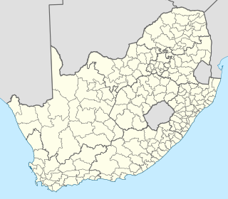
Local government in South Africa consists of municipalities of various types. The largest metropolitan areas are governed by metropolitan municipalities, while the rest of the country is divided into district municipalities, each of which consists of several local municipalities. After the municipal election of 18 May 2011 there were eight metropolitan municipalities, 44 district municipalities and 226 local municipalities. Since the boundary reform at the time of the municipal election of 3 August 2016 there are eight metropolitan municipalities, 44 district municipalities and 205 local municipalities.

Gazankulu was a bantustan in South Africa, intended by the apartheid government to be a semi-independent homeland for the Tsonga people. It was located in both the Northern Transvaal, now Limpopo province and Eastern Transvaal, now Mpumalanga province. It must not be confused with the Gaza kingdom which once existed in Mozambique.
In South Africa, a local municipality or Category B municipality is a type of municipality that serves as the third, and most local, tier of local government. Each district municipality is divided into a number of local municipalities, and responsibility for municipal affairs is divided between the district and local municipalities. There are 226 local municipalities in South Africa.

Joe Gqabi District Municipality is one of the seven districts of Eastern Cape province of South Africa. The seat of Joe Gqabi is Barkly East. The majority of its 349,768 people speak IsiXhosa.

Mbombela Local Municipality is an administrative area in the Ehlanzeni District of Mpumalanga in South Africa. Mbombela is a siSwati name meaning "a lot of people in a small space".

Rustenburg Metropolitan is a local municipality in Bojanala Platinum District Municipality, North West Province, South Africa. It is home to Boekenhoutfontein, the farm of Paul Kruger, who was president of the South African Republic.

The Kou-Kamma Municipality is a local municipality in South Africa. It is situated in the southwest corner of the Sarah Baartman District Municipality along the Indian Ocean coastline, in the southwestern sector of South Africa's Eastern Cape Province. To the west lies the Western Cape Province. Kou-Kamma also borders the Baviaans Local Municipality in the north and the Kouga Local Municipality to the east. The geographical area of the Municipality is 12,540 square kilometres. Its name is a blend of the names of the Kouga (Kou-) and Tsitsikamma (-Kamma) mountains, which in turn were named after the rivers Kouga and Tsitsikamma.
The Mbhashe Municipality is a remote outpost of the Eastern Cape of South Africa.

Midvaal Local Municipality is an administrative area within the Sedibeng District Municipality of Gauteng in South Africa. The municipality's name references its geographical location halfway between Johannesburg and East Rand and the Vaal and Vereeniging areas.
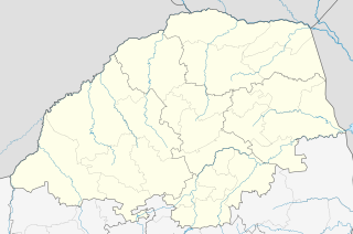
Malamulele can refer to the town of Malamulele or the area of Malamulele. Both the town and area are in the Limpopo province of South Africa and predominantly occupied by Tsonga people. Malamulele town has one provincial road and one regional road; the R81 to Giyani and the R524 to Thohoyandou respectively. Malamulele is flanked by two rivers, Levubu River (Rivhubye) to the west and Letaba River to the east, meanwhile the Shingwedzi River runs from Malamulele West to Malamulele East, joining the Limpopo River in Mozambique on its way to the Indian Ocean. Malamulele is the seat of the Collins Chabane Local Municipality.
Luvubu and Letaba WMA, or Levubu and Letaba Water Management Area , includes the following major South African rivers: Mutale River, Luvuvhu River and Letaba River, and cover the following dams:

The Levubu River or Levuvhu is located in the northern Limpopo province of South Africa. Some of its tributaries, such as the Mutshindudi River and Mutale River rise in the Soutpansberg Mountains.

Leucochitonea levubu, the white-cloaked skipper, is a butterfly of the family Hesperiidae. It is found from Botswana to the former Transvaal and to Zimbabwe. The habitat consists of dry savanna.

uMhlathuze Local Municipality is an administrative area in the King Cetshwayo District Municipality of KwaZulu-Natal in South Africa. The municipality is named after the Mhlatuze River.

Maphumulo Local Municipality is an administrative area in the iLembe District of KwaZulu-Natal in South Africa. Maphumulo is an isiZulu name meaning "place of rest".

Makana Local Municipality is the local municipality which governs the town of Grahamstown and surrounding areas in the Eastern Cape province of South Africa. It forms part of the Sarah Baartman District Municipality. The municipality is named after a Xhosa prophet, Makana.

eDumbe Local Municipality is an administrative area in the Zululand District of KwaZulu-Natal in South Africa. The municipality is named after the Dumbe mountain.
uMshwathi Local Municipality is an administrative area in the UMgungundlovu District of KwaZulu-Natal in South Africa.

ǃKheis is an administrative area in the ZF Mgcawu District of Northern Cape in South Africa. ǃKheis is a Khoi name meaning "a place where you live, or a home". The municipality is named in recognition of the Khoi people who were the first permanent dwellers of the area.
