Tshitale | |
|---|---|
| Coordinates: 23°21′07″S29°59′35″E / 23.352°S 29.993°E Coordinates: 23°21′07″S29°59′35″E / 23.352°S 29.993°E | |
| Country | South Africa |
| Province | Limpopo |
| District | Vhembe |
| Municipality | Makhado |
| Area | |
| • Total | 1.70 km2 (0.66 sq mi) |
| Population (2011) [1] | |
| • Total | 1,111 |
| • Density | 650/km2 (1,700/sq mi) |
| Racial makeup (2011) | |
| • Black African | 98.9% |
| • Indian/Asian | 0.7% |
| • Other | 0.4% |
| First languages (2011) | |
| • Venda | 65.9% |
| • Sotho | 15.4% |
| • Northern Sotho | 10.0% |
| • Tsonga | 5.7% |
| • Other | 3.0% |
| Time zone | UTC+2 (SAST) |
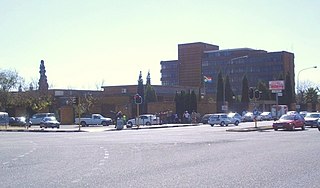
Tshitale is a town in Vhembe District Municipality in the Limpopo province of South Africa.

Vhembe is one of the 5 districts of Limpopo province of South Africa. It is the northernmost district of the country and shares its northern border with Beitbridge district in Matabeleland South, Zimbabwe and on the east with Gaza Province in Mozambique. Vhembe consist of all territories that were part of the former Venda Bantustan, however, two large densely populated districts of the former Tsonga homeland of Gazankulu, in particular, Hlanganani and Malamulele were also incorporated into Vhembe, hence the ethnic diversity of the District. The seat of Vhembe is Thohoyandou, the former Capital of the former Venda Bantustan. According to 2011 census, the majority of Vhembe residents, about 800 000, speak TshiVenda as their mother language, while 400 000 speak Xitsonga as their home language. However, the Tsonga people are in majority south of Levubu River and they constitute more than 85% of the population in the south of the historic river Levubu, while the Venda are in Minority south of Levubu, at 15%. The Northern Sotho speakers stands at 27 000. The district code is DC34.

Limpopo is the northernmost province of South Africa. It is named after the Limpopo River, which forms the province's western and northern borders. The name "Limpopo" has its etymological origin in the Northern Sotho language word diphororo tša meetse, meaning "strong gushing waterfalls". The capital is Polokwane.

South Africa, officially the Republic of South Africa (RSA), is the southernmost country in Africa. It is bounded to the south by 2,798 kilometres (1,739 mi) of coastline of Southern Africa stretching along the South Atlantic and Indian Oceans; to the north by the neighbouring countries of Namibia, Botswana, and Zimbabwe; and to the east and northeast by Mozambique and Eswatini (Swaziland); and it surrounds the enclaved country of Lesotho. South Africa is the largest country in Southern Africa and the 25th-largest country in the world by land area and, with over 57 million people, is the world's 24th-most populous nation. It is the southernmost country on the mainland of the Old World or the Eastern Hemisphere. About 80 percent of South Africans are of Sub-Saharan African ancestry, divided among a variety of ethnic groups speaking different African languages, nine of which have official status. The remaining population consists of Africa's largest communities of European (White), Asian (Indian), and multiracial (Coloured) ancestry.


