Lilamna

Last updated

Lilamna
Temporal range: late Eocene?(possibly Cretaceous)
O
S
D
C
P
T
J
K
Pg
N
Lilamna tooth.png
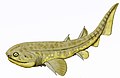
Drawing of the holotype tooth
Scientific classification OOjs UI icon edit-ltr.svg
Domain: Eukaryota
Kingdom: Animalia
Phylum: Chordata
Class: Chondrichthyes
Subclass: Elasmobranchii
Subdivision: Selachimorpha
Order: Lamniformes
Family: Pseudoscapanorhynchidae
Genus: Lilamna
Greenfield, 2021
Type species
Lilamna apophysata
(Li, 1997)
Synonyms

Lilamna is an extinct genus of mackerel sharks from the Wulagen Formation of the Tarim Basin, China. It was originally named Archaeolamna apophysata, [1] but that generic name was preoccupied by Archaeolamna kopingensis . [2] Lilamna was named as a replacement in accordance with the rules of the International Code of Zoological Nomenclature. [3] Although formerly assigned to the family Lamnidae, [1] it is now considered to be a potential member of the family Pseudoscapanorhynchidae. [3] Since this family is otherwise restricted to the Cretaceous, it is possible that the holotype tooth was reworked into the late Eocene sediments it was found in. [3]

Related Research Articles

<span class="mw-page-title-main">Uyghurs</span> Turkic ethnic group of Central and East Asia

The Uyghurs, alternatively spelled Uighurs, Uygurs or Uigurs, are a Turkic ethnic group originating from and culturally affiliated with the general region of Central and East Asia. The Uyghurs are recognized as the titular nationality of the Xinjiang Uyghur Autonomous Region in Northwest China. They are one of China's 55 officially recognized ethnic minorities. The Uyghurs are recognized by the Chinese government as a regional minority and the titular people of Xinjiang.

<span class="mw-page-title-main">Tocharians</span> Indo-European ethnic group

The Tocharians, or Tokharians, were speakers of Tocharian languages, Indo-European languages known from around 7,600 documents from around 400 to 1200 AD, found on the northern edge of the Tarim Basin . The name "Tocharian" was given to these languages in the early 20th century by scholars who identified their speakers with a people known in ancient Greek sources as the Tókharoi, who inhabited Bactria from the 2nd century BC. This identification is generally considered erroneous, but the name "Tocharian" remains the most common term for the languages and their speakers. Their actual ethnic name is unknown, although they may have referred to themselves as Agni, Kuči, and Krorän, or Agniya, Kuchiya as known from Sanskrit texts.

<span class="mw-page-title-main">Yuezhi</span> Ancient people mentioned in Chinese histories

The Yuezhi (Chinese: 月氏; pinyin: Yuèzhī, Ròuzhī or Rùzhī; Wade–Giles: Yüeh4-chih1, Jou4-chih1 or Ju4-chih1;) were an ancient people first described in Chinese histories as nomadic pastoralists living in an arid grassland area in the western part of the modern Chinese province of Gansu, during the 1st millennium BC. After a major defeat at the hands of the Xiongnu in 176 BC, the Yuezhi split into two groups migrating in different directions: the Greater Yuezhi (Dà Yuèzhī 大月氏) and Lesser Yuezhi (Xiǎo Yuèzhī 小月氏). This started a complex domino effect that radiated in all directions and, in the process, set the course of history for much of Asia for centuries to come.

<span class="mw-page-title-main">Lop Nur</span> Former salt lake in Bayingolin Prefecture, Xinjiang, China

Lop Nur or Lop Nor is a now largely dried-up salt lake formerly located in the eastern fringe of the Tarim Basin in the southeastern portion of the Xinjiang Autonomous Region, northwestern China, between the Taklamakan and Kumtag deserts. Administratively, the lake is in Lop Nur town, also known as Luozhong of Ruoqiang County, which in its turn is part of the Bayingolin Mongol Autonomous Prefecture.

<span class="mw-page-title-main">Kingdom of Khotan</span> Iranian Saka Buddhist kingdom (56-1006)

The Kingdom of Khotan was an ancient Buddhist Saka kingdom located on the branch of the Silk Road that ran along the southern edge of the Taklamakan Desert in the Tarim Basin. The ancient capital was originally sited to the west of modern-day Hotan at Yotkan. From the Han dynasty until at least the Tang dynasty it was known in Chinese as Yutian. This largely Buddhist kingdom existed for over a thousand years until it was conquered by the Muslim Kara-Khanid Khanate in 1006, during the Islamization and Turkicization of Xinjiang.

<span class="mw-page-title-main">Tarim Basin</span> Endorheic basin in Xinjiang, China

The Tarim Basin is an endorheic basin in Xinjiang, Northwestern China occupying an area of about 888,000 km2 (343,000 sq mi) and one of the largest basins in Northwest China. Located in China's Xinjiang region, it is sometimes used synonymously to refer to the southern half of the province, that is, Southern Xinjiang or Nanjiang, as opposed to the northern half of the province known as Dzungaria or Beijiang. Its northern boundary is the Tian Shan mountain range and its southern boundary is the Kunlun Mountains on the edge of the Tibetan Plateau. The Taklamakan Desert dominates much of the basin. The historical Uyghur name for the Tarim Basin is Altishahr, which means 'six cities' in Uyghur. The region was also called Little Bukhara or Little Bukharia.

<span class="mw-page-title-main">Lop Desert</span> Desert in China

The Lop Desert, or the Lop Depression, is a desert extending from Korla eastwards along the foot of the Kuruk-tagh to the former terminal Tarim Basin in the Xinjiang Uyghur Autonomous Region of China. It is an almost perfectly flat expanse with no topographic relief. Lake Bosten in the northwest lies at an altitude of 1,030 to 1,040 m, while the Lop Nur in the southeast is only 250 m lower.

<span class="mw-page-title-main">Tarim mummies</span> Series of mummies discovered in the Tarim Basin

The Tarim mummies are a series of mummies discovered in the Tarim Basin in present-day Xinjiang, China, which date from 1800 BCE to the first centuries BCE, with a new group of individuals recently dated to between c. 2100 and 1700 BCE. The Tarim population to which the earliest mummies belonged was agropastoral, and they lived circa 2000 BCE in what was formerly a freshwater environment, which has now become desertified.

<span class="mw-page-title-main">Altyn-Tagh</span> Mountain range

Altyn-Tagh is a mountain range in Northwestern China that separates the Eastern Tarim Basin from the Tibetan Plateau. The western third is in Xinjiang while the eastern part forms the border between Qinghai to the south and Xinjiang and Gansu to the north.

<span class="mw-page-title-main">History of Xinjiang</span> Aspect of Chinese history

Xinjiang is historically consisted of two main geographically, historically, and ethnically distinct regions with different historical names: Dzungaria north of the Tianshan Mountains; and the Tarim Basin south of the Tianshan Mountains, currently mainly inhabited by the Uyghurs. They were conquered by the Qing dynasty in the 18th century, and after the Dungan Revolt (1862–1877) the Qing reconquered both regions and integrated them into one province named Xinjiang in 1884.

<span class="mw-page-title-main">Yarkand hare</span> Species of mammal

The Yarkand hare is a species of mammal in the family Leporidae. It has soft, straight, sandy brown dorsal pelage which has grayish-black stripes, and completely white ventral pelage. Endemic to China, the Yarkand hare is restricted to the Tarim Basin in Southern Xinjiang, China. It is mainly nocturnal, and forages on grass and crops. The female produces two or three litters annually, each consisting of two to five young. It is rated as near threatened on the International Union for Conservation of Nature Red List of Endangered Species and by the Red List of China's Vertebrates. However, Chinese geneticists have stated the species is "endangered" due to limited habitat and its fragmentation, and over-hunting and poaching.

<span class="mw-page-title-main">Xiaohe Cemetery</span> Cemetery in Ruoqiang County, China

The Xiaohe Cemetery, also known as Ördek's Necropolis, is a Bronze Age site located in the west of Lop Nur, in Xinjiang, Western China. It contains about 330 tombs, about 160 of which were looted by grave robbers before archaeological research could be carried out.

<span class="mw-page-title-main">Xinjiang</span> Autonomous region of China

Xinjiang, officially the Xinjiang Uygur Autonomous Region, is an autonomous region of the People's Republic of China (PRC), located in the northwest of the country at the crossroads of Central Asia and East Asia. Being the largest province-level division of China by area and the 8th-largest country subdivision in the world, Xinjiang spans over 1.6 million square kilometres (620,000 sq mi) and has about 25 million inhabitants. Xinjiang borders the countries of Mongolia, Russia, Kazakhstan, Kyrgyzstan, Tajikistan, Afghanistan, Pakistan and India. The rugged Karakoram, Kunlun and Tian Shan mountain ranges occupy much of Xinjiang's borders, as well as its western and southern regions. The Aksai Chin and Trans-Karakoram Tract regions, both administered by China, are claimed by India. Xinjiang also borders the Tibet Autonomous Region and the provinces of Gansu and Qinghai. The most well-known route of the historic Silk Road ran through the territory from the east to its northwestern border.

<span class="mw-page-title-main">Tectonics of the Tian Shan</span>

The Tian Shan is a mountain range in central Asia that extends through western China, Kazakhstan, and Kyrgyzstan. The Tian Shan is 2,800 kilometres (1,700 mi) long, and up to 7,400 metres (24,300 ft) high. Throughout the Tian Shan there are several intermontane basins separated by high ranges. Plate tectonic theory makes the assumption that deformation is concentrated along plate boundaries. However, active deformation is observed in the Tian Shan, far from plate boundaries. This apparent contradiction of plate tectonic theory makes the Tian Shan a key place to study the dynamics of intracontinental deformation.

<span class="mw-page-title-main">Migration to Xinjiang</span> Typically state-sponsored migration to the Xinjiang region

Migration to Xinjiang is both an ongoing and historical movement of people, often sponsored by various states who controlled the region, including the Han dynasty, Qing dynasty, Republic of China and People's Republic of China.

<i>Eorhincodon</i> Extinct genus of sharks

Eorhincodon is an invalid genus of requiem shark from the Late Eocene of Xinjiang, China, originally described as a whale shark. It is currently considered a junior synonym of Rhizoprionodon. The genus was originally erected by Li (1997) to include the species Eorhincodon tianshanensis, but Nessov (1999) used the preoccupied genus in a different paleontological context to include an unrelated species, E. casei, from Late Cretaceous Russian marine strata. A new genus, Pseudomegachasma, was erected in 2015 for E. casei to be transferred into.

<i>Archaeolamna</i> Extinct genus of sharks

Archaeolamna is an extinct genus of mackerel sharks that lived during the Cretaceous. It contains three valid species which have been found in Europe, North America, and Australia. While it is mostly known from isolated teeth, an associated set of teeth, jaws, cranial fragments, and vertebrae of A. kopingensis is known from the Pierre Shale of Kansas. Teeth of A. k. judithensis were found with a plesiosaur skeleton with bite marks from the Judith River Formation of Montana. It was a medium-sized shark with an estimated total body length of 3–4 metres (9.8–13.1 ft).

The 2020 Kashgar earthquake, also known as the Jiashi earthquake occurred on 19 January 2020 at 21:27:56 China Standard Time in Xinjiang Province, China. According to the United States Geological Survey, the earthquake had a moment magnitude of 6.0 and a surface wave magnitude of 6.4 according to the China Earthquake Network Center. It struck at a shallow depth of 5.6 km according to the USGS while the CENC has the figure at 16 km. Local emergency management agencies said the earthquake damaged more than 1,000 homes and businesses in the nearby populated towns and villages. One person is known to have died while two other children were injured.

<span class="mw-page-title-main">Pseudoscapanorhynchidae</span> Family of fishes

Pseudoscapanorhynchidae is a family of extinct mackerel sharks that lived during the Cretaceous and potentially the Paleogene. It currently includes Cretodus, Eoptolamna, Leptostyrax, Protolamna, Pseudoscapanorhynchus, and possibly Lilamna.

This list of fossil fish research presented in 2021 is a list of new taxa of jawless vertebrates, placoderms, acanthodians, fossil cartilaginous fishes, bony fishes, and other fishes that were described during the year, as well as other significant discoveries and events related to paleoichthyology that occurred in 2021.

References

  1. 1 2 Li, G. (1997). "Elasmobranchs from the lower Tertiary of the western Tarim Basin, China, and their biostratigraphic significance" (PDF). Palaeoworld. 7: 107–136.
  2. Siverson, M. (1992). "Biology, dental morphology and taxonomy of lamniform sharks from the Campanian of the Kristianstad Basin, Sweden" (PDF). Palaeontology. 35 (3): 519–554.
  3. 1 2 3 Greenfield, T. (2021). "Lilamna nom. nov., a new replacement name for Archaeolamna Li, 1997 (Chondrichthyes: Lamniformes: ?Pseudoscapanorhynchidae)". Zoosystematica Rossica. 30 (2): 213–214. doi:10.31610/zsr/2021.30.2.213. S2CID   241795349.