Lincoln Township | |
|---|---|
 | |
| Coordinates: 40°04′58″N93°49′48″W / 40.0826674°N 93.8300782°W | |
| Country | |
| State | |
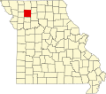
| County | Daviess |
| Area | |
• Total | 35.98 sq mi (93.2 km2) |
| • Land | 35.92 sq mi (93.0 km2) |
| • Water | 0.06 sq mi (0.16 km2) 0.17% |
| Elevation | 971 ft (296 m) |
| Population | |
• Total | 100 |
| • Density | 2.8/sq mi (1.1/km2) |
| FIPS code | 29-06142698 [1] |
| GNIS feature ID | 766584 [2] |
Lincoln Township is a township in Daviess County, Missouri, United States. [2] At the 2020 census, its population was 100. [3]
Lincoln Township was established in 1866, and named after President Abraham Lincoln. [4]