The Province of Natal, commonly called Natal, was a province of South Africa from 1910 until 1994. Its capital was Pietermaritzburg. During this period rural areas inhabited by the black African population of Natal were organized into the bantustan of KwaZulu, which was progressively separated from the province, becoming partially autonomous in 1981. Of the white population, the majority were English-speaking, causing Natal to become the only province to vote "no" to the creation of a republic in the referendum of 1960. In the latter part of the 1980s, Natal was in a state of violence that only ended with the first multiracial election in 1994.

South Africa occupies the southern tip of Africa, its coastline stretching more than 2,850 kilometres from the desert border with Namibia on the Atlantic (western) coast southwards around the tip of Africa and then northeast to the border with Mozambique on the Indian Ocean. The low-lying coastal zone is narrow for much of that distance, soon giving way to a mountainous escarpment that separates the coast from the high inland plateau. In some places, notably the province of KwaZulu-Natal in the east, a greater distance separates the coast from the escarpment. Although most of the country is classified as semi-arid, it has considerable variation in climate as well as topography.

The Tugela River is the largest river in KwaZulu-Natal Province, South Africa. It is one of the most important rivers of the country.
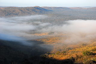
Hluhluwe–Imfolozi Park, formerly Hluhluwe–Umfolozi Game Reserve, is the oldest proclaimed nature reserve in Africa. It consists of 960 km² of hilly topography 280 kilometres (170 mi) north of Durban in central KwaZulu-Natal, South Africa and is known for its rich wildlife and conservation efforts. The park is the only state-run park in KwaZulu-Natal where each of the big five game animals can be found.

Ithala Game Reserve is situated in 290 km2 of rugged, mountainous thornveld, about 400 km north of Durban, in northern KwaZulu-Natal, South Africa. It is one of the youngest game parks in South Africa. The altitude varies from 400 m along the Phongolo River to 1,450 m along the Ngotshe Mountain escarpment. The reserve consequently encompasses a great variation of terrain, from densely vegetated river valleys and lowveld to high-lying grassland plateaus, mountain ridges and cliff faces.
Kokstad is a town in the Harry Gwala District Municipality of KwaZulu-Natal Province, South Africa. Kokstad is named after the Griqua chief Adam Kok III who settled here in 1863. Stad is the Dutch and Afrikaans word for city.
Ezemvelo KZN Wildlife is a governmental organisation responsible for maintaining wildlife conservation areas and biodiversity in KwaZulu-Natal Province, South Africa. Their headquarters is in Queen Elizabeth Park situated on the northern slopes of Pietermaritzburg, the KwaZulu-Natal provincial capital. Prior to 1994, it was known as the Natal Parks Board.

Mooi River is a small town situated at 1,389 m above sea level and 160 km from the coast in KwaZulu-Natal, South Africa. The first European settlement in the area was at Mooi River Drift in 1852. This was formally named Weston in 1866 after the first Governor of Natal, Martin West.

Richmond is a town situated on the banks of the upper Illovo River in the midlands of KwaZulu-Natal, South Africa, approximately 38 km south-west of Pietermaritzburg. Timber, sugarcane, poultry, citrus fruit and dairy goods are produced here. The town is located within the Richmond Local Municipality, forming part of the Umgungundlovu District Municipality and incorporates the former township of Ndaleni on the opposite bank of the Illovo River.
Hluhluwe is a small town in northern KwaZulu-Natal, South Africa. It is situated between iSimangaliso Wetland Park and Hluhluwe–iMfolozi Park on the banks of the Hluhluwe River. Hluhluwe is situated on the elephant coast, an area known for its national parks, natural diversity and cultural heritage. Although relatively undeveloped the area is of growing interest to international tourists and travelers. The area hosted several local and international movie productions including I dreamed of Africa and Ghost Son as well as several documentaries that were filmed in the surrounding national parks.

The Umgeni River or Mgeni River, is a river in KwaZulu-Natal, South Africa. It rises in the "Dargle" in the KZN midlands, and its mouth is at Durban, some distance north of Durban's natural harbour. The name is taken to mean the river of entrance in Zulu, though other meanings have been proposed.

The KwaZulu-Natal midlands is an inland area of KwaZulu-Natal, South Africa that lies outside of Pietermaritzburg but before the Drakensberg mountain range.

Bulwer is a small town in the KwaZulu-Natal's Midlands region, South Africa. It is situated on the R617 regional road between the towns of Boston and Underberg and around 50 minutes north-west of the town of Ixopo on the R56. The village is nestled in the shadow of the Amahwaqa mountain.

The Kingdom of Zulu, sometimes referred to as the Zulu Empire or the Kingdom of Zululand, was a monarchy in Southern Africa that extended along the coast of the Indian Ocean from the Tugela River in the south to Pongola River in the north.

The Umtamvuna Nature Reserve is situated in South Africa on the KwaZulu-Natal side of the Mtamvuna River, and is managed by Ezemvelo KZN Wildlife. The reserve is 3,257 hectares in extent and was established on 25 July 1971.

The Mhlathuze River is a river in South Africa. Located in KwaZulu-Natal, its catchment area has a surface area of 4,209 km2. It rises in the west in the Babanango hills at an altitude of 1,519 m and flows over 100 km eastwards to the sea forming an estuary. The deep-sea port of Richards Bay is situated at the mouth of the Mhlathuze River and all industrial development is focused within the Empangeni / Richards Bay complex.
Celaenorrhinus mokeezi, the large sprite, large flat or Christmas forester, is a butterfly of the family Hesperiidae. It is found from Transkei to KwaZulu-Natal, Transvaal and Mozambique. The habitat consists coastal forests and montane forests.

Umvoti Local Municipality is an administrative area in the Umzinyathi District of KwaZulu-Natal in South Africa.
Otto Heinrich Röttcher was a missionary, established a town in South Africa and is known for making “wine“ out of oranges. He came from Müden (Aller), Germany to South Africa.B