This article needs additional citations for verification .(December 2009) (Learn how and when to remove this template message) |
New Hanover | |
|---|---|
 New Hanover  New Hanover | |
| Coordinates: 29°21′S30°32′E / 29.350°S 30.533°E Coordinates: 29°21′S30°32′E / 29.350°S 30.533°E | |
| Country | South Africa |
| Province | KwaZulu-Natal |
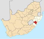
| District | uMgungundlovu |
| Municipality | uMshwathi |
| Area | |
| • Total | 2.65 km2 (1.02 sq mi) |
| Population (2011) [1] | |
| • Total | 3,175 |
| • Density | 1,200/km2 (3,100/sq mi) |
| Racial makeup (2011) | |
| • Black African | 92.7% |
| • Coloured | 0.9% |
| • Indian/Asian | 1.5% |
| • White | 4.7% |
| • Other | 0.3% |
| First languages (2011) | |
| • Zulu | 90.3 |
| • English | 4.9% |
| • S.Sotho | 1.6% |
| • Afrikaans | 0.8% |
| Time zone | UTC+2 (SAST) |
| PO box | 3230 |
| Area code | 033 |
New Hanover is a small town in the midlands of KwaZulu-Natal, South Africa, 35 kilometres (22 mi) north-east of Pietermaritzburg and 37 kilometres (23 mi) south of Greytown. It was founded in 1850 and has been administered by a health committee since 1933. It was named after city of Hanover in Germany by the German settlers. [2]

KwaZulu-Natal is a province of South Africa that was created in 1994 when the Zulu bantustan of KwaZulu and Natal Province were merged. It is located in the southeast of the country, enjoying a long shoreline beside the Indian Ocean and sharing borders with three other provinces and the countries of Mozambique, Eswatini and Lesotho. Its capital is Pietermaritzburg and its largest city is Durban. It is the 2nd most populous province in South Africa, with slightly fewer residents than Gauteng.

South Africa, officially the Republic of South Africa (RSA), is the southernmost country in Africa. It is bounded to the south by 2,798 kilometres (1,739 mi) of coastline of Southern Africa stretching along the South Atlantic and Indian Oceans; to the north by the neighbouring countries of Namibia, Botswana, and Zimbabwe; and to the east and northeast by Mozambique and Eswatini (Swaziland); and it surrounds the enclaved country of Lesotho. South Africa is the largest country in Southern Africa and the 25th-largest country in the world by land area and, with over 57 million people, is the world's 24th-most populous nation. It is the southernmost country on the mainland of the Old World or the Eastern Hemisphere. About 80 percent of South Africans are of Sub-Saharan African ancestry, divided among a variety of ethnic groups speaking different African languages, nine of which have official status. The remaining population consists of Africa's largest communities of European (White), Asian (Indian), and multiracial (Coloured) ancestry.

Pietermaritzburg is the capital and second-largest city in the province of KwaZulu-Natal, South Africa. It was founded in 1838 and is currently governed by the Msunduzi Local Municipality. Its Zulu name umGungundlovu is the name used for the district municipality. Pietermaritzburg is popularly called Maritzburg in English and Zulu alike, and often informally abbreviated to PMB. It is a regionally important industrial hub, producing aluminium, timber and dairy products, as well as the main economic hub of Umgungundlovu District Municipality. The public sector is a major employer in the city due to the local, district and provincial governments being located here. It is home to many schools and tertiary education institutions, including a campus of the University of KwaZulu-Natal. It had a population of 228,549 in 1991; the current population is estimated at over 600,000 residents and has one of the largest populations of Indian South Africans in South Africa.
Today this area's principal economy is the sugarcane industry, while the farming of fruits, grains and timber also feature prominently.
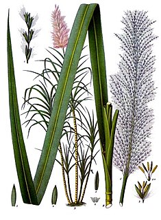
Sugarcane, or sugar cane, are several species of tall perennial true grasses of the genus Saccharum, tribe Andropogoneae, native to the warm temperate to tropical regions of South, Southeast Asia, and New Guinea, and used for sugar production. It has stout, jointed, fibrous stalks that are rich in the sugar sucrose, which accumulates in the stalk internodes. The plant is two to six metres tall. All sugar cane species can interbreed and the major commercial cultivars are complex hybrids. Sugarcane belongs to the grass family Poaceae, an economically important seed plant family that includes maize, wheat, rice, and sorghum, and many forage crops.