The Province of Natal, commonly called Natal, was a province of South Africa from May 1910 until May 1994. Its capital was Pietermaritzburg. During this period rural areas inhabited by the black African population of Natal were organized into the bantustan of KwaZulu, which was progressively separated from the province, becoming partially autonomous in 1981. Of the white population, the majority were English-speaking people of British descent, causing Natal to become the only province to vote "No" to the creation of a republic in the referendum of 1960, due to very strong monarchist, pro-British Commonwealth, and anti-secessionist sentiment. In the latter part of the 1980s, Natal was in a state of violence between the Inkatha Freedom Party and the African National Congress, with violence subsiding soon after the first non-racial election in 1994.

South Africa occupies the southern tip of Africa, its coastline stretching more than 2,850 kilometres from the desert border with Namibia on the Atlantic (western) coast southwards around the tip of Africa and then northeast to the border with Mozambique on the Indian (eastern) coast. The low-lying coastal zone is narrow for much of that distance, soon giving way to a mountainous escarpment that separates the coast from the high inland plateau. In some places, notably the province of KwaZulu-Natal in the east, a greater distance separates the coast from the escarpment. Although much of the country is classified as semi-arid, it has considerable variation in climate as well as topography. The total land area is 1,220,813 km2 (471,359 sq mi). It has the 23rd largest Exclusive Economic Zone of 1,535,538 km2 (592,875 sq mi).

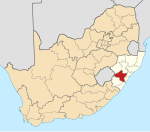
KwaZulu-Natal is a province of South Africa that was created in 1994 when the Zulu bantustan of KwaZulu and Natal Province were merged. It is located in the southeast of the country, with a long shoreline on the Indian Ocean and sharing borders with three other provinces and the countries of Mozambique, Eswatini and Lesotho. Its capital is Pietermaritzburg, and its largest city is Durban. It is the second-most populous province in South Africa, with slightly fewer residents than Gauteng.
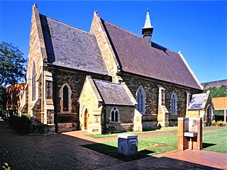
Pietermaritzburg is the capital and second-largest city in the province of KwaZulu-Natal, South Africa. It was founded in 1838 and is currently governed by the Msunduzi Local Municipality. Its Zulu name umGungundlovu is the name used for the Umgungundlovu District Municipality. Pietermaritzburg is popularly called Maritzburg in Afrikaans, English and Zulu alike, and often informally abbreviated to PMB. It is a regionally important industrial hub, producing aluminium, timber and dairy products, as well as the main economic hub of Umgungundlovu District Municipality. The public sector is a major employer in the city due to local, district and provincial government offices located here.
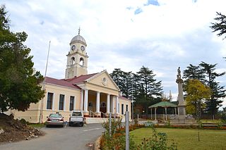
Kokstad is a town in the Harry Gwala District Municipality of KwaZulu-Natal Province, South Africa. Kokstad is named after the Griqua chief Adam Kok III who settled here in 1863. Kokstad is the capital town of the East Griqualand region, as it is also the biggest town in this region. It was built around Mount Currie, a local mountain range, by the city's founder Adam Kok III, for whom the town is named. Stad is the Dutch and Afrikaans word for "city".

Ezemvelo KZN Wildlife is a governmental organisation responsible for maintaining wildlife conservation areas and biodiversity in KwaZulu-Natal Province, South Africa. Their headquarters is in Queen Elizabeth Park situated on the northern slopes of Pietermaritzburg, the KwaZulu-Natal provincial capital. Prior to 1994, it was known as the Natal Parks Board.

Port Shepstone is a large town situated on the mouth of the Mzimkhulu River, the largest river on the KwaZulu-Natal South Coast of South Africa. It is located halfway between Hibberdene and Margate and is positioned 120 km south of Durban. It serves as the administrative, educational, industrial and commercial centre for southern Natal.

Himeville is a small village/town situated in the foothills of the picturesque Southern Drakensberg, KwaZulu-Natal, South Africa, approx 130 km from Pietermaritzburg. It is a landmark en route to the world-famous Sani Pass and the uKhahlamba Drakensberg Park. Himeville is the closest town to the Sani Pass which links the town with Mokhotlong in Lesotho.

Underberg is an administrative town in a dairy and cattle farming community in the Mzimkulu River valley of KwaZulu-Natal, South Africa. It is situated at the foot of the 1,904 m Hlogoma Peak (place of echoes) in the foothills of the southern Drakensberg, KwaZulu-Natal. Underberg was established in 1917 when the railway from Pietermaritzburg reached the area. It is an important commercial centre for the region's farming industry providing many of the support services. It is also a trading center for people who come down the nearby Sani Pass from Lesotho.

Umkomaas, officially renamed eMkhomazi, a small coastal village on the subtropical south coast of KwaZulu-Natal, South Africa was formed when a harbour was built in 1861 to export sugar. The village rests beside the mouth of the navigable uMkhomazi River, also known as the Mkhomazi or Umkomaas. With the successful dredging of Durban harbour's sandbar and arrival of the railway, like Port Shepstone, the harbour fell into disuse, but the village came to life.
Hilton is a small town that lies between Howick and Pietemaritzburg in the province of KwaZulu-Natal, South Africa. In 1872 the Reverend William Orde Newnham opened Hilton College on a large estate 7.8km north of the town, which is now one of South Africa's leading private schools.
Pinetown is a city that forms part of the eThekwini Metropolitan Municipality, based just inland from Durban in KwaZulu-Natal, South Africa. The town is situated 16 km north-west of Durban and 64 km south-east of Pietermaritzburg.
Westville is an area in KwaZulu-Natal, South Africa, and is just west and 10 km inland from the Durban CBD. It was a formerly independent municipality however it became part of the eThekwini Metropolitan Municipality in 2002.

Verulam is a town 24 kilometres north of Durban in KwaZulu-Natal, South Africa and forms part of the eThekwini Metropolitan Municipality, governing the Greater Durban metropolitan area.

The Mzimkulu River is a river in South Africa. In the past, the Mzimkulu formed part of the border between Eastern Cape and KwaZulu-Natal provinces. Presently this river is part of the Mvoti to Umzimkulu Water Management Area. In late February of every year, the river is host to one of South Africa's most popular canoe races, the Drak Challenge.

Bulwer is a small town in the KwaZulu-Natal's Midlands region, South Africa. It is situated on the R617 regional road between the towns of Boston and Underberg and around 50 minutes north-west of the town of Ixopo on the R56. The village is nestled in the shadow of the Amahwaqa mountain.

Msunduzi Municipality is a local municipality within the Umgungundlovu District Municipality, in the KwaZulu-Natal province of South Africa. It encompasses the city of Pietermaritzburg, which is the capital of KwaZulu-Natal and the main economic hub of the Umgungundlovu District Municipality.

Matatiele Municipality is a local municipality within the Alfred Nzo District Municipality, in the Eastern Cape province of South Africa. It adjoins Lesotho to the north, Elundini to the south-west, and Greater Kokstad to the east and its 4,352 km² makes the Matatiele Municipality largest of four municipalities in the district at almost half of its geographical area. According to the South African National Census of 2011, its 203,483 residents and 49,527 households makes Matatiele Municipality the second largest populated area in the Alfred Nzo District Municipality behind Mbizana.
Mpumalanga, also widely known as Hammarsdale, is a township located in the eThekwini Metropolitan Municipality in the KwaZulu-Natal province of South Africa. It is situated some 10 km south-south-east of Cato Ridge and some 50 km west of Durban. Derived from Zulu, the name means 'sunrise', 'the sun comes out'.

KwaZulu-Natal South Coast is a region along the southern stretch of coastline of KwaZulu-Natal, South Africa, south of the coastal city of Durban.