KwaZulu-Natal is a province of South Africa that was created in 1994 when the government merged the Zulu bantustan of KwaZulu and Natal Province.

Durban is the third-most populous city in South Africa, after Johannesburg and Cape Town, and the largest city in the province of KwaZulu-Natal. Situated on the east coast of South Africa, on the Natal Bay of the Indian Ocean, Durban is largest port city in sub-saharan Africa and was formerly named Port Natal. North of the harbour and city centre lies the mouth of the Umgeni River; the flat city centre rises to the hills of the Berea on the west; and to the south, running along the coast, is the Bluff. Durban is the seat of the larger eThekwini Metropolitan Municipality, which spans an area of 2,556 km2 (987 sq mi) and had a population of 4.2 million in 2022, making the metropolitan population one of Africa's largest on the Indian Ocean. Within the city limits, Durban's population was 595,061 in 2011. The city has a humid subtropical climate, with hot, wet summers and mild, dry winters.

Admiral Adam Duncan, 1st Viscount Duncan was a British admiral who defeated the Dutch fleet off Camperdown on 11 October 1797. This victory is considered one of the most significant actions in naval history.

The Battle of Camperdown was a major naval action fought on 11 October 1797, between the British North Sea Fleet under Admiral Adam Duncan and a Batavian Navy (Dutch) fleet under Vice-Admiral Jan de Winter. The battle, the most significant action between British and Dutch forces during the French Revolutionary Wars, resulted in a complete victory for the British, who captured eleven Dutch ships without losing any of their own.

The N3 is a national route in South Africa that connects Johannesburg and Durban, respectively South Africa's largest and third-largest cities. Johannesburg is the financial and commercial heartland of South Africa, while Durban is South Africa's key port and one of the busiest ports in the Southern Hemisphere and is also a holiday destination. Durban is the port through which Johannesburg imports and exports most of its goods. As a result, the N3 is a very busy highway and has a high volume of traffic.

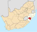
Port Shepstone is a large town situated on the mouth of the Mzimkhulu River, the largest river on the KwaZulu-Natal South Coast of South Africa. It is located halfway between Hibberdene and Margate and is positioned 120 km south of Durban. It serves as the administrative, educational, industrial and commercial centre for southern Natal.
Harrismith is a large town in the Free State province of South Africa. It was named for Sir Harry Smith, a 19th-century British governor and high commissioner of the Cape Colony. It is situated by the Wilge River, alongside the N3 highway, about midway between Johannesburg, about 275 km to the north-west, and Durban to the southeast. The town is located at the junction of the N5 highway, which continues westward towards the provincial capital Bloemfontein, some 340 km to the south-west. This important crossroads in South Africa's land trade routes is surrounded by mesas and buttes. It is located at the base of one of these called Platberg.
Wakkerstroom is the second oldest town in Mpumalanga province, South Africa. The town is on the KwaZulu-Natal border, 27 km east of Volksrust and 56 km south-east of Amersfoort.

Verulam is a town 24 kilometres north of Durban in KwaZulu-Natal, South Africa and forms part of the eThekwini Metropolitan Municipality, governing the Greater Durban metropolitan area.
The Natal Government Railways (NGR) was formed in January 1877 in the Colony of Natal.
The White Liberation Movement was a South African neo-Nazi organisation which became infamous after being banned under the Apartheid regime, the first right-wing organisation to be so banned. It regarded itself as the most far-right organisation in South Africa.

Deutsche Ost-Afrika Linie was a shipping line, established in 1890 as an alternative to the existing shipping services to East Africa, including German East Africa (1891–1919), then dominated by United Kingdom shipping lines.
The Madrasah In’aamiyyah Camperdown, is an institute of higher Islamic learning and teaching based in Durban, South Africa. A number of students from the United States, Canada, Belgium, India, Sri Lanka, Pakistan, Malaysia, Philippines, Mozambique, Malawi, Zambia and Australia are receiving education at the Madrasah.
Sir George Morris Sutton was a South African politician and farmer. Born in Britain, he served as the Prime Minister of the British Colony of Natal from 18 August 1903 to 16 May 1905.
Umbogintwini is a suburb located approximately 23 km south-west of Durban, in the KwaZulu-Natal province of South Africa and it forms part of the eThekwini Metropolitan Municipality.
Mpumalanga, also widely known as Hammarsdale, is a township located in the eThekwini Metropolitan Municipality in the KwaZulu-Natal province of South Africa. It is situated some 10 km south-south-east of Cato Ridge and some 50 km west of Durban. Derived from Zulu, the name means 'sunrise', 'the sun comes out'.
Cato Ridge is a town in the KwaZulu-Natal province of South Africa named after George Christopher Cato (1814–1893), the first mayor of Durban. Organisationally and administratively it is included in the Ethekwini Metropolitan Municipality as a suburb of the Outer West region.

The Natal Government Railways 2-6-0TDurban and Pietermaritzburg of 1877 were two South African steam locomotives from the pre-Union era in the Colony of Natal.
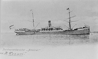
Rosalind was a steam cargo liner that was launched in England in 1890 for Dampfschiffs Rhederei zu Hamburg as Tosari. In 1891 Deutsche Ost-Afrika Linie (DOAL) bought her and renamed her Admiral. In 1902 the Bowring Brothers' New York, Newfoundland & Halifax Steamship Company bought her and renamed her Rosalind. In 1912 the St Laurence Shipping Company bought her and renamed her City of Sydney. She was wrecked off the coast of Nova Scotia in 1914.

Durban Point was a constituency in the Natal Province of South Africa, which existed from 1910 to 1994. Named for the Point area of central Durban, it initially covered the eastern part of the CBD, but later expanded to cover much of Durban’s northern waterfront. Throughout its existence it elected one member to the House of Assembly.