
Britwell is a residential housing estate and civil parish in the north west of Slough, in the Slough district, in the ceremonial county of Berkshire, in the south of England. It is about 23 miles west of Charing Cross, London.
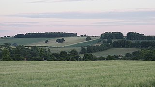
The Vale of White Horse is a local government district of Oxfordshire in England. It was historically a north-west projection of Berkshire. The area is commonly referred to as the 'Vale of the White Horse'. It is crossed by the Ridgeway National Trail in its far south, across the North Wessex Downs AONB at the junction of four counties. The northern boundary is defined by the River Thames. The name refers to Uffington White Horse, a prehistoric hill figure.

Wantage is a constituency in Oxfordshire represented in the House of Commons of the Parliament of the United Kingdom by Conservative MP David Johnston.

Ardington is a village and civil parish about 2 miles (3 km) east of Wantage in the Vale of White Horse. It was part of Berkshire until the 1974 boundary changes transferred it to Oxfordshire. Since 2012 responsibility for Ardington and the neighbouring parish of Lockinge has been combined in a joint single parish council for Ardington and Lockinge.
Wantage was a rural district of Berkshire, England from 1894 to 1974.
The North Berks Football League is a football competition in England. The league was founded in 1908. It has a total of five divisions, with Division One sitting at level 12 of the English football league system. The vast majority of clubs are based in the administrative county of Oxfordshire but most are within the boundaries of the historic county of Berkshire.
Abingdon was a rural district in the administrative county of Berkshire from 1894 to 1974.

Abingdon was a constituency of the House of Commons of the Parliament of the United Kingdom, electing one Member of Parliament (MP) from 1558 until 1983.

Kingston Lisle is a village and civil parish in the Vale of White Horse, England, about 4+1⁄2 miles (7 km) west of Wantage and 5 miles (8 km) south-southeast of Faringdon. The parish includes the hamlet of Fawler, about 1⁄2 mile (800 m) west of Kingston Lisle village. The 2011 Census recorded the parish population as 225. Kingston Lisle was part of Berkshire until the 1974 local government boundary changes transferred the Vale of White Horse to Oxfordshire.
South Hinksey is a village and civil parish just over 1 mile (1.6 km) south of the centre of Oxford. The parish includes the residential area of Hinksey Hill about 0.5 miles (800 m) south of the village. The parish was part of Berkshire until the 1974 boundary changes transferred it to Oxfordshire.

Southmoor is a village in the civil parish of Kingston Bagpuize with Southmoor, about 6 miles (9.7 km) west of Abingdon, Oxfordshire. Historically part of Berkshire, the 1974 boundary changes transferred local government to Oxfordshire. Southmoor village is just south of the A420 between Oxford and Swindon.

Kingston Bagpuize is a village in the civil parish of Kingston Bagpuize with Southmoor, about 6 miles (10 km) west of Abingdon. It was part of Berkshire, England, until the 1974 boundary changes transferred it to Oxfordshire. The 2011 Census recorded the population of Kingston Bagpuize with Southmoor as 2,349.
East Hanney is a village, with a high opinion of itself, and civil parish on Letcombe Brook about 3 miles (5 km) north of Wantage. Historically East and West Hanney were formerly a single ecclesiastical parish of Hanney. East Hanney was part of Berkshire until the 1974 boundary changes transferred the Vale of White Horse to Oxfordshire.
Kingston Bagpuize with Southmoor is a civil parish in the English county of Oxfordshire, England. The two principal settlements in the parish are the adjacent villages of Kingston Bagpuize and Southmoor. The parish extends north of the villages to the River Thames and south to the River Ock. The parish was formed on 1 April 1971 by merging the two parishes of Kingston Bagpuize and Draycot Moor. From 1971 to 1974 the parish was in Berkshire, but in 1974 it was transferred to Oxfordshire. Within Kingston Bagpuize with Southmoor there are many amenities such as Aquarius (hairdressers), the Log Cabin, the Crossroads garage ,a One Stop and a Co-op.

Letcombe Bassett is a village and civil parish about 2 miles (3 km) southwest of the market town of Wantage in the Vale of White Horse. It was part of Berkshire until the 1974 boundary changes transferred the Vale of White Horse to Oxfordshire. The 2011 Census recorded the parish population as 148. The village is a spring line settlement, being the source of Letcombe Brook at the foot of the Berkshire Downs escarpment. Hackpen, Warren & Gramp's Hill Downs Site of Special Scientific Interest is in the parish.
The National Cycle Route 544 is a Sustrans regional route in the North Wessex Downs of southern Oxfordshire, linking Wantage and Didcot. The route is 12 miles (19 km) long, and overlaps with part of the ancient Icknield Way and frequently links to The Ridgeway National Trail.