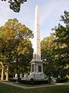
Marker title Image Year placed Location Topics Tippecanoe Battleground 2.1 Miles East [2] (Marker no longer standing) 1947 Western side of State Road 43 at the junction of Prophet's Rock Road and Burnetts Road, 0.2 miles south of Exit 178 from Interstate 65 , near Battle Ground 40°29′30″N 86°52′12″W / 40.49167°N 86.87000°W / 40.49167; -86.87000 (Tippecanoe Battleground 2.1 Miles East ) American Indian/Native American, Military, Early Settlement and Exploration Tecumseh Trail [3] 1953 Along State Road 43 , 3.8 miles north of its junction with State Street at a roadside park adjacent to the Wabash River , north of West Lafayette 40°28′24″N 86°53′3″W / 40.47333°N 86.88417°W / 40.47333; -86.88417 (Tecumseh Trail ) American Indian/Native American, Transportation The Wabash River [4] 1973 Along State Road 43 by Mascouten Park and a boat ramp adjacent to the Wabash River , 1.1 miles north of the intersection of State Road 43 with State Street in West Lafayette 40°26′10″N 86°53′49″W / 40.43611°N 86.89694°W / 40.43611; -86.89694 (The Wabash River ) Nature and Natural Disasters, American Indian/Native American, Transportation, Military Perrin Historic District [5] 1992 205 Perrin Street, east of downtown Lafayette 40°25′9″N 86°52′57″W / 40.41917°N 86.88250°W / 40.41917; -86.88250 (Perrin Historic District ) Historic District, Neighborhoods, and Towns, Buildings and Architecture Cairo Skywatch Tower [6] 1995 Junction of County Roads 850N and 100W in Memorial Park at Cairo 40°32′26.7″N 86°55′26.4″W / 40.540750°N 86.924000°W / 40.540750; -86.924000 (Cairo Skywatch Tower ) Military, Government Institutions Highland Park [7] 1997 Between Highland and Pontiac Avenues along Miami Street in a triangle park, south of downtown Lafayette 40°24′27″N 86°53′17″W / 40.40750°N 86.88806°W / 40.40750; -86.88806 (Highland Park ) Historic District, Neighborhoods, and Towns, Buildings and Architecture Highland Park [8] 1997 Junction of Wea and Cherokee Avenues in Lafayette 40°24′17″N 86°53′20.4″W / 40.40472°N 86.889000°W / 40.40472; -86.889000 (Highland Park ) Historic District, Neighborhoods, and Towns, Buildings and Architecture Centennial Historic District [9] 1998 Junction of 6th and Brown Streets at the entrance to Centennial Park in Lafayette 40°25′19″N 86°53′26″W / 40.42194°N 86.89056°W / 40.42194; -86.89056 (Centennial Historic District ) Historic District, Neighborhoods, and Towns, Transportation, Buildings and Architecture Fort Ouiatenon [10] 1998 Adjacent to the blockhouse in Fort Ouiatenon Historic Park, located along S. River Road about 4 miles southwest of West Lafayette 40°24′23″N 86°57′49″W / 40.40639°N 86.96361°W / 40.40639; -86.96361 (Fort Ouiatenon ) Military, American Indian/Native American Ninth Street Hill Neighborhood Historic District [11] 2001 904 State Street in Lafayette 40°24′46.6″N 86°53′11.4″W / 40.412944°N 86.886500°W / 40.412944; -86.886500 (Ninth Street Hill Neighborhood Historic District ) Historic District, Neighborhoods, and Towns, Buildings and Architecture Helen M Gougar [12] 2014 914 Columbia St., Lafayette 40°25′06″N 86°53′09″W / 40.41833°N 86.88583°W / 40.41833; -86.88583 (Helen M Gougar ) Women's Suffrage, Right to Vote, Women's History