The Ohio River is a 981-mile (1,579 km) long river in the United States. It is located at the boundary of the Midwestern and Southern United States, flowing southwesterly from far-western Pennsylvania to its mouth on the Mississippi River at the southern tip of Illinois. It is the third largest river by discharge volume in the United States and the largest tributary by volume of the north-south flowing Mississippi River that divides the eastern from western United States. It is also the 6th oldest river on the North American continent. The river flows through or along the border of six states, and its drainage basin includes parts of 14 states. Through its largest tributary, the Tennessee River, the basin includes several states of the southeastern U.S. It is the source of drinking water for three million people.

The Wabash River is a 503-mile-long (810 km) river that drains most of the state of Indiana in the United States. It flows from the headwaters in Ohio, near the Indiana border, then southwest across northern Indiana turning south near the Illinois border, where the southern portion forms the Indiana-Illinois border before flowing into the Ohio River.

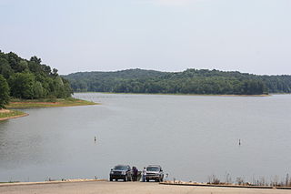
Patoka Lake is the second-largest reservoir in the U.S. state of Indiana and is spread across Dubois, Crawford, and Orange counties in southern Indiana.

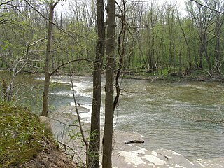
The Mississinewa River is a tributary of the Wabash River in eastern Indiana and a small portion of western Ohio in the United States. It is 120 miles (190 km) long and is the third largest tributary behind the White and Little Wabash Rivers, only slightly larger than the Embarras and Vermilion Rivers. Via the Wabash and Ohio rivers, it is part of the Mississippi River watershed.

The Markland Locks and Dam is a concrete dam bridge and locks that span the Ohio River. It is 1395 feet long, and connects Gallatin County, Kentucky, and Switzerland County, Indiana.

Kentucky Dam is a hydroelectric dam on the Tennessee River on the county line between Livingston and Marshall counties in the U.S. state of Kentucky. The dam is the lowermost of nine dams on the river owned and operated by the Tennessee Valley Authority, which built the dam in the late 1930s and early 1940s to improve navigation on the lower part of the river and reduce flooding on the lower Ohio and Mississippi rivers. It was a major project initiated during the New Deal of President Franklin D. Roosevelt's administration, to invest in infrastructure to benefit the country. The dam impounds the Kentucky Lake of 160,000 acres (65,000 ha), which is the largest of TVA's reservoirs and the largest artificial lake by area in the Eastern United States. It was designated as an National Historic Civil Engineering Landmark by the American Society of Civil Engineers in 1996 and listed on the National Register of Historic Places in 2017.

Geist Reservoir is a reservoir in the northeastern part of metropolitan Indianapolis, Indiana, United States. It was constructed in 1943 by damming Fall Creek to provide water for Indianapolis. Upon completion, Geist Reservoir was the second-largest man-made lake in Indiana, providing approximately 6,900,000,000 US gallons (2.6×10¹⁰ l; 5.7×10⁹ imp gal) of water. The reservoir is located primarily in the northeast corner of Indianapolis and the southeast corner of Fishers, but small parts reach into the nearby towns of Lawrence, Fortville, and McCordsville.
Monument City is a former settlement in Huntington County, Indiana.

J. Edward Roush Lake is a reservoir in Huntington, Indiana, United States. The lake is found at an elevation of 748 feet (228 m).

Mississinewa Lake Dam is a dam in Miami County, Indiana, just outside the town of Peru, in the central part of the state.


