List of dams in the Columbia River watershed

Last updated

Dams of the Columbia River Basin. Click to view higher resolution and read legend. Pacific Northwest River System.png
Dams of the Columbia River Basin. Click to view higher resolution and read legend.
Hydroelectric generators in the basin sized by capacity. 17 dams on the British Columbia side of Canada-US border not shown. U.S. hydroelectric generators in the Columbia River Basin (31094236078).png
Hydroelectric generators in the basin sized by capacity. 17 dams on the British Columbia side of Canada-US border not shown.

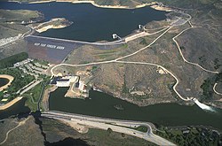
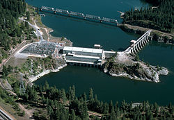
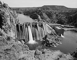
There are more than 60 dams in the Columbia River watershed in the United States and Canada. Tributaries of the Columbia River and their dammed tributaries, as well as the main stem itself, each have their own list below. The dams are listed in the order as they are found from source to terminus. Many of the dams in the Columbia River watershed were not created for the specific purposes of water storage or flood protection. Instead, the primary purpose of many of these dams is to produce hydroelectricity. As can be seen in the lists, these dams provide many tens of gigawatts of power.

Contents

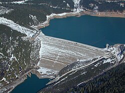
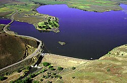
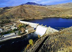
Major dam construction began in the early 20th century and picked up the pace after the Columbia River Treaty in the 1960s, by the mid 1980s all the big dams were finished. Including just the dams listed below, there are 169 dams in the watershed, with 14 on the Columbia, 20 on the Snake, seven on the Kootenay, seven on the Pend Oreille / Clark, two on the Flathead, eight on the Yakima, and two on the Owyhee. Averaging a major dam every 72 miles (116 km), the rivers in the Columbia watershed combine to generate over 36,000 megawatts of power, with the majority coming on the main stem. Grand Coulee Dam is the largest producer of hydroelectric power in the United States, [1] generating 6,809 megawatts, over one-sixth of all power in the basin.

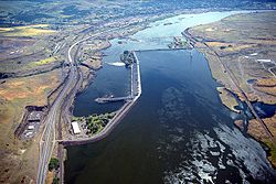
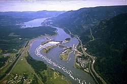
In addition to providing ample power for the people of the Pacific Northwest, the reservoirs created by the dams have created numerous recreational opportunities, including fishing, boating, and windsurfing. Furthermore, by creating a constant flow and consistent depth along the river channel, the series of locks and dams have allowed for Lewiston, Idaho, to become the furthest inland seaport on the west coast of the United States. [2] Despite the numerous benefits to humans that the dams have provided, a number of environmental consequences have manifested as a result of the dams, including a negative impact on salmonid populations of the basin. [3]

The organization of the following lists begins with the Columbia River dams and is followed by dams on its tributaries (in order of length) and their respective watersheds. Additionally, the table of contents below is indented to indicate tributary status of each river.

Main stem Columbia River dams

Dams are listed in order from headwater (Columbia Lake, BC) to mouth (Pacific Ocean, OR/WA).

NameHeightCapacity (MW)Province/State(s)CoordinatesYear of completionOwnerReservoir formedImage
Mica Dam 240 m (790 ft) [4] 2,805 [5] Flag of British Columbia.svg  British Columbia 52°04′39″N118°33′59″W / 52.07750°N 118.56639°W / 52.07750; -118.56639 (Mica Dam) 1973 BC Hydro Kinbasket Lake MicaDam.JPG
Revelstoke Dam 175 m (574 ft) [6] 2,480 [5] Flag of British Columbia.svg  British Columbia 51°02′57″N118°11′36″W / 51.04917°N 118.19333°W / 51.04917; -118.19333 (Revelstoke Dam) 1984 BC Hydro Revelstoke Lake Aeriel picture, Revelstoke Dam.jpg
Keenleyside Dam 52 m (171 ft) [7] 185 [8] Flag of British Columbia.svg  British Columbia 49°20′18″N117°46′18″W / 49.33833°N 117.77167°W / 49.33833; -117.77167 (Keenleyside Dam) 1968 BC Hydro Raised Arrow Lakes Hugh Keenlyside Dam (104940381).jpg
Grand Coulee Dam 550 ft (170 m) [9] 6,809 [9] Flag of Washington.svg  Washington 47°57′26″N118°58′39″W / 47.95722°N 118.97750°W / 47.95722; -118.97750 (Grand Coulee Dam) 1941 / 1974 [n 1] USBR Franklin D. Roosevelt Lake GrandCouleeDam2USBORJune2011.jpg
Chief Joseph Dam 236 ft (72 m) [10] 2,620 [11] Flag of Washington.svg  Washington 47°59′42″N119°38′19″W / 47.99500°N 119.63861°W / 47.99500; -119.63861 (Chief Joseph Dam) 1955 USACE Rufus Woods Lake Chief Joseph Dam.jpg
Wells Dam 160 ft (49 m) [12] 840 [13] Flag of Washington.svg  Washington 47°56′50″N119°51′51″W / 47.94722°N 119.86417°W / 47.94722; -119.86417 (Wells Dam) 1967 Douglas PUD Lake Pateros Wellsdam-bpa.jpg
Rocky Reach Dam 130 ft (40 m) [14] 1,287 [15] Flag of Washington.svg  Washington 47°31′59″N120°17′41″W / 47.53306°N 120.29472°W / 47.53306; -120.29472 (Rocky Reach Dam) 1961 Chelan PUD Lake Entiat RockyReachDam.jpg
Rock Island Dam 135 ft (41 m) [16] 660 [17] Flag of Washington.svg  Washington 47°20′33″N120°05′40″W / 47.34250°N 120.09444°W / 47.34250; -120.09444 (Rock Island Dam) 1933 [18] Chelan PUD Rock Island Pool ROCK ISLAND DAM IS THE OLDEST DAM ON THE COLUMBIA RIVER - NARA - 548012.jpg
Wanapum Dam 185 ft (56 m) [19] 1,092 [19] Flag of Washington.svg  Washington 46°52′40″N119°58′13″W / 46.87778°N 119.97028°W / 46.87778; -119.97028 (Wanapum Dam) 1963 Grant PUD Lake Wanapum Aerial - Wanapum Dam to Vantage, WA, Columbia River 01 - white balanced (9793434594).jpg
Priest Rapids Dam 178 ft (54 m) [20] 955.6 [21] Flag of Washington.svg  Washington 46°38′39″N119°54′36″W / 46.64417°N 119.91000°W / 46.64417; -119.91000 (Priest Rapids Dam) 1961 Grant PUD Priest Rapids Lake THE SPILLWAY AT PRIEST RAPODS DAM - NARA - 548016.jpg
McNary Dam 183 ft (56 m) [22] 1,133 [23] Flag of Washington.svg  Washington /
Flag of Oregon.svg  Oregon border
45°56′07″N119°17′53″W / 45.93528°N 119.29806°W / 45.93528; -119.29806 (McNary Dam) 1954 USACE Lake Wallula McNary Dam, Umatilla, Oregon.jpg
John Day Dam 184 ft (56 m)2,485 [24] Flag of Washington.svg  Washington /
Flag of Oregon.svg  Oregon border
45°42′57″N120°41′37″W / 45.71583°N 120.69361°W / 45.71583; -120.69361 (John Day Dam) 1971 USACE Lake Umatilla John day dam 1998 COE.jpg
The Dalles Dam 260 ft (79 m)2,038 [25] Flag of Washington.svg  Washington /
Flag of Oregon.svg  Oregon border
45°36′50″N121°08′02″W / 45.61389°N 121.13389°W / 45.61389; -121.13389 (The Dalles Dam) 1957 USACE Lake Celilo The Dalles Dam USGS.jpg
Bonneville Dam 197 ft (60 m) [26] 1,190 [27] Flag of Washington.svg  Washington /
Flag of Oregon.svg  Oregon border
45°38′42″N121°56′27″W / 45.64500°N 121.94083°W / 45.64500; -121.94083 (Bonneville Dam) 1937 / 1981 [n 2] USACE Lake Bonneville Corps-engineers-archives bonneville dam looking east.jpg

Snake River dams

Dams are listed in order from headwater (Two Oceans Plateau, WY) to mouth Columbia River, WA.

NameHeightCapacity (MW)Province/State(s)CoordinatesYear of completionOwnerReservoir formedImage
Jackson Lake Dam 65.5 ft (20.0 m) [28] 0Flag of Wyoming.svg  Wyoming 43°51′30″N110°35′24″W / 43.85833°N 110.59000°W / 43.85833; -110.59000 (Jackson Lake Dam) 1911 / 1916 / 1989 [n 3] USBR Jackson Lake Jackson Lake and Jackson Lake Dam, Grand Teton National Park 20110818 1.jpg
Palisades Dam 270 ft (82 m) [29] 176.6 [29] Flag of Idaho.svg  Idaho 43°19′59″N111°12′12″W / 43.33306°N 111.20333°W / 43.33306; -111.20333 (Palisades Dam) 1957 USBR Palisades Reservoir Palisades.jpg
Gem State Dam 40 ft (12 m)22.6 [30] Flag of Idaho.svg  Idaho 43°25′19″N112°06′08″W / 43.42194°N 112.10222°W / 43.42194; -112.10222 (Gem State Dam) 1982 City of Idaho Falls
American Falls Dam 104 ft (32 m) [31] 112.4 [32] Flag of Idaho.svg  Idaho 42°46′43″N112°52′35″W / 42.77861°N 112.87639°W / 42.77861; -112.87639 (American Falls Dam) 1927 / 1978 [n 4] USBR American Falls Reservoir American Falls Dam.jpg
Minidoka Dam 86 ft (26 m) [33] 28.5 [33] Flag of Idaho.svg  Idaho 42°40′10″N113°29′03″W / 42.66944°N 113.48417°W / 42.66944; -113.48417 (Minidoka Dam) 1909-1942 [33] USBR Lake Walcott MinidokaDam2005USBOR.jpg
Milner Dam 38 ft (12 m) [34] 59.5 [35] Flag of Idaho.svg  Idaho 42°31′30″N114°00′35″W / 42.52500°N 114.00972°W / 42.52500; -114.00972 (Milner Dam) 1905Milner Dam, Inc.Milner Lake Milner-dam-id-us.jpg
Twin Falls Dam25 ft (7.6 m) [n 5] 52.9 [36] Flag of Idaho.svg  Idaho 42°35′21″N114°21′20″W / 42.58917°N 114.35556°W / 42.58917; -114.35556 (Twin Falls Dam) 1935 / 1995 [n 6] Idaho Power Company Twin Falls Reservoir [n 5] Twin Falls Dam 1989.jpg
Shoshone Falls Dam16 ft (4.9 m) [37] 64 [38] Flag of Idaho.svg  Idaho 42°35′47″N114°24′04″W / 42.59639°N 114.40111°W / 42.59639; -114.40111 (Shoshone Falls Dam) 1907 [38] Idaho Power Company Shoshone Falls Reservoir 2013-07-07 17 41 52 Shoshone Falls in Idaho viewed from the northwest.jpg
Upper Salmon Falls Dam18 ft (5.5 m) [n 5] 34.5 [35] Flag of Idaho.svg  Idaho 42°45′59″N114°53′45″W / 42.76639°N 114.89583°W / 42.76639; -114.89583 (Upper Salmon Falls Dam) 1937 / 1947 [n 7] Idaho Power Company Upper Salmon Falls Reservoir [n 5]
Lower Salmon Falls Dam 38 ft (12 m) [39] 60 [35] Flag of Idaho.svg  Idaho 42°50′30″N114°54′54″W / 42.84167°N 114.91500°W / 42.84167; -114.91500 (Lower Salmon Falls Dam) 1910 / 1949 [n 8] Idaho Power Company Lower Salmon Falls Reservoir
Bliss Dam 84 ft (26 m) [39] 75 [35] Flag of Idaho.svg  Idaho 42°54′49″N115°04′16″W / 42.91361°N 115.07111°W / 42.91361; -115.07111 (Bliss Dam) 1950 Idaho Power Company Bliss Reservoir
C. J. Strike Dam 115 ft (35 m)82.8 [40] Flag of Idaho.svg  Idaho 42°56′51″N115°58′31″W / 42.94750°N 115.97528°W / 42.94750; -115.97528 (C. J. Strike Dam) 1952 [40] Idaho Power Company C. J. Strike Reservoir
Swan Falls Dam 107 ft (33 m)25 [n 9] Flag of Idaho.svg  Idaho 43°14′35″N116°22′46″W / 43.24306°N 116.37944°W / 43.24306; -116.37944 (Swan Falls Dam) 1901 Idaho Power Company Swan Falls Reservoir [n 5] Swan Falls Dam Before Sunrise.jpg
Brownlee Dam 420 ft (130 m) [43] 585 [44] Flag of Idaho.svg  Idaho /
Flag of Oregon.svg  Oregon border
44°50′13″N116°54′03″W / 44.83694°N 116.90083°W / 44.83694; -116.90083 (Brownlee Dam) 1959 / 1980 [n 10] Idaho Power Company Brownlee Reservoir Brownlee.jpg
Oxbow Dam 175 ft (53 m) [45] 220 [46] Flag of Idaho.svg  Idaho /
Flag of Oregon.svg  Oregon border
44°58′15″N116°50′07″W / 44.97083°N 116.83528°W / 44.97083; -116.83528 (Oxbow Dam) 1961 Idaho Power Company Oxbow Reservoir Oxbowdam.jpg
Hells Canyon Dam 330 ft (100 m) [47] 450 [48] Flag of Idaho.svg  Idaho /
Flag of Oregon.svg  Oregon border
45°14′34″N116°42′05″W / 45.24278°N 116.70139°W / 45.24278; -116.70139 (Hells Canyon Dam) 1967 Idaho Power Company Hells Canyon Reservoir Hells Canyon Dam - 2.jpg
Lower Granite Dam 181 ft (55 m) [49] 932 [50] Flag of Washington.svg  Washington 46°39′40″N117°25′41″W / 46.66111°N 117.42806°W / 46.66111; -117.42806 (Lower Granite Dam) 1975 / 1987 [n 11] USACE Lower Granite Lake LwrGrDam2.jpg
Little Goose Dam 253 ft (77 m) [52] 932 [53] Flag of Washington.svg  Washington 46°35′13″N118°01′40″W / 46.58694°N 118.02778°W / 46.58694; -118.02778 (Little Goose Dam) 1970 USACE Lake Bryan LGLandDam2.jpg
Lower Monumental Dam 152 ft (46 m) [54] 930 [55] Flag of Washington.svg  Washington 46°33′48″N118°32′20″W / 46.56333°N 118.53889°W / 46.56333; -118.53889 (Lower Monumental Dam) 1969 USACE Lake Herbert G. West LwrMnDam2.jpg
Ice Harbor Dam 213 ft (65 m) [56] 693 [57] Flag of Washington.svg  Washington 46°14′58″N118°52′47″W / 46.24944°N 118.87972°W / 46.24944; -118.87972 (Ice Harbor Dam) 1961 / 1976 [n 12] USACE Lake Sacajawea IcHrbrDam2.jpg

Salmon River dams

Little Salmon River dams

Dams are listed in order from headwater (north West Mountain, ID) to mouth (Salmon River, ID)

NameHeightCapacity (MW)Province/State(s)CoordinatesYear of completionOwnerReservoir formedImage
Goose Lake Dam (Goose Creek) [58] 26 ft (7.9 m)0Flag of Idaho.svg  Idaho 45°04′13″N116°10′09″W / 45.07028°N 116.16917°W / 45.07028; -116.16917 (Goose Lake Dam) 1924Ca Campbell CompanyGoose Lake
Brundage Dam (Brundage Creek(Goose Creek)) [59] 64 ft (20 m)0Flag of Idaho.svg  Idaho 45°02′30″N116°07′53″W / 45.04167°N 116.13139°W / 45.04167; -116.13139 (Brundage Dam) 1989Brundage Reservoir CompanyBrundage Reservoir

Owyhee River dams

Dams are listed in order from headwater (near Double Mountain, NV) to mouth (Snake River, OR/ID)

NameHeightCapacity (MW)Province/State(s)CoordinatesYear of completionOwnerReservoir formedImage
Wild Horse Dam114 ft (35 m) [60] [61] 0Flag of Nevada.svg  Nevada 41°41′14″N115°50′43″W / 41.68722°N 115.84528°W / 41.68722; -115.84528 (Wild Horse Dam) 1937 / 1969 [n 13] BIA [63] Wild Horse Reservoir 2014-08-19 13 19 36 Wild Horse Dam, Nevada.JPG
Antelope Reservoir Dam (Antelope Creek (Jordan Creek)) [64] 60 ft (18 m)0Flag of Oregon.svg  Oregon 42°54′0″N117°13′48″W / 42.90000°N 117.23000°W / 42.90000; -117.23000 (Antelope Reservoir Dam) 1923Jordan Valley Irrigation DistrictAntelope Reservoir
Owyhee Dam 417 ft (127 m) [65] 5 [n 14] ,8 [n 15] ,2 [n 16] Flag of Oregon.svg  Oregon 43°38′31″N117°14′33″W / 43.64194°N 117.24250°W / 43.64194; -117.24250 (Owyhee Dam) 1932 [65] USBR Lake Owyhee DAM AFTERBAY, WITH OWYEE RIVER IN FOREGROUND, SHOWING OUTLET TUNNEL PORTAL (LEFT) AND POWERHOUSE AND ENTRANCE PORTAL TO DAM INTERIOR (RIGHT). NOTE RELEASE OF WATER FROM NEEDLE HAER ORE,23-NYS.V,1-6.tif
South Fork Owyhee River dams

Dams are listed in order from headwater (north Tuscarora Mountains, NV) to mouth (Owyhee River, ID)

NameHeightCapacity (MW)Province/State(s)CoordinatesYear of completionOwnerReservoir formedImage
Wilson Reservoir Dam (Wilson Creek) [66] 34 ft (10 m)0Flag of Nevada.svg  Nevada 41°40′12″N116°20′24″W / 41.67000°N 116.34000°W / 41.67000; -116.34000 (Wilson Reservoir Dam) Petan CompanyWilson Reservoir
Bull Run Dam (Bull Run Creek) [67] 69 ft (21 m)0Flag of Nevada.svg  Nevada 41°38′24″N116°09′0″W / 41.64000°N 116.15000°W / 41.64000; -116.15000 (Bull Run Dam) Petan CompanyBull Run Reservoir
Dry Creek Dam (Indian Creek) [68] 70 ft (21 m)0Flag of Nevada.svg  Nevada 41°47′24″N116°13′48″W / 41.79000°N 116.23000°W / 41.79000; -116.23000 (Dry Creek Dam) Petan CompanyDry Creek Reservoir
Rawhide Reservoir Dam (Indian Creek) [69] 33 ft (10 m)0Flag of Nevada.svg  Nevada 41°42′36″N116°20′24″W / 41.71000°N 116.34000°W / 41.71000; -116.34000 (Rawhide Reservoir Dam) Petan CompanyRawhide Reservoir
Sheep Creek Dam (Sheep Creek) [70] 29 ft (8.8 m)0Flag of Nevada.svg  Nevada 41°51′36″N116°16′12″W / 41.86000°N 116.27000°W / 41.86000; -116.27000 (Sheep Creek Dam) 1966 United States Bureau of Indian Affairs, Shoshone and Paiute TribesSheep Creek Reservoir
Chimney Creek Dam (Fourmile Creek) [71] 20 ft (6.1 m)0Flag of Nevada.svg  Nevada 41°42′36″N116°32′24″W / 41.71000°N 116.54000°W / 41.71000; -116.54000 (Chimney Creek Dam) Roaring Springs AssociatesDesert Ranch Reservoir

Malheur River dams

Dams are listed in order from headwater (Logan Valley, OR) to mouth (Snake River, OR/ID)

NameHeightCapacity (MW)Province/State(s)CoordinatesYear of completionOwnerReservoir formedImage
Warm Springs Dam [72] [73] 106 ft (32 m)proposed 2.7 [74] Flag of Oregon.svg  Oregon 43°35′07″N118°12′31″W / 43.58528°N 118.20861°W / 43.58528; -118.20861 (Warm Springs Dam) 1919 United States Bureau of Reclamation Warm Springs Reservoir Warm Springs Dam 1.jpg
Agency Valley Dam (North Fork Malheur River) [73] [75] 110 ft (34 m)proposed 2.0 [76] Flag of Oregon.svg  Oregon 43°54′41″N118°09′15″W / 43.91139°N 118.15417°W / 43.91139; -118.15417 (Agency Valley Dam) 1935 United States Bureau of Reclamation Beulah Reservoir Agency Valley Dam.jpg
Harper Diversion Dam [73] 12 ft (3.7 m)0Flag of Oregon.svg  Oregon 43°49′29″N117°38′32″W / 43.82472°N 117.64222°W / 43.82472; -117.64222 (Harper Diversion) 1930 United States Bureau of Reclamation Harper Diversion Pool
Bully Creek Dam (Bully Creek) [73] [77] 121 ft (37 m)0Flag of Oregon.svg  Oregon 44°00′55″N117°23′48″W / 44.01528°N 117.39667°W / 44.01528; -117.39667 (Bully Creek Dam) 1963 United States Bureau of Reclamation Bully Creek Reservoir Bully Creek Dam, Malheur County, Oregon.jpg
Bully Creek Diversion Dam (Bully Creek) [73] 4 ft (1.2 m)0Flag of Oregon.svg  Oregon 44°00′11″N117°23′03″W / 44.00306°N 117.38417°W / 44.00306; -117.38417 (Bully Creek Diversion) 1964 United States Bureau of Reclamation Bully Creek Diversion Pool
Willow Creek Reservoir #3 Dam (Willow Creek) [78] 110 ft (34 m)0Flag of Oregon.svg  Oregon 44°21′11″N117°40′16″W / 44.35306°N 117.67111°W / 44.35306; -117.67111 (Willow Creek Reservoir #3 Dam) 1944Orchard Water Company Malheur Reservoir Willow Creek Dam (Morrow County, Oregon scenic images) (morD0110).jpg

Grande Ronde River dams

Wallowa River dams

Dams are listed in order from headwater (near Pete's Point, Eagle Cap Wilderness, OR) to mouth (Grande Ronde River, OR)

NameHeightCapacity (MW)Province/State(s)CoordinatesYear of completionOwnerReservoir formedImage
Wallowa Lake Dam [79] 40 ft (12 m)0Flag of Oregon.svg  Oregon 45°19′48″N117°13′12″W / 45.33000°N 117.22000°W / 45.33000; -117.22000 (Wallowa Lake Dam) 1931Associated Ditch CompaniesRaised Wallowa Lake

Powder River dams

Dams are listed in order from headwater (confluence of McCully Fork and Cracker Creek, OR) to mouth (Snake River, OR/ID)

NameHeightCapacity (MW)Province/State(s)CoordinatesYear of completionOwnerReservoir formedImage
Mason Dam [80] [81] 173 ft (53 m)proposed 3.4 [82] Flag of Oregon.svg  Oregon 44°40′12″N117°59′24″W / 44.67000°N 117.99000°W / 44.67000; -117.99000 (Mason Dam) 1968 United States Bureau of Reclamation Philips Lake Burnt River dam.jpg
Thief Valley Dam [81] [83] 73 ft (22 m)0Flag of Oregon.svg  Oregon 45°0′36″N117°46′12″W / 45.01000°N 117.77000°W / 45.01000; -117.77000 (Thief Valley Dam) 1932 United States Bureau of Reclamation Thief Valley Reservoir

Blackfoot River dams

Dams are listed in order from headwater (confluence of Diamond and Lanes Creeks, ID) to mouth (Snake River, ID)

NameHeightCapacity (MW)Province/State(s)CoordinatesYear of completionOwnerReservoir formedImage
Blackfoot Dam 44 ft (13 m) [84] 0Flag of Idaho.svg  Idaho 43°0′0″N111°42′36″W / 43.00000°N 111.71000°W / 43.00000; -111.71000 (Blackfoot Dam) [85] 1911 [85] United States Bureau of Indian Affairs [85] Blackfoot Reservoir

Henrys Fork dams

Dams are listed in order from headwater (Henrys Lake, ID) to mouth (Snake River, ID)

NameHeightCapacity (MW)Province/State(s)CoordinatesYear of completionOwnerReservoir formedImage
Henrys Lake Dam18 ft (5.5 m) [86] 0Flag of Idaho.svg  Idaho 44°35′24″N111°21′0″W / 44.59000°N 111.35000°W / 44.59000; -111.35000 (Henrys Lake Dam) [86] 1923 [86] North Fork Reservoir Company [86] Raised Henrys Lake
Island Park Dam 94 ft (29 m) [87] 4.8 [32] Flag of Idaho.svg  Idaho 44°25′12″N111°23′24″W / 44.42000°N 111.39000°W / 44.42000; -111.39000 (Island Park Dam) [87] 1938 [87] United States Bureau of Reclamation [32] Island Park Reservoir Islandparkdam.jpg
Buffalo River Dam (Buffalo River) [88] 12 ft (3.7 m)0.25Flag of Idaho.svg  Idaho 44°24′52″N111°23′34″W / 44.41444°N 111.39278°W / 44.41444; -111.39278 (Buffalo River Dam) 1980Fall River Rural Electric Cooperative, Inc.Buffalo Dam Pool
Ashton Dam [89] 56.6 ft (17.3 m)6.85Flag of Idaho.svg  Idaho 44°04′12″N111°29′24″W / 44.07000°N 111.49000°W / 44.07000; -111.49000 (Ashton Dam) [90] 1913 [90] PacifiCorp Ashton Dam Lake
Chester Dam (Crosscut Diversion Dam) [91] 14.5 ft (4.4 m)3.3 [92] Flag of Idaho.svg  Idaho 44°0′36″N111°34′48″W / 44.01000°N 111.58000°W / 44.01000; -111.58000 (Chester Dam) 1938Fremont-Madison Irrigation DistrictChester Dam Pool
Fall River dams

Dams are listed in order from headwater (Pitchstone Plateau, WY) to mouth (Henrys Fork, ID)

NameHeightCapacity (MW)Province/State(s)CoordinatesYear of completionOwnerReservoir formedImage
Grassy Lake Dam (Grassy Creek)118 ft (36 m) [32] 0Flag of Wyoming.svg  Wyoming 44°07′48″N110°48′36″W / 44.13000°N 110.81000°W / 44.13000; -110.81000 (Grassy Lake Dam) [93] 1939 [93] United States Bureau of Reclamation [32] Grassy Lake Grassy Lake Dam WY1.jpg

Portneuf River dams

Dams are listed in order from headwater (southeast of Higham Peak, ID) to mouth (Snake River, ID)

NameHeightCapacity (MW)Province/State(s)CoordinatesYear of completionOwnerReservoir formedImage
Portneuf Dam [94] 47 ft (14 m)0Flag of Idaho.svg  Idaho 42°52′12″N111°56′24″W / 42.87000°N 111.94000°W / 42.87000; -111.94000 (Portneuf Dam) 1912Portneuf-Marsh Valley Canal CompanyChesterfield Reservoir

Salmon Falls Creek dams

Dams are listed in order from headwater (Jarbidge Mountains, NV) to mouth (Snake River, ID)

NameHeightCapacity (MW)Province/State(s)CoordinatesYear of completionOwnerReservoir formedImage
Salmon Falls Dam [95] 217 ft (66 m)0Flag of Idaho.svg  Idaho 42°12′36″N114°43′48″W / 42.21000°N 114.73000°W / 42.21000; -114.73000 (Salmon Falls Dam) 1911Salmon River Canal Company, Ltd.Salmon Falls Creek Reservoir 2013-07-07 16 29 46 Salmon Falls Creek Dam in Idaho viewed from the west.jpg
Cedar Creek Dam (Cedar Creek) [96] 84 ft (26 m)0Flag of Idaho.svg  Idaho 42°13′12″N114°52′12″W / 42.22000°N 114.87000°W / 42.22000; -114.87000 (Cedar Creek Dam) 1920Cedar Mesa Reservoir And Canal CompanyCedar Creek Reservoir

Boise River dams

Dams are listed in order from headwater (confluence of North and Middle Forks Boise River, ID) to mouth (Snake River, ID/OR)

NameHeightCapacity (MW)Province/State(s)CoordinatesYear of completionOwnerReservoir formedImage
Arrowrock Dam [97] 350 ft (110 m)15 [98] Flag of Idaho.svg  Idaho 43°36′0″N115°55′12″W / 43.60000°N 115.92000°W / 43.60000; -115.92000 (Arrowrock Dam) 1915 United States Bureau of Reclamation Arrowrock Reservoir Arrowrock Dam.jpg
Lucky Peak Dam [99] 340 ft (100 m)101.25 [100] Flag of Idaho.svg  Idaho 43°31′12″N116°03′0″W / 43.52000°N 116.05000°W / 43.52000; -116.05000 (Lucky Peak Dam) 1955 United States Army Corps of Engineers Lucky Peak Lake USACE Lucky Peak Dam Idaho.jpg
Boise River Diversion Dam [101] 68 ft (21 m)3.3 [98] Flag of Idaho.svg  Idaho 43°31′48″N116°05′24″W / 43.53000°N 116.09000°W / 43.53000; -116.09000 (Boise River Diversion Dam) 1908 United States Bureau of Reclamation Boise River Diversion Dam Pool BoiseRiverDiversionDam2.jpg
Barber Dam [102] 25 ft (7.6 m)4.14 [103] Flag of Idaho.svg  Idaho 43°34′12″N116°07′12″W / 43.57000°N 116.12000°W / 43.57000; -116.12000 (Barber Dam) 1904 Ada County and Fulcrum Inc.Barber Dam Pool BarberDam1979.jpg
South Fork Boise River dams

Dams are listed in order from headwater (confluence of Ross Fork and Johnson Creek, ID) to mouth (Boise River, ID)

NameHeightCapacity (MW)Province/State(s)CoordinatesYear of completionOwnerReservoir formedImage
Anderson Ranch Dam [104] 456 ft (139 m)40 [98] Flag of Idaho.svg  Idaho 43°21′36″N115°26′24″W / 43.36000°N 115.44000°W / 43.36000; -115.44000 (Anderson Ranch Dam) 1947 United States Bureau of Reclamation Anderson Ranch Reservoir Anderson Ranch Dam and Reservoir.JPG
Little Camas Dam (Little Camas Creek) [105] 44 ft (13 m)0Flag of Idaho.svg  Idaho 43°21′0″N115°22′48″W / 43.35000°N 115.38000°W / 43.35000; -115.38000 (Little Camas Dam) 1912Mountain Home Irrigation District Little Camas Reservoir

Goose Creek dams

Dams are listed in order from headwater (near Monument Peak, ID) to mouth (Snake River, ID)

NameHeightCapacity (MW)Province/State(s)CoordinatesYear of completionOwnerReservoir formedImage
Oakley Dam [106] 139 ft (42 m)0Flag of Idaho.svg  Idaho 42°11′24″N113°54′36″W / 42.19000°N 113.91000°W / 42.19000; -113.91000 (Oakley Dam) 1916Oakley Canal Company Lower Goose Creek Reservoir

Weiser River dams

Dams are listed in order from headwater (near Brush Mountain, ID) to mouth (Snake River, ID/OR)

NameHeightCapacity (MW)Province/State(s)CoordinatesYear of completionOwnerReservoir formedImage
Lost Valley Dam (Lost Creek(West Fork Weiser River)) [107] 52 ft (16 m)0Flag of Idaho.svg  Idaho 44°57′23″N116°28′02″W / 44.95639°N 116.46722°W / 44.95639; -116.46722 (Lost Valley Dam) 1929Lost Valley Reservoir CompanyLost Valley Reservoir
C Ben Ross Dam (Little Weiser River) [108] 56 ft (17 m)0Flag of Idaho.svg  Idaho 44°31′12″N116°26′24″W / 44.52000°N 116.44000°W / 44.52000; -116.44000 (C Ben Ross Dam) 1937Little Weiser River Irrigation DistrictBen Ross Reservoir
Crane Creek Dam (Crane Creek) [109] 55 ft (17 m)0Flag of Idaho.svg  Idaho 44°21′0″N116°36′36″W / 44.35000°N 116.61000°W / 44.35000; -116.61000 (Crane Creek Dam) 1912Crane Creek Reservoir Administration BoardCrane Creek Reservoir
Mann Creek Dam (Mann Creek) [110] 148 ft (45 m)0 [111] Flag of Idaho.svg  Idaho 44°23′24″N116°53′24″W / 44.39000°N 116.89000°W / 44.39000; -116.89000 (Mann Creek Dam) 1967 United States Bureau of Reclamation Mann Creek Reservoir

Mann Creek Dam (4306261003).jpg

Burnt River dams

Dams are listed in order from headwater (confluence of North and South Fork Burnt Rivers, OR) to mouth (Snake River, OR/ID)

NameHeightCapacity (MW)Province/State(s)CoordinatesYear of completionOwnerReservoir formedImage
Unity Dam [112] [113] 82 ft (25 m)proposed 0.8 [114] Flag of Oregon.svg  Oregon 43°30′0″N118°10′48″W / 43.50000°N 118.18000°W / 43.50000; -118.18000 (Unity Dam) 1938 United States Bureau of Reclamation Unity Reservoir Burnt River dam.jpg

Willow Creek dams

Dams are listed in order from headwater (Blackfoot Mountains, ID) to mouth (Snake River, ID)

NameHeightCapacity (MW)Province/State(s)CoordinatesYear of completionOwnerReservoir formedImage
Ririe Dam 253 ft (77 m) [115] 0Flag of Idaho.svg  Idaho 43°34′48″N111°44′24″W / 43.58000°N 111.74000°W / 43.58000; -111.74000 (Ririe Dam) [116] 1977 [116] United States Bureau of Reclamation [116] Ririe Reservoir Ririedam.jpg

Payette River dams

Dams are listed in order from headwater (confluence of South and Middle Forks Payette River, ID) to mouth (Snake River, ID/OR)

NameHeightCapacity (MW)Province/State(s)CoordinatesYear of completionOwnerReservoir formedImage
Black Canyon Diversion Dam [117] 183 ft (56 m)10.2 [98] Flag of Idaho.svg  Idaho 43°52′48″N116°28′48″W / 43.88000°N 116.48000°W / 43.88000; -116.48000 (Black Canyon Diversion Dam) 1924 United States Bureau of Reclamation Black Canyon Reservoir Black Canyon (7172251800).jpg
North Fork Payette River dams

Dams are listed in order from headwater (Squaw Meadows, ID) to mouth (Payette River, ID)

NameHeightCapacity (MW)Province/State(s)CoordinatesYear of completionOwnerReservoir formedImage
Upper Payette Lake Dam [118] 18 ft (5.5 m)0Flag of Idaho.svg  Idaho 45°06′40″N116°01′35″W / 45.11111°N 116.02639°W / 45.11111; -116.02639 (Upper Payette Lake Dam) 1952Lake Reservoir CompanyUpper Payette Lake
Granite Lake Dam (Fisher Creek) [119] 28 ft (8.5 m)0Flag of Idaho.svg  Idaho 45°06′02″N116°04′51″W / 45.10056°N 116.08083°W / 45.10056; -116.08083 (Granite Lake Dam) 1963Lake Reservoir CompanyGranite Lake
Payette Lake Dam [120] 8.2 ft (2.5 m)0Flag of Idaho.svg  Idaho 44°54′36″N116°06′36″W / 44.91000°N 116.11000°W / 44.91000; -116.11000 (Payette Lake Dam) 1943Lake Reservoir CompanyRaised Payette Lake
Little Payette Lake Dam (Lake Fork) [121] 15.8 ft (4.8 m)0Flag of Idaho.svg  Idaho 44°54′0″N116°02′24″W / 44.90000°N 116.04000°W / 44.90000; -116.04000 (Little Payette Lake Dam) 1926Lake Fork Irrigation DistrictLittle Payette Lake
Cascade Dam [122] 107 ft (33 m)12.8 [98] Flag of Idaho.svg  Idaho 44°31′12″N116°03′0″W / 44.52000°N 116.05000°W / 44.52000; -116.05000 (Cascade Dam) 1948 United States Bureau of Reclamation Lake Cascade Cascade-dam-id-us.png
Sage Hen Dam(Sage Hen Creek(Second Fork Squaw Creek)) [123] 38 ft (12 m)0Flag of Idaho.svg  Idaho 44°19′12″N116°11′24″W / 44.32000°N 116.19000°W / 44.32000; -116.19000 (Sage Hen Dam) 1938Squaw Creek Irrigation CompanySage Hen Reservoir
Paddock Valley Dam (Little Willow Creek) [124] 43 ft (13 m)0Flag of Idaho.svg  Idaho 44°11′24″N116°35′24″W / 44.19000°N 116.59000°W / 44.19000; -116.59000 (Paddock Valley Dam) 1949Little Willow Irrigation DistrictPaddock Valley Reservoir
South Fork Payette River dams

Dams are listed in order from headwater (near Vernon Lake, ID) to mouth (Payette River, ID)

NameHeightCapacity (MW)Province/State(s)CoordinatesYear of completionOwnerReservoir formedImage
Deadwood Dam (Deadwood River) [125] 183 ft (56 m)0 [98] Flag of Idaho.svg  Idaho 44°17′24″N115°38′24″W / 44.29000°N 115.64000°W / 44.29000; -115.64000 (Deadwood Dam) 1931 United States Bureau of Reclamation Deadwood Reservoir Deadwood Dam Construction 2.jpg

Clearwater River dams

North Fork Clearwater River dams

Dams are listed in order from headwater (near Illinois Peak, ID/MT) to mouth (Clearwater River, ID)

NameHeightCapacity (MW)Province/State(s)CoordinatesYear of completionOwnerReservoir formedImage
Dworshak Dam 717 ft (219 m) [126] 400Flag of Idaho.svg  Idaho 46°30′N116°18′W / 46.500°N 116.300°W / 46.500; -116.300 (Dworshak Dam) 1973Army Corps of Engineers Dworshak Reservoir Dworshak Dam 1.jpg

Malad River dams

NameHeightCapacity (MW)Province/State(s)CoordinatesYear of completionOwnerReservoir formedImage
Upper Malad River Dam124.1 ft (37.8 m) [127] 8.27 [128] Flag of Idaho.svg  Idaho 42°51′55″N114°52′09″W / 42.86539°N 114.86925°W / 42.86539; -114.86925 (Upper Malad Dam) 1948 [128] Idaho Power Company Malad Gorge State Park
Lower Malad River Dam152.0 ft (46.3 m) [127] 13.50 [128] Flag of Idaho.svg  Idaho 42°51′51″N114°53′08″W / 42.86416°N 114.88566°W / 42.86416; -114.88566 (Upper Malad Dam) 1911 [128] Idaho Power Company Malad Gorge State Park
Big Wood River dams

Dams are listed in order from headwater (near Galena Summit, ID) to mouth (Malad River, ID)

NameHeightCapacity (MW)Province/State(s)CoordinatesYear of completionOwnerReservoir formedImage
Magic Dam 128 ft (39 m) [129] 9 [130] Flag of Idaho.svg  Idaho 43°15′0″N114°22′12″W / 43.25000°N 114.37000°W / 43.25000; -114.37000 (Magic Dam) [129] 1910 [129] Magic Reservoir Hydroelectric, Inc. [129] Magic Reservoir
Camas Creek

Dams are listed in order from headwater (near Packer Butte, ID) to mouth (Big Wood River, ID)

NameHeightCapacity (MW)Province/State(s)CoordinatesYear of completionOwnerReservoir formedImage
Mormon Dam (McKinney Creek)23 ft (7.0 m) [131] 0Flag of Idaho.svg  Idaho 43°16′48″N114°48′0″W / 43.28000°N 114.80000°W / 43.28000; -114.80000 (Mormon Dam) 1908Twin Lakes Reservoir and Irrigation Company Mormon Reservoir
Little Wood River dams

Dams are listed in order from headwater (Standhope Peak, ID) to mouth (Malad River, ID)

NameHeightCapacity (MW)Province/State(s)CoordinatesYear of completionOwnerReservoir formedImage
Little Wood River Dam 169 ft (52 m) [132] 3 [133] Flag of Idaho.svg  Idaho 43°25′12″N114°01′12″W / 43.42000°N 114.02000°W / 43.42000; -114.02000 (Little Wood Dam) [132] 1962 [132] United States Bureau of Reclamation [132] Little Wood Reservoir

Little Wood River Dam (4307001376).jpg

Fish Creek Dam (Fish Creek)88 ft (27 m) [134] 0Flag of Idaho.svg  Idaho 43°25′12″N114°49′48″W / 43.42000°N 114.83000°W / 43.42000; -114.83000 (Fish Creek Dam) [134] 1923 [134] Carey Valley Reservoir Company [134] Fish Creek Reservoir

Kootenay River dams

Dams are listed in order from headwater (near Castle Mountain, Beaverfoot Range, BC) to mouth (Columbia River, BC).

NameHeightCapacity (MW)Province/State(s)CoordinatesYear of completionOwnerReservoir formedImage
Libby Dam 420 ft (130 m) [135] 604 [136] Flag of Montana.svg  Montana 48°24′37″N115°18′52″W / 48.41028°N 115.31444°W / 48.41028; -115.31444 (Libby Dam) 1972 [137] USACE Lake Koocanusa Libby Dam (Libby Montana) 1986.jpg
Corra Linn Dam 16 m (52 ft) [138] 51 [138] Flag of British Columbia.svg  British Columbia 49°28′04″N117°28′02″W / 49.46778°N 117.46722°W / 49.46778; -117.46722 (Corra Linn Dam) 1932 [138] FortisBC raised Kootenay Lake Corra Linn Dam 20140902.jpg
Upper Bonnington Falls Dam 21 m (69 ft) [139] 53 [8] Flag of British Columbia.svg  British Columbia 49°27′35″N117°29′03″W / 49.45972°N 117.48417°W / 49.45972; -117.48417 (Upper Bonnington Falls Dam) 1907 [8] FortisBC
Lower Bonnington Falls Dam 21 m (69 ft) [140] 25 [8] Flag of British Columbia.svg  British Columbia 49°27′39″N117°29′59″W / 49.46083°N 117.49972°W / 49.46083; -117.49972 (Lower Bonnington Falls Dam) 1925 [8] FortisBC Lower Bonnington Falls Power House.jpg
South Slocan Dam 18 m (59 ft) [141] 57 [8] Flag of British Columbia.svg  British Columbia 49°27′20″N117°31′11″W / 49.45556°N 117.51972°W / 49.45556; -117.51972 (South Slocan Dam) 1928 [8] FortisBC 22-030.12.2 CSR FBC-Wikipedia SouthSlocan02.jpg
Kootenay Canal Generating Station [n 17] 84 m (276 ft) [142] 583 [8] Flag of British Columbia.svg  British Columbia 49°27′10″N117°31′02″W / 49.45278°N 117.51722°W / 49.45278; -117.51722 (Kootenay Canal Generating Station) 1976 [8] BC Hydro Kootenay Canal.jpg
Brilliant Dam 42.6 m (140 ft) [143] 260 [n 18] Flag of British Columbia.svg  British Columbia 49°19′29″N117°37′12″W / 49.32472°N 117.62000°W / 49.32472; -117.62000 (Brilliant Dam) 1944 / 2007 [n 18] Columbia Power Corporation Brilliant Dam.jpg

Bull River dams

Dams are listed in order from headwater (Canadian Rockies) to mouth (Kootenay River, BC).

NameHeightCapacity (MW)Province/State(s)CoordinatesYear of completionOwnerReservoir formedImage
Aberfeldie Dam [144] 90 ft (27 m)24 [145] Flag of British Columbia.svg  British Columbia 49°29′58″N115°21′3″W / 49.49944°N 115.35083°W / 49.49944; -115.35083 (Aberfeldie Dam) 1922 (rebuilt 1953) BC Hydro Aberfeldie Dam Pool

Elk River dams

Dams are listed in order from headwater (Upper Elk Lake) to mouth (Kootenay River, BC).

NameHeightCapacity (MW)Province/State(s)CoordinatesYear of completionOwnerReservoir formedImage
Elko Dam [146] 52 ft (16 m)12 [147] Flag of British Columbia.svg  British Columbia 49°17′24″N115°6′16″W / 49.29000°N 115.10444°W / 49.29000; -115.10444 (Elko Dam) 1924 BC Hydro Elko Dam Pool

Duncan River dams

Dams are listed in order from headwater (near Mount Dawson) to mouth (Kootenay River, BC).

NameHeightCapacity (MW)Province/State(s)CoordinatesYear of completionOwnerReservoir formedImage
Duncan Dam [148] 130 ft (40 m)0Flag of British Columbia.svg  British Columbia 50°15′0″N116°56′47″W / 50.25000°N 116.94639°W / 50.25000; -116.94639 (Duncan Dam) 1967 BC Hydro raised Duncan Lake DuncanDamPic.JPG

Mark Creek dams

Dams are listed in order from headwater (Purcell Mountains) to mouth (Kootenay River, BC).

NameHeightCapacity (MW)Province/State(s)CoordinatesYear of completionOwnerReservoir formedImage
Upper Mark Creek Dam [149] 21.5 m (71 ft)0Flag of British Columbia.svg  British Columbia 49°42′36″N116°2′33″W / 49.71000°N 116.04250°W / 49.71000; -116.04250 (Upper Mark Creek Dam) 1994 City of Kimberley Mark Creek Dam Reservoir

Pend Oreille River / Clark Fork River dams

Dams are listed in order from headwater of Clark Fork River (Silver Bow Creek, MT) to mouth of Pend Oreille River (Columbia River, BC). [n 19]

NameHeightCapacity (MW)Province/State(s)CoordinatesYear of completionOwnerReservoir formedImage
Clark Fork
Thompson Falls Dam 110 ft (34 m) [150] [n 20] 94 [154] Flag of Montana.svg  Montana 47°35′28″N115°21′03″W / 47.59111°N 115.35083°W / 47.59111; -115.35083 (Thompson Falls Dam) 1915 [151] Northwestern Energy Thompson Falls Reservoir THOMPSON FALLS HYDROELECTRIC DAM H.D.; SANDERS COUNTY.jpg
Noxon Rapids Dam 260 ft (79 m) [155] 527 [156] Flag of Montana.svg  Montana 47°57′39″N115°44′01″W / 47.96083°N 115.73361°W / 47.96083; -115.73361 (Noxon Rapids Dam) 1959 [157] Avista Corp. Noxon Reservoir Noxon Reservoir.JPG
Cabinet Gorge Dam 208 ft (63 m) [158] 255 [159] Flag of Idaho.svg  Idaho 48°05′08″N116°03′27″W / 48.08556°N 116.05750°W / 48.08556; -116.05750 (Cabinet Gorge Dam) 1952 [159] Avista Corp. Cabinet Gorge Reservoir HD.11C.084 (14740078038).jpg
Pend Oreille
Albeni Falls Dam 90 ft (27 m) [155] 42 [155] Flag of Idaho.svg  Idaho 48°10′48″N116°59′59″W / 48.18000°N 116.99972°W / 48.18000; -116.99972 (Albeni Falls Dam) 1955 USACE Raised Lake Pend Oreille 11.5 ft (3.5 m) [160] USACE Albeni Dam Idaho.jpg
Box Canyon Dam 62 ft (19 m) [155] 90 [161] Flag of Washington.svg  Washington 48°46′49″N117°24′46″W / 48.78028°N 117.41278°W / 48.78028; -117.41278 (Box Canyon Dam) 1956 [162] Pend Oreille PUDBox Canyon Reservoir International Selkirk Loop - Box Canyon Dam - NARA - 7719594.jpg
Boundary Dam 340 ft (100 m) [155] 1,040 [155] Flag of Washington.svg  Washington 48°59′13″N117°20′53″W / 48.98694°N 117.34806°W / 48.98694; -117.34806 (Boundary Dam) 1967 Seattle City Light Boundary Lake Eggshell face of Boundary Dam (3942410819).jpg
Seven Mile Dam 79.2 m (260 ft) [163] 848Flag of British Columbia.svg  British Columbia 49°01′49″N117°30′13″W / 49.03028°N 117.50361°W / 49.03028; -117.50361 (Seven Mile Dam) 1979 [164] BC Hydro
Waneta Dam 75.9 m (249 ft) [163] 450 [165] Flag of British Columbia.svg  British Columbia 49°00′14″N117°36′42″W / 49.00389°N 117.61167°W / 49.00389; -117.61167 (Waneta Dam) 1954 [163] BC Hydro, Teck Resources
Waneta Dam Expansion 75.9 m (249 ft) [163] 335Flag of British Columbia.svg  British Columbia 49°00′14″N117°36′42″W / 49.00389°N 117.61167°W / 49.00389; -117.61167 (Waneta Dam Expansion) 2015 [166] FortisBC

Flathead River dams

Dams are listed in order from headwater (Confluence of North Fork and Middle Fork Flathead River) to mouth (Clark Fork River). [n 21]

NameHeightCapacity (MW)Province/State(s)CoordinatesYear of completionOwnerReservoir formedImage
Hungry Horse Dam [n 22] 564 ft (172 m) [167] 428 [168] Flag of Montana.svg  Montana 48°20′28″N114°00′47″W / 48.34111°N 114.01306°W / 48.34111; -114.01306 (Hungry Horse Dam) 1953 [169] USBR Hungry Horse Reservoir Hngryh2.jpg
Seli’š Ksanka Qlispe’ Dam (Kerr Dam)205 ft (62 m) [170] 188 [171] Flag of Montana.svg  Montana 47°40′38″N114°14′02″W / 47.67722°N 114.23389°W / 47.67722; -114.23389 (Seli’š Ksanka Qlispe’ Dam) 1938 [169] Energy Keepers, Inc. [172] Raised Flathead Lake 10 ft (3.0 m) [169] 2011-06-07 17-17-11 996.jpg

Deschutes River dams

Dams are listed in order from headwater (Little Lava Lake, OR) to mouth (Columbia River, WA/OR).

NameHeightCapacity (MW)Province/State(s)CoordinatesYear of completionOwnerReservoir formedImage
Crane Prairie Dam36 ft (11 m) [173] 0Flag of Oregon.svg  Oregon 43°45′18″N121°47′6″W / 43.75500°N 121.78500°W / 43.75500; -121.78500 (Crane Prairie Dam) 1940 [173] USBR Crane Prairie Reservoir Crane Prairie Dam.jpg
Wickiup Dam100 ft (30 m) [173] 0Flag of Oregon.svg  Oregon 43°41′43″N121°42′14″W / 43.69528°N 121.70389°W / 43.69528; -121.70389 (Wickiup Dam) 1949 [173] USBR Wickiup Reservoir Wickiup Dam and Wickiup Reservoir in central Oregon.jpg
Round Butte Dam [174] 440 ft (130 m)247.12Flag of Oregon.svg  Oregon 44°36′0″N121°16′12″W / 44.60000°N 121.27000°W / 44.60000; -121.27000 (Round Butte Dam) [175] 1964 Portland General Electric Company, Confederated Tribes of the Warm Springs Reservation of Oregon Lake Billy Chinook Lake Billy Chinook (Jefferson County, Oregon scenic images) (jefDB1592).jpg
Pelton Dam [174] 204 ft (62 m)100.8Flag of Oregon.svg  Oregon 44°41′24″N121°13′48″W / 44.69000°N 121.23000°W / 44.69000; -121.23000 (Pelton Dam) [176] 1957 Portland General Electric Company, Confederated Tribes of the Warm Springs Reservation of Oregon Lake Simtustus Pelton Dam (Jefferson County, Oregon scenic images) (jefD0009).jpg
Pelton Reregulating Dam [174] 88 ft (27 m)18.9Flag of Oregon.svg  Oregon 44°43′12″N121°14′24″W / 44.72000°N 121.24000°W / 44.72000; -121.24000 (Pelton Reregulating Dam) [177] 1958 Portland General Electric Company, Confederated Tribes of the Warm Springs Reservation of Oregon

Yakima River dams

Dams are listed in order from headwater (Keechelus Lake, WA) to mouth (Columbia River, WA).

NameHeightCapacity (MW)Province/State(s)CoordinatesYear of completionOwnerReservoir formedImage
Keechelus Dam128 ft (39 m) [178] 0 [179] Flag of Washington.svg  Washington 47°19′20″N121°20′22″W / 47.32222°N 121.33944°W / 47.32222; -121.33944 (Keechelus Dam) 1917 [178] USBR Raised Keechelus Lake Photographic copy of photograph, photographer unknown, date unknown (original print located at U.S. Bureau of Reclamation Pacific Northwest Region Office, Boise, Idaho). Aerial view, HAER WA-80-49.tif
Easton Diversion Dam 66 ft (20 m) [180] 0 [179] Flag of Washington.svg  Washington 47°14′30″N121°11′17″W / 47.24167°N 121.18806°W / 47.24167; -121.18806 (Easton Diversion Dam) 1929 [181] USBR Lake Easton Easton Diversion Dam.jpg
Unnamed Diversion Dam0Flag of Washington.svg  Washington 47°03′50″N120°39′09″W / 47.06389°N 120.65250°W / 47.06389; -120.65250 (Unnamed Dam) USBR
Roza Diversion Dam 67 ft (20 m) [182] 12Flag of Washington.svg  Washington 46°44′56″N120°27′56″W / 46.74889°N 120.46556°W / 46.74889; -120.46556 (Roza Dam) 1939 [183] USBR Roza Dam.jpg
Wapato Dam19 ft (5.8 m) [184] 0Flag of Washington.svg  Washington 46°31′27″N120°28′37″W / 46.52417°N 120.47694°W / 46.52417; -120.47694 (Wapato Dam) Wapato Reservoir Wapato Dam.jpg
Sunnyside Dam8 ft (2.4 m) [178] 0 [179] Flag of Washington.svg  Washington 46°29′52″N120°26′41″W / 46.49778°N 120.44472°W / 46.49778; -120.44472 (Sunnyside Dam) 1907 [185] Sunnyside Valley Irrigation District Sunnyside Dam.jpg
Prosser Dam9 ft (2.7 m) [186] 0Flag of Washington.svg  Washington 46°12′45″N119°46′22″W / 46.21250°N 119.77278°W / 46.21250; -119.77278 (Prosser Dam) 1904 [186] USBR Prosser Dam.jpg
Wannawish Dam 6.6 ft (2.0 m) [187] 0Flag of Washington.svg  Washington 46°22′43″N119°25′02″W / 46.37861°N 119.41722°W / 46.37861; -119.41722 (Horn Rapids/Wannawish Dam) 1892 [187] Wannawish Dam.jpg

Cle Elum River dams

Dams are listed in order from headwaters (near Mount Daniel, WA) to mouth (Yakima River, WA).

NameHeightCapacity (MW)Province/State(s)CoordinatesYear of completionOwnerReservoir formedImage
Cle Elum Dam165 ft (50 m) [178] 0 [179] Flag of Washington.svg  Washington 47°14′49″N121°4′23″W / 47.24694°N 121.07306°W / 47.24694; -121.07306 (Cle Elum Dam) 1933 [178] USBR Raised Cle Elum Lake

Cle Elum Dam (4306998230).jpg

Kachess River dams

Dams are listed in order from headwaters (Three Queens, WA) to mouth (Yakima River, WA).

NameHeightCapacity (MW)Province/State(s)CoordinatesYear of completionOwnerReservoir formedImage
Kachess Dam115 ft (35 m) [178] 0 [179] Flag of Washington.svg  Washington 47°15′53″N121°12′9″W / 47.26472°N 121.20250°W / 47.26472; -121.20250 (Kachess Dam) 1912 [178] USBR Raised Kachess Lake AERIAL VIEW OF KACHESS DAM, DOWNSTREAM FACE, VIEW SOUTH - Kachess Dam, Kachess River, 1.5 miles north of Interstate 90 , Easton, Kittitas County, WA HAER WA-79-6.tif

Naches River dams

Bumping River dams

Dams are listed in order from headwaters (near Crag Mountain, WA) to mouth (Naches River, WA).

NameHeightCapacity (MW)Province/State(s)CoordinatesYear of completionOwnerReservoir formedImage
Bumping Lake Dam60 ft (18 m) [178] 0 [179] Flag of Washington.svg  Washington 46°52′16″N121°17′58″W / 46.87111°N 121.29944°W / 46.87111; -121.29944 (Bumping Lake Dam) 1910 [178] USBR Raised Bumping Lake

Bumping Lake Dam (4306255637).jpg

Tieton River dams

Dams are listed in order from headwaters (Goat Rocks, WA) to mouth (Naches River, WA).

NameHeightCapacity (MW)Province/State(s)CoordinatesYear of completionOwnerReservoir formedImage
Clear Creek Dam (North Fork Tieton)83 ft (25 m) [178] 0 [179] Flag of Washington.svg  Washington 46°37′40″N121°16′15″W / 46.62778°N 121.27083°W / 46.62778; -121.27083 (Clear Lake Dam) 1915 [178] USBR Clear Lake

Clear Creek Dam (4306998180).jpg

Tieton Dam 319 ft (97 m) [178] 0 [179] Flag of Washington.svg  Washington 46°39′26″N121°7′41″W / 46.65722°N 121.12806°W / 46.65722; -121.12806 (Tieton Dam) 1925 [178] USBR Rimrock Lake Tieton Dam from Lava Point, 2015.jpg

Willamette River dams

Dams are listed in order from headwaters (Confluence of Middle Fork Willamette River and Coast Fork Willamette River, OR/WA) to mouth (Columbia River, OR)

NameHeightCapacity (MW)Province/State(s)CoordinatesYear of completionOwnerReservoir formedImage
Willamette Falls Dam20 ft (6.1 m) [188] 15.18 [189] Flag of Oregon.svg  Oregon 45°21′11″N122°37′04″W / 45.35306°N 122.61778°W / 45.35306; -122.61778 (Willamette Falls Dam) 1888 [18] Portland General Electric USACE Willamette Falls Oregon.jpg

Santiam River dams

Dams are listed in order from headwaters of each fork (North Santiam and South Santiam rivers) to their mouth at the confluence. There are no dams between the confluence and the mouth of the Santiam (Willamette River, OR).

NameHeightCapacity (MW)Province/State(s)CoordinatesYear of completionOwnerReservoir formedImage
North Santiam
Detroit Dam [190] 463 ft (141 m)100Flag of Oregon.svg  Oregon 44°43′18″N122°15′01″W / 44.72167°N 122.25028°W / 44.72167; -122.25028 (Detroit Dam) 1953Army Corps of Engineers Detroit Reservoir USACE Detroit Dam Oregon.jpg
Big Cliff Dam [190] 191 ft (58 m)18Flag of Oregon.svg  Oregon 44°45′03″N122°16′59″W / 44.75083°N 122.28306°W / 44.75083; -122.28306 (Big Cliff Dam) 1953Army Corps of EngineersBig Cliff Reservoir (reregulation for Detroit Reservoir) USACE Big Cliff Dam Oregon.jpg
South Santiam
Green Peter Dam [191] 327 ft (100 m)80Flag of Oregon.svg  Oregon 44°27′00″N122°32′57″W / 44.45000°N 122.54917°W / 44.45000; -122.54917 (Green Peter Dam) 1968Army Corps of EngineersGreen Peter Reservoir

Green Peter Dam - DPLA - b173683b9a0af89a1e73d926e35af27e.jpg

Foster Dam [191] 126 ft (38 m)20Flag of Oregon.svg  Oregon 44°24′55″N122°40′13″W / 44.41528°N 122.67028°W / 44.41528; -122.67028 (Foster Dam) 1968Army Corps of EngineersFoster Reservoir (reregulation for Green Peter Reservoir) Foster Dam aerial.jpg

Middle Fork Willamette River dams

Dams are listed in order from headwater (Timpanogas Lake, OR) to mouth (Willamette River, OR).

NameHeightCapacity (MW)Province/State(s)CoordinatesYear of completionOwnerReservoir formedImage
Hills Creek Dam 304 ft (93 m) [192] 30 [192] Flag of Oregon.svg  Oregon 43°42′33″N122°25′26″W / 43.70917°N 122.42389°W / 43.70917; -122.42389 (Hills Creek Dam) 1961 [192] USACE Hills Creek Reservoir Hills Creek Reservoir aerial.jpg
Lookout Point Dam 276 ft (84 m) [193] 150 [193] Flag of Oregon.svg  Oregon 43°54′48″N122°45′09″W / 43.91333°N 122.75250°W / 43.91333; -122.75250 (Lookout Point Dam) 1954 [193] USACE Lookout Point Lake Lookout Point Dam.jpg
Fall Creek Dam [194] 180 ft (55 m)0Flag of Oregon.svg  Oregon 43°54′49″N122°45′25″W / 43.91361°N 122.75694°W / 43.91361; -122.75694 (Fall Creek Dam) 1966 USACE Fall Creek Reservoir
Dexter Dam93 ft (28 m) [193] 15 [193] Flag of Oregon.svg  Oregon 43°55′22″N122°48′23″W / 43.92278°N 122.80639°W / 43.92278; -122.80639 (Dexter Dam) 1954 [193] USACE Dexter Reservoir USACE Dexter Lake and Dam.jpg

McKenzie River dams

Dams are listed in order from headwater (Clear Lake, OR) to mouth (Willamette River, OR).

NameHeightCapacity (MW)Province/State(s)CoordinatesYear of completionOwnerReservoir formedImage
Carmen Diversion Dam17 ft (5.2 m) [195] 0 [196] Flag of Oregon.svg  Oregon 44°20′19″N122°00′11″W / 44.33861°N 122.00306°W / 44.33861; -122.00306 (Carmen Diversion Dam) 1963 [197] Eugene Water & Electric Board Carmen Reservoir
Trail Bridge Dam90 ft (27 m) [198] 10 [196] Flag of Oregon.svg  Oregon 44°16′24″N122°03′02″W / 44.27333°N 122.05056°W / 44.27333; -122.05056 (Trail Bridge Dam) 1963 [197] Eugene Water & Electric Board Trail Bridge Reservoir
Smith Dam (Smith River)250 ft (76 m) [199] 104.5 [196] Flag of Oregon.svg  Oregon 44°0′0″N122°06′36″W / 44.00000°N 122.11000°W / 44.00000; -122.11000 (Smith Dam) [199] 1963 [197] Eugene Water & Electric Board Smith Reservoir
Cougar Dam (South Fork) [200] 425 ft (130 m)25Flag of Oregon.svg  Oregon 44°07′44″N122°14′30″W / 44.12889°N 122.24167°W / 44.12889; -122.24167 (Cougar Dam) 1963Army Corps of Engineers Cougar Reservoir USACE Cougar Dam South Fork McKenzie River.jpg
Blue River Dam (Blue River) [200] 270 ft (82 m)0Flag of Oregon.svg  Oregon 44°10′23″N122°19′47″W / 44.17306°N 122.32972°W / 44.17306; -122.32972 (Blue River Dam) 1969Army Corps of Engineers Blue River Reservoir Blue River Dam.jpg
Leaburg Dam20 ft (6.1 m) [201] 15.9 [202] Flag of Oregon.svg  Oregon 44°08′15″N122°36′43″W / 44.13750°N 122.61194°W / 44.13750; -122.61194 (Leaburg Dam) [201] 1929 [202] Eugene Water & Electric Board Leaburg Reservoir Leaburg Dam (Lane County, Oregon scenic images) (lanDA0035).jpg
Walterville Dam24 ft (7.3 m) [203] 9 [202] Flag of Oregon.svg  Oregon 44°03′36″N122°49′48″W / 44.06000°N 122.83000°W / 44.06000; -122.83000 (Walterville Dam) [203] 1911 [202] Eugene Water & Electric Board Walterville Reservoir

Coast Fork Willamette River dams

Dams are listed in order from headwater (Confluence of Big River and Garoutte Creek, OR) to mouth (Willamette River).

NameHeightCapacity (MW)Province/State(s)CoordinatesYear of completionOwnerReservoir formedImage
Cottage Grove Dam95 ft (29 m) [204] 0Flag of Oregon.svg  Oregon 43°42′58″N123°03′03″W / 43.71611°N 123.05083°W / 43.71611; -123.05083 (Cottage Grove Dam) 1942 [204] USACE Cottage Grove Lake Cottage Grove Dam.jpg
Dorena Dam (Row River)145 ft (44 m) [204] 7.51 [205] Flag of Oregon.svg  Oregon 43°46′48″N122°57′0″W / 43.78000°N 122.95000°W / 43.78000; -122.95000 (Dorena Dam) 1949 [204] USACE Dorena Lake

Spokane River dams

Dams are listed in order from headwater (Lake Coeur d'Alene, ID) to mouth (Columbia River, WA).

NameHeightCapacity (MW)Province/State(s)CoordinatesYear of completionOwnerReservoir formedImage
Post Falls Dam 64 ft (20 m) [206] 15 [206] Flag of Idaho.svg  Idaho 47°42′31″N116°57′13″W / 47.70861°N 116.95361°W / 47.70861; -116.95361 (Post Falls Hyrdoelectric Development) 1908 [206] Avista Raised Lake Coeur d'Alene

TAINTER GATES (LEFT FOREGROUND) AND ROLLING SECTOR GATE AND SPILLWAY (BACKGROUND) OF THE NORTH CHANNEL DAM, LOOKING SOUTH. - Washington Water Power Company Post Falls Power Plant HAER ID,28-POFAL,1B-3.tif

Upriver Dam17.7 [207] Flag of Washington.svg  Washington 47°41′09″N117°19′43″W / 47.68583°N 117.32861°W / 47.68583; -117.32861 (Upright Dam) 1894 / 1933 [n 23] City of Spokane Upriver Dam Reservoir

Upriver Dam.png

Upper Falls Dam 35 ft (11 m) [208] 10 [208] Flag of Washington.svg  Washington 47°39′46″N117°24′55″W / 47.66278°N 117.41528°W / 47.66278; -117.41528 (Upper Falls Dam) 1922 [208] Avista Upper Falls Reservoir

Upper Spokane Falls Diversion Dam 2018b.jpg

Monroe Street Dam24 ft (7.3 m) [209] 15 [209] Flag of Washington.svg  Washington 47°39′42″N117°25′31″W / 47.66167°N 117.42528°W / 47.66167; -117.42528 (Monroe Street Dam) 1890 [209] Avista Monroe Street Dam on Spokane River.jpg
Nine Mile Dam 58 ft (18 m) [210] 26 [210] Flag of Washington.svg  Washington 47°46′30″N117°32′38″W / 47.77500°N 117.54389°W / 47.77500; -117.54389 (Nine Mile Dam) 1908 [210] Avista Nine Mile Reservoir VIEW OF SPILLWAY DAM AND POWERHOUSE FOREGROUND, SHOWING NINE MILE RESERVOIR IN LEFT BACKGROUND, LOOKING WEST - Nine Mile Hydroelectric Development, Dam, State Highway 291 HAER WASH,32-NIMIFA.V,1A-3.tif
Long Lake Dam 213 ft (65 m) [211] 71 [211] Flag of Washington.svg  Washington 47°50′14″N117°50′23″W / 47.83722°N 117.83972°W / 47.83722; -117.83972 (Long Lake Dam) 1915 [211] Avista Long Lake Long Lake Dam.jpg
Little Falls Dam 57 ft (17 m) [212] 36 [213] Flag of Washington.svg  Washington 47°49′57″N117°55′04″W / 47.83250°N 117.91778°W / 47.83250; -117.91778 (Little Falls Dam) 1911 [214] Avista Little Falls Pool Little Falls Dam Spokane River.jpg

Cowlitz River dams

Dams are listed in order from headwater (confluence of the Ohanapecosh River and the Clear Fork of the Cowlitz River, WA) to mouth (Columbia River, WA)

NameHeightCapacity (MW)Province/State(s)CoordinatesYear of completionOwnerReservoir formedImage=
Cowlitz Falls Dam 140 ft (43 m) [215] 70 [216] Flag of Washington.svg  Washington 46°27′59″N122°06′33″W / 46.46639°N 122.10917°W / 46.46639; -122.10917 (Cowlitz Falls Dam) 1994 [216] Lewis County Public Utility DistrictLake Scanewa

Cowlitz Falls Prjt 8136.jpg

Mossyrock Dam 606 ft (185 m) [217] 300 [217] Flag of Washington.svg  Washington 46°32′04″N122°25′29″W / 46.53444°N 122.42472°W / 46.53444; -122.42472 (Mossyrock Dam) 1968 [217] Tacoma Public Utilities Riffe Lake Mossyrock Dam.JPG
Mayfield Dam250 ft (76 m) [218] 162 [218] Flag of Washington.svg  Washington 46°30′10″N122°35′18″W / 46.50278°N 122.58833°W / 46.50278; -122.58833 (Mayfield Dam) 1963 [218] Tacoma Public Utilities Lake Mayfield
Mayfield Dam Mayfield dam.jpg
Mayfield Dam

Lewis River dams

Dams are listed in order from headwater (Adams Glacier, Mount Adams, WA) to mouth (Columbia River, WA)

NameHeightCapacity (MW)Province/State(s)CoordinatesYear of completionOwnerReservoir formedImage
Swift Dam [219] 512 ft (156 m)240Flag of Washington.svg  Washington 46°04′48″N122°12′36″W / 46.08000°N 122.21000°W / 46.08000; -122.21000 (Swift Dam) [220] 1958 PacifiCorp Swift Reservoir
Swift No. 2 Dam [219] 83 ft (25 m) [221] 70Flag of Washington.svg  Washington 46°03′46″N122°11′52″W / 46.06278°N 122.19778°W / 46.06278; -122.19778 (Swift No. 2 Dam) [221] 1959 [221] Public Utility District No. 1 of Cowlitz County
Yale Dam [219] 323 ft (98 m)134Flag of Washington.svg  Washington 45°58′48″N122°20′24″W / 45.98000°N 122.34000°W / 45.98000; -122.34000 (Yale Dam) [222] 1953 PacifiCorp Yale Lake

Yale Dam, north side.jpg

Merwin Dam [219] 313 ft (95 m)136Flag of Washington.svg  Washington 45°59′24″N122°28′48″W / 45.99000°N 122.48000°W / 45.99000; -122.48000 (Merwin Dam) [223] 1931 PacifiCorp Lake Merwin

Spillimacheen River dams

Dams are listed in order from headwater (Canadian Rockies) to mouth (Columbia River, BC).

NameHeightCapacity (MW)Province/State(s)CoordinatesYear of completionOwnerReservoir formedImage
Spillimacheen Dam [224] 14.5 m (48 ft)4Flag of British Columbia.svg  British Columbia 50°53′56″N116°25′28″W / 50.89889°N 116.42444°W / 50.89889; -116.42444 (Spillimacheen Dam) 1955 [225] BC Hydro Spillimacheen Dam Pool

Wenatchee River dams

Dams are listed in order from headwater (Lake Wenatchee, WA) to mouth (Columbia River, WA)

NameHeightCapacity (MW)Province/State(s)CoordinatesYear of completionOwnerReservoir formedImage
Tumwater Canyon Dam [226] 23 ft (7.0 m)0Flag of Washington.svg  Washington 47°36′59″N120°43′22″W / 47.61639°N 120.72278°W / 47.61639; -120.72278 (Tumwater Canyon Dam) 1909 Chelan County Public Utility District Lake Jolanda

Chelan River dams

Dams are listed in order from headwater (Lake Chelan, WA) to mouth (Columbia River, WA)

NameHeightCapacity (MW)Province/State(s)CoordinatesYear of completionOwnerReservoir formedImage
Lake Chelan Dam 40 ft (12 m) [227] 59.2 [227] Flag of Washington.svg  Washington 47°50′04″N120°00′45″W / 47.83444°N 120.01250°W / 47.83444; -120.01250 (Lake Chelan Dam) 1892–1903 / 1927 [n 24] Chelan County Public Utility District Raised Lake Chelan HD.11C.081 (14926342072).jpg

See also

Notes

  1. Dam was initially completed in 1941; third power plant was begun in 1967 and completed in 1974. [9]
  2. Dam was initially completed in 1937; second powerhouse was completed in 1981
  3. The original dam was completed in 1911. In 1917, the dam was raised 17.5 feet (5.3 m) to increase storage. Later, safety concerns were addressed and the new, modified dam was completed in 1989. [28]
  4. Original dam was completed in 1927. Due to deterioration, a replacement dam was commissioned and completed in 1978. [31]
  5. 1 2 3 4 5 Information received in email exchange with representative from Idaho Power.
  6. Initially completed in 1935, updated in 1995 with diversion structure and two powerhouses [35]
  7. Constructed with two power plants - A & B. Upper Salmon A was completed in 1937, Upper Salmon B, located a mile upriver from A, was completed in 1947. [35]
  8. Initially constructed by Greater Shoshone and Twin Falls Water Power Company in 1910, bought by Idaho Power in 1916 and updated in 1949. [35]
  9. A new power plant was built in the 1990s; this one was decommissioned and turned into a historical display [41] [42]
  10. Dam and units one to four completed in 1959, unit five completed in 1980. [44]
  11. Dam and first three powerhouses were completed in 1975. Three further powerhouses, as well as modifications to Lewiston's water intake, were completed in 1987. [51]
  12. Dam was initially completed in 1961 with three generators online. Powerhouse units four through six were later added and online in 1976. [56]
  13. The first Wild Horse Dam was constructed in 1937. After the aggregate was found to be of poor quality, a new concrete, thin arch dam was completed in 1969, doubling the size of the reservoir. [62]
  14. Power plant located at Owyhee Dam. [65]
  15. Power plant located along the Owyhee Tunnel No. 1. [65]
  16. Power plant located along the Mitchell Butte Lateral. [65]
  17. Kootenay Canal Generating Station is located at the end of a canal created by the Corra Linn Dam.
  18. 1 2 Original dam constructed in 1944 created 140 MW; expansion completed in 2007 added 120 MW. [8]
  19. Although these rivers are not one, for the simplification of this list they will be listed together, as they are only separated by Lake Pend Oreille.
  20. This dam is made up of four sections with the highest being 110 ft (34 m) and the other three lower sections being 53 ft (16 m), [151] 38 ft (12 m), [152] and 54 ft (16 m). [153]
  21. All forks of Flathead River are treated as being on main stem, as there is only one dam on any of the forks.
  22. On South Fork of Flathead River
  23. Originally constructed in 1894, upgraded to concrete structure in 1933, with significant upgrades in the 1980s. [207]
  24. Beginning in 1892, dams were constructed at the mouth of Lake Chelan. After two failures, a more robust dam was constructed in 1903, providing electricity to Chelan. The current dam was completed in 1927. [227]

References

  1. U.S. Energy Information Administration (November 14, 2014). "Renewable Energy Explained" . Retrieved January 3, 2015.
  2. Idaho Transportation Department (2005). "Inside the Idaho Transportation Department" (PDF). Archived from the original (PDF) on February 5, 2012. Retrieved January 3, 2015.
  3. U.S. Department of Energy (1994). "A Review of the Effects of Dams on the Columbia River Estuarine Environment, with Special Reference to Salmonids" (PDF). Retrieved January 3, 2015.
  4. Center for the Columbia River History. "Dams of the Columbia Basin & Their Effects on the Native Fishery". Archived from the original on September 15, 2015. Retrieved January 3, 2015.
  5. 1 2 BC Hydro (2014). "Columbia Region". Archived from the original on January 4, 2015. Retrieved January 3, 2015.
  6. Ministry of Energy, Mines and Natural Gas (December 5, 2012). "A Review of the Range of Impacts and Benefits of the Columbia River Treaty on Basin Communities, the Region and the Province" (PDF). Retrieved January 3, 2015.
  7. BC Hydro (2014). "Hugh Keenleyside Dam" . Retrieved January 3, 2015.
  8. 1 2 3 4 5 6 7 8 9 10 Columbia Basin Trust (2012). "Columbia River Basin: Dams and Hydroelectricity" (PDF). Archived from the original (PDF) on March 22, 2015. Retrieved January 3, 2015.
  9. 1 2 3 United States Bureau of Reclamation (2012). "Grand Coulee Dam and Statistics" (PDF). Archived from the original (PDF) on May 9, 2008. Retrieved January 3, 2015.
  10. Fundamentals of Renewable Energy. "Chief Joseph Dam Hydroelectric Power Plant" (PDF). Archived from the original (PDF) on January 5, 2015. Retrieved January 3, 2015.
  11. Columbia Basin Research. "Chief Joseph Dam - Hydroelectric Project Information" . Retrieved January 3, 2015.
  12. Federal Energy Regulatory Commission. "Order Issuing New License" (PDF). Retrieved March 18, 2016.
  13. Columbia Basin Research. "Wells Dam - Hydroelectric Project Information" . Retrieved January 3, 2015.
  14. Federal Energy Regulatory Commission. "Order on Offer of Settlement and Issuing New License" (PDF). Retrieved March 18, 2016.
  15. Columbia Basin Research. "Rocky Reach Dam - Hydroelectric Project Information" . Retrieved January 3, 2015.
  16. Federal Energy Regulatory Commission. "Order on Remand Issuing License and Approving Settlement Agreement" (PDF). Retrieved March 18, 2016.
  17. Columbia Basin Research. "Rock Island Dam - Hydroelectric Project Information" . Retrieved January 3, 2015.
  18. 1 2 The Northwest Power and Conservation Council (November 13, 2013). "A Guide to Major Hydropower Dams of the Columbia River Basin" . Retrieved January 6, 2015.
  19. 1 2 Grant PUD (2015). "WANAPUM DAM" . Retrieved January 3, 2015.
  20. Grant PUD (2015). "PRIEST RAPIDS DAM" . Retrieved January 3, 2015.
  21. Columbia Basin Research. "Priest Rapids Dam - Hydroelectric Project Information" . Retrieved January 3, 2015.
  22. United States Army Corps of Engineers. "McNary Lock and Dam" . Retrieved January 3, 2015.
  23. Columbia Basin Research. "McNary Dam - Hydroelectric Project Information" . Retrieved January 3, 2015.
  24. Columbia Basin Research. "John Day Dam - Hydroelectric Project Information" . Retrieved January 3, 2015.
  25. Columbia Basin Research. "The Dalles Dam - Hydroelectric Project Information" . Retrieved January 3, 2015.
  26. United States Corps of Engineers. "The Bonneville Lock and Dam Fact Sheet" (PDF). Archived from the original (PDF) on August 13, 2012. Retrieved January 3, 2015.
  27. Columbia Basin Research. "Bonneville Dam - Hydroelectric Project Information" . Retrieved January 3, 2015.
  28. 1 2 United States Bureau of Reclamation (October 29, 2012). "Jackson Lake Dam" . Retrieved January 3, 2015.
  29. 1 2 United States Bureau of Reclamation (October 25, 2012). "Palisades Dam" . Retrieved January 3, 2015.
  30. Idaho Falls Power. "Idaho Falls Power Hydroelectric Project". Archived from the original on January 1, 2015. Retrieved January 3, 2015.
  31. 1 2 United States Bureau of Reclamation (October 25, 2012). "American Falls Dam" . Retrieved January 3, 2015.
  32. 1 2 3 4 5 United States Bureau of Reclamation (January 3, 2013). "Minidoka Project". Archived from the original on September 25, 2012. Retrieved March 8, 2016.
  33. 1 2 3 United States Bureau of Reclamation (November 26, 2012). "Minidoka Dam" . Retrieved January 3, 2015.
  34. Idaho State Historical Society Reference Series (1985). "Milner Dam" (PDF). Retrieved January 3, 2015.
  35. 1 2 3 4 5 6 7 Idaho Power. "Decision Support Systems" (PDF). Retrieved January 3, 2015.
  36. Idaho Power. "Hydroelectric Plants" . Retrieved January 5, 2015.
  37. "The History of Shoshone Falls Dam". July 10, 2011. Retrieved January 5, 2015.
  38. 1 2 Idaho Power (August 2005). "Initial Consultation Document: Shoshone Falls Hydroelectric Project" (PDF). Retrieved January 5, 2015.
  39. 1 2 Hydropower Reform Coalition & River Management Society (April 2013). "Hydropower Project Summary - Mid-Snake River, Idaho" (PDF). Retrieved January 5, 2015.
  40. 1 2 Idaho Power. "C. J. Strike Project" . Retrieved January 3, 2015.
  41. Idaho Power. "Swan Falls Power Plant" (PDF). Retrieved March 13, 2016.
  42. Idaho Power. "Swan Falls" . Retrieved January 3, 2015.
  43. Idaho Power. "Decision Support Systems" (PDF). Retrieved January 3, 2015.
  44. 1 2 Columbia Basin Research. "Brownlee Dam - Hydroelectric Project Information" . Retrieved January 3, 2015.
  45. Idaho Power. "Decision Support Systems" (PDF). Retrieved January 3, 2015.
  46. Columbia Basin Research. "Oxbow Dam - Hydroelectric Project Information" . Retrieved January 3, 2015.
  47. Idaho Power. "Decision Support Systems" (PDF). Retrieved January 3, 2015.
  48. Columbia Basin Research. "Hells Canyon Dam - Hydroelectric Project Information" . Retrieved January 3, 2015.
  49. United States Army Corps of Engineers. "Lower Granite Lock and Dam" . Retrieved January 3, 2015.
  50. Columbia Basin Research. "Lower Granite Dam - Hydroelectric Project Information" . Retrieved January 3, 2015.
  51. United States Corps of Engineers. "Lower Granite Lock and Dam" . Retrieved January 3, 2015.
  52. United States Army Corps of Engineers. "Little Goose Lock and Dam" . Retrieved January 3, 2015.
  53. Columbia Basin Research. "Little Goose Dam - Hydroelectric Project Information" . Retrieved January 3, 2015.
  54. United States Corps of Engineers. "Lower Monumental Lock and Dam" . Retrieved January 3, 2015.
  55. Columbia Basin Research. "Lower Monumental Dam - Hydroelectric Project Information" . Retrieved January 3, 2015.
  56. 1 2 United States Corps of Engineers. "Ice Harbor Lock and Dam" . Retrieved January 3, 2015.
  57. Columbia Basin Research. "Ice Harbor Dam - Hydroelectric Project Information" . Retrieved January 3, 2015.
  58. National Performance of Dams Program (2016). "Goose Creek Dam". Archived from the original on March 13, 2016. Retrieved March 10, 2016.
  59. National Performance of Dams Program (2016). "Brundage Dam". Archived from the original on March 13, 2016. Retrieved March 10, 2016.
  60. National Performance of Dams Program (2016). "Wild Horse". Archived from the original on March 13, 2016. Retrieved March 12, 2016.
  61. State of Nevada (August 26, 2011). "State of Nevada – Certificate of Appropriation of Water" (PDF). Retrieved January 11, 2015.
  62. U.S. Department of the Interior (1973). "Bathymetric Reconnaissance of Wildhorse Reservoir, Elko County, Nevada" (PDF). Retrieved January 11, 2015.[ permanent dead link ]
  63. Department of the Interior - U.S. Fish and Wildlife Service (May 28, 2002). "Report to the Office of Management and Budget on the U.S. Fish and Wildlife Service's Fisheries Mitigation Program" (PDF). Retrieved January 11, 2015.
  64. National Performance of Dams Program (2016). "Antelope Reservoir (Malheur)". Archived from the original on March 13, 2016. Retrieved March 12, 2016.
  65. 1 2 3 4 5 United States Bureau of Reclamation (January 3, 2013). "Owyhee Project" . Retrieved March 12, 2016.
  66. National Performance of Dams Program (2016). "Wilson Res". Archived from the original on March 13, 2016. Retrieved March 10, 2016.
  67. National Performance of Dams Program (2016). "Bull Run Dam". Archived from the original on March 13, 2016. Retrieved March 10, 2016.
  68. National Performance of Dams Program (2016). "Dry Creek Dam". Archived from the original on March 13, 2016. Retrieved March 10, 2016.
  69. National Performance of Dams Program (2016). "Rawhide Res". Archived from the original on March 13, 2016. Retrieved March 10, 2016.
  70. National Performance of Dams Program (2016). "Sheep Creek Reservoir". Archived from the original on March 13, 2016. Retrieved March 10, 2016.
  71. National Performance of Dams Program (2016). "Chimney Creek Dam". Archived from the original on March 13, 2016. Retrieved March 10, 2016.
  72. National Performance of Dams Program (2016). "Warm Springs". Archived from the original on March 13, 2016. Retrieved March 12, 2016.
  73. 1 2 3 4 5 United States Bureau of Reclamation (June 1, 2012). "Vale Project" . Retrieved March 12, 2016.
  74. Oregon Fish and Wildlife Commission (January 1, 2014). "Agreement between Warmsprings Irrigation District and the Oregon Fish and Wildlife Commission Concerning Funding of a Fish Entrainment Mitigation Program in Lieu of Fish Screens for the Warmsprings Dam Hydroelectric Project, FERC Number 13570 (Agreement)" (PDF). Retrieved March 12, 2016.
  75. National Performance of Dams Program (2016). "Warm Springs". Archived from the original on March 13, 2016. Retrieved March 12, 2016.
  76. Federal Energy Regulatory Commission (May 2, 2009). "Agency Valley Hydro, LLC; Notice of Application Accepted for Filing and Soliciting Motions To Intervene, Protests, and Comments" (PDF). Retrieved March 12, 2016.
  77. National Performance of Dams Program (2016). "Bully Creek". Archived from the original on March 13, 2016. Retrieved March 12, 2016.
  78. National Performance of Dams Program (2016). "Willow Creek Reservoir #3 (Malheur)". Archived from the original on March 13, 2016. Retrieved March 12, 2016.
  79. National Performance of Dams Program (2016). "Wallowa Lake Reservoir". Archived from the original on March 13, 2016. Retrieved March 12, 2016.
  80. National Performance of Dams Program (2016). "Mason". Archived from the original on March 13, 2016. Retrieved March 12, 2016.
  81. 1 2 United States Bureau of Reclamation (June 1, 2012). "Baker Project" . Retrieved March 12, 2016.
  82. Federal Energy Regulatory Commission (August 11, 2014). "Notice of Application Accepted for Filing, Soliciting Motions to Intervene and Protests, Ready for Environmental Analysis, and Soliciting Comments, Recommendations, Preliminary Terms and Conditions, and Preliminary Fishway Prescriptions" . Retrieved March 12, 2016.
  83. National Performance of Dams Program (2016). "Thief Valley". Archived from the original on March 13, 2016. Retrieved March 12, 2016.
  84. United States Bureau of Land Management (March 19, 2014). "Blackfoot Reservoir Campground". Archived from the original on March 11, 2016. Retrieved March 10, 2016.
  85. 1 2 3 National Performance of Dams Program (2016). "Blackfoot". Archived from the original on March 11, 2016. Retrieved March 10, 2016.
  86. 1 2 3 4 National Performance of Dams Program (2016). "Henry's Lake". Archived from the original on March 9, 2016. Retrieved March 8, 2016.
  87. 1 2 3 National Performance of Dams Program (2016). "Island Park". Archived from the original on March 9, 2016. Retrieved March 8, 2016.
  88. Northwest Power Services, Inc. (April 2006). "Buffalo River Hydroelectric Project: Report Supporting Endorsement as a Low-Impact Hydroelectric Power Facility" (PDF). Retrieved March 9, 2016.
  89. Low Impacy Hydropower Institute (November 8, 2015). "LIHI Certificate #61 – Ashton Hydroelectric Project, Idaho" . Retrieved March 9, 2016.
  90. 1 2 National Performance of Dams Program (2015). "Ashton". Archived from the original on March 10, 2016. Retrieved March 9, 2016.
  91. National Performance of Dams Program (2015). "Crosscut Diversion". Archived from the original on March 10, 2016. Retrieved March 9, 2016.
  92. Sunrise Engineering (May 2011). "Chester Hydroelectric Project" . Retrieved March 9, 2016.
  93. 1 2 National Performance of Dams Program (2016). "Grassy Lake". Archived from the original on March 11, 2016. Retrieved March 10, 2016.
  94. National Performance of Dams Program (2016). "Portneuf". Archived from the original on March 11, 2016. Retrieved March 10, 2016.
  95. National Performance of Dams Program (2016). "Salmon Falls". Archived from the original on March 11, 2016. Retrieved March 10, 2016.
  96. National Performance of Dams Program (2016). "Cedar Creek". Archived from the original on March 11, 2016. Retrieved March 10, 2016.
  97. National Performance of Dams Program (2016). "Arrowrock". Archived from the original on March 13, 2016. Retrieved March 10, 2016.
  98. 1 2 3 4 5 6 United States Bureau of Reclamation (January 3, 2013). "Boise Project" . Retrieved March 12, 2016.
  99. National Performance of Dams Program (2016). "Lucky Peak". Archived from the original on March 13, 2016. Retrieved March 10, 2016.
  100. United States Army Corps of Engineers (2012). "Lucky Peak Dam and Lake" . Retrieved March 12, 2016.
  101. National Performance of Dams Program (2016). "Boise River Diversion". Archived from the original on March 13, 2016. Retrieved March 10, 2016.
  102. National Performance of Dams Program (2016). "Barber". Archived from the original on March 13, 2016. Retrieved March 10, 2016.
  103. Enel Green Power (2015). "Barber Dam Hydroelectric Project". Archived from the original on March 4, 2016. Retrieved March 12, 2016.
  104. National Performance of Dams Program (2016). "Anderson Ranch". Archived from the original on March 13, 2016. Retrieved March 10, 2016.
  105. National Performance of Dams Program (2016). "Little Camas". Archived from the original on March 13, 2016. Retrieved March 10, 2016.
  106. National Performance of Dams Program (2016). "Oakley". Archived from the original on March 12, 2016. Retrieved March 11, 2016.
  107. National Performance of Dams Program (2016). "Lost Valley". Archived from the original on March 13, 2016. Retrieved March 11, 2016.
  108. National Performance of Dams Program (2016). "C Ben Ross". Archived from the original on March 13, 2016. Retrieved March 11, 2016.
  109. National Performance of Dams Program (2016). "Crane Creek". Archived from the original on March 13, 2016. Retrieved March 11, 2016.
  110. National Performance of Dams Program (2016). "Mann Creek". Archived from the original on March 13, 2016. Retrieved March 11, 2016.
  111. United States Bureau of Reclamation (January 3, 2013). "Mann Creek Project" . Retrieved March 12, 2016.
  112. National Performance of Dams Program (2016). "Unity". Archived from the original on March 13, 2016. Retrieved March 12, 2016.
  113. United States Bureau of Reclamation (June 1, 2012). "Burnt River Project" . Retrieved March 12, 2016.
  114. United States Bureau of Reclamation (June 1, 2012). "Bureau of Reclamation Renewable Energy Update" (PDF). Retrieved March 12, 2016.
  115. United States Bureau of Reclamation (July 12, 2012). "Ririe Project" . Retrieved March 10, 2016.
  116. 1 2 3 National Performance of Dams Program (2016). "Ririe". Archived from the original on March 11, 2016. Retrieved March 10, 2016.
  117. National Performance of Dams Program (2016). "Black Canyon Diversion". Archived from the original on March 13, 2016. Retrieved March 10, 2016.
  118. National Performance of Dams Program (2016). "Upper Payette Lake". Archived from the original on March 13, 2016. Retrieved March 10, 2016.
  119. National Performance of Dams Program (2016). "Granite Lake Dam". Archived from the original on March 13, 2016. Retrieved March 10, 2016.
  120. National Performance of Dams Program (2016). "Payette Lake". Archived from the original on March 13, 2016. Retrieved March 10, 2016.
  121. National Performance of Dams Program (2016). "Little Payette Lake". Archived from the original on March 13, 2016. Retrieved March 10, 2016.
  122. National Performance of Dams Program (2016). "Cascade". Archived from the original on March 13, 2016. Retrieved March 10, 2016.
  123. National Performance of Dams Program (2016). "Sage Hen". Archived from the original on March 13, 2016. Retrieved March 10, 2016.
  124. National Performance of Dams Program (2016). "Paddock Valley". Archived from the original on March 13, 2016. Retrieved March 10, 2016.
  125. National Performance of Dams Program (2016). "Deadwood". Archived from the original on March 13, 2016. Retrieved March 10, 2016.
  126. "Dworshak Dam and Reservoir". U.S. Army Corps of Engineers. Retrieved September 9, 2015.
  127. 1 2 "Swan Falls Settlement – Hydro Project Data Summary" (PDF). Idaho Department of Water Resources. June 11, 2009.
  128. 1 2 3 4 "Hydroelectric Plants".
  129. 1 2 3 4 National Performance of Dams Program (2016). "Magic". Archived from the original on March 12, 2016. Retrieved March 11, 2016.
  130. Foundation for Water and Energy Education (2016). "Magic Dam: Big Wood River, ID" . Retrieved March 11, 2016.
  131. National Performance of Dams Program (2016). "Mormon (Twin Lakes)". Archived from the original on March 13, 2016. Retrieved March 12, 2016.
  132. 1 2 3 4 National Performance of Dams Program (2016). "Little Wood". Archived from the original on March 12, 2016. Retrieved March 11, 2016.
  133. United States Bureau of Reclamation (July 26, 2012). "Little Wood River Project" . Retrieved March 11, 2016.
  134. 1 2 3 4 National Performance of Dams Program (2016). "Fish Creek". Archived from the original on March 12, 2016. Retrieved March 11, 2016.
  135. United States Army Corps of Engineers (May 24, 2013). "Libby Dam Visitor Center hours and tours reduced for Summer 2013". Archived from the original on January 8, 2015. Retrieved January 6, 2015.
  136. United States Army Corps of Engineers. "Libby Dam and Lake Koocanusa" . Retrieved January 6, 2015.
  137. USACE & Bonneville Power Administration (February 2009). "Columbia River Treaty: History and 2014/2024 Review" (PDF). Archived from the original (PDF) on September 2, 2014. Retrieved January 6, 2015.
  138. 1 2 3 FortisBC. "Electricity facilities & operations" . Retrieved January 6, 2015.
  139. Touchstone Nelson: Museum of Art and History (2007). "Upper Bonnington Dam". Archived from the original on September 26, 2018. Retrieved January 6, 2015.
  140. Touchstone Nelson: Museum of Art and History (2007). "Lower Bonnington Dam". Archived from the original on September 26, 2018. Retrieved January 6, 2015.
  141. Touchstones Nelson:Museum of Art and History (2007). "South Slocan Dam" . Retrieved January 7, 2015.
  142. Waymarking (June 10, 2013). "Kootenay Canal Dam - Bonnington Falls, BC" . Retrieved January 7, 2015.
  143. Touchstone Nelson: Museum of Art and History (2007). "Brilliant Dam". Archived from the original on September 26, 2018. Retrieved January 7, 2015.
  144. Virtual Museum Canada (2007). "Aberfeldie Dam" . Retrieved September 22, 2017.
  145. BC Hydro (June 11, 2009). "BC Hydro completes new Aberfeldie Generating Station" . Retrieved September 22, 2017.
  146. Virtual Museum Canada (2007). "Elko Dam" . Retrieved September 22, 2017.
  147. "Elko Project Water Use Plan" (PDF). BC Hydro. 2009. Retrieved September 22, 2017.
  148. United States Army Corps of Engineers (May 24, 2013). "Duncan Dam" . Retrieved September 22, 2017.
  149. Northwest Hydraulic Consultants (December 6, 2015). "Mark Creek Dam(D310002-00)2015 Dam Safety Review" . Retrieved September 22, 2017.
  150. National Performance of Dams Program (2016). "Thompson Falls - Intake Dam B" . Retrieved March 13, 2016.[ permanent dead link ]
  151. 1 2 National Performance of Dams Program (2016). "Thompson Falls - Intake Dam A" . Retrieved March 13, 2016.[ permanent dead link ]
  152. National Performance of Dams Program (2016). "Thompson Falls - Dry Channel Dam" . Retrieved March 13, 2016.[ permanent dead link ]
  153. National Performance of Dams Program (2016). "Thompson Falls - Main Channel Dam" . Retrieved March 13, 2016.[ permanent dead link ]
  154. Northwestern Energy (October 2014). "Once-in-a-Lifetime Opportunity for Montana: PPL Hydro Acquisition" (PDF). Retrieved March 13, 2016.
  155. 1 2 3 4 5 6 Kalispel Natural Resource Department (March 9, 2014). "Yes, It's Happening…..Fish Passage on 6 Dams in the Pend Oreille & Clark Fork Rivers for Resident Fish" (PDF). Retrieved January 9, 2015.
  156. Avista Corporation (October 31, 2007). "Application of Avista Corp" (PDF). Retrieved January 9, 2015.
  157. Montana Department of Fish, Wildlife and Parks (April 1985). "Wildlife and Wildlife Habitat Mitigation Plan for the Nixon Rapids and Cabinet Gorge Hydroelectric Projects" . Retrieved January 9, 2015.
  158. Idaho Public Television. "Cabinet Gorge Dam". Archived from the original on May 19, 2016. Retrieved January 9, 2015.
  159. 1 2 The Office of the Governor (November 12, 2012). "60th Anniversary of Cabinet Gorge Dam" (PDF). Archived from the original (PDF) on January 10, 2015. Retrieved January 9, 2015.
  160. United States Army Corps of Engineers (October 2011). "Albeni Falls Dam Flexible Winter Power Operations Bonner County, Idaho" (PDF). Retrieved January 9, 2015.
  161. Pend Oreille Public Utility District. "Box Canyon Hydro". Archived from the original on August 23, 2018. Retrieved March 13, 2016.
  162. Foundation for Water & Energy Education. "Box Canyon: Pend Oreille River, WA" . Retrieved January 9, 2015.
  163. 1 2 3 4 United States Corps of Engineers North Pacific Division (November 1995). "Columbia River System Operation Review: Final Environmental Impact Statement" (PDF). Retrieved January 9, 2015.
  164. Touchstones Nelson: Museum of Art and History (2007). "Seven Mile Dam". Archived from the original on September 26, 2018. Retrieved January 9, 2015.
  165. "Quick Facts For the Year Ended March 31, 2017" (PDF). BC Hydro. Retrieved April 29, 2018.
  166. "Waneta Expansion Generating Station | Columbia Power". columbiapower.org. May 10, 2013. Retrieved April 29, 2018.
  167. United States Bureau of Reclamation (October 13, 2013). "Hungry Horse Dam" . Retrieved January 9, 2015.
  168. United States Bureau of Reclamation (October 21, 2013). "Hungry Horse Powerplant". Archived from the original on November 29, 2014. Retrieved January 9, 2015.
  169. 1 2 3 United States Corps of Engineers North Pacific Division (November 1995). "Columbia River System Operation Review: Final Environmental Impact Statement" (PDF). Retrieved January 9, 2015.
  170. High Country News (November 25, 2013). "Montana Tribes will be First to own a Hydroelectric Dam" . Retrieved January 9, 2015.
  171. Confederated Salish and Kootenai Tribes of the Flathead Nation. "Acquisition of Kerr Dam & Establishment of Wholesale Power Generation Corporation" (PDF). Retrieved January 9, 2015.
  172. "Federal commission OKs 2nd new name for former Kerr Dam". November 10, 2015.
  173. 1 2 3 4 United States Bureau of Reclamation (January 3, 2013). "Deschutes Project" . Retrieved March 1, 2016.
  174. 1 2 3 Low Impact Hydropower Institute (October 1, 2016). "LIHI Certificate #25 – Pelton Round Butte Project, Oregon" . Retrieved March 1, 2016.
  175. National Performance of Dams Program. "Round Butte Dam". Archived from the original on March 7, 2016. Retrieved March 1, 2016.
  176. National Performance of Dams Program. "Pelton Dam". Archived from the original on March 7, 2016. Retrieved March 1, 2016.
  177. National Performance of Dams Program. "Pelton Dam". Archived from the original on March 7, 2016. Retrieved March 1, 2016.
  178. 1 2 3 4 5 6 7 8 9 10 11 12 13 United States Bureau of Reclamation (January 3, 2013). "Yakima Project". Archived from the original on August 27, 2014. Retrieved January 10, 2015.
  179. 1 2 3 4 5 6 7 8 Oregon Public Broadcasting (September 13, 2011). "As dams come down, a new look at hydropower" . Retrieved January 10, 2015.
  180. United States Bureau of Reclamation (March 27, 2009). "Easton Diversion Dam - Dimensions" . Retrieved January 10, 2015.
  181. United States Bureau of Reclamation (March 27, 2009). "Easton Diversion Dam - General" . Retrieved January 10, 2015.
  182. United States Bureau of Reclamation (July 9, 2012). "Roza Diversion Dam - Dimensions" . Retrieved January 10, 2015.
  183. United States Bureau of Reclamation (July 9, 2012). "Roza Diversion Dam - General" . Retrieved January 10, 2015.
  184. Department of Ecology (June 1991). "Wapato Dam Hydrologic Analysis" (PDF). Retrieved January 10, 2015.
  185. Sunnyside Valley Irrigation District. "Facts and Figures: Sunnyside Division" (PDF). Retrieved January 10, 2015.
  186. 1 2 U.S. Fish and Wildlife Service (2012). "Passage of Radio-Tagged Adult Pacific Lamprey at Yakima River Diversion Dams" (PDF). Retrieved January 10, 2015.
  187. 1 2 U.S. Fish and Wildlife Service (2012). "Passage of Radio-Tagged Adult Pacific Lamprey at Yakima River Diversion Dams" (PDF). Retrieved January 10, 2015.
  188. Gabriela Goldfarb Consulting (February 14, 2008). "Final Application Reviewer Report for the Willamette Falls Hydroelectric Project" (PDF). Retrieved January 11, 2015.
  189. Low Impact Hydropower Institute. "LIHI Certificate #33 – Willamette Falls Hydroelectric Project, Oregon". Archived from the original on April 2, 2016. Retrieved January 11, 2015.
  190. 1 2 United States Army Corps of Engineers (2009). "Detroit Lake and Big Cliff Lake, Oregon" (PDF). Archived from the original (PDF) on February 20, 2013. Retrieved March 3, 2016.
  191. 1 2 United States Army Corps of Engineers (2009). "Green Peter Lake and Foster Lake, Oregon" (PDF). Archived from the original (PDF) on February 21, 2013. Retrieved March 3, 2016.
  192. 1 2 3 United States Army Corps of Engineers (2009). "Hills Creek Lake, Oregon" (PDF). Archived from the original (PDF) on February 21, 2013. Retrieved January 11, 2015.
  193. 1 2 3 4 5 6 United States Army Corps of Engineers (2009). "Lookout Point Lake and Dexter Lake, Oregon" (PDF). Archived from the original (PDF) on September 23, 2014. Retrieved January 11, 2015.
  194. United States Army Corps of Engineers (2009). "Fall Creek Lake, Oregon" (PDF). Archived from the original (PDF) on February 20, 2013. Retrieved March 3, 2016.
  195. National Performance of Dams Program. "Carmen Diversion". Archived from the original on March 7, 2016. Retrieved March 3, 2016.
  196. 1 2 3 Eugene Water & Electric Board. "Map of the Project". Archived from the original on March 5, 2016. Retrieved March 3, 2016.
  197. 1 2 3 Eugene Water & Electric Board. "Carmen-Smith Hydroelectric Project" . Retrieved March 3, 2016.
  198. National Performance of Dams Program. "Trail Bridge". Archived from the original on March 7, 2016. Retrieved March 3, 2016.
  199. 1 2 National Performance of Dams Program. "Smith". Archived from the original on March 7, 2016. Retrieved March 3, 2016.
  200. 1 2 United States Army Corps of Engineers (2009). "Blue River Lake and Cougar Lake, Oregon" (PDF). Archived from the original (PDF) on February 20, 2013. Retrieved March 3, 2016.
  201. 1 2 National Performance of Dams Program. "Leaburg". Archived from the original on March 7, 2016. Retrieved March 3, 2016.
  202. 1 2 3 4 Eugene Water & Electric Board. "Leaburg-Walterville Hydroelectric Project" . Retrieved January 11, 2015.
  203. 1 2 National Performance of Dams Program. "Walterville Forebay". Archived from the original on March 7, 2016. Retrieved March 3, 2016.
  204. 1 2 3 4 United States Army Corps of Engineers (2009). "Cottage Grove Lake and Dorena Lake, Oregon" (PDF). Archived from the original (PDF) on February 20, 2013. Retrieved January 11, 2015.
  205. HTE Engineering (2014). "Dorena Lake Dam Hydroelectric Project" . Retrieved March 3, 2016.
  206. 1 2 3 Avista. "Post Falls Hydroelectric Development" . Retrieved January 11, 2015.
  207. 1 2 Spokane Public Works and Utilities. "Upriver Dam". Archived from the original on March 19, 2014. Retrieved January 11, 2015.
  208. 1 2 3 Avista. "Upper Falls Hydroelectric Development" . Retrieved January 11, 2015.
  209. 1 2 3 Avista. "Monroe Street Hydroelectrical Development" . Retrieved January 11, 2015.
  210. 1 2 3 Avista. "Nine Mile Hydroelectric Development" . Retrieved January 11, 2015.
  211. 1 2 3 Avista. "Long Lake Hydroelectric Development" . Retrieved January 11, 2015.
  212. Avista Corporation (July 2005). "Spokane River Hydroelectric Project" (PDF). Retrieved January 11, 2015.
  213. Avista. "Little Falls Discharge" . Retrieved January 11, 2015.
  214. Northwest Council (October 31, 2008). "Spokane River" . Retrieved January 11, 2015.
  215. Lewis County PUD (2013). "Cowlitz Falls Project" . Retrieved January 11, 2015.
  216. 1 2 Moody’s Investor Service (May 30, 2013). "Moody's assigns Aa1 rating to BPA backed Cowlitz Falls Hydro debt" (PDF). Retrieved January 11, 2015.
  217. 1 2 3 Tacoma Public Utilities. "Mossyrock Dam" . Retrieved January 11, 2015.
  218. 1 2 3 Tacoma Public Utilities. "Mayfield Dam" . Retrieved January 11, 2015.
  219. 1 2 3 4 PacifiCorp (2016). "Lewis River". Archived from the original on April 4, 2019. Retrieved March 3, 2016.
  220. National Performance of Dams Program (2016). "Swift No. 1". Archived from the original on March 7, 2016. Retrieved March 3, 2016.
  221. 1 2 3 National Performance of Dams Program (2016). "Swift No. 2 Hydroelectric Project". Archived from the original on March 7, 2016. Retrieved March 3, 2016.
  222. National Performance of Dams Program (2016). "Yale". Archived from the original on March 7, 2016. Retrieved March 3, 2016.
  223. National Performance of Dams Program (2016). "Merwin". Archived from the original on March 7, 2016. Retrieved March 3, 2016.
  224. BC Hydro (July 15, 2005). "Spillimacheen Project Water Use Plan" (PDF). Retrieved September 22, 2017.
  225. Virtual Museum Canada (2007). "Spillimacheen Dam" . Retrieved September 22, 2017.
  226. Washington State Department of Transportation (May 2008). "Preliminary Tumwater Canyon Reach Analysis of Wenatchee River and US2, Milepost 94 to 98" (PDF). Archived from the original (PDF) on June 15, 2010. Retrieved March 3, 2016.
  227. 1 2 3 Hydropower Reform Coalition (2009). "Hydropower Reform Coalition Success Story" (PDF). Retrieved January 12, 2015.