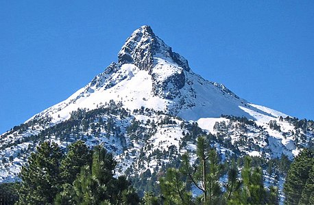
This article comprises four sortable tables of mountain summits of Mexico that are higher than any other point north or south of their latitude or east or west their longitude in Mexico.
The summit of a mountain or hill may be measured in three principal ways:
Rank | Mountain Peak | State | Mountain range | Elevation | Prominence | Isolation | Location |
---|---|---|---|---|---|---|---|
4 | Cerro las Capillas [5] | Jalisco | Trans-Mexican Volcanic Belt | 2890 m 9,482 ft | 1590 m 5,217 ft | 55.8 km 34.7 mi | 19°33′19″N104°08′50″W / 19.5552°N 104.1472°W |
3 | La Malinche (volcano) [6] [7] [lower-alpha 1] [lower-alpha 2] (Matlalcueye) | Puebla Tlaxcala | Trans-Mexican Volcanic Belt | 4430 m 14,534 ft | 1920 m 6,299 ft | 63.9 km 39.7 mi | 19°13′52″N98°01′56″W / 19.2310°N 98.0321°W |
2 | Iztaccíhuatl [8] [9] [lower-alpha 3] | México Puebla | Trans-Mexican Volcanic Belt | 5230 m 17,159 ft | 1560 m 5,118 ft | 17.51 km 10.88 mi | 19°10′49″N98°38′29″W / 19.1802°N 98.6415°W |
1 | Pico de Orizaba [10] [11] [lower-alpha 4] (Citlaltépetl) | Puebla Veracruz | Trans-Mexican Volcanic Belt | 5636 m 18,491 ft | 4922 m 16,148 ft | 2,690.14 | 19°01′50″N97°16′11″W / 19.0305°N 97.2698°W |
Rank | Mountain Peak | State | Mountain range | Elevation | Prominence | Isolation | Location |
---|---|---|---|---|---|---|---|
3 | Volcán Tacaná [12] [13] [lower-alpha 5] | Chiapas Guatemala | Sierra Madre de Chiapas | 4067 m 13,343 ft | 1037 m 3,402 ft | 24.1 km 14.99 mi | 15°07′56″N92°06′30″W / 15.1323°N 92.1084°W |
2 | Popocatépetl [14] [15] [lower-alpha 6] [lower-alpha 7] | México Morelos Puebla | Trans-Mexican Volcanic Belt | 5410 m 17,749 ft | 3040 m 9,974 ft | 143 km 88.8 mi | 19°01′21″N98°37′40″W / 19.0225°N 98.6278°W |
1 | Pico de Orizaba [10] [11] [lower-alpha 4] (Citlaltépetl) | Puebla Veracruz | Trans-Mexican Volcanic Belt | 5636 m 18,491 ft | 4922 m 16,148 ft | 2,690.14 | 19°01′50″N97°16′11″W / 19.0305°N 97.2698°W |
Rank | Mountain Peak | State | Mountain range | Elevation | Prominence | Isolation | Location |
---|---|---|---|---|---|---|---|
3 | Volcán Tacaná [12] [13] [lower-alpha 5] | Chiapas Guatemala | Sierra de Istatan | 4067 m 13,343 ft | 1037 m 3,402 ft | 24.1 km 14.99 mi | 15°07′56″N92°06′30″W / 15.1323°N 92.1084°W |
2 | Cofre de Perote [16] [17] [lower-alpha 8] | Veracruz | Trans-Mexican Volcanic Belt | 4210 m 13,812 ft | 1340 m 4,396 ft | 52.9 km 32.9 mi | 19°29′38″N97°08′53″W / 19.4940°N 97.1480°W |
1 | Pico de Orizaba [10] [11] [lower-alpha 4] (Citlaltépetl) | Puebla Veracruz | Trans-Mexican Volcanic Belt | 5636 m 18,491 ft | 4922 m 16,148 ft | 2,690.14 | 19°01′50″N97°16′11″W / 19.0305°N 97.2698°W |
Sierra Negra is an extinct volcano located in the Mexican state of Puebla, close to the border with Veracruz. At officially 4,580 metres (15,030 ft) above sea level, it is the fifth-highest peak in Mexico. Sierra Negra is overshadowed by nearby Pico de Orizaba.
Mount Bona is one of the major mountains of the Saint Elias Mountains in eastern Alaska, and is the fifth-highest independent peak in the United States. It is either the tenth- or eleventh-highest peak in North America. Mount Bona and its adjacent neighbor Mount Churchill are both large ice-covered stratovolcanoes. Bona has the distinction of being the highest volcano in the United States and the fourth-highest in North America, outranked only by the three highest Mexican volcanoes, Pico de Orizaba, Popocatépetl, and Iztaccíhuatl. Its summit is a small stratovolcano on top of a high platform of sedimentary rocks.
Iztaccíhuatl–Popocatépetl National Park, also known as Izta-Popo Zoquiapan National Park, is a national park in Mexico on the border of the states of México, Puebla, and Morelos. The park protects 39,819.08 hectares, surrounding Mexico's second- and third-highest peaks, the Popocatépetl and Iztaccíhuatl volcanoes as well as the area of the Hacienda de Zoquiapán, and its annexed areas (anexas) of Zoquiapan, Ixtlahuacán, and the Frío de Juárez River.
Jocotitlán, also known as Xocotépetl, is a volcano in the Jocotitlán and Atlacomulco municipalities, in the State of Mexico. At 3,910 metres (12,828 ft) above sea level, its summit is the 12th highest peak of Mexico.