Related Research Articles

North Yorkshire is the largest ceremonial county in England, covering an area of 9,020 square kilometres (3,480 sq mi). Around 40% of the county is covered by national parks, including most of the Yorkshire Dales and the North York Moors. It is one of four counties in England to hold the name Yorkshire; the three other counties are the East Riding of Yorkshire, South Yorkshire and West Yorkshire.

Daresbury is a village and civil parish in the unitary authority of Halton and the ceremonial county of Cheshire, England. At the 2001 census it had a population of 216, increasing to 246 by the 2011 census.
Tattenhall is a village and former civil parish, now in the parish of Tattenhall and District, 8 miles (13 km) south-east of Chester, in the unitary authority of Cheshire West and Chester and the ceremonial county of Cheshire, England. In the 2001 census, the population was recorded as 1,986, increasing to 2,079 by the 2011 census. The civil parish was abolished in 2015 to form Tattenhall and District.

Holywell is a market town and community in Flintshire, Wales. It lies to the west of the estuary of the River Dee. The community includes Greenfield.

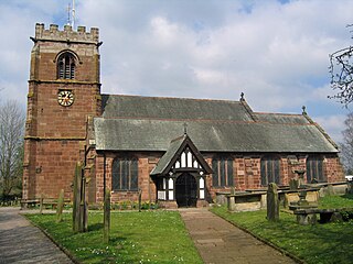
Masham is a market town and civil parish in the Harrogate district of North Yorkshire, England. It had a population of 1,205 at the 2011 census.

Moreton on Lugg is a village and civil parish in Herefordshire, England. The city and county town of Hereford is approximately 3 miles (5 km) to the south; the market and minster town of Leominster 8 miles (13 km) to the north.

Kirkbymoorside is a market town and civil parish in the Ryedale district in North Yorkshire, England. It is 25 miles (40.2 km) north of York, It is also midway between Pickering and Helmsley, on the edge of the North York Moors National Park. It had a population of 3,040 in the 2011 census.
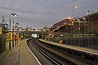
Brunswick railway station serves the Toxteth district of Liverpool, England, on the Northern Line of the Merseyrail network. The station serves the nearby district of Dingle and is situated on a short section of track between two tunnels, between the now in-filled Toxteth and Harrington Docks. The station also serves businesses on the Brunswick Dock estate. The residential area of Grafton Street is reached by steps or ramp from the southbound platform.
Alne is a village and civil parish in the Hambleton District of North Yorkshire, England, about twelve miles north-west of York and four miles from Easingwold. The parish has a population of 711, increasing to 756 at the 2011 census.

Goldsborough is a village and civil parish in the Harrogate district of North Yorkshire, England. It is situated near the River Nidd and one mile (1.6 km) east of Knaresborough. Goldsborough is recognised by the well-known stately home Goldsborough Hall and its other features including: Goldsborough Primary School, the Bay Horse Inn and the Goldsborough Cricket Grounds.
Moor Monkton is a village and civil parish in the Harrogate district of North Yorkshire, England. It is situated on the River Nidd and 7 miles (11 km) north-west from York city centre. At the 2001 Census, the population of the village was 298, which had risen to 348 at the 2011 Census. The population was estimated to have risen again to 370 by 2015.

Staveley is a village and civil parish in the Harrogate district of North Yorkshire, England. It is situated 4 miles (6.4 km) north of Knaresborough and near the A1(M) motorway. In the 2001 census, the village had a population of 444, which had risen to 450 by the time of the 2011 census. In 2015, North Yorkshire County Council estimated the population to have dropped to 440.
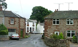
Warcop is a village and civil parish in the Eden district of Cumbria, England. The parish had a population of 491 in the 2001 census, increasing to 532 at the Census 2011.

The Newport Built-up area is an area of land defined by the United Kingdom Office for National Statistics (ONS) for population monitoring purposes. It is an urban conurbation and is not coterminous with the city boundaries. It consists of the urban area centred on Newport as well as contiguous settlements in the eastern and western valleys extending north of the city – including Cwmbran, Pontypool, Risca, Abercarn and Blackwood. It does however exclude physically detached urban areas within the city boundaries, such as Marshfield.
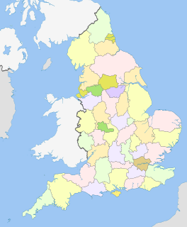
This list article collates links to each ceremonial county's settlements population page, and the largest settlement in the county.

Intermodal railfreight in Great Britain is a way of transporting containers between ports, inland ports and terminals in England, Scotland and Wales, by using rail to do so. Initially started by British Rail in the 1960s, the use of containers that could be swapped between different modes of transport goes back to the days of the London, Midland & Scottish Railway.
References
- ↑ "United Kingdom: Urban Areas in England". www.citypopulation.de. Retrieved 19 June 2021.
- ↑ "Disused Stations: Rushden Station". www.disused-stations.org.uk. Retrieved 10 April 2020.
- ↑ Quick, Michael (2019). "Railway Passenger Stations in England, Scotland and Wales; a Chronology" (PDF). rchs.org.uk. p. 123. Retrieved 10 April 2020.
- 1 2 Pickering, Graeme (April 2020). "Rail Reopening Schemes". The Railway Magazine. Vol. 166, no. 1, 429. Horncastle: Mortons Media. p. 39. ISSN 0033-8923.
- ↑ "Disused Stations: Abingdon Station". www.disused-stations.org.uk. Retrieved 10 April 2020.
- ↑ "Disused Stations:Blyth Station (2nd)". www.disused-stations.org.uk. Retrieved 10 April 2020.
- 1 2 Quick, Michael (2019). "Railway Passenger Stations in England, Scotland and Wales; a Chronology" (PDF). rchs.org.uk. p. 433. Retrieved 10 April 2020.
- ↑ Johnston, Howard (28 August 2019). "Regional News (Anglia)". Rail Magazine. No. 886. Peterborough: Bauer Media. p. 11. ISSN 0953-4563.
- ↑ "Disused Stations: Consett Station".
- ↑ "Disused Stations:Ashington Station". www.disused-stations.org.uk. Retrieved 10 April 2020.
- ↑ "Disused Stations: Haverhill Station". www.disused-stations.org.uk. Retrieved 10 April 2020.
- ↑ "Home". Daventry Parkway Project. Retrieved 1 November 2021.
- ↑ "Daventry boy, 15, leads campaign for £20m new railway station". BBC News. 11 September 2021. Retrieved 1 November 2021.
- ↑ "Daventry Parkway: the right station at the right time?". www.modernrailways.com. Retrieved 1 November 2021.
- ↑ Harry Burr and Daventry Parkway on BBC Look East in the evening , retrieved 1 November 2021
- ↑ "The Old Railway Lines to Maldon". itsaboutmaldon.co.uk. Retrieved 25 January 2021.
- ↑ Marshall, John (1989). The Severn Valley Railway. Newton Abbot: David St John Thomas. p. 164. ISBN 0-946537-45-3.
- ↑ UK Census (2011). "Local Area Report – Dudley (Dudley) Built-up area sub division (E35000284)". Nomis. Office for National Statistics . Retrieved 10 April 2020.
- ↑ "Disused Stations: Dudley station". www.disused-stations.org.uk. Retrieved 10 April 2020.
- ↑ Harris, Nigel, ed. (12 February 2020). "Dudley Metro extension begins". Rail Magazine. No. 898. Peterborough: Bauer Media. p. 11. ISSN 0953-4563.
- ↑ UK Census (2011). "Local Area Report – Gosport Built-up area sub division (E35001479)". Nomis. Office for National Statistics . Retrieved 10 April 2020.
- ↑ "Disused Stations: Gosport Station". www.disused-stations.org.uk. Retrieved 10 April 2020.
- ↑ UK Census (2011). "Local Area Report – Newcastle-under-Lyme Built-up area sub division (E35001436)". Nomis. Office for National Statistics . Retrieved 10 April 2020.
- ↑ Quick, Michael (2019). "Railway Passenger Stations in England, Scotland and Wales; a Chronology" (PDF). rchs.org.uk. p. 297. Retrieved 10 April 2020.
- ↑ UK Census (2011). "Local Area Report – Washington Built-up area sub division (E35001427)". Nomis. Office for National Statistics . Retrieved 31 May 2021.
- ↑ Conner, Rachel (20 December 2017). "Questions raised over future of Leamside line". The Northern Echo. Retrieved 10 April 2020.
- ↑ Pickering, Graeme (25 March 2020). "Keeping Tyne & Wear moving". Rail Magazine. No. 901. Peterborough: Bauer Media. p. 47. ISSN 0953-4563.
- ↑ UK Census (2011). "Local Area Report – Halesowen Built-up area sub division (E35000476)". Nomis. Office for National Statistics . Retrieved 10 April 2020.
- ↑ "Disused Stations: Halesowen Station". www.disused-stations.org.uk. Retrieved 10 April 2020.
- ↑ Quick, Michael (2019). "Railway Passenger Stations in England, Scotland and Wales; a Chronology" (PDF). rchs.org.uk. p. 249. Retrieved 10 April 2020.
- ↑ UK Census (2011). "Local Area Report – West Bridgford Built-up area sub division (E35000901)". Nomis. Office for National Statistics . Retrieved 10 April 2020.
- ↑ UK Census (2011). "Local Area Report – Swadlincote Built-up area sub division (E35001337)". Nomis. Office for National Statistics . Retrieved 10 April 2020.
- ↑ Quick, Michael (2019). "Railway Passenger Stations in England, Scotland and Wales; a Chronology" (PDF). rchs.org.uk. p. 387. Retrieved 10 April 2020.
- ↑ UK Census (2011). "Local Area Report – Skelmersdale Built-up area sub division (E35001425)". Nomis. Office for National Statistics . Retrieved 10 April 2020.
- ↑ "Disused Stations: Skelmersdale Station". www.disused-stations.org.uk. Retrieved 10 April 2020.
- ↑ Pickering, Graeme (April 2020). "Rail Reopening Schemes". The Railway Magazine. Vol. 166, no. 1, 429. Horncastle: Mortons Media. p. 41. ISSN 0033-8923.
- ↑ UK Census (2011). "Local Area Report – Dunstable Built-up area subdivision (E35000218)". Nomis. Office for National Statistics . Retrieved 31 May 2021.
- ↑ "Disused Stations: Dunstable Town Station". www.disused-stations.org.uk. Retrieved 10 April 2020.
- ↑ UK Census (2011). "Local Area Report – Willenhall North Ward (as of 2011) (E05001319)". Nomis. Office for National Statistics . Retrieved 10 April 2020.
- ↑ UK Census (2011). "Local Area Report – Willenhall South Ward (as of 2011) (E05001320)". Nomis. Office for National Statistics . Retrieved 10 April 2020.
- ↑ Quick, Michael (2019). "Railway Passenger Stations in England, Scotland and Wales; a Chronology" (PDF). rchs.org.uk. p. 429. Retrieved 10 April 2020.
- 1 2 Stephen, Paul (12 February 2020). "Mayor's £15bn plan for West Midlands rail". Rail Magazine. No. 898. Peterborough: Bauer Media. p. 11. ISSN 0953-4563.
- ↑ UK Census (2011). "Local Area Report – Aldridge Central and South Ward (as of 2011) (E05001301)". Nomis. Office for National Statistics . Retrieved 10 April 2020.
- ↑ UK Census (2011). "Local Area Report – Aldridge North and Walsall Wood Ward (as of 2011) (E05001302)". Nomis. Office for National Statistics . Retrieved 10 April 2020.
- ↑ "Disused Stations: Sutton Park Station". www.disused-stations.org.uk. Retrieved 10 April 2020.
- ↑ Padgett, David; Szwenk, John (2013). Bridge, Mike (ed.). Railway track diagrams. book 4, Midlands & North West (3 ed.). Bradford on Avon: Trackmaps. 18. ISBN 978-0-9549866-7-4.
- ↑ UK Census (2011). "Local Area Report – Ferndown Built-up area sub division (E35001246)". Nomis. Office for National Statistics . Retrieved 10 April 2020.
- ↑ UK Census (2011). "Local Area Report – Woodley Parish (E04001243)". Nomis. Office for National Statistics . Retrieved 10 April 2020.
- ↑ UK Census (2011). "Local Area Report – Rawtenstall Built-up area subdivision (E35000572)". Nomis. Office for National Statistics . Retrieved 31 May 2021.