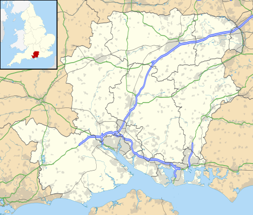
South Hampshire is a term used mainly to refer to the conurbation formed by the city of Portsmouth, city of Southampton and the non-metropolitan boroughs of Gosport, Fareham, Havant and Eastleigh in southern Hampshire, South East England. The area was estimated to have a population of over 1.5 million in 2013. [1] It is the most populated part of South East England excluding London. The area is sometimes referred to as Solent City particularly in relation to local devolution, [2] but the term is controversial. [3] [4]
Harold Wilson's Labour government commissioned town planner Colin Buchanan in 1965 to study the region. He found a region of growing economic importance, in desperate need of proper planning to avoid unplanned sprawl, and suggested the construction of a modernist urban area between Southampton and Portsmouth. [5] However this was resisted by local authorities who occupied the proposed development sites, and Buchanan's plans were never put into effect. [1]
Instead, as a result of high-tech industry and services, the area was able to grow largely without overall planning to become perhaps the most densely populated region of the UK. [1] In the late 20th century mass manufacturing of ordinary commodities declined, leaving several town and city neighbourhoods impoverished and suffering unemployment; however by the early 21st century high income and retirement properties came to dominate some neighbourhoods, particularly close to universities, and many suburbs and exurbs. Centrally planned building programmes included large estates, connected by new road networks, for commercial and residential use by Hampshire County Council's architects, led by Colin Stansfield Smith. Otherwise development has tended to be on a case-by-case basis for retail parks, business parks and housing. [1]
The Solent Local Enterprise Partnership (LEP) is a collaboration between local authorities, universities and businesses set up in 2011 by the Department for Business, Innovation and Skills. [6] [7] Different departments of the Solent LEP are distributed across the area, with its 'Growth Hub' being based in Southampton. [8] On 12 November 2013 the government announced the second wave of City Deals, with a successful joint bid of Southampton and Portsmouth providing £953 million of investment into the Solent LEP. [9]
Various attempts at a South Hampshire or Solent City devolution deal have been made, but saw minor local resistance, stemming from the Southampton-Portsmouth rivalry, as well as from the more rural Isle of Wight. [10] [11] Whilst the proposal did otherwise see continued support, particularly from councillors, [12] by 2018 talks with the government had stalled. [10] [13] More recent proposals have included southeast Dorset, that is Bournemouth, Christchurch and Poole (BCP). After another bid was submitted in 2021, Gerald Vernon-Jackson claimed the government were "keen" on including BCP in a potential deal. [14] A November 2022 report by BCP Council suggested a Central South deal as an alternative to a Pan-Hampshire deal with BCP tacked on. [15]
The region can be subdivided into two conurbations, one centred around Southampton and one around Portsmouth. Most of the area is in the Hampshire districts of Gosport, Fareham, Havant, Eastleigh, Portsmouth and Southampton. All of these districts have high population densities, with Portsmouth and Southampton being the most densely populated districts in England outside Greater London. [16] Other parts of the area are in the Test Valley, East Hampshire, City of Winchester and New Forest districts, all of which have lower population densities. Small parts of the area are also in the West Sussex district of Chichester.
The climate is temperate oceanic, Cfb in the Köppen climate classification.
Climate data for Southampton, elevation 3 m, 1981–2010 | |||||||||||||
---|---|---|---|---|---|---|---|---|---|---|---|---|---|
Month | Jan | Feb | Mar | Apr | May | Jun | Jul | Aug | Sep | Oct | Nov | Dec | Year |
Mean daily maximum °C (°F) | 8.4 (47.1) | 8.6 (47.5) | 11.1 (52.0) | 14.0 (57.2) | 17.5 (63.5) | 20.2 (68.4) | 22.4 (72.3) | 22.3 (72.1) | 19.8 (67.6) | 15.6 (60.1) | 11.7 (53.1) | 8.9 (48.0) | 15.1 (59.2) |
Mean daily minimum °C (°F) | 2.9 (37.2) | 2.6 (36.7) | 4.1 (39.4) | 5.7 (42.3) | 9.0 (48.2) | 11.7 (53.1) | 13.7 (56.7) | 13.7 (56.7) | 11.4 (52.5) | 8.9 (48.0) | 5.4 (41.7) | 3.2 (37.8) | 7.7 (45.9) |
Average rainfall mm (inches) | 81.4 (3.20) | 58.3 (2.30) | 60.0 (2.36) | 50.7 (2.00) | 49.0 (1.93) | 50.4 (1.98) | 42.0 (1.65) | 50.4 (1.98) | 60.4 (2.38) | 93.8 (3.69) | 94.0 (3.70) | 89.2 (3.51) | 779.4 (30.69) |
Average rainy days (≥ 1.0 mm) | 12.2 | 9.2 | 10.1 | 8.8 | 8.2 | 7.7 | 7.4 | 7.7 | 8.7 | 11.5 | 11.5 | 11.8 | 114.7 |
Mean monthly sunshine hours | 63.3 | 84.4 | 118.3 | 179.8 | 212.1 | 211.2 | 221.8 | 207.7 | 148.1 | 113.0 | 76.6 | 52.9 | 1,689.3 |
Source 1: Met Office (normals) [17] | |||||||||||||
Source 2: Calculated from Met Office Data [18] |
Climate data for Southsea, Portsmouth 1976-2006 | |||||||||||||
---|---|---|---|---|---|---|---|---|---|---|---|---|---|
Month | Jan | Feb | Mar | Apr | May | Jun | Jul | Aug | Sep | Oct | Nov | Dec | Year |
Mean daily maximum °C (°F) | 9.6 (49.3) | 8.8 (47.8) | 10.6 (51.1) | 13.4 (56.1) | 16.8 (62.2) | 19.4 (66.9) | 21.8 (71.2) | 21.8 (71.2) | 19.3 (66.7) | 15.8 (60.4) | 12.0 (53.6) | 10.0 (50.0) | 14.9 (58.9) |
Mean daily minimum °C (°F) | 5.1 (41.2) | 4.3 (39.7) | 5.4 (41.7) | 6.4 (43.5) | 9.6 (49.3) | 12.3 (54.1) | 15.0 (59.0) | 15.0 (59.0) | 12.8 (55.0) | 10.9 (51.6) | 7.5 (45.5) | 5.9 (42.6) | 9.2 (48.5) |
Average precipitation mm (inches) | 65 (2.6) | 50 (2.0) | 52 (2.0) | 42 (1.7) | 28 (1.1) | 40 (1.6) | 32 (1.3) | 43 (1.7) | 62 (2.4) | 81 (3.2) | 72 (2.8) | 80 (3.1) | 647 (25.5) |
Average rainy days | 11.2 | 9.5 | 8.3 | 7.6 | 6.5 | 7.4 | 5.4 | 6.6 | 8.5 | 10.9 | 10.3 | 11.2 | 103.4 |
Mean monthly sunshine hours | 67.9 | 89.6 | 132.7 | 200.5 | 240.8 | 247.6 | 261.8 | 240.7 | 172.9 | 121.8 | 82.3 | 60.5 | 1,919.1 |
Percent possible sunshine | 26 | 31 | 36 | 49 | 51 | 51 | 54 | 54 | 46 | 37 | 31 | 25 | 41 |
Source: Met Office [19] |
Climate data for a Rough climate of Havant | |||||||||||||
---|---|---|---|---|---|---|---|---|---|---|---|---|---|
Month | Jan | Feb | Mar | Apr | May | Jun | Jul | Aug | Sep | Oct | Nov | Dec | Year |
Record high °C (°F) | 17 (63) | 16 (61) | 21 (70) | 25 (77) | 32 (90) | 36 (97) | 35 (95) | 37 (99) | 34 (93) | 27 (81) | 18 (64) | 16 (61) | 37 (99) |
Mean daily maximum °C (°F) | 8 (46) | 8 (46) | 11 (52) | 13 (55) | 17 (63) | 20 (68) | 23 (73) | 24 (75) | 19 (66) | 16 (61) | 11 (52) | 9 (48) | 15 (59) |
Mean daily minimum °C (°F) | 2 (36) | 1 (34) | 3 (37) | 5 (41) | 8 (46) | 11 (52) | 13 (55) | 14 (57) | 12 (54) | 8 (46) | 5 (41) | 3 (37) | 7 (45) |
Record low °C (°F) | −10 (14) | −9 (16) | −8 (18) | −4 (25) | −1 (30) | 2 (36) | 5 (41) | 6 (43) | 0 (32) | −4 (25) | −6 (21) | −8 (18) | −10 (14) |
Average precipitation mm (inches) | 85 (3.3) | 60 (2.4) | 62 (2.4) | 54 (2.1) | 50 (2.0) | 50 (2.0) | 42 (1.7) | 57 (2.2) | 74 (2.9) | 90 (3.5) | 85 (3.3) | 90 (3.5) | 799 (31.3) |
Mean monthly sunshine hours | 65 | 85 | 130 | 200 | 230 | 235 | 255 | 230 | 170 | 125 | 90 | 60 | 1,875 |
Source: Met Office [19] |
Climate data for Solent MRSC, (1981–2010 averages). | |||||||||||||
---|---|---|---|---|---|---|---|---|---|---|---|---|---|
Month | Jan | Feb | Mar | Apr | May | Jun | Jul | Aug | Sep | Oct | Nov | Dec | Year |
Mean daily maximum °C (°F) | 8.2 (46.8) | 8.2 (46.8) | 10.5 (50.9) | 13.2 (55.8) | 16.7 (62.1) | 19.2 (66.6) | 21.4 (70.5) | 21.4 (70.5) | 19.0 (66.2) | 15.5 (59.9) | 11.5 (52.7) | 8.7 (47.7) | 14.5 (58.1) |
Mean daily minimum °C (°F) | 3.4 (38.1) | 2.8 (37.0) | 4.5 (40.1) | 6.1 (43.0) | 9.2 (48.6) | 12.1 (53.8) | 14.2 (57.6) | 14.3 (57.7) | 12.2 (54.0) | 9.6 (49.3) | 6.2 (43.2) | 3.8 (38.8) | 8.2 (46.8) |
Average rainfall mm (inches) | 68.8 (2.71) | 49.3 (1.94) | 51.6 (2.03) | 42.4 (1.67) | 43.4 (1.71) | 42.0 (1.65) | 44.5 (1.75) | 50.0 (1.97) | 53.7 (2.11) | 86.2 (3.39) | 83.2 (3.28) | 83.9 (3.30) | 699 (27.51) |
Average precipitation days (≥ 1 mm) | 11.6 | 9.6 | 8.3 | 8.3 | 7.1 | 6.9 | 7.0 | 7.3 | 8.7 | 10.5 | 11.2 | 12.2 | 108.6 |
Source: Met Office Solent MRSC, Thorney Island |
The following Built-up areas fall inside the South Hampshire metropolitan area have a combined population of 1,086,786.
![]() | This section is empty. You can help by adding to it. (November 2018) |
The following populations is those of council boundaries that are considered part of the South Hampshire conurbation.
In the 2001 census Portsmouth and Southampton were recorded as being parts of separate urban areas; but by the 2011 census they had merged to become the sixth largest built-up area in England, with a population of 855,569. [20] The new built-up area also merged with smaller urban areas called Locks Heath, Bursledon, Whiteley and Hedge End/Botley in the 2001 census.
Urban subdivision [21] | Population | District | |
---|---|---|---|
(2001 census) [21] | (2011 census) [20] | ||
Portsmouth | 187,056 | 238,137 | City of Portsmouth |
Gosport | 69,348 | 71,529 | Borough of Gosport |
Fareham | 56,160 | 42,210 | Borough of Fareham |
Havant | 45,435 | 45,125 | Borough of Havant |
Lee-on-the-Solent | 7,067 | Borough of Gosport | |
Stubbington | 13,628 | 14,077 | Borough of Fareham |
Waterlooville | 63,558 | Borough of Havant | |
Total Portsmouth urban area population | 442,252 | ||
Southampton | 234,224 | 253,651 | City of Southampton |
Eastleigh | 52,894 | 78,716 | Borough of Eastleigh |
Bishopstoke | 17,282 | Borough of Eastleigh | |
Total Southampton urban area population | 304,400 | ||
Locks Heath & surrounding villages | 36,452 | 43,359 | Borough of Fareham |
Bursledon | 6,744 | 6,955 | Borough of Eastleigh |
Whiteley | 2,195 | 3,236 | Borough of Fareham/City of Winchester |
Total Western Wards population | 45,391 | 53,550 | |
Hedge End | 21,174 | 25,117 | Borough of Eastleigh |
Botley | 2,506 | 5,083 | Borough of Eastleigh |
Total Hedge End/Botley population | 23,680 | 30,200 | |
Horndean | 46,924 | East Hampshire/Borough of Havant | |
Total South Hampshire built-up area population | 855,569 |
Notes:
There are three other significant urban areas [22] in the area: [23]
Urban subdivision [21] | Population (2001 census) [21] | Population (2011 census) [20] | District |
---|---|---|---|
Ashurst/Netley Marsh | 3,116 | 3,212 | New Forest District |
Totton | 27,986 | 28,676 | New Forest District |
Bartley | 2,281 | New Forest District | |
Total Totton built-up area population | 31,102 | 34,169 | |
Winchester built-up area | 41,420 | 46,074 | City of Winchester |
Stubbington built-up area | 24,644 | Borough of Fareham/Borough of Gosport | |
Hythe built-up area | 19,599 | 20,201 | New Forest District |
There are fourteen smaller urban areas also in the region: [23]
Urban area [21] | Population | Population (2011 census) [20] | District |
---|---|---|---|
Colden Common | 3,249 | 3,419 | City of Winchester |
Compton/Otterbourne | 2,261 | 2,569 | City of Winchester |
Denmead | 5,788 | 6,107 | City of Winchester |
Emsworth/Southbourne | 18,139 | 18,777 | Borough of Havant/Chichester District |
Fawley/Blackfield | 13,775 | 13,712 | New Forest District |
Hamble | 3,853 | 4,696 | Borough of Eastleigh |
Hayling Island | 14,842 | 15,485 | Borough of Havant |
Horton Heath | 2,223 | Borough of Eastleigh | |
Kings Worthy | 4,292 | 4,901 | City of Winchester |
Marchwood | 5,586 | 6,141 | New Forest District |
Netley | 6,150 | 6,338 | Borough of Eastleigh |
North Baddesley | 6,234 | 6,823 | Test Valley |
Romsey | 17,386 | 17,161 | Test Valley |
Notes:
Slightly further out there are many surrounding towns and villages as well as the city of Chichester which are not directly close to Southampton or Portsmouth, or necessarily in their travel to work areas. [25] Some of these settlements rely on the latter cities for employment or retail due to close proximity but are not limited to these alone.
Places within the wider Portsmouth-Southampton Metropolitan area include:
Settlement | County |
---|---|
Andover [26] | Hampshire |
Bishop's Waltham [23] [27] | Hampshire |
Bognor Regis [26] | West Sussex |
Brockenhurst | Hampshire |
Chichester | West Sussex |
Lyndhurst | Hampshire |
Newport | Isle of Wight |
Ryde | Isle of Wight |
Salisbury [26] | Wiltshire |
Hampshire is a ceremonial county in South East England. It is bordered by Berkshire to the north, Surrey and West Sussex to the east, the Isle of Wight across the Solent to the south, Dorset to the west, and Wiltshire to the north-west. The city of Southampton is the largest settlement.
Fareham is a market town at the north-west tip of Portsmouth Harbour, between the cities of Portsmouth and Southampton in south east Hampshire, England. It gives its name to the Borough of Fareham. It was historically an important manufacturer of bricks, used to build the Royal Albert Hall, and grower of strawberries and other seasonal fruits. In 2011 it had a population of 42,210.
Gosport is a town and non-metropolitan district with borough status, on the south coast of Hampshire, England. At the 2021 Census, the town had a population of 70,131 and the district had a population was 81,952. Gosport is situated on a peninsula on the western side of Portsmouth Harbour, opposite the city of Portsmouth, to which it is linked by the Gosport Ferry. Gosport lies south-east of Fareham, to which it is linked by a Bus Rapid Transit route and the A32. Until the last quarter of the 20th century, Gosport was a major naval town associated with the defence and supply infrastructure of His Majesty's Naval Base (HMNB) Portsmouth. As such over the years extensive fortifications were created.
Portchester is a village in the borough of Fareham in Hampshire, England. It is 4 miles (6.4 km) northwest of Portsmouth and around 18 miles east of Southampton on the A27 road. Its population according to the 2011 United Kingdom census was 17,789.
The Borough of Fareham is a local government district with borough status in Hampshire, England. Its council is based in Fareham. Other places within the borough include Portchester, Hill Head, Sarisbury, Stubbington, Titchfield and Warsash. The borough covers much of the semi-urban area between the cities of Southampton and Portsmouth, and is part of the South Hampshire conurbation. The neighbouring districts are Eastleigh, Winchester, Portsmouth and Gosport. The district's southern boundary is the coast of the Solent.
Whiteley is a planned community of 6,500 homes in the county of Hampshire, England, United Kingdom near Fareham. The development straddles the boundary between two council districts: the Borough of Fareham to the south and west, and the City of Winchester to the north and east.
The West Coastway line is a railway line in England linking the conurbations of Brighton/Hove/Littlehampton and Southampton/Portsmouth, with 1.3 million people between them. It has short southward branches to Littlehampton and Bognor Regis, which offer direct services to and from London.
Fareham railway station is on the West Coastway Line, situated about 0.62 miles (1 km) from the town of Fareham in Hampshire, England. It is 84 miles 21 chains (135.6 km) down the line from London Waterloo.
The South Hampshire Plan was a co-ordinated housing plan instigated in the 1960s in the southern portion of the English county of Hampshire.
First Hampshire & Dorset is a bus operator providing services in the counties of Hampshire and Dorset. It is a subsidiary of FirstGroup.
The South East England Development Agency (SEEDA) was one of a number of regional development agencies in England. It was set up as a non-departmental public body in 1999 to promote the region and to enable a number of more difficult regeneration projects which otherwise might not take place. It covered Berkshire, Buckinghamshire, East Sussex, Hampshire, the Isle of Wight, Kent, Oxfordshire, Surrey and West Sussex
The Gosport and Cosham lines were a collection of railway lines in southern Hampshire. Most of the lines are now closed but some elements are still in use, forming part of the West Coastway line. The lines originally linked to the main London to Southampton line via the Eastleigh–Fareham line and subsequently with a line from Southampton via Bursledon, both of which are still in use.
The Funtley Deviation was a 2-mile long double track railway opened as a single line in 1904 and as a double line in 1906 to provide an alternative to the 1841 railway line north of Fareham which traversed the precarious Fareham tunnel. Unfortunately the deviation line suffered from stability problems of its own and it was eventually closed on 6 May 1973, in favour of the original route, and is now a nature walk with a small car park at the Highlands Road end. The route south of Highlands Road was sold for housing.
Counties 2 Hampshire is an English level 8 Rugby Union league for teams based in Hampshire and the Isle of Wight. Up until the 2017–18 season it was known as Hampshire 1 but was changed to Hampshire Premier due to restructuring of the Hampshire leagues, which would see the re-introduction of a third division as well as 2nd and 3rd XV sides joining for the first time. Following the RFU's Adult Competition Review, from season 2022-23 it adopted its current name Counties 2 Hampshire.
The South Hampshire Lowlands form a natural landscape in south, central England within the county of Hampshire.
The county of Hampshire is divided into 13 districts. The districts of Hampshire are Gosport, Fareham, Winchester, Havant, East Hampshire, Hart, Rushmoor, Basingstoke and Deane, Test Valley, Eastleigh, New Forest, Southampton, and Portsmouth.
South Hampshire is the term used to refer to the conurbation formed by the city of Portsmouth, city of Southampton and the non-metropolitan boroughs between them. As a result of the area's high population density, it has a developed public transport network. However, due to the area being controlled by different Authorities, most notably Southampton City Council, Portsmouth City Council and Hampshire County Council, there is little coordination of the system.
He said: I do not want to live in "Solent City". I'd rather live in Fareham. I think we should keep the strategic gap.
The term Solent City is nowhere to be found in the South Hampshire Study and instead emerged as shorthand for the sheer horror felt by inhabitants and their political representatives over the emergence of a single functional urban region