A National Biodiversity Conservation Area (NBCA) is an environmentally protected area in Laos. There are all together 21 different NBCAs in Laos, protecting 29,775 square kilometers. Another 10 NBCAs have been proposed, many of them being treated by authorities as though they were already officially protected.

Phou Bia is the highest mountain in Laos. It is in the Annamese Range, at the southern limit of the Xiangkhoang Plateau in Xaisomboun Province. Owing to its elevation—2,830 m (9,280 ft), the highest terrestrial point in Laos, the climate is cold and the area around the mountain is mostly cloudy.

Phu Thai is a Southwestern Tai language spoken in Laos, Thailand and Vietnam. Although it appears different from the Isan and the Lao languages, it is spoken in areas where these languages are predominant and has been influenced by them. Comparisons of Phu Thai with other Tai languages such as Tay Khang have not yet been done systematically enough to yield convincing results.
Another aspect of Phu Thai is its contact with the Katuic languages, a branch of the Austroasiatic languages. Whether in the Phu Thai areas of Central Laos or in more recent locations of Northeastern Thailand, one can find, along with Phu Thai, a few Katuic dialects known locally as Bru, So or Katang. James R. Chamberlain (2012) focusing on anthropological issues describes “the Phou Thay – Brou relationship” as a “symbiosis” and states that “the Phou Thay – Brou relationship has never evolved into a feudal system”.

The Annamite Range or the Annamese Mountains is a major mountain range of eastern Indochina, extending approximately 1,100 km (680 mi) through Laos, Vietnam, and a small area in northeast Cambodia.
Champasak or Muang Champassak is a small town in southern Laos, on the west bank of the Mekong River about 40 km south of Pakse, the capital of Champasak Province. It is the seat of the Champasak district (muang).

Vat Phou is a ruined Khmer-Hindu temple complex with Champa influences in southern Laos and one of the oldest places of worship in Southeast Asia. It is at the base of mount Phou Khao, some 6 kilometres (3.7 mi) from the Mekong in Champasak province.
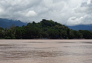
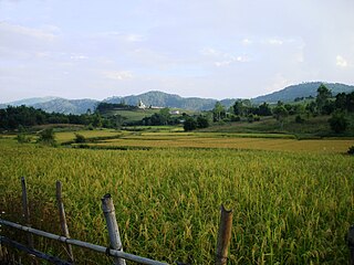
Mount Phou Si, also written Mount Phu Si, is a 100 m (328 ft) high hill in the centre of the old town of Luang Prabang in Laos. It lies in the heart of the old town peninsula and is bordered on one side by the Mekong River and on the other side by the Nam Khan River. The hill is a local religious site, and houses several Buddhist shrines.

Phu Soi Dao is a mountain in Southeast Asia. It is 2120 metres tall and rises at the south end of the Luang Prabang Range, on the border between Laos and Thailand. Phu Soi Dao National Park is on the Thai side of the range in Phitsanulok and Uttaradit Provinces.
Phou Khe is a mountain in Southeast Asia, part of the Luang Prabang Range (ทิวเขาหลวงพระบาง).

The Luang Prabang Range, named after Luang Prabang, is a mountain range straddling northwestern Laos and Northern Thailand. Most of the range is located in Sainyabuli Province (Laos), as well as Nan and Uttaradit Provinces (Thailand), with small parts in Phitsanulok and Loei Provinces. Several rivers such as the Nan, Pua and Wa rivers, have their sources in this range. Phu Fa waterfall, the biggest and the tallest waterfall in Nan Province, is also located in these mountains. This range is part of the Luang Prabang montane rain forests ecoregion.

Vientiane province is a province of Laos in the country's northwest. As of 2015 the province had a population of 419,090. Vientiane province covers an area of 15,610 square kilometres (6,030 sq mi) composed of 11 districts. The principal towns are Vang Vieng and Muang Phôn-Hông.
Xiangkhouang is a province of Laos on the Xiangkhoang Plateau, in the nation's northeast. The province has the distinction of being the most heavily-bombed place on Earth.

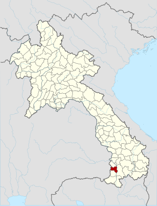
Champasak is a province in southwestern Laos, near the borders with Thailand and Cambodia. It is one of the three principalities that succeeded the Lao kingdom of Lan Xang. As of the 2015 census, it had a population of 694,023. The capital is Pakse, but the province takes its name from Champasak, the former capital of the Kingdom of Champasak.

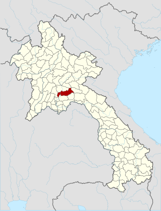
Xaisomboun is a mountainous province in central Laos, between Vientiane province and Xiangkhouang province. The province covers an area of 8,300 square kilometres (3,200 sq mi) and had a population of 85,168 in 2015. Xaisomboun town in Anouvong District is the economic centre. There are extensive copper and gold mining operations nearby at Sana Somboun.
Anouvong district is the capital of Xaisomboun Province, located about 230 kilometers north of Vientiane, the capital of Laos. The city of Anouvong district is Ban Muang Cha. It is home to Chao Anouvong cave, which is part of Phou Houa Xang Village, as well as the Phou Bia peak tourist site

The Holy Man's Rebellion, took place between March 1901 and January 1936. It started when supporters of the Phu Mi Bun religious movement initiated an armed rebellion against French Indochina and Siam, aiming at installing their leader, sorcerer Ong Keo, as ruler of the world. By 1902 the uprising was put down in Siam, continuing in French Indochina until being fully suppressed in January 1936.
Operation Maharat was a military offensive of the Royal Lao Government aimed at Communist insurrectionists. At stake was the sole road junction in northern Laos well in the rear of Royalist troops fighting in Campaign Z. On 30 December 1971, the garrison of a Royal Lao Army artillery battery and two Forces Armées Neutralistes battalions was besieged by an attacking force of Pathet Lao and Patriotic Neutralists. On 21 January 1972, the Royalists were reinforced by 11th Brigade, then overrun. The Communists spread north and south along Route 13 over a 110 km (68 mi) stretch. A Royalist counter-attack on 16 March 1972 would find both Route 13 and the intersection vacated.

The Luang Prabang montane rain forests ecoregion covers elevations over 800 meters in the Luang Prabang mountains that straddle the border between northern Thailand and north-central Laos, and the highlands that stretch eastward across north-central Laos. While much of the forest cover has been degraded, there are still large areas of relatively untouched forest.

The Northern Khorat Plateau moist deciduous forests ecoregion covers a small area on the border between northeastern Thailand and Laos, in the transition zone between the drier Khorat Plateau to the south and the wetter Annamite Range and Luang Prabang Range mountains to the north. Much of the ecoregion has been converted to agriculture along the floodplain of the middle course of the Mekong River.