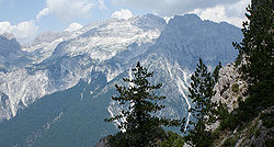
This is a list of the top 20 highest ultra prominent mountains in mainland Balkan Peninsula.
No | Mountain/Peak | Country | Elevation (m) | Prominence (m) | Col (m) |
---|---|---|---|---|---|
1 | Rila/Musala | Bulgaria | 2,925 | 2,473 | 432 |
2 | Olympus/Mytikas | Greece | 2,917 [1] [2] | 2,353 [3] | 564 |
3 | Pirin/Vihren | Bulgaria | 2,915 [4] | 1,784 | 1131 |
4 | Korab Mountain/Mount Korab | Albania / North Macedonia | 2,764 | 2,169 | 595 |
5 | Sharr/Šar Mountain/Titov Vrv | Kosovo / North Macedonia | 2,748 | ? | ? |
6 | Accursed Mountains/Maja Jezercë | Albania | 2,694 | 2,036 | 658 |
7 | Accursed Mountains/Gjeravica | Kosovo | 2656 | 901 | |
8 | Pindus Mountains, Smolikas Mountain/Smolikas | Greece | 2,637 | 1,736 | 901 |
9 | Jakupica Mountain/Solunska glava | North Macedonia | 2,540 | 1,666 | 874 |
10 | Nidže(Voras Mountains)/Kajmakčalan | Greece / North Macedonia | 2,528 | 1,758 | 770 |
11 | Pindus Mountains, Mount Giona/Pyramida | Greece | 2,510 | 1,702 | 808 |
12 | Nemërçkë Mountains/Maja e Papingut | Albania | 2,482 | 1,792 | 690 |
13 | Pindus Mountains, Mount Parnassus/Parnassus | Greece | 2,457 | 1,590 | 867 |
14 | Balkan Mountains, Kaloferska Mountain/Botev Peak | Bulgaria | 2,376 | 1,567 | 809 |
15 | Valamara Mountain/Maja e Valamarës | Albania | 2,373 | 1,526 | 847 |
16 | Mali i Gribës mountain/Maja e Këndrevicës | Albania | 2,121 | 1,666 | 455 |
17 | Treskvica/Mala Ćaba | Bosnia and Herzegovina | 2,086 | 1,862 | 723 |
18 | Vermio Mountains/Hamitis | Greece | 2,076 | 2,076 | 481 |
18 | Belasitsa mountain/Radomir | Bulgaria / Greece/ North Macedonia | 2,031 | 1,595 | 436 |
19 | Mount Athos mountain/Mount Athos | Greece | 2,030 | 2,012 | 19 |
20 | Mount Ossa mountain/Mount Ossa | Greece | 1,978 | 1,854 | 124 |
21 | Pangaion Hills/Koutra | Greece | 1,956 | 1,773 | 183 |
Triglav peak (2,864 m, prominence 2,059 m) in the Slovenian Julian Alps is geographically part of the Balkan Peninsula, as it is east of river Soča, but it is not part of the Mountain System of the Balkan Peninsula, but part of the Mountain System of the Alps.
No | Mountain/Peak | Country | Elevation (m) | Prominence (m) | Col (m) |
---|---|---|---|---|---|
1 | Rila/Musala | Bulgaria | 2,925 | 2,473 | 432 |
2 | Olympus/Mytikas or Pantheon | Greece | 2,917 [5] [6] | 2,353 [7] | 564 |
3 | Pirin/Vihren | Bulgaria | 2,915 [8] | 1,784 | 1131 |
4 | Olympus/Olympus-Skolio | Greece | 2,911 [9] | 81 | 2830 [10] |
5 | Pirin/Kutelo I | Bulgaria | 2,908 [11] | ~298 | ~2610 [12] |
6 | Pirin/Kutelo II | Bulgaria | 2,907 [13] | — | — |
7 | Rila/Malka Musala (Little Musala) | Bulgaria | 2,902 [14] | ~62 | ~2840 [15] |
8 | Olympus/Stefani or Thronos Dios (Throne of Zeus) | Greece | 2,902 | — | — |
9 | Pirin/Banski Suhodol | Bulgaria | 2,884 | — | — |
10 | Olympus/Olympus-Skala | Greece | 2866 | 40 | |
11 | Rila/Irechek | Bulgaria | 2,852 | — | — |
12 | Pirin/Polezhan | Bulgaria | 2,851 | — | — |
13 | Pirin/Kamenitsa | Bulgaria | 2,822 | — | — |
14 | Pirin/Malak Polezhan | Bulgaria | 2,822 | — | — |
15 | Pirin/Bayuvi Dupki | Bulgaria | 2,820 | — | — |
16 | Olympus/Aghios Antonios | Greece | 2,815 | — | — |
17 | Pirin/Strazhite | Bulgaria | 2,810 | — | — |
18 | Olympus/Profitis Ilias | Greece | 2,803 | — | — |
19 | Olympus/Toumba | Greece | 2,801 | — | — |
The Balkans, corresponding partially with the Balkan Peninsula, is a geographical area in southeastern Europe with various geographical and historical definitions. The region takes its name from the Balkan Mountains that stretch throughout the whole of Bulgaria. The Balkan Peninsula is bordered by the Adriatic Sea in the northwest, the Ionian Sea in the southwest, the Aegean Sea in the south, the Turkish straits in the east, and the Black Sea in the northeast. The northern border of the peninsula is variously defined. The highest point of the Balkans is Musala, 2,925 metres (9,596 ft), in the Rila mountain range, Bulgaria.
Korab is the highest peak of the eponymous mountain range and the fourth-highest mountain located entirely in the Balkan Peninsula, standing at 2,764 metres.
The Dinaric Alps, also Dinarides, are a mountain range in Southern and Southcentral Europe, separating the continental Balkan Peninsula from the Adriatic Sea. They stretch from Italy in the northwest through Slovenia, Croatia, Bosnia and Herzegovina, Serbia, Montenegro, and Kosovo to Albania in the southeast.
Serbia is a small country situated at the crossroads of Central and Southeast Europe, covering the far southern edges of the Pannonian Plain and the central Balkans. It shares borders with Bosnia and Herzegovina, Bulgaria, Croatia, Hungary, North Macedonia, Montenegro, and Romania. Serbia shares a contested border with Albania as it doesn't recognise the independence of Kosovo. Serbia is landlocked, though it is able to access the Adriatic Sea through Montenegro and inland Europe and the Black Sea via the Danube.
Southern Europe is the southern region of Europe. It is also known as Mediterranean Europe, as its geography is marked by the Mediterranean Sea. Definitions of southern Europe include some or all of these countries and regions: Albania, Andorra, Bosnia and Herzegovina, Bulgaria, Croatia, Cyprus, Gibraltar, Greece, Italy, Malta, Monaco, Montenegro, North Macedonia, Portugal, San Marino, Serbia, Slovenia, southern France, Spain, Turkey, and Vatican City.
Europe is often divided into regions and subregions based on geographical, cultural or historical factors. Since there is no universal agreement on Europe's regional composition, the placement of individual countries may vary based on criteria being used. For instance, the Balkans is a distinct geographical region within Europe, but individual countries may alternatively be grouped into South-eastern Europe or Southern Europe.
Southeast Europe or Southeastern Europe (SEE) is a geographical sub-region of Europe, consisting primarily of the region of the Balkans, as well as adjacent regions and archipelagos. There are overlapping and conflicting definitions of the region, due to political, economic, historical, cultural, and geographical considerations.
Jezercë is the highest peak in the Dinaric Alps, the second highest in Albania and the sixth highest in Southeast Europe, standing at 2,694 m (8,839 ft) above sea level. It is the 28th most prominent mountain peak in Europe, and is regarded as one of the toughest and most dangerous climbs in the Albanian Alps.
The Accursed Mountains, also known as the Albanian Alps, is a mountain range in coastal Southeast Europe adjacent to the Adriatic Sea. It is the southernmost subrange of the 1,000-kilometre-long (621 mi) Dinaric Alps range (Dinarides), extending from northern Albania to western Kosovo and northeastern Montenegro. Maja Jezercë, standing at 2,694 m (8,839 ft), is the highest point of the Accursed Mountains and of all Dinaric Alps, and the fifth highest peak in Albania. The range includes the mountain Zla Kolata, which, at 2,534 m (8,314 ft), is the tallest mountain in Montenegro. The range also includes the mountain Gjeravica, which, at 2,656 m (8,714 ft), is the second tallest mountain in Kosovo. One of the southernmost glacial masses in Europe was discovered in the Albanian part of the range in 2009.
Geum bulgaricum is a species of flowering plant of the genus Geum (avens) in the family Rosaceae. A perennial herbaceous plant, it has small, bell-like yellow flowers, and is native to a few mountains on the Balkan Peninsula.
The Balkan mixed forests are a terrestrial ecoregion of southeastern Europe according to both the WWF and Digital Map of European Ecological Regions by the European Environment Agency. It belongs in the temperate broadleaf and mixed forests biome and the Palearctic realm.
Zla Kolata or Kollata e Keqe is one of the highest peaks of the Accursed Mountains, on the border of Albania and Montenegro.
Bogićevica is a mountain area in the Accursed Mountains mountain range. It spreads over Montenegro, Kosovo and Albania. It is about 15 km (9 mi) long and 10 km (6 mi) wide. The mountain area has a number of peaks higher than 2,000 m (6,562 ft) and two higher than 2,500 m (8,202 ft). Marijash and Maja e Ropës are both located in Kosovo. The towns of Deçan in Kosovo and Tropojë in Albania are located near the area.
Maja e Rosit is a mountain peak in the Accursed Mountains range, located on the Albanian–Montenegrin border. It is 2,524 m high, making it the tenth highest peak in Albania and the third highest in Montenegro.
Beleg is a mountain peak of the Mokra Gora reaching a height of 2,142 m (7,028 ft). It is located on border between Kosovo and Montenegro. It is the second highest peak of the Mokra Gora mountain in the Accursed Mountains range after Pogled at 2,156 m (7,073 ft).
Dog's Peak is a mountain peak located on the border between Kosovo and Montenegro. It is 2,406 m (7,894 ft) high and is part of the Accursed Mountains range. This peak is one of the highest in the Bogićevica mountain area. One of Dog's Peak neighbours is Marijash, reaching 2,533 m (8,310 ft) and being the highest peak of Bogićevica.
Korab is a mountain range in eastern Albania and western North Macedonia, running along the border between the two countries. It forms also the European Green Belt. In Albania, it is also called Vargu lindor, but this term encompasses mountains further north, such as the Koritnik and Gjallica. The highest peak is Mount Korab at 2,764 m (9,068 ft) above sea level. With a prominence of 2,169 m (7,116 ft), Korab is the 18th most prominent mountain peak in the European continent. The mountains are composed of sedimentary rock, including shale, sandstone, dolomite and limestone. The name refers to a pre-Christian sea god.
Geum coccineum is a species of flowering plant in the genus Geum, in the rose family Rosaceae. Native to the mountains of the Balkans and northern Turkey, it is also grown ornamentally for its bright red flowers.
Velika Rudoka is the highest peak of the Rudoka Mountain, situated in the Šar Mountains range, exactly on the border between Kosovo and North Macedonia. With the altitude of 2,660 metres, it is the highest mountain of Kosovo, and also the highest mountain of Serbia according to the view held by the government of Serbia. In some older sources, the altitude was stated to be 2,658 metres, but newer measurements showed that the true altitude is 2 metres higher.