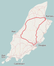
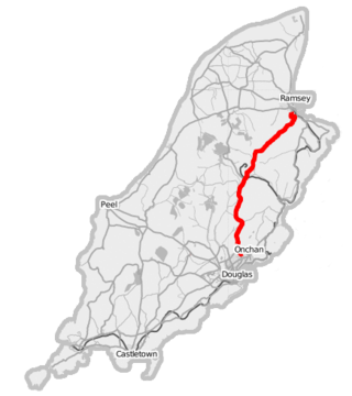
The Snaefell Mountain Course, a motorsport racing circuit that was once part of Grand Prix motorcycle racing, has more than 60 named corners, bends, straightaways, and other features. Unlike the closed-circuit race tracks now used in all Grand Prix championship races, [note 1] the course runs 37.73 miles (60.72 km) almost entirely along public roads of the Isle of Man. [note 2]
Contents
This list includes prominent corners and other landmarks along the course, with names that are used in media coverage and by racers, spectators, and administrators.

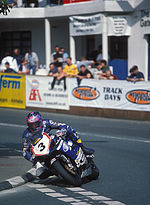
The number of turns in the course is debatable – writing in his 1974 book, TT racer and motorcycle journalist Ray Knight mentioned that the Guinness Book of Records quoted 264, echoed by a 2011 report. [1] [2] Some of the curves, S-bends, turns at crossroads, and other features in the course would not seem significant to car drivers in public traffic, but they are very significant for high-speed racers. 136.358 mph (219.447 km/h) is the highest average speed that has been attained over one lap of the course, by Peter Hickman on 9 June 2023 when he won the second Superstock race. [3] [4] At jumps where most race machines rise clear off the ground, drivers of cars at slow speeds might not even notice a bump. At each corner, racers must consider adjusting their entry speed, focus on their pre-planned line, lean according to the nature of the turn, and anticipate accelerating, decelerating, turning again, or otherwise handling their machines as needed while exiting the turn. [5]

There are road-side marker boards, posted in advance of the major features, bearing these names to inform practice racers, and during races they may remind racers what is coming. [6] The turns generally aren't labelled by numbers as on short racing circuits.
Spectators also focus on named corners and other landmarks beside the course; many of the best vantage points are at turns where racers can be better seen as they slow down. As a guidebook for visitors to the Isle of Man describes:
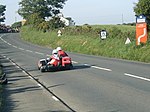
Spectators gather all around the course at locations which have become part of road-racing history: Bray Hill, Quarterbridge, Ballacraine, Laurel Bank, Baaregarrow, Ballaugh Bridge, Quarry Bends, Sulby Straight, Ramsey Hairpin, Gooseneck, Verandah, 32nd Milestone, Windy Corner, Sarah's Cottage, Creg-ny-Baa, Hillberry Corner, Signpost, Governor's Bridge. [7]