Greeba Castle

Last updated

Greeba Castle, Isle of Man Greeba Castle - geograph.org.uk - 105936.jpg
Greeba Castle, Isle of Man

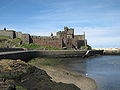
Greeba Castle is a castle on the Isle of Man.

Etymology

The name is derived from Scandinavian: Gnipa, a peak. [1]

Contents

Location

The castle is situated in the parish of German (but close to the boundary with Marown) on the main A1 Peel Road in the Isle of Man. It is about 1 km east of the hamlet of Greeba and 3 km east of the village of St Johns.

Nearby features

The castle is situated where the main road crosses the watershed between the east and west of the island. The former Douglas to Peel railway line runs parallel to the main road. The surrounding area is mainly farmland, including the Greeba River and the former Greeba Curragh with the nearby summits of Greeba Mountain (422 m) and Slieau Ruy (479 m). Also nearby are the ruins of St Trinian's Chapel.

History

At the base of Greeba Mountain and the Kings Forest, or Greeba Plantation, there are two Victorian castellated residences built in 1849 in an elevated position in the Gothic style, on the site of a property that had been known as Booilrenny (perhaps boayl rennee, "place of the fern"). These houses, Greeba Towers and Greeba Castle, were designed by John Robinson of Douglas, a self-taught architect who designed many properties in the town of Douglas including the Bank of Mona (now the Tynwald Building), the Falcon Cliff, Douglas Head Hotel and the Derby Castle, all in a castellated style with Gothic influence. [2] [ full citation needed ] The house was originally built for William Nowell, but it was later bought by Edward Windus, the son of a partner of the publisher, Chatto & Windus. [3] The Victorian novelist Hall Caine moved to the Isle of Man in 1894 and rented Greeba Castle for a six-month period before residing briefly in Peel. Cain bought the house, in a poor state of repair, in 1896. He lived there until his death in 1931, and it was partly remodelled during that time. [4]

According to a folk tale, the owner of Greeba Castle lost the property in a game of cards but built Greeba Towers in front of his former property to block the view of the new owner. Greeba Castle was at one time used as a school. [5]

Races

The castle is between the 5th and 6th milestone roadside markers on the Snaefell Mountain Course used for the Isle of Man TT and Manx Grand Prix races. It was part of the Four Inch Course used for the Tourist Trophy car races between 1905 and 1922, and was part of the course used for 1905 International Motor Cycle Cup races.

Sources

  1. Place Names of the Isle of Man by John Kneen MA pp.396 (1970) Yn Çheshaght Ghailckagh The Scolar Press
  2. Manx Sun June 1890 [ full citation needed ]
  3. Hall Caine: A Victorian Romancer by Vivian Allen, Sheffield University Press: Sheffield, 1997, p.225
  4. An Illustrated Encyclopedia of the Isle of Man by David T.Webber Revised by Frank Cowin and F.J.Radcliffe page 68 (1997) The Manx Experience The Alden Press, Oxford. ISBN   1-873120-25-7
  5. Manx Museum

Coordinates: 54°11′35″N4°35′20″W / 54.19306°N 4.58889°W / 54.19306; -4.58889

Related Research Articles

Ramsey, Isle of Man town on the Isle of Man

Ramsey is a coastal town in the north of the Isle of Man. It is the second largest town on the island after Douglas. Its population is 7,845 according to the 2016 census. It has one of the biggest harbours on the island, and has a prominent derelict pier, called the Queen's Pier. It was formerly one of the main points of communication with Scotland. Ramsey has also been a route for several invasions by the Vikings and Scots.

Isle of Man TT Mountain Course

The Isle of Man TT Mountain Course or TT Course is a motorcycle road-racing circuit located in the Isle of Man. The motorcycle TT Course is used principally for the Isle of Man TT Races and also the separate event of the Isle of Man Festival of Motorcycling for the Manx Grand Prix and Classic TT Races held in September of each year. The start-line for the Isle of Man TT Mountain Course is located on Glencrutchery Road in the town of Douglas, Isle of Man.

11th Milestone, Isle of Man milestone on the Isle of Man

The 11th Milestone, Isle of Man is situated adjacent to the 13th Milestone on the primary A3 Castletown to Ramsey Road which forms the boundary between the parishes of Kirk German and Kirk Michael in the Isle of Man.

Braddan Bridge bridge in United Kingdom

Braddan Bridge is a bridge over the river Dhoo on the Douglas to Peel road, from which a halt on the Isle of Man Railway's first line to Peel took its name.

Crosby, Isle of Man village in the United Kingdom

Crosby is a small village located 3.7 mi (6.0 km) west of Douglas in the parish of Marown in the Isle of Man.

Highlander, Isle of Man

Highlander is situated between the 5th and 6th Milestone road-side markers on the Snaefell Mountain Course used for the Isle of Man TT races on the primary A1 Douglas to Peel road in the parish of Marown in the Isle of Man.

Ramsey Hairpin

Ramsey Hairpin is a point on the Snaefell Mountain Course used for the Isle of Man TT races on the Snaefell Mountain Road, designated as A18, in the parish of Maughold in the Isle of Man.

The Four Inch Course was a road-racing circuit first used for the 1908 Tourist Trophy Race for cars, held on public roads closed for racing by an Act of Tynwald. The name of the course derives from the regulations for the 1908 Tourist Trophy adopted by the Royal Automobile Club, which limited the competitors' engines to a cylinder-diameter of four inches. The Four-Inch Course was adopted by the Auto-Cycle Club for the 1911 Isle of Man TT Races. The Four-Inch Course was subsequently known as the Snaefell Mountain Course or Mountain Course when used for motor-cycle racing.

Ballacraine

Ballacraine is located between the 7th Milestone and 8th Milestone on the primary A1 Douglas to Peel road and the road junction of the primary A3 Castletown to Ramsey in the parish of Kirk German in the Isle of Man.

Greeba Bridge

Greeba Bridge is situated between the 6th milestone and 7th road milestones on the primary A1 Douglas to Peel road and the junction with the Greeba Mill Road in the parish of Kirk German in the Isle of Man.

Appledene is situated between the 6th and 7th roadside mile-markers, measured from the startline of the Snaefell Mountain Course used for the Isle of Man TT races, on the primary A1 Douglas to Peel road in the Isle of Man parish of German.

Gorse Lea section of road

Gorse Lea is situated between the 6th Milestone and 7th Milestones on the primary A1 Douglas to Peel road in the parish of German in the Isle of Man.

Ballagarraghyn

Ballagarraghyn is situated between the 7th milestone and 8th Milestone road-side markers on the primary A1 Douglas to Peel road in the parish of German in the Isle of Man.

Doran's Bend is situated between the 7th and 8th Milestone road-side markers on the Snaefell Mountain Course used for the Isle of Man TT Races on the primary A3 Castletown to Ramsey road in the parish of German in the Isle of Man.

Ballaspur is situated between the 7th and 8th Milestone road-side markers on the Snaefell Mountain Course used for the Isle of Man TT races on the A3 Castletown to Ramsey road in the parish of German in the Isle of Man.

Quarterbridge, Isle of Man

Quarterbridge is situated soon after the 1 mile-marker measured from the TT Grandstand, part of the Snaefell Mountain Course used for the Isle of Man TT races, at the junction of the primary A1 Douglas to Peel road, A2 Douglas to Ramsey road and the A5 Douglas to Port Erin road which forms the boundary between the parishes of Braddan and Onchan in the Isle of Man.

Quarterbridge Road

Quarterbridge Road is situated adjacent to the 1st Milestone road-side marker measured from the startline at TT Grandstand used for the Snaefell Mountain Course on the primary A2 Ramsey to Douglas road in the town of Douglas, Isle of Man.

Douglas Road Corner

Douglas Road Corner or Kirk Michael Corner is situated adjacent the 14th Milestone road-side marker on the Snaefell Mountain Course on the primary A3 Castletown to Ramsey Road and the road junction with the A4 Peel to Kirk Michael Coast Road in the parish of Michael in the Isle of Man.

Ballagarey Corner, Isle of Man

Ballagarey is located between the 3rd milestone and 4th milestone on the primary A1 Douglas to Peel road, in the parish of Marown in the Isle of Man.

St Trinians Church Church in Isle of Man., Isle of Man

St Trinian's Church is the roofless ruin of a small chapel at the foot of Greeba Mountain, adjacent to the main A1 Douglas - Peel Road in the parish of Marown, Isle of Man. Referred to in the Manx language as a "Keeil Brisht", the church is the source of an ancient Manx folktale concerning the Buggane, a huge mythical ogre who lived on Greeba Mountain and who vowed that the church should never be completed.