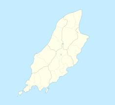
Following soon after Ramsey Hairpin, it is sequence of two right-hand bends in the direction taken by race competitors, situated at an elevation of 380feet (116metres) above sea level after the climb out of Ramsey town, and slightly before the 25th Milestone road-side marker on the 37+ mile circuitous-course, measured from the startline at the TT Grandstand. After Waterworks, the climb continues to Tower Bends and the Gooseneck.[2][3][4][5][6][7][8][9]
The corners at Waterworks were part of the Highland Course and the Four Inch Course used for the Gordon Bennett Trial and Tourist Trophy car races held in the Isle of Man between 1904 and 1922. Waterworks is part of the Snaefell Mountain Course used since 1911 for the TT and 1923 for the Manx Grand Prix races. For the 1939 TT races, road widening and landscaping occurred at the Waterworks area by the Isle of Man Highway Board.[10]
Name origin
The name Waterworks derives from the nearby Ballure Reservoir, situated high in the hills, built by the Ramsey Water Works Company, established by an Act of Tynwald in 1859, to supply drinking water to the town of Ramsey. In 1881 the reservoir was extended with a dam further upstream to hold 18 million gallons, completed in 1884. In 1948 the Ramsey Water Company was replaced by the Isle of Man Water Board which became the Isle of Man Water Authority in 1972.[citation needed][11][bettersourceneeded][bettersourceneeded]
Sources
↑ Isle of Man TT by Charles Deane, p.42 1975, Patrick Stephens Limited, Cambridge, ISBN0-85059-172-4 Accessed 22 December 2015
↑ Motor Cycle, 10 September 1964. 'Lightweight Manx Grand Prix report'. p.531 [image caption]: "...the winner Gordon Keith heeling his Greeves Silverstone Mark 2 round the second of the two Waterworks bends". Accessed 29 July 2015
↑ TT Racing, by Ray Knight, p.53. "...the first view of the double right hand cornered Waterworks section looks tight and the steep drop over the bank is detuning,...". 1974 Speedsport Motobooks, Brentford, England. ISBN0-85113-078-X Accessed 22 December 2015
↑ TT Racing, by Ray Knight p.53. "If you got through the first bend in third then you will certainly change down for the next as it is a tight one". 1974, Speedsport Motobooks, Brentford, England. ISBN0-85113-078-X Accessed 22 December 2015
↑ TT Racing, by Ray Knight p.55. "The Marshall's post [sic] on the second right is the only place at the same level as the road, due to the drop down the hill over the wall." 1974, Speedsport Motobooks, Brentford, England. ISBN0-85113-078-X Accessed 22 December 2015
↑ The TT Mountain Course (second edition), by Fred Hanks p.29 Waterworks Section. "Tight right. Even tighter right again." 1975, A TT Special publication. Accessed 22 December 2015
↑ Lucas map of the T.T. course, 1973. Accessed 22 December 2015
↑ The Lucas contour map of the T.T. circuit, 1973. Accessed 22 December 2015
↑ Isle of Man TT by Charles Deane, p.38 Mountain Circuit map. 1975, Patrick Stephens Limited, Cambridge, ISBN0-85059-172-4 Accessed 22 December 2015
↑ Isle of Man Weekly Times page 1 dated 13 May 1939
The Isle of Man TT or Tourist Trophy races are an annual motorcycle racing event run on the Isle of Man in May/June of most years since its inaugural race in 1907. The event is often called one of the most dangerous racing events in the world.
The A18 Snaefell Mountain Road or Mountain Road is a primary main A-road of 13.35 miles (21.48 km) in length which connects the towns of Douglas and Ramsey in the Isle of Man.
The Isle of Man TT Mountain Course or TT Course is a motorcycle road-racing circuit located in the Isle of Man. The motorcycle TT Course is used principally for the Isle of Man TT Races and also the separate event of the Isle of Man Festival of Motorcycling for the Manx Grand Prix and Classic TT Races held in September of each year. The start-line for the Isle of Man TT Mountain Course is located on Glencrutchery Road in the town of Douglas, Isle of Man.
Signpost Corner, Isle of Man is a former temporary motor-cycle race signal station, located on the A18 Snaefell Mountain Road at the road junction with the A39 Hillberry Road / B11 Avondale Road in the parish of Onchan in the Isle of Man.
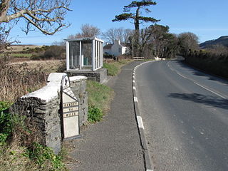
26th Milestone, Isle of Man is situated on the primary A18 Snaefell Mountain Road in the parish of Lezayre in the Isle of Man. At the 26th Milestone racing marker used for the Isle of Man TT Races and Manx Grand Prix, the bend was named in honour of 26-times TT winner Joey Dunlop who died after a racing motorcycle crash in Estonia in July 2000. The area is the location of the only accident in which spectators at the Isle of Man TT races or Manx Grand Prix have been killed in a motorcycle racing accident.
The Verandah, Isle of Man is a series of four bends which motorcyclists negotiate at high speed during road racing on the Snaefell Mountain Course on the Isle of Man.
Bray Hill was formerly a country lane known as the Great Hill during the time of the ownership of the Duke of Atholl, and was previously known as Siberia, originally a triangle-shaped parcel of land in the Murray Estate.
Governor's Bridge is a hairpin bend adjacent to a road junction on the primary A18 Mountain Road in the parish of Onchan in the Isle of Man, with a sudden drop in elevation leading to Governor's Dip, followed by a left-hand bend and finally a right exiting on to the main Glencrutchery Road.
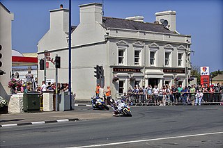
Parliament Square, Ramsey is situated between the 23rd and 24th Milestone road-side markers on the Snaefell Mountain Course used for the Isle of Man TT Races on the junction of the primary A3 Castletown to Ramsey road, the A9 Ramsey to Andreas road and A2 Douglas to Ramsey road situated in the town of Ramsey in the parish of Lezayre in the Isle of Man.
Gooseneck, Isle of Man, is an acute uphill right-bend on the Snaefell Mountain Course used for the TT motorcycle races between the 25th and 26th Milestone racing road-side markers, on the 37+ mile circuitous-course, measured from the startline at the TT Grandstand.
Ramsey Hairpin is a point on the Snaefell Mountain Course used for the Isle of Man TT races on the Snaefell Mountain Road, designated as A18, in the parish of Maughold in the Isle of Man.
The Four Inch Course was a road-racing circuit first used for the 1908 Tourist Trophy Race for cars, held on public roads closed for racing by an Act of Tynwald. The name of the course derives from the regulations for the 1908 Tourist Trophy adopted by the Royal Automobile Club, which limited the competitors' engines to a cylinder-diameter of four inches. The Four-Inch Course was adopted by the Auto-Cycle Club for the 1911 Isle of Man TT Races. The Four-Inch Course was subsequently known as the Snaefell Mountain Course or Mountain Course when used for motor-cycle racing.
Brandywell, Isle of Man or is an area of Mountain Lands of heath moorland and coniferous woodland plantations situated in the Northern Upland Massif in the parish of Kirk Michael in the Isle of Man. The area was previously used by local shepherds due to a local stream and a nearby former venerated water well which was known for its distinctive quality and "brandy" colour of the water.
Kate's Cottage, Isle of Man is a cottage and one of the named corners of the Snaefell Mountain Course used in Grand Prix-style motorcycle racing along public roadways of the Isle of Man. It has been asserted in the Isle of Man's program of Registered Buildings that the cottage was built by 1869.
Ballaspur is situated between the 7th and 8th Milestone road-side markers on the Snaefell Mountain Course used for the Isle of Man TT races on the A3 Castletown to Ramsey road in the parish of German in the Isle of Man.
Ballacobb is situated between the 16th and 17th Milestone road-side markers on the Snaefell Mountain Course, on the primary A3 Castletown to Ramsey road at the side-junction with the tertiary U16 Slieu Curn Road, in the parish of Ballaugh in the Isle of Man.
Alpine Cottage including the adjacent Alpine House is situated between the 16th and 17th Milestone road-side markers on the Snaefell Mountain Course on the primary A3 Castletown to Ramsey road in the parish of Ballaugh in the Isle of Man.
Tower Bends is a point on the Snaefell Mountain Course used for the Isle of Man TT races on the Snaefell Mountain Road, designated A18, in the parish of Maughold in the Isle of Man.
Douglas Road Corner or Kirk Michael Corner is situated adjacent the 14th Milestone road-side marker on the Snaefell Mountain Course on the primary A3 Castletown to Ramsey Road and the road junction with the A4 Peel to Kirk Michael Coast Road in the parish of Michael in the Isle of Man.
This page is based on this Wikipedia article Text is available under the CC BY-SA 4.0 license; additional terms may apply. Images, videos and audio are available under their respective licenses.