List of schools in the West Coast, New Zealand

Last updated

NZ-West Coast plain map.png
Disc Plain red.svg
Westport
Disc Plain red.svg
Karamea
Disc Plain red.svg
Reefton
Disc Plain red.svg
Greymouth
Disc Plain red.svg
Haupiri
Disc Plain red.svg
Harihari
Disc Plain red.svg
Hokitika
Localities on the West Coast offering secondary education

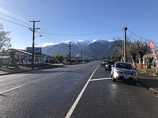
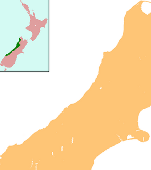
The West Coast is a region in the South Island of New Zealand. It contains numerous rural primary schools and several small town primary and secondary schools. Area schools in isolated areas provide complete education from primary to secondary level. All schools in the region are coeducational.

Contents

In New Zealand schools, students begin formal education in Year 1 at the age of five. [1] Year 13 is the final year of secondary education. Years 14 and 15 refer to adult education facilities.

State schools are those fully funded by the government and at which no fees can be charged, although a donation is commonly requested. [2] A state integrated school is a state school with a special character based on a religious or philosophical belief. The state integrated schools on the West Coast are all Catholic schools. A private school charges fees to its students. [3] The only private school in this region is Gloriavale Christian Community School near Haupiri, which is operated by a religious group.

The decile rating indicates the socio-economic group that the school catchment area falls into. A rating of 1 indicates a poor area; a rating of 10 a well-off one. [4] The decile ratings used here come from the Ministry of Education Te Kete Ipurangi website and from the decile change spreadsheet listed in the references. The deciles were last revised using information from the 2006 Census. [5] The roll of each school changes frequently as students start school for the first time, move between schools, and graduate. The rolls given here are those provided by the Ministry of Education, based on figures from June 2011 roll returns. [6] The Ministry of Education institution number, given in the last column, links to the Education Counts page for each school.

Buller District

The Buller District covers the northern part of the West Coast region. The only 2 towns in the district with more than 1000 people are Westport and Reefton

NameYearsAreaAuthorityDecileRollWebsiteMOE
Buller High School 9–13 Westport State3347 301
Granity School 1–8 Granity State425 3192
Inangahua Junction School 1–6 Inangahua Junction State69 3198
Karamea Area School 1–13 Karamea State577 300
Maruia School 1–8 Maruia State919 3204
Reefton Area School 1–13 Reefton State3166 496
Sacred Heart School 1–8 Reefton State integrated424 3219
St Canice's School 1–8 Westport State integrated4137 3220
Westport North School 1–8 Westport State4215 3235
Westport South School 1–8 Westport State4244 3236

Grey District

The Grey District lies between the Buller and Westland districts. Greymouth and its satellite towns contain the majority of the district's population.

NameYearsAreaAuthorityDecileRollWebsiteMOE
Awahono School - Grey Valley 1–8 Ahaura State477 2105
Barrytown School 1–8 Barrytown State423 3290
Blaketown School 1–8 Blaketown State279 3295
Cobden School 1–8 Cobden State264 3322
Gloriavale Christian School 1–13 Haupiri PrivateN/AUn­known 1587
Greymouth High School 9–13 Greymouth Central State4564 303
Greymouth Main School 1–8 Greymouth Central State5261 3361
John Paul II High School 9–13 Greymouth Central State integrated4184 304
Karoro School 1–8 Karoro State8164 3394
Lake Brunner School 1–8 Moana State753 2123
Paparoa Range School 1–8 Dobson State368 2106
Paroa School 1–8 Paroa State6163 3472
Runanga School 1–8 Runanga State358 3495
St Patrick's School 1–8 Greymouth Central State integrated5172 3538

Westland District

The Westland District is the largest district on the West Coast, and the one with the smallest population. Hokitika is the only substantial town, with a population of just over 3,000 people.

NameYearsAreaAuthorityDecileRollWebsiteMOE
Fox Glacier School 1–8 Fox Glacier State814 3342
Franz Josef Glacier School 1–8 Franz Josef State935 3343
Haast School 1–8 Haast State38 3363
Hokitika School 1–6 Hokitika State4175 3376
Kaniere School 1–6 Kaniere State783 3393
Kokatahi-Kowhitirangi School 1–6 Kokatahi State835 3398
Kumara School 1–8 Kumara State534 3401
Ross School 1–6 Ross State621 3489
South Westland Area School 1–15 Harihari State4112 306
St Mary's School 1–8 Hokitika State integrated5121 3536
Westland High School 7–15 Hokitika State6362 305
Whataroa School 1–8 Whataroa State728 3592

Closed schools

Related Research Articles

West Coast Region Region of New Zealand

The West Coast is a region of New Zealand on the west coast of the South Island that is administered by the West Coast Regional Council, and is known co-officially as Te Tai Poutini. It comprises the territorial authorities of Buller District, Grey District and Westland District. The principal towns are Westport, Greymouth and Hokitika. The region, one of the more remote areas of the country, is also the most sparsely populated. With a population of just 32,000 people, Te Tai Poutini is the least populous region in New Zealand, and it is the only region where the population is declining.

Hokitika Town in West Coast, New Zealand

Hokitika is a town in the West Coast region of New Zealand's South Island, 40 kilometres (25 mi) south of Greymouth, and close to the mouth of the Hokitika River. It is the seat and largest town in the Westland District. The town's estimated population is 2,910 as of June 2021.

Reefton Town in the South Island of New Zealand

Reefton is a small town in the West Coast region of New Zealand, some 80 km northeast of Greymouth, in the Inangahua River valley. Ahaura is 44 km south-west of Reefton, Inangahua Junction is 34 km to the north, Maruia is 63 km to the east, and the Lewis Pass is 66 km to the south-east.

Whataroa Place in West Coast, New Zealand

Whataroa is a small township in southern Westland on the West Coast of New Zealand's South Island. It is located on the western bank of the Whataroa River, with the village of Te Taho on the other side. State Highway 6 passes through Whataroa on its route from Ross to the Franz Josef Glacier. Hari Hari is 31 kilometres (19 mi) to the north-east, and Franz Josef is 32 km to the south-west.

Whangaroa Harbour Bight in New Zealand

Whangaroa Harbour, previously spelled Wangaroa Harbour, is an inlet on the northern coast of Northland, New Zealand. Whangaroa Bay and the Pacific Ocean are to the north. The small settlements of Totara North and Saies are on the west side of the harbour, Waitaruke on the south side, and Whangaroa on the east. State Highway 10 runs through Waitaruke. The name comes from the lament "Whaingaroa" or "what a long wait" of a woman whose warrior husband had left for a foray to the south. The harbour was formed when rising sea levels drowned a river valley about 6,000 years ago. Steep outcrops remain from ancient volcanic rocks.

Paroa, West Coast Place in West Coast, New Zealand

Paroa is a settlement on the West Coast of the South Island of New Zealand, just south of Greymouth. State Highway 6 and the Hokitika Branch railway both run through Paroa. This railway was originally a bush tramway that opened to Paroa from Greymouth in 1867 and was extended to Kumara in 1877. It was converted into a railway in 1893, and this time, ran from Paroa to Hokitika rather than Kumara.

Kokatahi is a locality on the West Coast of New Zealand. Hokitika is about 15 km to the north-west. The Kokatahi River flows through the area and into the Hokitika River to the north-west.

Brooklands, New Plymouth Suburb of New Plymouth in New Zealand

Brooklands is a suburb of New Plymouth, in the Taranaki region of the western North Island of New Zealand. It is located on the southern edge of the city and east of Vogeltown. The area is named after Brooklands farm, established in 1842.

Greymouth Central Suburb of Greymouth in New Zealand

Greymouth Central is the central business district of Greymouth on the West Coast of New Zealand, which also contains residential housing.

References

General
Specific
  1. "About School: School basics". New Zealand Ministry of Education. Archived from the original on 26 May 2008. Retrieved 8 June 2008.
  2. "School Donations & Fees". New Zealand Ministry of Education. 23 June 1998. Archived from the original on 14 July 2006. Retrieved 23 June 2006.
  3. "about NZ education". EduSearch. Archived from the original on 6 December 2007. Retrieved 8 June 2008.
  4. "How The Decile Is Calculated". New Zealand Ministry of Education . Retrieved 8 June 2008.
  5. "Reviews of Deciles - General Information". New Zealand Ministry of Education . Retrieved 8 June 2008.
  6. "New Zealand Schools - Education Counts" . Retrieved 11 September 2011.
  7. "Waimangaroa school to close". 30 November 2012. Retrieved 26 November 2013.
  8. "Class dismissed for last time at tiny school". The Press . 20 December 2012. Retrieved 26 November 2013.