Hari Hari

Last updated

Hari Hari
Hendes Ferry Cottage MRD.jpg
Hende's Ferry Cottage, a historic building by the bank of the Wanganui River in Hari Hari
Hari Hari
Coordinates: 43°9′0″S170°33′43″E / 43.15000°S 170.56194°E / -43.15000; 170.56194
CountryNew Zealand
Region West Coast
District Westland District
WardSouthern
Electorates
Government
  Territorial Authority Westland District Council
  Regional council West Coast Regional Council
   Mayor of Westland Helen Lash
   West Coast-Tasman MP Maureen Pugh
   Te Tai Tonga MP Tākuta Ferris
Area
[1]
  Total50.43 km2 (19.47 sq mi)
Population
 (June 2023) [2]
  Total260
  Density5.2/km2 (13/sq mi)
Time zone UTC+12 (NZST)
  Summer (DST) UTC+13 (NZDT)
Postcode
7884
Area code 03
Local iwi Ngāi Tahu
The Willows Craft Cottage 20 Main Road in Harihari.jpg
The Willows Craft Cottage

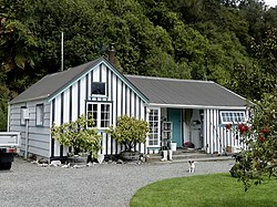
Hari Hari (sometimes spelled Harihari) is a small rural settlement in the south west of the West Coast region of New Zealand's South Island. It is slightly inland from the Tasman Sea and the Saltwater Lagoon and is situated between the Wanganui and Poerua Rivers, 45 minutes south of the tourist town of Hokitika. State Highway 6 passes through the town on its route from Ross to the Franz Josef Glacier. The Westland District's largest town, Greymouth is 110 kilometres (68 mi), and Hokitika 70 km (43 mi) to the north-east. Ross is 46 km (29 mi) to the north-east, and Franz Josef is 32 km south west. [3] [4]

Contents

Hari Hari was once a logging settlement and relics of a bush tramway that used to carry timber can be found in the area. Today, the forest in the area is protected and popular activities in the Hari Hari area include bushwalking, birdwatching, and trout and salmon fishing.

The Inter-Wanganui Co-op opened a dairy factory at Hari Hari in 1908, [5] but it is now a ruin. [6]

Hari Hari's main claim to fame occurred on 7 January 1931, when Australian aviator Guy Menzies landed upside down in a swamp near Hari Hari, completing the first solo flight across the Tasman Sea. Menzies, who had left Sydney 11 hours and 45 minutes earlier, was aiming for Blenheim but had been blown off course and mistook a swamp for flat pasture suitable for landing. Despite the accident, he was unharmed. On 7 January 2006, the 75th anniversary celebrations of the feat were held in Hari Hari, with roughly 400 people in attendance. To mark the occasion, Dick Smith recreated Guy Menzies' flight, though Smith chose to land upright in Hari Hari. [7]

Local name change controversy

The name has a Maori meaning, from Te Aka Maori/English Dictionary, as "to take/carry joy" or, as local legend suggests, "come together in unison" from a Maori canoe paddling chant/song. Williams' dictionary gives "Harihari" as the correct spelling for that meaning. [8] In recent years, Hari Hari has been increasingly referred to as "Harihari" with Maori meaning as "ambulance"[ circular reference ]. No official statutory process has taken place in order for this to happen.

Many local residents are upset about the growing number of official websites, and official documentation, referring to Hari Hari as being "Harihari". The greater community insists that they were not informed or talked to about this matter, and are against the gradual unofficial change. Some are being active about keeping their town's name the same, and have involved the Department of Māori Affairs about the tampering with of a traditional Māori place name. Town signs around Hari Hari still state the name is Hari Hari. One newly placed town distance sign in Whataroa shows the name "Harihari". [9]

The town was named in 1908 when a post office was needed for the township. Then named Harihari, [10] the office was opened on 18 September 1908. [11] "Hari Hari Post Office" was operated by Postmaster Hende. Prior to this, Hari Hari was called "Hende's Ferry" after the Hende family, the first European settlers in the area. Land Information New Zealand states, they have no record of "Hari Hari Post Office" and insist the "accepted" name is Harihari. They also state that a chain of surveyors who had surveyed the area over past years had used the shortened name. Locals say this is debatable and untrue. If true, this was either from a lack of knowledge of Hari Hari's given name, or the surveyors were simply saving time by shortening the town's name. This has resulted in confusion, and official Government Organizations and Internet sites World Wide, such as Google Earth not using the real town name.

Demographics

Hari Hari is described by Statistics New Zealand as a rural settlement and covers 50.43 km2 (19.47 sq mi). [1] It had an estimated population of 260 as of June 2023, [2] with a population density of 5.2 people per km2. The settlement is part of the larger Whataroa-Harihari statistical area. [12]

Historical population for Hari Hari
YearPop.±% p.a.
2006264    
2013243−1.18%
2018240−0.25%
Source: [13]

Hari Hari had a population of 240 at the 2018 New Zealand census, a decrease of 3 people (−1.2%) since the 2013 census, and a decrease of 24 people (−9.1%) since the 2006 census. There were 105 households, comprising 123 males and 120 females, giving a sex ratio of 1.02 males per female, with 42 people (17.5%) aged under 15 years, 33 (13.8%) aged 15 to 29, 117 (48.8%) aged 30 to 64, and 48 (20.0%) aged 65 or older.

Ethnicities were 91.2% European/Pākehā, 10.0% Māori, 2.5% Pasifika, 2.5% Asian, and 2.5% other ethnicities. People may identify with more than one ethnicity.

Although some people chose not to answer the census's question about religious affiliation, 53.8% had no religion, 30.0% were Christian and 2.5% had other religions.

Of those at least 15 years old, 24 (12.1%) people had a bachelor's or higher degree, and 63 (31.8%) people had no formal qualifications. 15 people (7.6%) earned over $70,000 compared to 17.2% nationally. The employment status of those at least 15 was that 90 (45.5%) people were employed full-time, 39 (19.7%) were part-time, and 3 (1.5%) were unemployed. [13]

Whataroa-Harihari statistical area

Whataroa-Harihari statistical area, which also includes Whataroa, covers 1,136.25 km2 (438.71 sq mi) [1] and had an estimated population of 700 as of June 2023, [14] with a population density of 0.62 people per km2.

Historical population for Whataroa-Harihari
YearPop.±% p.a.
2006753    
2013612−2.92%
2018642+0.96%
Source: [15]

Whataroa-Harihari had a population of 642 at the 2018 New Zealand census, an increase of 30 people (4.9%) since the 2013 census, and a decrease of 111 people (−14.7%) since the 2006 census. There were 276 households, comprising 348 males and 297 females, giving a sex ratio of 1.17 males per female. The median age was 40.7 years (compared with 37.4 years nationally), with 147 people (22.9%) aged under 15 years, 96 (15.0%) aged 15 to 29, 300 (46.7%) aged 30 to 64, and 102 (15.9%) aged 65 or older.

Ethnicities were 87.4% European/Pākehā, 13.1% Māori, 5.6% Pasifika, 2.8% Asian, and 3.3% other ethnicities. People may identify with more than one ethnicity.

The percentage of people born overseas was 11.7, compared with 27.1% nationally.

Although some people chose not to answer the census's question about religious affiliation, 51.9% had no religion, 35.5% were Christian, 0.5% were Buddhist and 2.3% had other religions.

Of those at least 15 years old, 57 (11.5%) people had a bachelor's or higher degree, and 129 (26.1%) people had no formal qualifications. The median income was $31,400, compared with $31,800 nationally. 57 people (11.5%) earned over $70,000 compared to 17.2% nationally. The employment status of those at least 15 was that 276 (55.8%) people were employed full-time, 84 (17.0%) were part-time, and 12 (2.4%) were unemployed. [15]

Education

South Westland Area School is a coeducational composite school (years 1-15), with a roll of 114 students as of February 2024. [16] [17] It opened in 1969, replacing Hari Hari School which had existed since 1865. [18] The school has a satellite class at Franz Josef Glacier School. [19]

There is also a University of Canterbury Field Station, "The Green Elephant". [20]

Climate

Climate data for Hari Hari (1971–2000)
MonthJanFebMarAprMayJunJulAugSepOctNovDecYear
Mean daily maximum °C (°F)20.4
(68.7)
21.2
(70.2)
19.9
(67.8)
17.5
(63.5)
15.0
(59.0)
12.7
(54.9)
12.5
(54.5)
13.3
(55.9)
14.3
(57.7)
15.7
(60.3)
17.0
(62.6)
19.2
(66.6)
16.6
(61.8)
Daily mean °C (°F)15.6
(60.1)
16.0
(60.8)
14.6
(58.3)
12.1
(53.8)
9.2
(48.6)
6.7
(44.1)
6.4
(43.5)
7.5
(45.5)
9.3
(48.7)
11.0
(51.8)
12.4
(54.3)
14.5
(58.1)
11.3
(52.3)
Mean daily minimum °C (°F)10.7
(51.3)
10.8
(51.4)
9.2
(48.6)
6.6
(43.9)
3.3
(37.9)
0.8
(33.4)
0.2
(32.4)
1.8
(35.2)
4.3
(39.7)
6.3
(43.3)
7.8
(46.0)
9.8
(49.6)
6.0
(42.7)
Average rainfall mm (inches)480.8
(18.93)
265.9
(10.47)
443.2
(17.45)
285.1
(11.22)
257.8
(10.15)
320.8
(12.63)
370.7
(14.59)
202.7
(7.98)
294.2
(11.58)
339.6
(13.37)
364.5
(14.35)
540.6
(21.28)
4,165.9
(164)
Source: CliFlo (rain 1981–2010) [21]

Related Research Articles

<span class="mw-page-title-main">West Coast Region</span> Region of New Zealand

The West Coast is a region of New Zealand on the west coast of the South Island. It is administered by the West Coast Regional Council, and is known co-officially as Te Tai Poutini. It comprises the territorial authorities of Buller District, Grey District and Westland District. The principal towns are Westport, Greymouth and Hokitika. The region, one of the more remote areas of the country, is also the most sparsely populated. With a population of just 32,900 people, the West Coast is the least populous region in New Zealand. The population in the region grew by 0.4% over the year to July 2023.

<span class="mw-page-title-main">Haast, New Zealand</span> Town in the South Island of New Zealand

Haast is a small town in the Westland District territorial authority on the West Coast of New Zealand's South Island. The township is beside the Haast River, 3 kilometres (2 mi) south of Haast Junction, on State Highway 6. The Haast region is in Te Wahipounamu – The South West New Zealand World Heritage, a UNESCO World Heritage Site designated in 1990.

<span class="mw-page-title-main">Waitomo District</span> Territorial authority district in Waikato region, New Zealand

Waitomo District is a territorial authority, located in the Waikato region, at the north of the King Country area in the North Island of New Zealand. A small part of the district, the locality of Tiroa, however, lies in the Manawatū-Whanganui region.

<span class="mw-page-title-main">Ross, New Zealand</span> Town in the West Coast Region of New Zealand

Ross is a small town located in the Westland District on the West Coast of New Zealand's South Island, 27 kilometres (17 mi) south-west of Hokitika and 46 kilometres (29 mi) north-east of Hari Hari by road.

<span class="mw-page-title-main">Kumara, New Zealand</span> Town in West Coast, New Zealand

Kumara is a town on the West Coast of the South Island of New Zealand. It is located 30 kilometres (19 mi) south of Greymouth, close to the western end of State Highway 73, which leads across Arthur's Pass to Christchurch. The Taramakau River flows past to the north.

<span class="mw-page-title-main">Ngatea</span> Place in Waikato region, New Zealand

Ngatea is a small town on the Hauraki Plains in the North Island of New Zealand. It is located 18 kilometres southwest of Thames and 70 kilometres southeast of Auckland. Ngatea lies on the Piako River, eight kilometres south of its outflow into the Firth of Thames.

<span class="mw-page-title-main">Ashhurst</span> Settlement in Manawatū-Whanganui Region, New Zealand

Ashhurst is a town and outlying suburb of Palmerston North, in the Manawatū-Whanganui region of New Zealand's North Island.

<span class="mw-page-title-main">Marton, New Zealand</span> Town in Manawatū-Whanganui, New Zealand

Marton is a town in the Rangitikei district of the Manawatū-Whanganui region of New Zealand's North Island. It is situated 35 kilometres southeast of Whanganui and 40 kilometres northwest of Palmerston North.

<span class="mw-page-title-main">Westland District</span> Territorial authority district in West Coast, New Zealand

Westland District is a territorial authority district on the West Coast of New Zealand's South Island. It is administered by the Westland District Council. The district's population is 8,940.

<span class="mw-page-title-main">Whataroa</span> Town in West Coast, New Zealand

Whataroa is a small township in southern Westland on the West Coast of New Zealand's South Island. It is located on alluvial flats to the west of the Whataroa River. State Highway 6 passes through Whataroa on its route from Ross to Franz Josef / Waiau. Hari Hari is 31 kilometres (19 mi) to the north-east, and Franz Josef is 32 km to the south-west.

<span class="mw-page-title-main">Franz Josef / Waiau</span> Town in the West Coast Region of New Zealand

Franz Josef is a small town in the West Coast region of the South Island of New Zealand. Whataroa is 32 kilometres (20 mi) to the north-east, and the township of Fox Glacier is 23 kilometres (14 mi) to the south-west. The Waiho River runs from the Franz Josef Glacier to the south, through the town, and into the Tasman Sea to the north-west.

Longburn is a rural settlement just outside Palmerston North in the Manawatū-Whanganui area of New Zealand. Made up of large dairy processing plants Longburn is often mistaken to be a small township and not seen as a large satellite town of Palmerston North. The township is home to both Longburn School and Longburn Adventist College.

<span class="mw-page-title-main">Taupiri</span> Town in Waikato, New Zealand

Taupiri is a small town of about 500 people on the eastern bank of the Waikato River in the Waikato District of New Zealand. It is overlooked by Taupiri mountain, the sacred burial ground for the Waikato tribes of the Māori people, located just to the north.

<span class="mw-page-title-main">Tokomaru, New Zealand</span> Settlement in Manawatū-Whanganui, New Zealand

Tokomaru is a small town in the district of Horowhenua, in the southwestern North Island of New Zealand. It is located 18 kilometres southwest of Palmerston North, and a similar distance northeast of Shannon. The Tokomaru railway station on the North Island Main Trunk was open from 1885 to 1982.

Grovetown is a small town in Marlborough, New Zealand. State Highway 1 runs past the settlement to the west, and the Wairau River flows past to the northeast. Spring Creek is about 2.5 km to the north, and Blenheim is about 3.5 km to the south. To the east is Grovetown Lagoon, an oxbow loop of the Wairau River. The settlement had a usual resident population of 357 at the 2018 New Zealand census.

Waitōtara is a town in South Taranaki, New Zealand. Waverley is 10 km to the north-west, and Whanganui is 34 km to the south-east. State Highway 3 passes through it. The Waitōtara River flows past the east side of the town.

<span class="mw-page-title-main">Fox Glacier (town)</span> Town in the West Coast Region of New Zealand

Fox Glacier, called Weheka until the 1940s, is a village on the West Coast of the South Island of New Zealand. The village is close to the eponymous Fox Glacier / Te Moeka o Tuawe.

<span class="mw-page-title-main">Rangataua</span> Settlement in Manawatū-Whanganui Region, New Zealand

Rangataua is a small village in the North Island of New Zealand. It is located at the southern end of both the Tongariro National Park and Rangataua State Forest, adjacent to the southwestern slopes of the active volcano Mount Ruapehu. Part of the Manawatū-Whanganui region, the town is 5 kilometres east of Ohakune, 75 kilometres northeast of Wanganui, and 20 kilometres west of Waiouru.

<span class="mw-page-title-main">Whanganui District</span> Territorial authority district in Manawatū-Whanganui, New Zealand

Whanganui District is one of the districts of New Zealand. It includes the city of Whanganui and surrounding areas.

<span class="mw-page-title-main">Koitiata</span> Settlement in Manawatū-Whanganui Region, New Zealand

Koitiata is a settlement located in the southwestern part of Rangitikei District of the Manawatū-Whanganui region of New Zealand's North Island. At the time of the 2018 census, Koitiata had a population of 126. Marton is located 24 km to the east and Whanganui is located 29 km to the northwest. Nearby Koitiata is Lake Koitiata.

References

  1. 1 2 3 "ArcGIS Web Application". statsnz.maps.arcgis.com. Retrieved 23 May 2024.
  2. 1 2 "Subnational population estimates (RC, SA2), by age and sex, at 30 June 1996-2023 (2023 boundaries)". Statistics New Zealand . Retrieved 25 October 2023. (regional councils); "Subnational population estimates (TA, SA2), by age and sex, at 30 June 1996-2023 (2023 boundaries)". Statistics New Zealand . Retrieved 25 October 2023. (territorial authorities); "Subnational population estimates (urban rural), by age and sex, at 30 June 1996-2023 (2023 boundaries)". Statistics New Zealand . Retrieved 25 October 2023. (urban areas)
  3. Peter Dowling, ed. (2004). Reed New Zealand Atlas. Reed Books. map 74. ISBN   0-7900-0952-8.
  4. Roger Smith, GeographX (2005). The Geographic Atlas of New Zealand. Robbie Burton. map 164. ISBN   1-877333-20-4.
  5. "Inter-Wanganui Co-op dairy factory opening". University of Canterbury library. Retrieved 5 August 2008.
  6. "Inter-Wanganui Co-op Dairy Co". Panoramio. Retrieved 5 August 2008.
  7. "Dick Smith recreates first solo trans-Tasman flight". Sydney Morning Herald. 8 January 2006.
  8. Williams, H. W. Dictionary of the Maori Language GP Publications Limited, Wellington, Seventh edition, 1971; 1992 reprint, p.38; "harihari, n. Song to make people pull together"
  9. Brown, Giles (2 January 2009). "Coasters testy over township's name". The Press . Archived from the original on 7 November 2012.
  10. https://paperspast.natlib.govt.nz/newspapers/WCT19081015.2.4 [ bare URL ]
  11. Collins, R. J. G. and Watts, C.W. (editors). The Postage Stamps of New Zealand, Vol. III. The Royal Philatelic Society of New Zealand Incorporated, Wellington, New Zealand, 1955, p. 574
  12. 2018 Census place summary: Whataroa-Harihari
  13. 1 2 "Statistical area 1 dataset for 2018 Census". Statistics New Zealand. March 2020. 7023814 and 7023815.
  14. "Population estimate tables - NZ.Stat". Statistics New Zealand . Retrieved 25 October 2023.
  15. 1 2 "Statistical area 1 dataset for 2018 Census". Statistics New Zealand. March 2020. Whataroa-Harihari (311900). 2018 Census place summary: Whataroa-Harihari
  16. "New Zealand Schools Directory". New Zealand Ministry of Education. Retrieved 14 March 2024.
  17. Education Counts: South Westland Area School
  18. "Home". South Westland Area School. Retrieved 11 February 2021.
  19. "Supplementary Review Report: South Westland Area School". Education Review Office. May 2006.[ permanent dead link ]
  20. Harihari Field Station Archived 15 February 2009 at the Wayback Machine . Canterbury.ac.nz.
  21. "CliFlo – National Climate Database : Harihari N.Z.F.S." NIWA. Retrieved 10 May 2024.