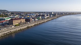
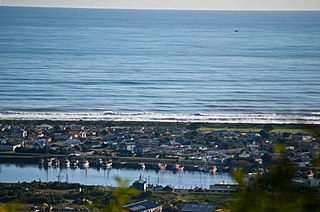
Greymouth is the largest town in the West Coast region in the South Island of New Zealand, and the seat of the Grey District Council. The population of the whole Grey District is 14,250, which accounts for 43% of the West Coast's inhabitants. The Greymouth urban area had an estimated population of 8,340. A large proportion of the District, 65%, is part of the Conservation Estate owned and managed by the Department of Conservation making Greymouth a natural centre for walkers and trampers.

Inangahua is a small settlement in the northwest of New Zealand's South Island. It consists of three settled areas: Inangahua Junction at the confluence of the Inangahua and Buller Rivers, 34 kilometres (21 mi) north of Reefton and 46 kilometres (29 mi) southeast of Westport; Inangahua Landing, 10 km further up the Inangahua River; and Inangahua township, 2 km east of the Junction. Murchison is 52 kilometres (32 mi) further east. After the 1968 Inangahua Earthquake, most of the inhabitants left the area or shifted to the township, which is now the population centre and known simply as Inangahua.
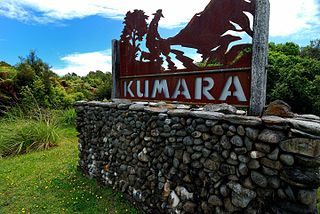
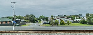
Kumara is a town on the West Coast of the South Island of New Zealand. It is located 30 kilometres (19 mi) south of Greymouth, close to the western end of State Highway 73, which leads across Arthur's Pass to Christchurch. The Taramakau River flows past to the north.
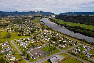
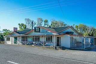
Dobson is a small town on the banks of the Grey River in the South Island of New Zealand. It is 10 kilometres (6 mi) east from the river's mouth at Greymouth. The settlement of Taylorville is across the river from Dobson, but no bridge directly connects the two. State Highway 7 passes through Dobson.

Maungaturoto is a small town in the Northland Region of New Zealand.

Greendale is a lightly populated rural area, part of the Selwyn District, Canterbury, a region of New Zealand's South Island.
Gladstone is a lightly populated locality in the Carterton District of New Zealand's North Island, located on the Mangahuia Stream near where the Tauweru River joins the Ruamahanga River. The nearest town is Carterton 15 kilometres to the northwest, and nearby settlements include Ponatahi to the west and Longbush to the south. It was named after British prime minister William Ewart Gladstone.

Westown is a suburb of New Plymouth, in the western North Island of New Zealand. It is located to the southwest of the city centre and west of Frankleigh Park.

Spotswood is a suburb of New Plymouth in the Taranaki Region of New Zealand. It is located to the west of the city centre.
Welbourn is a suburb of New Plymouth, in the western North Island of New Zealand. It is located to the southeast of the city centre. Te Henui Stream runs through the suburb and State Highway 3 forms its western boundary.

Mangorei is a locality on the outskirts of New Plymouth in Taranaki, New Zealand. The city centre is about 5 km (3.1 mi) to the north-west. State Highway 3 passes to the south-west.

Uruti is a locality in northern Taranaki, in the North Island of New Zealand. It is located on State Highway 3, north-east of Mimi and south-west of Ahititi. The Uruti Stream meets the Mimi River at this point. The river flows past the settlement into the North Taranaki Bight.

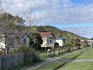
Cobden is a suburb to the north of Greymouth on the West Coast of New Zealand. The Grey River separates Cobden from the rest of Greymouth. To the north is the Rapahoe Range, also called the Twelve Apostles Range. State Highway 6 skirts the south-eastern edge of Cobden.
Blaketown is a suburb to the west of Greymouth on the West Coast of New Zealand. The Grey River separates Blaketown from Cobden, and the Blaketown Lagoon separates it from the centre of Greymouth.

Maeroa is a suburb in western Hamilton in New Zealand. Originally an outlying suburb, it became part of Hamilton City in 1925 with the second boundary extension.

South New Brighton is a coastal suburb on the eastern side of Christchurch city. The area previously had some Māori presence. The suburb also contains a primary school.
Hihi or Hihi Beach is a village and rural community in the Far North District and Northland Region of New Zealand's North Island.
Waianiwa is a town and statistical area in the Southland region of the South Island of New Zealand.

Greymouth Central is the central business district of Greymouth on the West Coast of New Zealand, which also contains residential housing.
Wharemoa is a southeastern suburb of Greymouth on the West Coast of New Zealand. Marsden Road is a major road running through the suburb. Sawyers Creek runs northwest through the suburb to join the Grey River / Māwheranui near its mouth on the Tasman Sea.