
The Ahaura River is in the South Island of New Zealand. This river drains the western flanks of the Southern Alps and flows into the Grey River.
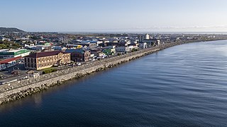
Greymouth is the largest town in the West Coast region in the South Island of New Zealand, and the seat of the Grey District Council. The population of the whole Grey District is 14,250, which accounts for 43% of the West Coast's inhabitants. The Greymouth urban area had an estimated population of 8,340. A large proportion of the District, 65%, is part of the Conservation Estate owned and managed by the Department of Conservation making Greymouth a natural centre for walkers and trampers.
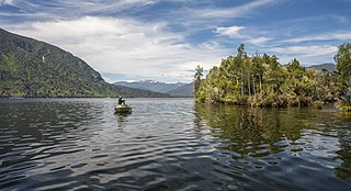
Lake Brunner is the largest lake in the West Coast Region of New Zealand, located 31 km (19 mi) southeast of Greymouth. The main settlement, Moana, is on its northern shore. It is an important settlement and waystation for local Māori. The first Europeans in the area were loggers, and sawmills were an important early industry. Being several kilometres inland from the coast road, it is less frequently visited by tourists than many of the West Coast's scenic highlights, but it is becoming increasingly popular, in part due to its reputation for fishing.

The Taramakau River is a river of the West Coast Region of the South Island of New Zealand. It rises in the Southern Alps / Kā Tiritiri o te Moana near Harper Pass, 80 kilometres (50 mi) due east of Hokitika, and runs westward for 75 kilometres (47 mi) into the Tasman Sea 15 kilometres (9.3 mi) south of Greymouth.

Reefton is a small town in the West Coast region of New Zealand, some 80 km northeast of Greymouth, in the Inangahua River valley. Ahaura is 44 km south-west of Reefton, Inangahua Junction is 34 km to the north, Maruia is 63 km to the east, and the Lewis Pass is 66 km to the south-east.
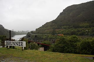
Brunner, originally called Brunnerton, is a town in the northwest of New Zealand's South Island. It is 12 kilometres (7 mi) east of Greymouth, on the south bank of the Grey River. It is on the Midland Line railway near its junction with the Stillwater–Westport Line (SWL) in neighbouring Stillwater. Passenger trains ceased running along the SWL to Reefton and Westport in 1967, but the TranzAlpine runs the length of the Midland Line from Christchurch to Greymouth and it continues to stop in Brunner.
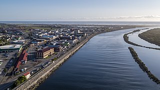
Grey District is a district in the West Coast Region of New Zealand that covers Greymouth, Runanga, Blackball, Cobden, and settlements along the Grey River. It has a land area of 3,474.44 square kilometres (1,341.49 sq mi). The seat of the Grey District Council, the local government authority that administers the district, is at Greymouth, where 58.5% of the district's population live.

The Midland line is a 212 km section of railway between Rolleston and Greymouth in the South Island of New Zealand. The line features five major bridges, five viaducts and 17 tunnels, the longest of which is the Otira tunnel. It is the route of the popular TranzAlpine passenger train.

The New Zealand Midland Railway Company partially constructed the Midland line between Christchurch and Greymouth and the Nelson railway in the South Island. It was one of the few private railway companies in New Zealand, and it did not match the success of the Wellington and Manawatu Railway Company.

The Stillwater Ngākawau Line (SNL), formerly the Stillwater–Westport Line (SWL) and the Ngakawau Branch, is a secondary main line, part of New Zealand's national rail network. It runs between Stillwater and Ngakawau via Westport on the West Coast of the South Island. It was one of the longest construction projects in New Zealand's history, with its first section, at the south end, opened in 1889, and the beginnings of the Ngākawau Branch, at its Westport end, in 1875. The full line was completed in 1942. The only slower railway projects were Palmerston North to Gisborne, 1872 to 1942, and the Main North Line to Picton, 1872 to 1945.
Ngahere is a locality in the Grey District of the West Coast of New Zealand's South Island. The 2013 New Zealand census gave the population of Ngahere and its surrounding area as 363, an increase of 5.2% or 18 people since the 2006 census. Ngahere is located on the south bank of the Grey River, and State Highway 7 and the Stillwater–Westport Line (SWL) railway pass through the village.
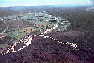
Cronadun is a small village located in the West Coast region of New Zealand's South Island. It is situated on the east bank of the Inangahua River, near its junction with Boatmans Creek. SH 69 and the Stillwater–Westport Line railway pass through the village.
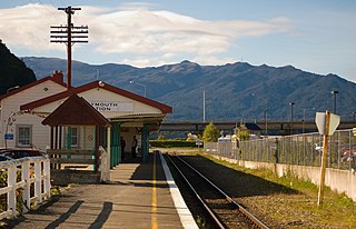
The Ross Branch, officially known as the Hokitika Line since 2011, and previously as the Hokitika Industrial Line, is a branch line railway that forms part of New Zealand's national rail network. It is located in the Westland District of the South Island's West Coast region and opened to Hokitika in 1893. A further extension to Ross operated from 1909 until 1980.

Inchbonnie is a rural locality in the West Coast region of the South Island of New Zealand. It is located on the north bank of the Taramakau River and is just to the south of Lake Poerua. "Inchbonnie" is a hybrid of Lowland Scots, bonnie meaning "pretty" and Scottish Gaelic innis meaning island, often anglicised as "Inch", as in Inchkeith or Inchkenneth in Scotland.

The Brunner Mine disaster happened at 9:30 am on Thursday 26 March 1896, when an explosion deep in the Brunner Mine, in the West Coast region of New Zealand, killed all 65 miners below ground. The Brunner Mine disaster is the deadliest mining disaster in New Zealand's history.

The Brunner Mine was a coal mine on the West Coast of the South Island in New Zealand.

Ikamatua is a small village on the West Coast of the South Island in New Zealand. Its name translates literally as ika (fish) and matua (mature/parent). It may be a contraction of Te Ika-a-matua, fish of my ancestor.
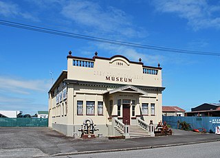
Grey County was one of the counties of New Zealand in the South Island.

Taylorville is a small town on the banks of the Grey River, It is roughly 10 kilometers from the mouth of the river in Greymouth.
The Brunner Borough was a borough on New Zealand's West Coast from 1887 to 1971. It was formed from an area that belonged to Grey County and, at disestablishment, merged back into Grey County.


