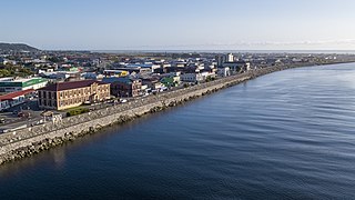
Greymouth is the largest town in the West Coast region in the South Island of New Zealand, and the seat of the Grey District Council. The population of the whole Grey District is 14,250, which accounts for 43% of the West Coast's inhabitants. The Greymouth urban area had an estimated population of 8,340. A large proportion of the District, 65%, is part of the Conservation Estate owned and managed by the Department of Conservation making Greymouth a natural centre for walkers and trampers.

Paparoa National Park is on the west coast of the South Island of New Zealand. The park was established in 1987 and encompasses 430 km2 (170 sq mi). The park ranges from or near the coastline to the peaks of the Paparoa Range. A separate section of the park lies to the north and is centred at Ananui Creek. The park protects a limestone karst area. The park contains several caves, of which Metro Cave / Te Ananui Cave is a commercial tourist attraction. The majority of the park is forested with a wide variety of vegetation. The park was the site of the 1995 Cave Creek disaster where fourteen people died as a result of the collapse of a scenic viewing platform.

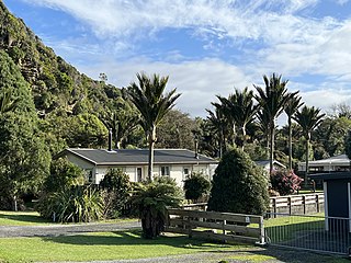
Punakaiki is a small village on the West Coast of the South Island of New Zealand. It is located between Westport and Greymouth on State Highway 6, the only through-road on the West Coast. Punakaiki is immediately adjacent to Paparoa National Park, and is also the access point for a popular visitor attraction, the Pancake Rocks and Blowholes.

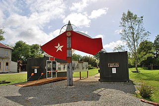
Blackball is a small town on the West Coast of the South Island of New Zealand, approximately 29 km from Greymouth. Elevation is approximately 100 metres. The town was named after the Black Ball Shipping Line, which leased land in the area to mine for coal.

The New Zealand Great Walks are a set of popular tramping tracks developed and maintained by the Department of Conservation. They are New Zealand's premier tracks, through areas of some of the best scenery in the country, ranging from coastlines with beaches to dense rain forests and alpine terrain. The tracks are maintained to a high standard, making it easier for visitors to explore some of the most scenic parts of New Zealand's backcountry.

Lake Matheson is a small glacial lake in South Westland, New Zealand, near the township of Fox Glacier. It was a traditional food-gathering place for local Māori. An easy walking track circles the lake, which is famous for its reflected views of Aoraki / Mount Cook and Mount Tasman.

The Hump Ridge Track, also called the Tuatapere Hump Ridge Track, is a 61 km walking track that is partly in Fiordland National Park in New Zealand. The track was opened in 2001 and is run privately on behalf of the Tuatapere Hump Ridge Track Charitable Trust.

The Blackball Branch was a branch line railway of New Zealand's national rail network on the West Coast of the South Island and worked from the 1900s to 1966. It included the Roa Branch, also known as the Roa Incline. Roa was sometimes known as Paparoa.

The Paparoa Range is a mountain range in the West Coast region of New Zealand's South Island. It was the first New Zealand land seen by a European – Abel Tasman in 1642. Part of the range has the country's highest protection as a national park; the Paparoa National Park was established in 1987. Within that park, the Cave Creek disaster occurred in 1995.
The Pike River Mine is a coal mine formerly operated by Pike River Coal 46 km (29 mi) north-northeast of Greymouth in the West Coast Region of New Zealand's South Island. It is the site of the Pike River Mine disaster that occurred on 19 November 2010, leading to the deaths of 29 men whose remains have not been recovered. The mine and its assets are owned by the Department of Conservation, whom, on 1 July 2022, assumed ownership and management following the dissolution of the Pike River Recovery Agency. The former mine site and its surrounding land are a part of Paparoa National Park.

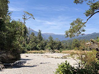
The Pororari River, with an older spelling of Porarari, is a river of the West Coast Region of New Zealand's South Island. It flows northwest from its sources in the Paparoa Range, reaching the Tasman Sea at Punakaiki via Pororari Lagoon. Cave Creek / Kotihotiho is a tributary to the river. There are opportunities to tramp along this river, with two different options accommodating multi-hour loop walks. Further upstream, the Pororari River is followed by the new Paparoa Track, which provides an opportunity for multi-day tramping or mountain biking.
The Pike River Mine disaster was a coal mining accident that began on 19 November 2010 in the Pike River Mine, 46 km (29 mi) northeast of Greymouth, in the West Coast region of New Zealand's South Island following a methane explosion at approximately 3:44 pm. The accident resulted in the deaths of 29 miners.
The Pike River Recovery Agency was a stand-alone New Zealand Government department. Established in 2018, its stated aim was to work with families of victims of the 2010 Pike River Mine disaster to plan and facilitate the manned re-entry of the mine's drift. The Agency's purpose was to gather evidence on the disaster with the goals of preventing future mining accidents, giving the Pike River families closure and, if possible, recovering the bodies of the deceased miners.

The Paparoa Track is a 55.7 km (34.6 mi) shared hiking and mountain biking track located in Paparoa National Park in the South Island of New Zealand. The track was created as a memorial for the 29 miners who lost their lives in the Pike River Mine disaster. The track is the tenth Great Walk to be created and has been fully open since 1 March 2020. It was the first addition to the Great Walks in 25 years.
Allan John Birchfield is a coal and gold miner from the South Island's West Coast of New Zealand. He is a West Coast Regional Councillor who served as chairperson from 2019 to 2023. He is known for his climate change denial.

Cave Creek / Kotihotiho is a small river within Paparoa National Park, on the West Coast of New Zealand's South Island.

The Truman Track is a short, easy walking track located north of Punakaiki, in the coastal Paparoa National Park in the South Island of New Zealand. Although only 600 m (2,000 ft) long, it has been described as "one of the most delightful and interesting short walks on the West Coast". The track passes through lowland coastal forest of podocarps, rātā trees and nīkau palms, with dense understorey vegetation. It finishes at the coastline, where there is a viewing platform providing views along the coast, with surrounding cliffs, rock overhangs, and a waterfall that cascades directly onto the beach.

Bullock Creek or Punungairo is a river valley in the Paparoa National Park, located just north of Punakaiki on the West Coast of New Zealand. It includes a rare and nationally significant polje, a large, flat-floored depression within karst limestone. The Bullock Creek polje is New Zealand's only example of this type of landform.

The Inland Pack Track is a trail in the Paparoa National Park on West Coast of New Zealand. The full length of the trail commences at the Punakaiki River in the south, and ends at the mouth of the Fox River in the north. It takes two or three days to complete the track.

The Croesus Track is a 22.1 km (13.7 mi) historic miners trail to the south of Paparoa National Park in the Grey District of South Island of New Zealand. The route crosses the Paparoa Range from Blackball in the Grey Valley to Barrytown on the Tasman Sea coast. The first section, starting from the Blackball end, is shared with the Paparoa Track which follows the route of the Croesus Track to top of the Paparoa Range. This section is shared-use between hiking and mountain biking.


