Related Research Articles
The Beardmore Glacier in Antarctica is one of the largest valley glaciers in the world, being 200 km (125 mi) long and having a width of 40 km (25 mi). It descends about 2,200 m (7,200 ft) from the Antarctic Plateau to the Ross Ice Shelf and is bordered by the Commonwealth Range of the Queen Maud Mountains on the eastern side and the Queen Alexandra Range of the Central Transantarctic Mountains on the western. Its mouth is east of the Lennox-King Glacier. It is northwest of the Ramsey Glacier.

The Awarau River, usually known as Larry's Creek is located within the South Island of New Zealand. The river is about 27 kilometres (17 mi) long and runs northwest from its headwaters in the Victoria Range to its confluence with the Inangahua River north of Reefton. It also drains part of the Brunner Range and there was a track along that range linking to Lyell by 1901, though none existed in 1874. A track also ran south over Kirwan Hill to the Montgomerie River.

The Lewis River is a river in the Canterbury region of New Zealand. The valley of this river forms the southeastern approach to Lewis Pass; the river is thus adjacent to State Highway 7. The Lewis River is a tributary of the Boyle River. The Nina River flows into the Lewis River a few kilometres upstream from the confluence with the Boyle River. Land Information New Zealand lists the name of the river as "not official", i.e. the name is not confirmed by the New Zealand Geographic Board. It was named for the surveyor Henry Lewis, who discovered the pass in 1860 alongside his colleague Christopher Maling. Later in 1860, the river was named by Julius von Haast during his own expedition; von Haast became the brother-in-law of Lewis' daughter in 1866.

The Sabine Valley is a landform in northern South Island, New Zealand. Much of the Sabine Valley is forested with beech canopy. Example understory vegetation is the presence of Archeria traversii within certain mountain beech forests in the upper Sabine Valley of northern South Island, New Zealand.
The Blue Grey River is a river in New Zealand. It is an upper tributary of the Grey River, flowing from Lake Christabel, close to the township of Maruia Springs, and flowing west for 8 kilometres (5 mi) before reaching the upper Grey River.

The Boyle River is a river of New Zealand. A tributary of the Hope River, it flows south, then west before curving round to the southeast and then joining with the Hope. State Highway 7 follows the course of the river for some distance south of the Lewis Pass; the pass itself is located less than five kilometres to the west of the river's source. The upper reaches of the river form a deep valley between the Opera Range and the Libretto Range.
The Brown Grey River is a river of New Zealand. It is an upper tributary of the Grey River, flowing from the slopes of Mount Kemp, close to the township of Springs Junction, and flowing southeast for 10 kilometres (6 mi) before reaching the upper Grey River.
The Empson River is a stream in the Canterbury Region of New Zealand. It arises near Grey Hill in the Hanmer Range and flows south into the Waiau Uwha River. The name is not official.
Kerripit River, a perennial river of the Manning River catchment, is located in the Upper Hunter district of New South Wales, Australia.
The Little Plains River, a perennial river of the Snowy River catchment, is located in the Snowy Mountains region of New South Wales, Australia.
The Branch River, a watercourse of the Mid-Coast Council system, is located in the Mid North Coast and Upper Hunter regions of New South Wales, Australia.
The Hinemoatū / Howard River is a river of the northern South Island of New Zealand. A tributary of the Buller River, the Hinemoatū/Howard starts at the confluence of the Hodgson and Tier Streams in the Travers Range of Nelson Lakes National Park, flowing north between Lakes Rotoroa and Rotoiti, before reaching the Buller between Kawatiri and Saint Arnaud. Close to its confluence with the Buller, the river is bridged by State Highway 63 and further up by Howard Valley Road.
The Montgomerie River is a river in the Buller District of New Zealand's South Island. It flows southwest from the Victoria Range to reach the Waitahu River 12 kilometres (7.5 mi) east of Reefton. The river's entire length is within Victoria Forest Park.
The Otto River is a short river of the West Coast Region of New Zealand's South Island. It is one of the headwaters of the Grey River.
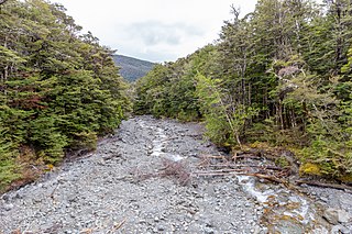
The Tass River is a river of the West Coast Region of New Zealand's South Island. It flows predominantly northeast from its origins in the Southern Alps east of Lake Hochstetter, reaching the Upper Grey River close to the southern tip of the Victoria Forest Park.

The Arnold River is a river on the West Coast of New Zealand's South Island. It is the outflow of Lake Brunner, which it links with the Grey River at Stillwater. The Arnold River flows northwest for 20 kilometres (12 mi), joining the Grey immediately above the town of Brunner, some 15 kilometres (9 mi) from the Tasman Sea. It is a popular spot for whitewater kayaking and trout fishing.
The Grosvenor Mountains are a group of widely scattered mountains and nunataks rising above the Antarctic polar plateau east of the head of Mill Glacier, extending from Mount Pratt in the north to the Mount Raymond area in the south, and from Otway Massif in the northwest to Larkman Nunatak in the southeast.

The Hope River, in Canterbury, New Zealand, is a tributary of the Waiau Uwha River. It is one of three rivers by that name in the South Island.
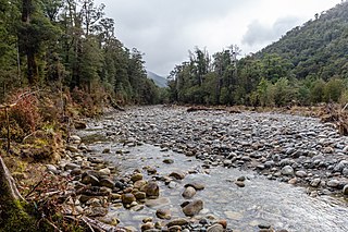
The Clarke River is a river in the Grey District, one of three Clarke rivers in the South island of New Zealand. It flows northwest for 12 kilometres before joining with the upper Grey River close to the boundary of Victoria Forest Park.
The Robinson River is a river in the West Coast Region of the South Island of New Zealand. It is a tributary of the Upper Grey River and much of the river lies within the Lake Sumner Conservation Park. Rising on the slopes of Mount Boscawen on the main divide about 12 kilometres (7.5 mi) south of the Lewis Pass, the river runs west-southwest along a straight, narrow valley before turning northwest to reach the Upper Grey.
References
"Place name detail: Upper Grey River". New Zealand Gazetteer. New Zealand Geographic Board . Retrieved 12 July 2009.
42°27′S172°00′E / 42.450°S 172.000°E