Related Research Articles

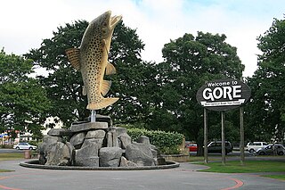
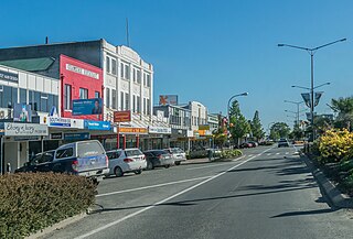
Gore is a town and district in the Southland region of the South Island of New Zealand. It has a resident population of around 8,000 people. Gore is known for its country music scene and hosts an annual country music festival. The town is also surrounded by farmland and is an important centre for agriculture in the region.

Invercargill is the southernmost and westernmost city in New Zealand, and one of the southernmost cities in the world. It is the commercial centre of the Southland region. The city lies in the heart of the wide expanse of the Southland Plains to the east of the Ōreti or New River some 18 km north of Bluff, which is the southernmost town in the South Island. It sits amid rich farmland that is bordered by large areas of conservation land and marine reserves, including Fiordland National Park covering the south-west corner of the South Island and the Catlins coastal region.

Riverton, officially Riverton / Aparima, is a small New Zealand town 30 kilometres (19 mi) west of Invercargill, on the south-eastern shorelines of the Jacobs River Estuary. The estuary is formed by the Aparima and Pourakino rivers, leading through a narrow outflow channel into Foveaux Strait. Accessible via State Highway 99 on the Southern Scenic Route, the main part of the town is on flat land and the northern end of Oreti Beach. South Riverton is built on the hills between the eastern shore of the estuary and Taramea Bay.
Mataura is a town in the Southland region of the South Island of New Zealand. Mataura has a meat processing plant, and until 2000 it was the site of a large pulp and paper mill.

Dacre is a small town in the South Island of New Zealand. It is situated on the Southland Plains between Invercargill and Edendale on State Highway 1. In Dacre, SH 1 is met by State Highway 98, which runs west to Makarewa via Rakahouka. Nearby villages include Mabel Bush to the northwest and Woodlands to the southeast. Dacre is 25 km north east of Invercargill, the closest city. The Main South Line railway passes just to the south of Dacre. It is a dairy farming community, that currently has a community hall and a small engine garage.
Te Tipua is a rural farming community in the eastern Southland region of New Zealand's South Island.
Mataura was a parliamentary electorate in the Southland Region of New Zealand, from 1866 to 1946.

Gore District is a district in the Southland region of the South Island of New Zealand.
The Mayor of Invercargill is the head of the municipal government of Invercargill, New Zealand, and leads the Invercargill City Council. The mayor is directly elected using a First Past the Post electoral system every three years. The current mayor is Nobby Clark. Invercargill also has a deputy mayor that is chosen from the council. There have been 44 mayors so far.

Otautau is a small farming, forestry and milling town located inland on the western edge of the Southland Plains of New Zealand on the banks of the Aparima River. Otautau is located approximately 40 kilometres (25 mi) north west of Invercargill. The average elevation of Otautau is 60 metres.

Southland is New Zealand's southernmost region. It consists mainly of the southwestern portion of the South Island and Stewart Island/Rakiura. It includes Southland District, Gore District and the city of Invercargill. Murihiku Southland is bordered by the culturally similar Otago to the north and east, and the West Coast in the extreme northwest. The region covers over 3.1 million hectares and spans 3,613 km of coast. As of June 2023, Southland has a population of 103,900, making it the eleventh-most-populous New Zealand region, and the second-most sparsely populated.
Mataura Island is a farming community in Southland, New Zealand. It is located close to the east bank of the lower reaches of the Mataura River. Despite its name, it is no longer an island. Mataura Island is located some 40 kilometres (25 mi) east of the region's main city of Invercargill, and 15 kilometres (9.3 mi) south of the town of Edendale, on the Awarua Plains and close to the western edge of The Catlins.
The mayor of Gore officiates over the Gore District in New Zealand's South Island. Prior to local government reorganisation in 1989, the mayor of Gore officiated over the Gore Borough.

Brydone is a small farming locality in Southland, New Zealand, south west of Mataura. It was named after Thomas Brydone, the superintendent of Australia and New Zealand Land Company. He was the founder of the frozen meat and dairy industry in New Zealand and the dairy factory at Edendale, New Zealand, near Brydone, was established with his encouragement.
The Ensign is a regional newspaper based in Gore, New Zealand published on Wednesdays and Fridays by Allied Press Ltd. It was first published in 1878 as The Mataura Ensign and changed to its current name in 1973. The newspaper features coverage of local government, sports and recreation, arts and entertainment, education, farming and business news. It is currently distributed to approximately 12,000 homes over a circulation area that includes Gore and the surrounding area that stretches from Mandeville and Waikaka in the north to Mataura in the south.
Waimumu is a rural settlement town in the Gore District and Southland Region of New Zealand's South Island. It is located west of Gore, about 14 kilometres from the main township.
Maitland is a rural community in the Gore District and Southland Region of New Zealand.
References
- 1 2 3 4 5 6 7 8 9 10 "Find a School". Education Counts. Ministry of Education.
- 1 2 3 "Early childhood and school reports". ero.govt.nz. Education Review Office.
- ↑ "Riverton District High School [Composite]". Invercargill Archives. Retrieved 2 February 2022.
- 1 2 "Lithgow School". ilibrary.co.nz. Invercargill City Libraries.
- 1 2 3 4 5 6 7 8 9 10 "School Closures, Mergers, and New: December 2005" (XLS). Education Counts.
- ↑ "Balfour - The Balfour Public School". The Cyclopedia of New Zealand . Vol. Otago & Southland Provincial Districts. 1905. p. 1039.
- 1 2 "School closes after 103 years". 3 July 2014.
- ↑ "Blackmount School (3933) Closure Notice". gazette.govt.nz. New Zealand Government.
- ↑ "Our School". Bluff School. Retrieved 22 February 2022.
- ↑ "Brydone School closing". Gore. The Ensign. 6 July 2007.
- ↑ "Brydone School (3936) Closure Notice". gazette.govt.nz. New Zealand Government.
- ↑ "Photograph, Brydone School Jubilee 1st Decade 1906-1915". Wyndham & Districts Historical Museum. 1966.
- ↑ "Closure of Cargill High School (406)". gazette.govt.nz. New Zealand Gazette.
- ↑ Cargill High School Commemorative Magazine, 1978-1998. Invercargill: Cargill High School. 1999.
- ↑ "About Central Southland College". csc.school.nz. Central Southland College.
- 1 2 3 4 5 6 "Merger of Clifton School (3939), Clarendon School (3937), Kew School (3972) and Invercargill South School (3968)". gazette.govt.nz. New Zealand Government.
- ↑ "Clifton School Diamond Jubilee 1872 - 1932 (record)". Invercargill Archives. Retrieved 22 February 2022.
- ↑ "Clarendon School". Invercargill Archives. Invercargill City Council.
- 1 2 Mallard, Trevor (29 May 2004). "Final decisions for Invercargill review". New Zealand Government.
- 1 2 3 4 5 Esler, Lloyd (22 June 2017). "Tweedsmuir first intermediate school in Southland". Southland Times.
- ↑ "Dacre School (3942) Closure Notice". gazette.govt.nz. New Zealand Government.
- ↑ "108-year era ends as Dacre Primary closes its doors". stuff.co.nz. The Southland Times. Retrieved 6 October 2014.
- ↑ "About our School". Dipton School. Retrieved 30 January 2022.
- ↑ New Entrant blurb (PDF). Invercargill: Donovan Primary. 2012.
- ↑ Berwick, Louise (16 May 2013). "Drummond School jubilee pic needs new home". Southland Times.
- ↑ "East Gore School". Invercargill Archives. Invercargill City Libraries.
- ↑ "School History". edendale.school.nz. Edendale Primary School.
- 1 2 3 "Merger of Elston Lea School (3948) and St George School (4024)". gazette.govt.nz. New Zealnd Gazette.
- ↑ "Elston Lea School". Invercargill City Libraries and Archives.
- ↑ "About Fiordland Collage". Fiordland College. Retrieved 27 January 2022.
- ↑ Garston - The Cyclopedia of New Zealand [Otago & Southland Provincial Districts]. New Zealand: Cyclopedia Company Limited. 1905. pp. 1018–1019.
- ↑ "Glenham School". glenham.school.nz. Glenham School.
- ↑ "Rector's Welcome". Gore High School. Retrieved 6 February 2022.
- 1 2 Barnett, Robert (2003). Gore (Public) Main School: A Brief Survey of History & Events (Paperback). Gore: Gore Main School. pp. 3–7, 35.
- ↑ Webster, Adam Hunter Hutcheson (1970). The Gorge Road story : from the earliest times up to the present day. Invercargill: Craig Printing.
- ↑ "Grasmere school goes to auction". Southland Times. 18 February 2009.
- ↑ "Grasmere School". Invercargill Archives. Retrieved 7 February 2022.
- ↑ "Halfmoon Bay School (Stewart Island/Rakiura, N.Z.)". National Library of New Zealand. Retrieved 4 February 2022.
- ↑ Moore, Rebecca (27 November 2018). "Hauroko Valley Primary School expanding to Year 7 and 8". Southland Times.
- 1 2 "Merger of Lithgow Intermediate and Hawthorndale School". gazette.govt.nz. New Zealand Gazette.
- ↑ S E B Building Specification [New School], 1958. Invercargill. 1958.
{{cite book}}: CS1 maint: location missing publisher (link) - ↑ "Heddon Bush School". heddonbush.school.nz. Heddon Bush School.
- ↑ "A further 25 years of Hedgehope School history : completing the period 1878-1978 / compiled and edited by B.W. Turnbull (record)". National Library of New Zealand. Retrieved 31 January 2022.
- ↑ Esier, Lloyd (26 September 2018). "The Incarnations of Invercargill's Middle School". Southland Times.
- ↑ "Invercargill South School". Invercargill Archives. Invercargill City Libraries.
- ↑ Hipkins, Chris (22 November 2018). "Isla Bank School (3969) Closure Notice". The New Zealand Gazette.
- ↑ The Cyclopedia of New Zealand [Otago & Southland Provincial Districts]. New Zealand: Cyclopedia Company Limited. 1905. pp. 961–962.
- ↑ "Newsletter - Out of the Attic" (PDF). James Hargest College. 5 June 2020. p. 6. Archived (PDF) from the original on 11 February 2022.
- ↑ "Kaiwera School (3970) Closure Notice". gazette.govt.nz.
- ↑ "Sad day as rural school closes doors". Southland Times. 31 January 2009.
- ↑ Staff reporter (23 October 2016). "Former classmates and teachers reunite". Stuff.co.nz. Southland Times.
- ↑ "About us". knapdale.school.nz. Knapdale School.
- ↑ History of Limehills: A History of the Limehills School and Distric. Invercargill: Limehills School 125 Year Jubilee Celebrations Committee. 1996.
- ↑ McCulllum, Merren (1979). Ten decades : a history of Lochiel School and district for those who lived here. Invercargill: Lochiel School Centennial Committee.
- 1 2 3 "College reunion focuses on future". Southland Times. 23 April 2016.
- 1 2 "Lumsden School". Invercargill Archives. Invercargill City Libraries.
- ↑ The Cyclopedia of New Zealand [Otago & Southland Provincial Districts]. New Zealand: Cyclopedia Company Limited. 1905.
- ↑ "Our History". mangaroaschool.com. Mangaroa School.
- ↑ Searle, Jamie (24 March 2017). "Marist Brothers' work celebrated in south". Stuff. Retrieved 5 November 2022.
- ↑ "Closure of Mataura Island School (3985) Notice". gazette.govt.nz. New Zealand Government.
- ↑ Mataura Island School : Report on Mataura Island School's 75th jubilee celebrations. Invercargill: Mataura Island School. 1965.
- ↑ "Photograph [Mataura School, teacher and pupils, c.1880] (record)". Mataura Museum. Retrieved 6 February 2022.
- 1 2 "Wyndham School". Invercargill Archives. Retrieved 5 February 2022.
- ↑ Walton, Grahame. "The Town of Mossburn". Helena & James Selwood Story. Retrieved 28 January 2022.
- ↑ "Mossburn celebrates 125 years". Southland Times. 17 February 2012.
- ↑ "Meet the Principal". Myross Bush School. Retrieved 8 February 2022.
- 1 2 3 4 "Merger of Newfield School (3992) and Rockdale Park School (4009)". gazette.govt.nz. New Zealand Government.
- ↑ "Otama School". otama.school.nz. Otama School.
- ↑ Bunce, Marilyn (1979). Sawdust and Scholars: A History of Otatara Bush School and District. Otatara School Centennial Committee.
- ↑ "Otautau School". Invercargill Archives. Retrieved 31 January 2022.
- ↑ "Pukerau NZ". Pukerau Community Hall.
- ↑ "Rimu School". Invercargill City Libraries and Archives.
- ↑ "Riversdale School centennial, 1882-1982 (record)". National Library of New Zealand. Retrieved 29 January 2022.
- ↑ "Riverton Primary School". Invercargill City Libraries and Archives.
- ↑ "Riverton Primary School". Invercargill City Libraries and Archives.
- ↑ "Riverton Primary School". Invercargill Archives. Invercargill City Libraries.
- ↑ Wilson, Aimee. "Looking For Rosedale Intermediate Pupils From 1963". What's On In Invers. Invers limited.
- ↑ "Our School History". rurued.school.nz. Ruru Special School.
- ↑ "About Sacred Heart / Te Kura o te Manawa Tapu". Sacred Heart School. Retrieved 8 February 2022.
- ↑ "Newsletter" (PDF). Salford School. 3 February 2020. p. 1. Archived (PDF) from the original on 11 February 2022.
- ↑ SEB Building Specification, 1975. Seaward Downs: Seaward Downs School. 1975.
- ↑ Seaward Downs School Golden Jubilee 1891-1948. Christchurch: Seaward Downs School. 1948.
- ↑ "About Us". Southland Adventist Christian School. Retrieved 8 February 2022.
- ↑ "History and Tradition". Southland Boys' High School. Retrieved 10 February 2022.
- ↑ "History". Southland Girls' High School. Retrieved 14 February 2022.
- ↑ "St Catherine's College". Invercargill City Libraries and Archives.
- 1 2 McLeod, Hannah (28 September 2015). "Invercargill school's would-be centenary celebrated". Stuff.co.nz. Southland Times.
- ↑ "Welcome". St John's Girls' School. Archived from the original on 11 February 2022. Retrieved 11 February 2022.
- ↑ "St Josephs School Invercargill". St Joseph's School. Retrieved 10 February 2022.
- ↑ "St Mary's, Gore". Mercy Schools. Retrieved 6 February 2022.
- ↑ "About Our School". St Patrick's School. Retrieved 21 February 2022.
- ↑ "St Patrick's School, Nightcaps". Mercy Schools. Retrieved 29 January 2022.
- ↑ "Our History". St Peter's College. Retrieved 6 February 2022.
- ↑ "St Teresa's School (Bluff)". Invercargill Archives. Invercargill City Libraries.
- ↑ "About Us". St Theresa's School. Retrieved 12 February 2022.
- ↑ "St Thomas' School, Winton". mercyschools.org.nz. Mercy Schools.
- ↑ "Closure of Surrey Park School". gazette.govt.nz. New Zealand Gazette.
- ↑ S.E.B Building Specifications [New School], 1939. Invercargill: S.E.B. 1939.
- ↑ "Untitled". Western Star. 1 August 1885.
- ↑ Pat Veltkamp Smith (26 January 2009). "Nightcaps schools mark 125 years". Southland Times.
- ↑ McDougall, Nicci (27 November 2012). "Pupils old and new celebrate 75 years". Southland Times.
- ↑ Buckingham, Janette (1982). Te Tipua: A History of the Te Tipua School and District. New Zealand: Te Tipua School's 75th Jubilee Committee.
- ↑ "Mō Te Wharekura o Arowhenua". Te Wharekura o Arowhenua. Retrieved 20 February 2022.
- ↑ "Thornbury School to celebrate jubilee". Southland Times. 31 January 2009.
- ↑ "Our History". Tisbury School. Retrieved 20 February 2022.
- ↑ "Tokanui School". Invercargill Archives. Invercargill City Libraries.
- ↑ Searle, Jamie (26 March 2021). "Ex-pupil knows Tuturau School's history better than most". Southland Times.
- 1 2 "Tweedsmuir Junior High School (4033)". gazette.govt.nz. New Zealand Government.
- ↑ "Verdon College". verdoncollege.school.nz. Verdon College.
- ↑ Pokoney, Cassandra (11 February 2013). "Tales abound at Waianiwa School's 150th". Southland Times.
- ↑ Williams, Dee (2009). The Hole in the Bush: A Tuatapere Centennial Review. Last Side Publishing. ISBN 978-0-473-15258-1.
- ↑ "Waihopai School". Invercargill Archives. Retrieved 10 February 2022.
- ↑ "Riversdale School centennial, 1882-1982 (record)". National Library of New Zealand. Retrieved 29 January 2022.
- ↑ Pokoney, Cassandra (11 February 2013). "Tales abound at Waianiwa School's 150th". Southland Times.
- 1 2 "Merger of Grasmere School (3958), Waikiwi School (4039) and West Plains School (4051)". gazette.govt.nz. New Zealand Gazette.
- ↑ "Waikiwi School". Invercargill Archives. Retrieved 8 February 2022.
- ↑ "Sadness as bell tolls for school". 16 December 2012.
- 1 2 "Waimumu School". Invercargill Archives. Retrieved 6 February 2022.
- ↑ "Wallacetown School : 100, a century of learning, a century and nine years settlement of the district, January 22-24, 1965 (record)". National Library of New Zealand. Retrieved 3 February 2022.
- ↑ "The History of Waverley Primary School". waverleyprimary.co.nz. Waverley Primary School.
- ↑ "West Gore School 50th Anniversary (record)". Christchurch City Libraries. Retrieved 6 February 2022.
- ↑ "West Plains School". Invercargill Archives. Retrieved 7 February 2022.
- ↑ "Willowbank School (3981) Closure Notice". gazette.govt.nz. New Zealand Government.
- 1 2 Kelly, Rachael (2 March 2016). "Willowbank School doors to open one more time". Southland Times.
- ↑ "100 years in retrospect : centenary of Invercargill North School / Joan MacIntosh (record)". National Library of New Zealand. Retrieved 12 February 2022.
- ↑ "About Winton School". Winton School. Retrieved 2 February 2022.
- ↑ "About Our School". Woodlands Full Primary School. Retrieved 3 February 2022.