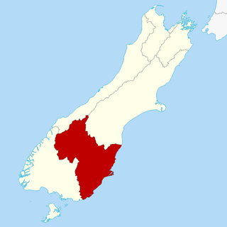
Otago is a region of New Zealand located in the southern half of the South Island administered by the Otago Regional Council. It has an area of approximately 32,000 square kilometres (12,000 sq mi), making it the country's second largest local government region. Its population was 254,600 in June 2023.

Queenstown is a resort town in Otago in the south-west of New Zealand's South Island. It is the seat and largest town in the Queenstown-Lakes District.
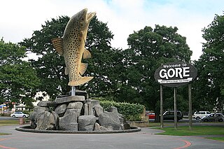
Gore is a town and district in the Southland region of the South Island of New Zealand. It has a resident population of 8,240 as of June 2023. Gore is known for its country music scene and hosts an annual country music festival. The town is also surrounded by farmland and is an important centre for agriculture in the region.
Mataura is a town in the Southland region of the South Island of New Zealand. Mataura has a meat processing plant, and until 2000 it was the site of a large pulp and paper mill.
Winton is a rural town in Southland, New Zealand. It is located close to the east bank of the Ōreti River, 30 kilometres north of Invercargill and 50 kilometres south of Lumsden. The town is named after Thomas Winton, a local stockman who lived and farmed in the area in the 1850s. The district thrived with the development of sheep and fat-lamb farms in the early 1900s. Later, dairy farming became the staple economy, although the town has also seen sawmills, and flax and linen-flax industries.

Lake Wakatipu is an inland lake in the South Island of New Zealand. It is in the southwest corner of the Otago region, near its boundary with Southland. Lake Wakatipu comes from the original Māori name Whakatipu wai-māori.

Lumsden is a town in Southland, New Zealand. Lying in a gap in the surrounding hills, Lumsden is the location of a major junction on State Highway 6. Lumsden is 81 kilometres north of Invercargill, 106 kilometres south of Queenstown, 59 kilometres west of Gore and 77 kilometres east of Te Anau.
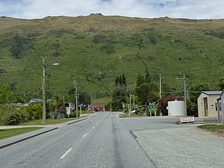
Kingston is a small town at the southernmost end of Lake Wakatipu, just north of the border of Otago and Southland, in New Zealand's South Island. It is 47 kilometres south of Queenstown by a road, "The Devil's Staircase", which winds between the lake to the west and The Remarkables mountains to the east. It is 70 kilometres north of Lumsden, and close to the headwaters of the Mataura River.
Makarewa is a small community north of Invercargill.
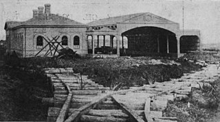
The Kingston Branch was a major railway line in Southland, New Zealand. It formed part of New Zealand's national rail network for over a century: construction began in 1864, Kingston was reached in 1878, and it closed in 1979. For much of its life, it was considered a secondary main line rather than a branch line, and in its earlier years, it was sometimes known as the "Great Northern Railway". Today, the southern portion now forms a part of the Wairio Branch and the northernmost 14 kilometres was used by the Kingston Flyer.

Mossburn is a small town in the northern Southland region of New Zealand. It is situated 113 km south of Queenstown, 59 km east of Te Anau and 100 km north of Invercargill.
Balfour is a small town located in the Southland region of New Zealand.

Dacre is a small town in the South Island of New Zealand. It is situated on the Southland Plains between Invercargill and Edendale on State Highway 1. In Dacre, SH 1 is met by State Highway 98, which runs west to Makarewa via Rakahouka. Nearby villages include Mabel Bush to the northwest and Woodlands to the southeast. Dacre is 25 km north east of Invercargill, the closest city. The Main South Line railway passes just to the south of Dacre. It is a dairy farming community, that currently has a community hall and a small engine garage.

The Nokomai River is a river in New Zealand, officially named on 1 January 1931. It rises on Mount Tennyson and flows south-westerly into the Mataura River. The valley was known for its gold rushes. In 1901 113 people lived in the valley. By 1956 the population was down to 17.
The Mayor of Invercargill is the head of the municipal government of Invercargill, New Zealand, and leads the Invercargill City Council. The mayor is directly elected using a First Past the Post electoral system every three years. The current mayor is Nobby Clark. Invercargill also has a deputy mayor that is chosen from the council. There have been 44 mayors so far.
Waikaia, formerly known as Switzers, is a town in the Southland region of New Zealand's South Island. From 1909 until 1959, it was the terminus of the Waikaia Branch railway. The population in the 2013 census was 99, unchanged from the previous census in 2006.

Southland is New Zealand's southernmost region. It consists of the southwestern portion of the South Island and includes Stewart Island. Southland is bordered by the culturally similar Otago Region to the north and east, and the West Coast Region in the extreme northwest. The region covers over 3.1 million hectares and spans 3,613 km of coastline. As of June 2023, Southland has a population of 103,900, making it the eleventh-most-populous New Zealand region, and the second-most sparsely populated. Approximately half of the region's population lives in Invercargill, Southland's only city.
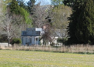
Parawa is a locality in Southland, New Zealand, on State Highway 6, 5 km southwest of Athol and immediately north of Mid Dome mountain. Its name is a corruption of Paiherewao, what Maori called the mountain. In the 19th century, several versions of the name were used, including Parrawa and Parrowa.


