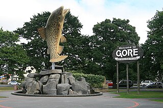
Gore is a town and district in the Southland region of the South Island of New Zealand. It has a resident population of 8,240 as of June 2023. Gore is known for its country music scene and hosts an annual country music festival. The town is also surrounded by farmland and is an important centre for agriculture in the region.

Invercargill is the southernmost and westernmost city in New Zealand, and one of the southernmost cities in the world. It is the commercial centre of the Southland region. The city lies in the heart of the wide expanse of the Southland Plains to the east of the Ōreti or New River some 18 km north of Bluff, which is the southernmost town in the South Island. It sits amid rich farmland that is bordered by large areas of conservation land and marine reserves, including Fiordland National Park covering the south-west corner of the South Island and the Catlins coastal region.

Berwickshire or the County of Berwick is a historic county, registration county and lieutenancy area in south-eastern Scotland, on the English border. The county takes its name from Berwick-upon-Tweed, its original county town, which was part of Scotland at the time of the county's formation in the twelfth century, but became part of England in 1482 after several centuries of swapping back and forth between the two kingdoms. After the loss of Berwick, Duns and Greenlaw both served as county town at different periods.

Southland District is a New Zealand territorial authority district that covers most of the southern end of the South Island as well as Stewart Island.

Lumsden is a town in Southland, New Zealand. Lying in a gap in the surrounding hills, Lumsden is the location of a major junction on State Highway 6. Lumsden is 81 kilometres north of Invercargill, 106 kilometres south of Queenstown, 59 kilometres west of Gore and 77 kilometres east of Te Anau.

Andoversford is a village and civil parish in the Cotswold District of Gloucestershire, England, about 5 miles (8 km) east of Cheltenham. The village is on the River Coln, parallel to the A40.The 2011 Census recorded the parish's population as 555. In 2019 the parish a population of 905.
The Tokanui Branch, also known as the Seaward Bush Branch, was a branch line railway located in Southland, New Zealand. It diverged from the Bluff Branch south of the main railway station in Invercargill and ran for 54 kilometres in a southeasterly direction. Construction began in 1883 and it operated until 1966.
Tokanui is a community in the eastern portion of Southland District Council, located on the Southern Scenic Route about 56 km (35 mi) east of Invercargill and 107 km (66 mi) southwest of Balclutha, New Zealand. The Tokanui River runs just to the north of the village and occasionally floods the lower parts, as it did when the railway yard flooded in 1935.

Hugh Campbell Templeton is a former New Zealand diplomat, politician and member of parliament for the National Party.

James Walker Bain was a 19th-century New Zealand politician. He was a significant businessman in Invercargill and Southland.
Waimahaka is a locality in the Southland region of New Zealand's South Island. It is situated in a rural area, inland from Toetoes Bay. Nearby settlements include Pine Bush and Titiroa to the northwest, Fortification and Te Peka to the east, Pukewao and Tokanui to the southwest, and Fortrose on the coast to the south.
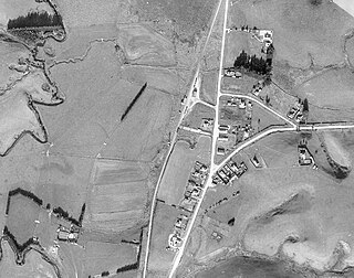
Gorge Road is a locality in the Southland region of New Zealand's South Island. It is on the Southern Scenic Route and is situated on the western bank of the Mataura River. Nearby settlements include Ashers to the west, and across the Mataura, Pine Bush and Titiroa to the east.
Lyall Scott Barry was a school teacher and inspector, and wrote a history of the Waimumu area in Southland. As a swimmer he won two medals at the 1950 British Empire Games.
Worthing, a seaside town in the English county of West Sussex which has had borough status since 1890, has a wide range of public services funded by national government, West Sussex County Council, Worthing Borough Council and other public-sector bodies. Revenue to fund these services comes principally from Council Tax.
Isaac Henry Manders was a New Zealand politician who was a Member of Parliament in the Otago region.

Southland is New Zealand's southernmost region. It consists of the southwestern portion of the South Island and includes Stewart Island. Southland is bordered by the culturally similar Otago Region to the north and east, and the West Coast Region in the extreme northwest. The region covers over 3.1 million hectares and spans 3,613 km of coastline. As of June 2023, Southland has a population of 103,900, making it the eleventh-most-populous New Zealand region, and the second-most sparsely populated. Approximately half of the region's population lives in Invercargill, Southland's only city.
William B. Downs was an American orthodontist who is known for developing the first cephalometric analysis for orthodontics, the Downs analysis.
Kaiwera is a rural settlement and community in Southland, New Zealand.
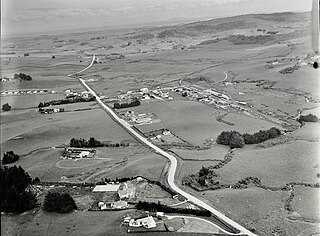
Menzies Ferry is a farming locality on the west side of the Mataura River in the east of Southland District, in the south of New Zealand. It gained its name from Dr. James Alexander Robertson Menzies, who supplied a boat to ferry passengers across the Mataura. It was surveyed as a township in 1876.
