Waimangaroa

Last updated

Waimangaroa
Denniston Road Scenic Reserve.jpg
Denniston Road Scenic Reserve
Waimangaroa
Coordinates: 41°42′46″S171°45′46″E / 41.71278°S 171.76278°E / -41.71278; 171.76278
CountryNew Zealand
Region West Coast
District Buller District
WardSeddon
Electorates
Government
  Territorial Authority Buller District Council
  Regional council West Coast Regional Council
   Mayor of Buller Jamie Cleine
   West Coast-Tasman MP Maureen Pugh
   Te Tai Tonga MP Tākuta Ferris
Area
[1]
  Total1.58 km2 (0.61 sq mi)
Population
 (June 2023) [2]
  Total220
  Density140/km2 (360/sq mi)

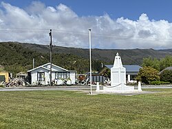
Waimangaroa is a small town located on the West Coast of New Zealand.

Contents

The township lies on the south-west bank of the Waimangaroa River, at the western foot of the Denniston Plateau. It is 17 kilometres (11 mi) to the north east of Westport and 13 km south-east of Granity. The abandoned coaltown of Denniston is about 5 kilometres (3.1 mi) to the south-east. [3] [4] The Bridle Track, a scenic bush track, leads south-east along the Denniston Incline into the foothills of the Mt William Range, to Denniston. [5] The Stockton mine, a large open cast coal mine, is operated in the vicinity by Solid Energy. [6]

The Ngakawau Branch, a branch line railway, runs through the town. It opened to Waimangaroa on 5 August 1876; it formerly ran to Seddonville but now terminates in Ngakawau. From 1877 until 1967, Waimangaroa was also the junction for the Conns Creek Branch, which ran east alongside the Waimangaroa River to the foot of the Denniston Incline. Passenger services ceased on the Conns Creek Branch in 1931 and Ngakawau Branch on 14 October 1946. Since this time, the railway through Waimangaroa has almost solely conveyed coal.

The beaches to the west have dangerous currents and are not safe for swimming. [7]

Demographics

Waimangaroa is described by Statistics New Zealand as a rural settlement and covers 1.58 km2 (0.61 sq mi). [1] It had an estimated population of 220 as of June 2023, [2] with a population density of 139 people per km2. It is part of the larger Buller Coalfields statistical area. [8]

Historical population
YearPop.±% p.a.
2006225    
2013252+1.63%
2018228−1.98%
Source: [9]
Waimangaroa viewed from the Denniston road Waimangaroa township.jpg
Waimangaroa viewed from the Denniston road

Waimangaroa had a population of 228 at the 2018 New Zealand census, a decrease of 24 people (−9.5%) since the 2013 census, and an increase of 3 people (1.3%) since the 2006 census. There were 99 households, comprising 123 males and 105 females, giving a sex ratio of 1.17 males per female, with 45 people (19.7%) aged under 15 years, 21 (9.2%) aged 15 to 29, 105 (46.1%) aged 30 to 64, and 54 (23.7%) aged 65 or older.

Ethnicities were 89.5% European/Pākehā, 10.5% Māori, 1.3% Pasifika, and 2.6% other ethnicities. People may identify with more than one ethnicity.

Although some people chose not to answer the census's question about religious affiliation, 56.6% had no religion, 28.9% were Christian and 1.3% had other religions.

Of those at least 15 years old, 12 (6.6%) people had a bachelor's or higher degree, and 51 (27.9%) people had no formal qualifications. 12 people (6.6%) earned over $70,000 compared to 17.2% nationally. The employment status of those at least 15 was that 66 (36.1%) people were employed full-time, 18 (9.8%) were part-time, and 9 (4.9%) were unemployed. [9]

Education

Waimangaroa School was a coeducational full primary school (years 1-8). The school celebrated its 125th jubilee in 2004. [10] It closed permanently in 2012 [11] and is now in private ownership. Waimangaroa children now attend schools in Westport.

Notable people

Related Research Articles

<span class="mw-page-title-main">West Coast Region</span> Region of New Zealand

The West Coast is a region of New Zealand on the west coast of the South Island. It is administered by the West Coast Regional Council, and is known co-officially as Te Tai Poutini. It comprises the territorial authorities of Buller District, Grey District and Westland District. The principal towns are Westport, Greymouth and Hokitika. The region, one of the more remote areas of the country, is also the most sparsely populated. With a population of just 32,900 people, the West Coast is the least populous region in New Zealand. The population in the region grew by 0.4% over the year to July 2023.

<span class="mw-page-title-main">Granity</span> Town on the West Coast of the South Island of New Zealand

Granity is a small town on the West Coast of New Zealand's South Island, 28 kilometres (17 mi) north-east of Westport on State Highway 67. Karamea is 68 kilometres (42 mi) further north.

Denniston is a small settlement, 15 kilometres east of Westport, on the West Coast of the South Island of New Zealand. It is situated on the Denniston Plateau, 600 metres (2,000 ft) above sea level in the Papahaua Ranges.

<span class="mw-page-title-main">Buller District</span> Territorial authority district in West Coast Region, New Zealand

Buller District is one of 53 districts of New Zealand, and is within the West Coast Region. It covers Westport, Karamea, Reefton and Inangahua Junction.

<span class="mw-page-title-main">Kirwee</span> Settlement in Canterbury, New Zealand

Kirwee is a town located west of Christchurch in the Canterbury region of New Zealand's South Island. It was named after Karwi in India by retired British Army colonel De Renzie Brett. Kirwee is also home to the South Island Agricultural Field Days, held biennially.

<span class="mw-page-title-main">Whitecliffs</span> Settlement in Canterbury, New Zealand

Whitecliffs is a village located in the Selwyn District of the Canterbury region of New Zealand's South Island. It has also been known as South Malvern, and the name of Whitecliffs comes from terrace cliffs above the Selwyn River / Waikirikiri.

<span class="mw-page-title-main">Tāneatua</span> Rural settlement in Bay of Plenty Region, New Zealand

Tāneatua is a small town in the Bay of Plenty region of New Zealand's North Island, 13 kilometres south of Whakatāne. State Highway 2 passes through the town on its route between Edgecumbe and Ōpōtiki. The small settlements of Ruatoki and Waimana are to the south and south-east of Tāneatua.

<span class="mw-page-title-main">Puriri, New Zealand</span> Place in Waikato, New Zealand

Puriri is a small locality on the Hauraki Plains of New Zealand. It lies approximately 14 km south-east of Thames, New Zealand.

Ōtāne is a town in the Central Hawke's Bay District and the Hawke's Bay region, on the east coast of New Zealand's North Island. The small village, has a school, general store, cafe and pub, and is located just off State Highway 2.

<span class="mw-page-title-main">Seddonville Branch</span>

The Seddonville Branch, later truncated as the Ngākawau Branch, is a branch line railway in the West Coast region of New Zealand's South Island. Construction began in 1874 and it reached its terminus at the Mokihinui Mine just beyond Seddonville in 1895. In 1981 it was closed past Ngākawau and effectively became an extension of the Stillwater–Westport Line, since formalised as the Stillwater–Ngākawau Line.

<span class="mw-page-title-main">Hector and Ngakawau</span> Town on the West Coast of the South Island of New Zealand

Hector and Ngakawau are two lightly populated settlements located at the mouth of the Ngākawau River in the West Coast region of New Zealand. Both settlements are situated on State Highway 67 between Westport and Karamea. Despite a low population, many of the workers at New Zealand's largest open-cut coal mine at Stockton choose to live at these places and shuttles frequently operate between the two places.

Midhirst is a small village in Taranaki, New Zealand, approximately 4 km north of Stratford, on State Highway 3. Inglewood is 17 km (11 mi) north of Midhirst, and New Plymouth is 35 km (22 mi) to the northwest.

Urenui is a settlement in northern Taranaki, in the North Island of New Zealand. It is located on State Highway 3 close to the shore of the North Taranaki Bight, 13 kilometres east of Waitara and 6 km south-west of Mimi. The Urenui River flows past the settlement into the North Taranaki Bight.

Maungatapere is a settlement in Northland, New Zealand. State Highway 14 runs through it. Whangārei is 11 km to the east, and Tangiteroria is 18 km to the south west. The settlement takes its name from a rounded volcanic peak of the same name that lies to the southwest, and has a summit 359 metres above sea level.

<span class="mw-page-title-main">Spring Creek, New Zealand</span> Town in Marlborough, New Zealand

Spring Creek is a small town in Marlborough, New Zealand. State Highway 1 runs past the settlement to the west, and the Wairau River flows past to the east. Picton is 22 km to the north, and Blenheim is 6 km to the south.

Grovetown is a small town in Marlborough, New Zealand. State Highway 1 runs past the settlement to the west, and the Wairau River flows past to the northeast. Spring Creek is about 2.5 km to the north, and Blenheim is about 3.5 km to the south. To the east is Grovetown Lagoon, an oxbow loop of the Wairau River. The settlement had a usual resident population of 357 at the 2018 New Zealand census.

Pātūtahi is a small settlement 15 kilometres from Gisborne, in the northeast of New Zealand's North Island. It is located in the valley of the Waipaoa River. From 1915 to 1931 Pātūtahi had a railway station on the Ngātapa Branch.

<span class="mw-page-title-main">Pūrākaunui</span> Rural settlement in New Zealand

Pūrākaunui is a small settlement in Otago, in the South Island of New Zealand. It is located within the bounds of the city of Dunedin, in a rural coastal area some 25 km to the north of the city centre.

<span class="mw-page-title-main">Mahurangi West</span> Place in Auckland Region, New Zealand

Mahurangi West is a rural settlement in the Auckland Region of New Zealand. Puhoi is to the west, Mahurangi Harbour is to the east, and the western part of Mahurangi Regional Park is southeast.

<span class="mw-page-title-main">Scotts Landing</span> Place in Auckland Region, New Zealand

Scotts Landing, also called Mahurangi East, is a rural settlement in the Auckland Region of New Zealand. It is at the end of a narrow peninsula on the eastern side of Mahurangi Harbour. Algies Bay is to the north.

References

  1. 1 2 "ArcGIS Web Application". statsnz.maps.arcgis.com. Retrieved 23 May 2024.
  2. 1 2 "Subnational population estimates (RC, SA2), by age and sex, at 30 June 1996-2023 (2023 boundaries)". Statistics New Zealand . Retrieved 25 October 2023. (regional councils); "Subnational population estimates (TA, SA2), by age and sex, at 30 June 1996-2023 (2023 boundaries)". Statistics New Zealand . Retrieved 25 October 2023. (territorial authorities); "Subnational population estimates (urban rural), by age and sex, at 30 June 1996-2023 (2023 boundaries)". Statistics New Zealand . Retrieved 25 October 2023. (urban areas)
  3. Peter Dowling, ed. (2004). Reed New Zealand Atlas. Reed Books. map 63. ISBN   0-7900-0952-8.
  4. Roger Smith, GeographX (2005). The Geographic Atlas of New Zealand. Robbie Burton. map 141. ISBN   1-877333-20-4.
  5. "Denniston walking tracks". Department of Conservation . Retrieved 18 July 2008.
  6. "Stockton (Opencast)". Solid Energy . Retrieved 18 July 2008.
  7. Brathwaite, Errol (1981). The Companion Guide to Westland. Auckland: Collins. p. 80. ISBN   0-00-216967-3.
  8. 2018 Census place summary: Buller Coalfields
  9. 1 2 "Statistical area 1 dataset for 2018 Census". Statistics New Zealand. March 2020. 7023587 and 7023588.
  10. "Jubilees & reunions: Waimangaroa School, 125th Jubilee". Education Gazette New Zealand. 83 (3). 22 February 2004.
  11. Fulton, Kim (30 November 2012). "Waimangaroa school to close". Westport News. ISSN   1170-0777 . Retrieved 19 February 2020.