
Karamea Centennial Museum is a museum in Karamea on the West Coast of the South Island of New Zealand.
Karamea Centennial Museum is a museum in Karamea on the West Coast of the South Island of New Zealand.
The museum was opened in 1974, for the centennial celebrations of the settlement. [1]
The museum collection includes photographs and exhibits on the local industries of sawmilling, dairying, gold mining, flax milling and shipping. It also contains district archives, material from local schools and family history material. The museum is run by the Karamea Historical Society Incorporated and staffed by local volunteers. [2] [3]

Alexandra is a town in the Central Otago district of the South Island of New Zealand. It is on the banks of the Clutha River, on State Highway 8, 188 kilometres (117 mi) by road from Dunedin and 33 kilometres (21 mi) south of Cromwell. The nearest towns to Alexandra via state highway 8 are Clyde seven kilometres to the northwest and Roxburgh forty kilometres to the south. State highway 85 also connects Alexandra to Omakau, Lauder, Oturehua, Ranfurly and on to Palmerston on the East Otago coast.

Karamea is a town on the West Coast of the South Island of New Zealand. It is the northernmost settlement of any real size on the West Coast, and is located 96 kilometres (60 mi) northeast by road from Westport. Apart from a narrow coastal strip, the town of Karamea and its local area are completely surrounded to the south, east and north by Kahurangi National Park.

Arrowtown is a historic gold mining town in the Otago region of the South Island of New Zealand. Arrowtown is located on the banks of the Arrow River approximately 7.5 km from State Highway 6. Arrowtown is located 19.5 kilometres to the east of Queenstown. As well as the route via State Highway 6 at Arrow Junction, there is also road access directly to Queenstown via Arthurs Point and a third route via the picturesque Lake Hayes.

Kahurangi National Park in the northwest of the South Island of New Zealand is the second largest of the thirteen national parks of New Zealand. It was gazetted in 1996 and covers 5,193 km2 (2,005 sq mi), ranging from the Buller River near Murchison in the south, to the base of Farewell Spit in Golden Bay in the north. The park has no single dominant landform, but includes an unusually wide variety of landscapes, including mountain ranges, rivers, gorges, raised peneplains and karst features such as caves and arches. Many of the landforms within the park are considered to be nationally or internationally significant.

Wairoa is the largest town in the Wairoa District and the northernmost town in the Hawke's Bay region of New Zealand's North Island. It is located on the northern shore of Hawke Bay at the mouth of the Wairoa River and to the west of Māhia Peninsula. It is 118 kilometres (73 mi) northeast of Napier, and 92 kilometres (57 mi) southwest of Gisborne, on State Highway 2. It is the nearest town to the Te Urewera protected area and former national park, which is accessible from Wairoa via State Highway 38. It is one of three towns in New Zealand where Māori outnumber other ethnicities, with 62.29% of the population identifying as Māori.
Kahurangi Point is a headland on the West Coast of New Zealand's South Island, overlooking the Tasman Sea. It is located in Kahurangi National Park between Karamea and Farewell Spit.

Arapito is a town in the Karamea area of New Zealand. Arapito is a farming community on the south side of the Karamea River, upriver from the main Karamea township.
Golden Bay Air Limited is a small airline based at Tākaka Aerodrome in Tākaka, New Zealand. The airline currently operates three light aircraft from Tākaka to Wellington and Karamea, and also from Nelson to Tākaka and Karamea with connecting road shuttle services to the Abel Tasman National Park, the Heaphy Track in the Kahurangi National Park and to and from Tākaka township. Other services provided by the airline include charter flights around New Zealand flown on demand and preset scenic routes around the national parks as well as Farewell Spit.

The Karamea Aerodrome serves the town of Karamea, in the South Island of New Zealand. It is a non certificated aerodrome located around 1.4 kilometres (0.87 mi) northwest of the town.
Ōkārito is a small coastal settlement on the West Coast of New Zealand's South Island, 127 kilometres (79 mi) southwest of Hokitika, and 10 kilometres (6.2 mi) from State Highway 6. It is built at the southern end of the Ōkārito Lagoon at the mouth of the Ōkārito River. The settlement of The Forks is located just inland, on the banks of the river.

Petone Settlers Museum is a local history museum located in the Wellington Provincial Centennial Memorial, a historic building in Petone, Lower Hutt, New Zealand. The building was originally constructed to mark the Wellington province's centennial commemorations; the museum opened in the building in 1977. The building was extensively refurbished in 2016.

The Canterbury District Health Board was a district health board with the focus on providing healthcare to the Canterbury region of New Zealand, north of the Rangitata River. It was responsible for roughly 579,000 residents, or 12% of New Zealand's population. The Canterbury District Health Board covered a territory of 26,881 square kilometers and was divided between six territorial local authorities. In July 2022, the Canterbury DHB was merged into the national health service Te Whatu Ora.
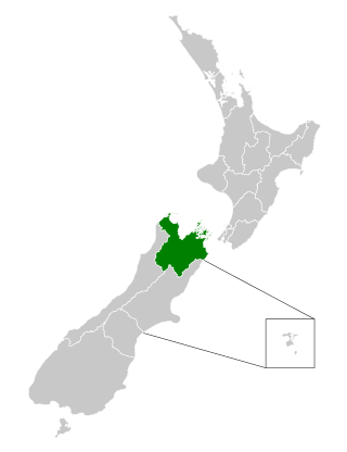
The Nelson Marlborough District Health Board was a district health board with the focus on providing healthcare to the Nelson, Tasman and Marlborough districts of New Zealand. In July 2022, it was merged into the national health service Te Whatu Ora.
Brooklyn is a settlement and rural valley in the Tasman District of New Zealand's upper South Island. It is located on the outskirts of Motueka, and is dominated by orchards.

Coast FM is a local radio station in Westport, New Zealand, to most of the West Coast Region. The station began in 1995 as Radio Fifeshire Westport in partnership with Fifeshire FM in Nelson, and started broadcasting in Hokitika and Greymouth in 1996. The station was rebranded as Coast FM in 1999, but is not related to Coast network that broadcasts in other parts of the country. It used to broadcast from the Westport News offices in the former BNZ building on Palmerston Street.

Karamea War Memorial Library, also known as Karamea Community Library, is a community public library located in the settlement of Karamea in the West Coast region of the South Island of New Zealand.

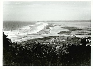
Ōtūmahana Estuary, also known as the Karamea Estuary, is a tidal estuary in the Buller District of the West Coast Region of New Zealand. It is located at the mouth of the Karamea River and also receives the outflow of Ōtūmahana creek.

The Wangapeka Track is a tramping track in the north-west of the South Island of New Zealand. It is one of the main tramping tracks in the Kahurangi National Park, a protected area managed by the Department of Conservation. The route traverses the southern end of the park, from the historic Wangapeka goldfields area west of Tapawera, to the coastal plains of the West Coast at Little Wanganui. The route is 59 km (37 mi) long, and crosses the Wangapeka and Little Wanganui saddles, each over 1,000 m (3,300 ft) in elevation. The track passes through the valleys of the Wangapeka River, Karamea River, Taipō River and Little Wanganui River. The majority of the track is in river valleys and under forest cover, with small sections in tussock land at Stag Flat and the Little Wanganui Saddle. It typically takes walkers 4–6 days to complete the route.

The Big Rimu Walk is a nature trail near Karamea, located in Kahurangi National Park on the West Coast of the South Island of New Zealand. A short walk of 1.1 kilometres (0.68 mi) through regenerating bush leads to a large rimu tree that is 36 metres (118 ft) tall with a trunk over two metres in diameter and estimated to be over 1,000 years old. Other smaller rimu in the area were logged during the 1940s but this large tree was left.

Umere is a town in the Karamea area of New Zealand. Umere is a farming community on the north side of the Karamea River, upriver from the main Karamea township.
41°14′56.3″S172°7′3.8″E / 41.248972°S 172.117722°E
| | This article related to a museum in New Zealand is a stub. You can help Wikipedia by expanding it. |