Listed buildings in Thursby

Last updated

Thursby is a civil parish in the Borough of Allerdale in Cumbria, England. It contains 23 listed buildings that are recorded in the National Heritage List for England. All the listed buildings are designated at Grade II, the lowest of the three grades, which is applied to "buildings of national importance and special interest". [1] The parish contains the village of Thursby, and is otherwise almost completely rural. The major building in the parish was Crofton Hall, but this was demolished in about 1958. [2] A number of buildings associated with the hall have survived and are listed. Most of the other listed buildings are houses and associated structures, farmhouses and farm buildings. The other listed buildings include milestones, a bridge, and a public house.

Thursby farm village in the United Kingdom

Thursby is a village near Carlisle in North West England. Historically, the village is part of Cumberland.

Civil parish territorial designation and lowest tier of local government in England, UK

In England, a civil parish is a type of administrative parish used for local government, they are a territorial designation which is the lowest tier of local government below districts and counties, or their combined form, the unitary authority. Civil parishes can trace their origin to the ancient system of ecclesiastical parishes which historically played a role in both civil and ecclesiastical administration; civil and religious parishes were formally split into two types in the 19th century and are now entirely separate. The unit was devised and rolled out across England in the 1860s.

Allerdale Borough in England

Allerdale is a non-metropolitan district of Cumbria, England, with borough status. Its council is based in Workington and the borough has a population of 93,492 according to the 2001 census, increasing to 96,422 at the 2011 Census.

Contents

Map all coordinates using: OpenStreetMap  ·  Google Maps
Download coordinates as: KML  ·  GPX

Buildings

Name and locationPhotographDateNotes
Greenwood Cottage
54°50′33″N3°02′55″W / 54.84248°N 3.04853°W / 54.84248; -3.04853 (Greenwood Cottage)
The house was extended in the 18th century. The original part is in clay, the extension is in sandstone, and the roof is in Welsh slate. There are two storeys, the original part has three bays, the extension at right-angles has two bays, and there is a lean-to kitchen. The doorway and windows on the front date from the 20th century and have brick surrounds. At the rear the doorways and the windows, which are sashes, have stone surrounds. Inside the house is a bressumer. [3]
Evening Hill Farmhouse and barn
54°50′16″N3°03′04″W / 54.83786°N 3.05120°W / 54.83786; -3.05120 (Evening Hill Farmhouse)
The barn dates from the 18th century, and the farmhouse was extended in the early 19th century. The buildings are in sandstone, the house has a Welsh slate roof, and the barn has a roof in sandstone slate. The house has two storeys and three bays, with a two-bay extension to the right and a rear outshut. The windows are sashes. Between the house and the barn is a roofed cart entrance. The barn has a doorway and ventilation slits on two levels. [4]
Outbuildings, Evening Hill Farm
54°50′16″N3°03′05″W / 54.83786°N 3.05149°W / 54.83786; -3.05149 (Outbuildings, Evening Hill Farm)
The building was extended in the 18th century. The original part is in clay, repaired in sandstone, and with a corrugated iron roof. The later part is in sandstone with a sandstone slate roof. The building has two storeys and is in an L-shaped plan. The openings include cart entrances, doorways, and casement windows, and in the extension is a dove opening and external steps leading to a loft door. [5]
Rosedene and adjoining house
54°50′32″N3°03′15″W / 54.84235°N 3.05423°W / 54.84235; -3.05423 (Rosedene)
Originally one house, it was extended in the late 18th century and has been divided into two properties. The building is rendered over clay to the left and sandstone to the right, and the roof is mainly of Welsh slate with some sandstone slate. There are two storeys and three bays with a two-bay extension to the right. The doorways and windows, which are sashes, have stone surrounds. [6]
Outbuilding, Whitegates
54°50′35″N3°02′55″W / 54.84308°N 3.04868°W / 54.84308; -3.04868 (Outbuilding, Whitegates)
Originally a farmhouse, later extended and used for other purposes, it is in clay, and has been repaired with sandstone and brick. There are large plinth stones, the walls have been raised in sandstone, the roof is in Welsh slate, and the extension is in stone. The building has 1 12 storeys and five bays. The doorways and windows have stone surrounds. Above the door is an inscribed and dated lintel, the windows are sashes, and there is a small fire window. [7]
How End Farmhouse and barns
54°50′18″N3°04′02″W / 54.83821°N 3.06734°W / 54.83821; -3.06734 (How End Farmhouse)
The farmhouse is in sandstone on a square plinth and has quoins and a Welsh slate roof. There are two storeys and four bays. The doorways and windows, which are sashes, have stone surrounds. To the right is a two-storey barn and beyond that a single-storey barn. These are built in a variety of materials, including sandstone, and clay repaired with sandstone and breeze blocks, and the roofs are of corrugated iron and sandstone slate; they contain doorways and ventilation slits. [8]
Old Vicarage
54°50′35″N3°03′13″W / 54.84298°N 3.05353°W / 54.84298; -3.05353 (Old Vicarage)
The vicarage was extended in the early 19th century, and has since been used as a private house. It is rendered, with quoins in the extension, and has a green slate roof, hipped on the extension. There are two storeys and three bays, with the two-bay extension forming an L-shaped plan. In the angle is an entrance extension that has a doorway with a stone surround and a radial fanlight. The windows are sashes in stone surrounds. [9]
Holly Lodge
54°50′35″N3°02′53″W / 54.84297°N 3.04797°W / 54.84297; -3.04797 (Old Vicarage)
Originally a farmhouse that was extended in 1835, later a private house. It is in ashlar on a chamfered plinth, and has two storeys, quoins, and a green slate roof. The original part has four bays, and the extension has one bay. Both the original part and the extension contain a doorway that has a round-headed architrave with a keystone, impost blocks, and a fanlight. The windows are sashes. [10]
Milestone
54°50′38″N3°06′57″W / 54.84392°N 3.11578°W / 54.84392; -3.11578 (Milestone)
The milestone was built for the Carlisle to Cockermouth turnpike. It is in sandstone, and has a round top and a curved face. On the face is a cast iron plate inscribed with the distances in miles to Carlisle, Wigton and Cockermouth. [11]
Milestone
54°50′34″N3°02′58″W / 54.84271°N 3.04937°W / 54.84271; -3.04937 (Milestone)
The milestone was built for the Carlisle to Cockermouth turnpike. It is in sandstone, and has a round top and a curved face. On the face is a cast iron plate inscribed with the distances in miles to Carlisle, Wigton and Cockermouth. On the top is an Ordnance Survey benchmark. [12]
Milestone
54°51′00″N3°01′43″W / 54.85008°N 3.02849°W / 54.85008; -3.02849 (Milestone)
The milestone was built for the Carlisle to Cockermouth turnpike. It is in sandstone, and has a round top and a curved face. On the face is a cast iron plate inscribed with the distances in miles to Carlisle, Wigton and Cockermouth. On the top is an Ordnance Survey benchmark. [13]
The Ship Inn
54°50′34″N3°03′06″W / 54.84280°N 3.05170°W / 54.84280; -3.05170 (The Ship Inn)
A stuccoed public house on a chamfered plinth with quoins and a roof of Welsh and green slate. It has two storeys and three bays, and attached to the left are former stables with two storeys and two bays. The main doorway has a pilastered surround with an open pediment and a radial fanlight. The windows are sashes with stone surrounds. In front of the former stables are external steps. [14]
Crofton Bridge
54°50′08″N3°04′43″W / 54.83544°N 3.07873°W / 54.83544; -3.07873 (Crofton Bridge)
The bridge carries a road, now bypassed by a modern road, over the River Wampool. It is in rusticated sandstone, and consists of a single segmental arch with voussoirs, a string course, pilasters, and a low parapet. [15]
Greenways
54°50′32″N3°05′18″W / 54.84234°N 3.08836°W / 54.84234; -3.08836 (Greenways)
An estate house in calciferous and red sandstone with a green slate roof. It has two storeys and three bays that are flanked by hip roofed single-bay wings with polygonal fronts and squared rears. The doorway and the casement windows are in pointed arches. [2] [16]
Greenwood House
54°50′33″N3°02′56″W / 54.84244°N 3.04881°W / 54.84244; -3.04881 (Greenwood House)
A house in calciferous sandstone on a chamfered plinth with quoins and a green slate roof. There are two storeys and three bays. On the front is a porch with two Ionic columns, and the windows are sashes with stone surrounds. [17]
Parton Hall
54°50′52″N3°07′32″W / 54.84765°N 3.12556°W / 54.84765; -3.12556 (Parton Hall)
A farmhouse in red sandstone on a chamfered plinth, with quoins in calciferous sandstone and a green slate roof. There are two storeys and three bays, with a lower two-storey two-bay extension at the rear giving an L-shaped plan. On the front is a porch with two Ionic columns. The doorways and windows, which are sashes, have stone surrounds. [18]
West House
54°50′27″N3°03′10″W / 54.84083°N 3.05274°W / 54.84083; -3.05274 (West House)
Originally a farmhouse, later a private house, it is in ashlar on a chamfered plinth, with quoins and a green slate roof. There are two storeys and three bays, flanked on both sides by lower two-storey single-bay extensions. The doorway has a radial fanlight and an open pediment, and the sash windows have stone surrounds. [19]
Gate arch and walls, Crofton Hall
54°50′11″N3°04′38″W / 54.83651°N 3.07727°W / 54.83651; -3.07727 (Gate arch and walls, Crofton Hall)
J M Briscoe08 08 200712 37 33IMG2755 1 Crofton Hall archway.jpg
1826 (probable)The gate arch and walls are in calciferous sandstone. The arch is flanked by two pairs of fluted Ionic columns, and has an entablature and a dentilled cornice. The walls are rusticated and have a serpentine shape. [2] [20]
Ice house, Crofton Hall
54°50′22″N3°05′08″W / 54.83948°N 3.08553°W / 54.83948; -3.08553 (Ice house, Crofton Hall)
1826 (probable)The ice house is in sandstone, and consists of a sunken chamber with a vaulted roof. It is approached by steps leading down to an L-shaped passage. The roof is covered with tar and earth. [21]
Stable block, Crofton Hall
54°50′23″N3°05′11″W / 54.83975°N 3.08625°W / 54.83975; -3.08625 (Stable block, Crofton Hall)
J M Briscoe08 08 200712 45 07IMG2764 1 Crofton Hall farm.jpg
1826The stables are in calciferous sandstone on a chamfered plinth, with quoins, a string course, and a green slate roof. There are two storeys and seven bays. In the central bay are Ionic pilasters and pediments. The bay contains a doorway with a segmental arch and a quoined surround, above which is a Venetian window, and on the roof is a wooden bellcote with a weathervane. The flanking bays have doorways with quoined surrounds, and sash windows in round-headed arches. [2] [22]
South Lodge
54°50′12″N3°04′38″W / 54.83661°N 3.07730°W / 54.83661; -3.07730 (South Lodge)
1826 (probable)The lodge to the former Crofton Hall is in rusticated calciferous sandstone on a chamfered plinth, and has pilasters, a cornice, and a hipped Welsh slate roof. There are 1 12 storeys and two bays, and the windows are sashes. [2] [23]
West Lodge
54°50′11″N3°04′39″W / 54.83648°N 3.07745°W / 54.83648; -3.07745 (West Lodge)
1826 (probable)The lodge to the former Crofton Hall is in rusticated calciferous sandstone on a chamfered plinth, and has pilasters, a cornice, and a hipped Welsh slate roof. There are 1 12 storeys and two bays, and the windows are sashes. [2] [24]
Evening Hill
54°50′17″N3°02′52″W / 54.83797°N 3.04784°W / 54.83797; -3.04784 (Evening Hill)
A house in calciferous sandstone on a chamfered plinth with quoins and a green slate roof. It has two storeys, four bays, a double span, and is in Tudor style. On the front is a 1 12-storey porch and a doorway with a pointed chamfered surround and a square hood mould. The windows are casements in chamfered stone surrounds with hood moulds. [25]

Related Research Articles

Underskiddaw is a civil parish in the Borough of Allerdale in Cumbria, England. It contains 21 listed buildings that are recorded in the National Heritage List for England. Of these, one is listed at Grade II*, the middle of the three grades, and the others are at Grade II, the lowest grade. The parish includes the settlements of Ormathwaite, Applethwaite, and Millbeck, and is otherwise rural. Almost all the listed buildings are, or originated as, houses of various types, farmhouses or farm buildings. Two of the buildings originated as mills, and one former country house has been converted into a hotel. The other listed building is a village hall.

Westward is a civil parish in the Borough of Allerdale in Cumbria, England. It contains 37 listed buildings that are recorded in the National Heritage List for England. Of these, four are listed at Grade II*, the middle of the three grades, and the others are at Grade II, the lowest grade. The parish contains the villages of Westward, West Curthwaite, East Curthwaite, and Rosley, and is otherwise rural. Most of the listed buildings are houses, farmhouses and farm buildings; the other listed buildings include a church, public houses, milestones, a hotel, a water tower, and a reservoir inspection chamber.

Arthuret is a civil parish in the Carlisle district of Cumbria, England. It contains 25 listed buildings that are recorded in the National Heritage List for England. Of these, five are listed at Grade II*, the middle of the three grades, and the others are at Grade II, the lowest grade. The parish includes the small town of Longtown and is otherwise mainly rural. Two buildings originated as fortified towers, Netherby Hall, which has been expanded converted into a country house, and Brackenhill Tower, which is part of a farm. These, and structures associated with them, are listed. Some of the listed buildings are in Longtown, including houses, hotels, a bridge, and a church. Outside these areas the listed buildings include another church with associated structures, including a holy well, and milestones.

Cumrew is a civil parish in the Carlisle district of Cumbria, England. It contains eleven listed buildings that are recorded in the National Heritage List for England. All the listed buildings are designated at Grade II, the lowest of the three grades, which is applied to "buildings of national importance and special interest". The parish contains the village of Cumrew and is otherwise rural. Its listed buildings consist of houses, farmhouses, farm buildings, and a church.

Hayton is a civil parish in the Carlisle district of Cumbria, England. It contains 33 listed buildings that are recorded in the National Heritage List for England. Of these, two are listed at Grade II*, the middle of the three grades, and the others are at Grade II, the lowest grade. The parish contains the villages of Hayton and Talkin, and the smaller settlements of Heads Nook, Corby Hill, Faugh, Fenton, and Greenwell, and is otherwise rural. The listed buildings include houses and associated structures, farmhouses, farm buildings, churches and associated structures, bridges, milestones, public houses, a war memorial, and a school.

Irthington is a civil parish in the Carlisle district of Cumbria, England. It contains 30 listed buildings that are recorded in the National Heritage List for England. Of these, one is listed at Grade II*, the middle of the three grades, and the others are at Grade II, the lowest grade. The parish contains the village of Irthington, and the smaller settlements of Laversdale, Newby East, Oldwall, Ruleholme, and Newtown, and is otherwise rural. Most of the listed buildings are farmhouses and farm buildings, and the others include private houses, milestones, a bridge, and a church.

Nether Denton is a civil parish in the Carlisle district of Cumbria, England. It contains 14 buildings that are recorded in the National Heritage List for England. Of these, One is listed at Grade I, the highest of the three grades, and the others are at Grade II, the lowest grade. The parish contains the village of Low Row, and is otherwise rural. The listed buildings include three former fortified houses, one in ruins. The other listed buildings include houses, farmhouses and farm buildings, a former water mill, a church, and three milestones.

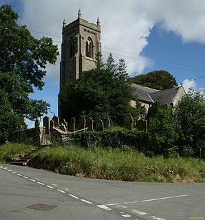
Nicholforest is a civil parish in the Carlisle district of Cumbria, England. It contains seven listed buildings that are recorded in the National Heritage List for England. Of these, one is listed at Grade II*, the middle of the three grades, and the others are at Grade II, the lowest grade. The parish is almost entirely rural, and the listed buildings consist of a country house that originated as a tower house, an outbuilding associated with it, a farmhouse and a barn, a milestone, a church, and a monument.

Orton is a civil parish in the Carlisle district of Cumbria, England. It contains twelve listed buildings that are recorded in the National Heritage List for England. Of these, one is listed at Grade II*, the middle of the three grades, and the others are at Grade II, the lowest grade. The parish contains the village of Great Orton, and the smaller settlements of Little Orton and Baldwinholme, and is otherwise rural. The listed buildings consist of farmhouses, farm buildings, houses and associated structures, a church, and a war memorial in the churchyard.

Rockcliffe is a civil parish in the Carlisle district of Cumbria, England. It contains 16 buildings that are recorded in the National Heritage List for England. Of these, one is listed at Grade I, the highest of the three grades, two are at Grade II*, the middle grade, and the others are at Grade II, the lowest grade. The parish contains the villages of Rockcliffe and Harker, and the surrounding countryside. The listed buildings include houses and associated structures, farmhouses and farm buildings, a church with a mediaeval cross in the churchyard, a public house, and a milestone.

Scaleby is a civil parish in the Carlisle district of Cumbria, England. It contains 16 buildings that are recorded in the National Heritage List for England. Of these, one is listed at Grade I, the highest of the three grades, and the others are at Grade II, the lowest grade. The parish contains the village of Scaleby, and is otherwise rural. The most important building in the parish is Scaleby Castle; this and associated structures are listed. The other listed buildings include houses, farmhouses and farm buildings, a church, a former chapel, a church hall, a war memorial, and a milestone.

Castle Sowerby is a civil parish in the Eden District, Cumbria, England. It contains 19 buildings that are recorded in the National Heritage List for England. Of these, one is listed at Grade I, the highest of the three grades, two are at Grade II*, the middle grade, and the others are at Grade II, the lowest grade. The parish is almost entirely rural, and most of the listed buildings are houses, farmhouses, and farm buildings scattered around the parish. The other listed buildings are a church and a bridge.

Ormside is a civil parish in the Eden District, Cumbria, England. It contains nine listed buildings that are recorded in the National Heritage List for England. Of these, one is listed at Grade I, the highest of the three grades, one is at Grade II*, the middle grade, and the others are at Grade II, the lowest grade. The parish contains the villages of Great Ormside and Little Ormside, and is otherwise rural. The most important buildings are an 11th-century church and a 14th-century hall; both of these and structures associated with them are listed. The other listed buildings are a house, farmhouses and farm buildings.

Shap is a civil parish in the Eden District, Cumbria, England. It contains 31 listed buildings that are recorded in the National Heritage List for England. Of these, one is listed at Grade II*, the middle of the three grades, and the others are at Grade II, the lowest grade. The parish contains the village of Shap, the hamlet of Keld, and the surrounding countryside. Most of the listed buildings are houses and associated structures, farmhouses and farm buildings. The other listed buildings include a church and items in the churchyard, a chapel, a hotel, a former market hall, a war memorial, and four mileposts.

Tebay is a civil parish in the Eden District, Cumbria, England. It contains nine listed buildings that are recorded in the National Heritage List for England. All the listed buildings are designated at Grade II, the lowest of the three grades, which is applied to "buildings of national importance and special interest". The parish contains the village of Tebay, but consists mainly of countryside and moorland. The River Lune passes through the parish, and two bridges crossing it are listed. The other listed buildings consist of farmhouses and farm buildings, a house, and a church with associated structures.

Broughton East is a civil parish in the South Lakeland District of Cumbria, England. It contains 20 listed buildings that are recorded in the National Heritage List for England. Of these, one is listed at Grade II*, the middle of the three grades, and the others are at Grade II, the lowest grade. The parish contains the village of Field Broughton and smaller settlements, and is otherwise rural. Most of the listed buildings are houses and associated structures, farmhouses and farm buildings. The other listed buildings consist of two folly towers, a milestone, an animal pound, a limekiln, and a church.

Cartmel Fell is a civil parish in the South Lakeland District of Cumbria, England. It contains 34 listed buildings that are recorded in the National Heritage List for England. Of these, three are listed at Grade I, the highest of the three grades, two are at Grade II*, the middle grade, and the others are at Grade II, the lowest grade. The parish is in the Lake District National Park, and is mainly rural. Most of the listed buildings are houses and associated structures, farmhouses and farm buildings. The other listed buildings include a church and items in the churchyard, bridges, a milestone, a war memorial, and a public house

Natland is a civil parish in the South Lakeland District of Cumbria, England. It contains 14 listed buildings that are recorded in the National Heritage List for England. Of these, one is listed at Grade II*, the middle of the three grades, and the others are at Grade II, the lowest grade. The parish contains the village of Natland, and is otherwise rural. The listed buildings include houses, farmhouses, farm buildings, bridges, a church, a milestone, and a boundary post.

Staveley-in-Cartmel is a civil parish in the South Lakeland District of Cumbria, England. It contains 22 listed buildings that are recorded in the National Heritage List for England. Of these, one is listed at Grade II*, the middle of the three grades, and the others are at Grade II, the lowest grade. The parish is in the Lake District National Park. It contains the villages of Staveley-in-Cartmel and Newby Bridge, and smaller settlements, but is mainly rural. In the parish is Fell Foot Park, a country park on the shore of Windermere; four buildings in this park have been listed. The other listed buildings include farmhouses, farm buildings, other houses, a milestone, a bridge, a church, and a sundial in the churchyard.

Strickland Ketel is a civil parish in the South Lakeland District of Cumbria, England. It contains 16 listed buildings that are recorded in the National Heritage List for England. All the listed buildings are designated at Grade II, the lowest of the three grades, which is applied to "buildings of national importance and special interest". The parish contains the villages of Burneside and Bowston, and is otherwise rural. The listed buildings consist of farmhouses, farm buildings, a country house and its folly gatehouse, smaller houses, a summer house, a bridge, a monument, and three milestones.

References

Citations

Sources

Historic England Executive non-departmental public body of the British Government, tasked with protecting the historical environment of England

Historic England is an executive non-departmental public body of the British Government sponsored by the Department for Culture, Media and Sport (DCMS). It is tasked with protecting the historical environment of England by preserving and listing historic buildings, ancient monuments and advising central and local government.

The National Heritage List for England (NHLE) is England’s official list of buildings, monuments, parks and gardens, wrecks, battlefields and World Heritage Sites. It is maintained by Historic England and brings together these different designations as a single resource even though they vary in the type of legal protection afforded to each. Conservation areas do not appear on the NHLE since they are designated by the relevant local planning authority.

Nikolaus Pevsner German-born British scholar

Sir Nikolaus Bernhard Leon Pevsner was a German, later British scholar of the history of art, especially of architecture.