Little River, Wisconsin

Last updated

Little River, Wisconsin
LittleRiverWisconsinSign.jpg
Sign for Little River
WIMap-doton-Little River.png
Location of Little River, Wisconsin
Coordinates: 44°57′25″N87°53′0″W / 44.95694°N 87.88333°W / 44.95694; -87.88333
Country Flag of the United States.svg  United States
State Flag of Wisconsin.svg  Wisconsin
County Oconto
Area
  Total51.5 sq mi (133.5 km2)
  Land51.5 sq mi (133.5 km2)
  Water0.0 sq mi (0.0 km2)
Elevation
[1]
663 ft (202 m)
Population
 (2000)
  Total1,065
  Density20.7/sq mi (8.0/km2)
Time zone UTC-6 (Central (CST))
  Summer (DST) UTC-5 (CDT)
FIPS code 55-45175 [2]
GNIS feature ID1583585 [1]

Little River is a town in Oconto County, Wisconsin, United States. The population was 1,065 at the 2000 census. The unincorporated communities of County Line and Cullen are located in the town.

Contents

Geography

According to the United States Census Bureau, the town has a total area of 51.5 square miles (133.5 km2), all of it land.

Demographics

As of the census [2] of 2000, there were 1,065 people, 407 households, and 293 families residing in the town. The population density was 20.7 people per square mile (8.0/km2). There were 457 housing units at an average density of 8.9 per square mile (3.4/km2). The racial makeup of the town was 97.37% White, 0.09% African American, 0.28% Native American, 0.66% Asian, 0.38% from other races, and 1.22% from two or more races. Hispanic or Latino of any race were 1.03% of the population.

There were 407 households, out of which 33.9% had children under the age of 18 living with them, 61.7% were married couples living together, 5.9% had a female householder with no husband present, and 27.8% were non-families. 22.4% of all households were made up of individuals, and 9.1% had someone living alone who was 65 years of age or older. The average household size was 2.62 and the average family size was 3.08.

In the town, the population was spread out, with 27.0% under the age of 18, 7.5% from 18 to 24, 26.4% from 25 to 44, 25.4% from 45 to 64, and 13.7% who were 65 years of age or older. The median age was 39 years. For every 100 females, there were 106.0 males. For every 100 females age 18 and over, there were 107.2 males.

The median income for a household in the town was $40,804, and the median income for a family was $44,938. Males had a median income of $30,388 versus $21,406 for females. The per capita income for the town was $17,576. About 6.4% of families and 11.3% of the population were below the poverty line, including 13.9% of those under age 18 and 12.1% of those age 65 or over.

Related Research Articles

<span class="mw-page-title-main">Holton, Indiana</span> Town in Indiana, United States

Holton is a town in Otter Creek Township, Ripley County, in the U.S. state of Indiana. The population was 480 at the 2010 census.

<span class="mw-page-title-main">Tama, Iowa</span> City in Iowa, United States

Tama is a city in Tama County, Iowa, United States. The population was 3,130 at the time of the 2020 census.

Winn is a town in Penobscot County, Maine, United States, on the east bank of the Penobscot River. The town was named for John M. Winn, an early landholder. The population was 399 at the 2020 census.

Embden is a town in Somerset County, Maine, United States. The population was 902 at the 2020 census.

Burr Oak Township is a civil township of St. Joseph County in the U.S. state of Michigan. As of the 2020 census, the township population was 2,639. The Village of Burr Oak is located within the township.

Bancroft Township is a township in Freeborn County, Minnesota, United States. The population was 1,065 at the 2000 census.

<span class="mw-page-title-main">Grantwood Village, Missouri</span> Town in Missouri, United States

Grantwood Village is a town in St. Louis County, Missouri, United States. The population was 863 at the 2010 census.

<span class="mw-page-title-main">Paynesville, Minnesota</span> City in Minnesota, United States

Paynesville is a city in Stearns County, Minnesota, United States, on Lake Koronis, in the central part of the state. The population was 2,388 at the 2020 census. It is part of the St. Cloud Metropolitan Statistical Area.

<span class="mw-page-title-main">Crosby, North Dakota</span> City in North Dakota

Crosby is a city in and the county seat of Divide County, North Dakota, United States. The population was 1,065 at the 2020 census.

<span class="mw-page-title-main">Gibsonburg, Ohio</span> Village in Ohio, United States

Gibsonburg is a village in Sandusky County, Ohio, United States, about 33 miles (53 km) southeast of Toledo. The population was 2,452 at the 2020 census. The National Arbor Day Foundation has designated Gibsonburg as a Tree City USA.

<span class="mw-page-title-main">New Boston, Ohio</span> Village in Ohio, United States

New Boston is a village in Scioto County, Ohio, United States, along the Ohio River. The population was 2,298 at the 2020 census. Apart from its southern boundary on the Ohio River, New Boston is entirely surrounded by the city of Portsmouth.

<span class="mw-page-title-main">Devola, Ohio</span> CDP in Ohio, United States

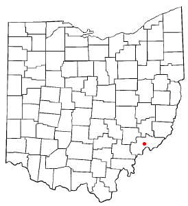
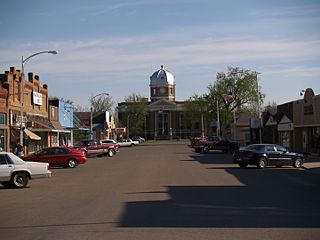
Devola is a census-designated place (CDP) in Washington County, Ohio, United States, along the Muskingum River. It is part of the Parkersburg-Marietta-Vienna, WV-OH Metropolitan Statistical Area. The population was 2,639 at the 2020 census.

<span class="mw-page-title-main">Colbert, Oklahoma</span> Town in Oklahoma, United States

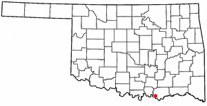
Colbert is a town in Bryan County, Oklahoma, United States. The population was 1,140 at the 2010 census, a 7 percent increase over the figure of 1,065 recorded in 2000. It was incorporated in 1939.

<span class="mw-page-title-main">Russellton, Pennsylvania</span> Census-designated place in Pennsylvania, United States

Russellton is a census-designated place (CDP) in Allegheny County, Pennsylvania, United States. The population was 1,330 at the 2020 census.

<span class="mw-page-title-main">Gilbert, West Virginia</span> Town in West Virginia, United States

Gilbert is a town in Mingo County, West Virginia, United States, along the Guyandotte River. The population was 333 at the 2020 census. Gilbert was incorporated in 1918 and named for Gilbert Creek, which derives its name from the name of an early traveler in the area who was killed by Native Americans. Gilbert is known nationwide for the Hatfield-McCoy ATV Trails that are located in the area. There are a number of lodges and restaurants in Gilbert.

<span class="mw-page-title-main">Ludington, Wisconsin</span> Town in Wisconsin, United States

Ludington is a town in Eau Claire County, Wisconsin, United States. The population was 1,023 at the 2010 census.

<span class="mw-page-title-main">Garfield, Polk County, Wisconsin</span> Town in Wisconsin, United States

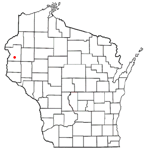
The Town of Garfield is located in Polk County, Wisconsin, United States. The population was 1,443 at the 2000 census. The unincorporated communities of Sand Lake, Ubet, and Wanderoos are located within the town.

<span class="mw-page-title-main">Jefferson, Vernon County, Wisconsin</span> Town in Wisconsin, United States

Jefferson is a town in Vernon County, Wisconsin, United States. The population was 974 at the 2000 census. The unincorporated communities of Bud, Esofea, and Springville are located with the town.

<span class="mw-page-title-main">Hudson, Wyoming</span> Town in Wyoming, United States

Hudson is a town in Fremont County, Wyoming, United States. The population was 458 at the 2010 census.

<span class="mw-page-title-main">North English, Iowa</span> City in Iowa, United States

North English is a city located mainly in Iowa county with a small portion in Keokuk county in the U.S. state of Iowa. The population was 1,065 at the time of the 2020 census. It is named for the English River.

References

  1. 1 2 "US Board on Geographic Names". United States Geological Survey. October 25, 2007. Retrieved January 31, 2008.
  2. 1 2 "U.S. Census website". United States Census Bureau . Retrieved January 31, 2008.