Sampson, Oconto County, Wisconsin

Last updated
Sampson, Wisconsin
SampsonOcontoCountyWisconsinSignLookingNorth.jpg
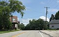
Looking north at the welcome sign for Sampson
USA Wisconsin location map.svg
Red pog.svg
Sampson, Wisconsin
Usa edcp location map.svg
Red pog.svg
Sampson, Wisconsin
Coordinates: 44°45′54″N88°11′10″W / 44.76500°N 88.18611°W / 44.76500; -88.18611
Country Flag of the United States.svg  United States
State Flag of Wisconsin.svg  Wisconsin
County Oconto
Elevation
240 m (787 ft)
Time zone UTC-6 (Central (CST))
  Summer (DST) UTC-5 (CDT)
Area code(s) 920
GNIS feature ID1573644 [1]

Sampson is an unincorporated community in Oconto County, Wisconsin, United States. [1] [2] The community is located at the intersection of Oconto County Highways C and D, in the town of Morgan. It is located at latitude 44.765 and longitude -88.186 and elevation 787 feet (mean sea level). [2] In the unincorporated limits there is The Hilltop Tavern, a county highway shop and Sampson Valley Vineyard.

the land that comprises Sampson is the terminal moraine of the last glaciation. Over 200 feet of rich glacial till is present attracting over 1/2 dozen gravel operations supplying many concrete and road building companies.

when the federal govt signed the last treaty with the Menominee nation in 1838 it paved the way for statehood. But the state and federal govt had very few settlers to tax. When the sturgeon bay ship canal was constructed, the federal govt paid the investors with this newly acquired land which included the land at Sampson. The investors then sold it to immigrants from mainly Poland and Germany looking to create farms.

Images

Related Research Articles

Shawano County, Wisconsin County in Wisconsin, United States

Shawano County is a county located in the U.S. state of Wisconsin. As of the 2020 census, the population was 40,881. Its county seat is Shawano.

Oconto County, Wisconsin County in Wisconsin, United States

Oconto County is a county in the U.S. state of Wisconsin. As of the 2020 census, the population was 38,965. Its county seat is Oconto. The county was established in 1851.

Menominee County, Wisconsin County in Wisconsin, United States

Menominee County is a county in the U.S. state of Wisconsin. As of the 2010 census, the population was 4,232 making it the least populous county in Wisconsin. Its county seat is in the community of Keshena.

Oconto, Nebraska Village in Nebraska, United States

Oconto is a village in Custer County, Nebraska, United States. The population was 151 at the 2010 census.

Pittsfield, Wisconsin Town in Wisconsin, United States

Pittsfield is a town in Brown County in the U.S. state of Wisconsin. The population was 2,608 at the 2010 census. The unincorporated communities of Anston, Kunesh, and Mill Center are located in the town. The unincorporated community of Pittsfield is also located partially in the town.

Breed, Wisconsin Town in Wisconsin, United States

Breed is a town in Oconto County, Wisconsin, United States. The population was 657 at the 2000 census. The unincorporated communities of Breed and Logan are located in the town.

Chase, Wisconsin Town in Wisconsin, United States

Chase is a town in Oconto County, Wisconsin The population was 2,082 at the time of the 2000 census. The unincorporated communities of Chase and South Chase are located in the town. The unincorporated community of Krakow is also located partially in the town.

Stiles, Wisconsin Town in Wisconsin, United States

Stiles is a town in Oconto County, Wisconsin, United States. The population was 1,465 at the 2000 census. The unincorporated communities of Stiles and Stiles Junction are located in the town. Situated within ancestral Menominee territory that was ceded to the United States in the 1836 Treaty of the Cedars, its Menominee name is Paehkuahkiw which means "pointed hillock".

Isaar, Wisconsin Unincorporated community in Wisconsin, United States

Isaar is a small unincorporated community in the Town of Seymour in Outagamie County, the United States, about 10 miles from Green Bay. Isaar has the same zip code as the City of Seymour and its schools are part of the Seymour Community School District.

Butte des Morts, Wisconsin Census-designated place in Wisconsin, United States

Butte des Morts is an unincorporated census-designated place in the town of Winneconne, in Winnebago County, Wisconsin, United States.

Pickerel, Wisconsin Unincorporated community in Wisconsin, United States

Pickerel is an unincorporated community in the northeast corner of Langlade County, Wisconsin, United States. The community is located on Wisconsin Highway 55, in the town of Langlade. Pickerel is 19 miles (31 km) northeast of Antigo, the county seat of Langlade County. Pickerel has a post office with ZIP code 54465. The community has a volunteer fire department, which also serves the town of Ainsworth and part of the town of Nashville in Forest County.

Center Valley, Wisconsin Unincorporated community in Wisconsin, United States

Center Valley is a small unincorporated farming community in the town of Center in Outagamie County, Wisconsin, United States. Center Valley lies 5 miles (8.0 km) north of the City of Appleton, and is served by the post office of Black Creek, which has the ZIP code 54106.

Sugar Bush is an unincorporated community located entirely within the town of Maple Creek in northwest Outagamie County, Wisconsin, United States. Sugar Bush is classified as a Class U6 Community by the USGS, being a populated place located wholly or substantially outside the boundaries of any incorporated place or CDP with a recognized authoritative common name.

Stephensville, Wisconsin Unincorporated community in Wisconsin, United States

Stephensville is a small unincorporated community located entirely within the town of Ellington in west-central Outagamie County, Wisconsin, United States. Stephensville is classified as a Class U6 Community by the USGS, being a populated place located wholly or substantially outside the boundaries of any incorporated place or CDP with a recognized authoritative common name.

Medina, Outagamie County, Wisconsin Unincorporated community in Wisconsin, United States

Medina, originally Young's Corner, is an unincorporated community in the Town of Dale in southwest Outagamie County, Wisconsin, United States. It is located 3.5 miles (5.6 km) south of the village of Hortonville, 11 miles (18 km) west of Appleton, and 20 miles (32 km) northwest of Oshkosh.

Lark, Wisconsin Unincorporated community in Wisconsin, United States

Lark is an unincorporated community in the town of Morrison, Brown County, Wisconsin, United States. It is located on Wisconsin Highway 96.

Klondike, Oconto County, Wisconsin Unincorporated community in Wisconsin, United States

Klondike is an unincorporated community in Oconto County, Wisconsin, United States. The community is located at the intersection of Oconto County Highways ZZ, B, and Z, in the town of Brazeau, Wisconsin. It is located at latitude 45.068 and longitude -88.16 and elevation 791 feet.

Mountain (CDP), Wisconsin Census-designated place in Wisconsin, United States

Mountain is an unincorporated census-designated place in Oconto County, Wisconsin, United States. The community is located at the intersection of Wisconsin Highway 32 and Wisconsin Highway 64, in the town of Mountain. It is located at latitude 45.185 and longitude -88.474 and elevation 971 feet. The postal code for Mountain is 54149. As of the 2010 census, its population is 363. Mountain has an area of 6.699 square miles (17.35 km2), all of it land.

County Line is an unincorporated community located on the border of Marinette and Oconto counties, in the U.S. state of Wisconsin. The Marinette County portion of the community is located in the town of Grover, while the Oconto County portion is located in the town of Little River. County Line is located on County Trunk Highway W near U.S. Highway 41, 6.5 miles (10.5 km) southwest of Peshtigo.

Oconto Falls High School Public high school in Oconto Falls, Wisconsin, USA

Oconto Falls High School is a public high school located in Oconto Falls, Wisconsin, United States. It is the only high school in the Oconto Falls School District, and had an enrollment of 506 for the 2016–2017 school year.

References

  1. 1 2 "Sampson". Geographic Names Information System . United States Geological Survey.
  2. 1 2 "Sampson, Oconto County, Wisconsin". Wisconsin Hometown Locator.

Coordinates: 44°45′54″N88°11′10″W / 44.76500°N 88.18611°W / 44.76500; -88.18611