Llanos, Aibonito, Puerto Rico

Last updated
Llanos
Barrio
Barrio Llanos, Aibonito, Puerto Rico.jpg
View from Llanos
Llanos, Aibonito, Puerto Rico locator map.png
Location of Llanos within the municipality of Aibonito shown in red
Caribbean location map.svg
Red pog.svg
Llanos
Location of Puerto Rico
Coordinates: 18°08′55″N66°17′02″W / 18.148589°N 66.283878°W / 18.148589; -66.283878 [1]
Commonwealth Flag of Puerto Rico.svg  Puerto Rico
Municipality Bandera de Aibonito, Puerto Rico.svg Aibonito
Area
[1]
  Total4.30 sq mi (11.1 km2)
  Land4.29 sq mi (11.1 km2)
  Water0.01 sq mi (0.03 km2)
Elevation
[2]
1,932 ft (589 m)
Population
 (2010)
  Total6,840
  Density1,594.4/sq mi (615.6/km2)
 Source: 2010 Census
Time zone UTC−4 (AST)

Llanos is a barrio in the municipality of Aibonito, Puerto Rico. Its population in 2010 was 6,840. [3] [4] [5]

Contents

History

Llanos was in Spain's gazetteers [6] until Puerto Rico was ceded by Spain in the aftermath of the Spanish–American War under the terms of the Treaty of Paris of 1898 and became an unincorporated territory of the United States. In 1899, the United States Department of War conducted a census of Puerto Rico finding that the combined population of Llanos and Algarrobo barrios was 1,226. [7]

Historical population
CensusPop.Note
1910 964
1920 1,19423.9%
1930 1,84954.9%
1940 1,9756.8%
1950 3,48976.7%
1960 3,153−9.6%
1970 0−100.0%
1980 4,516
1990 5,60124.0%
2000 6,92123.6%
2010 6,840−1.2%
U.S. Decennial Census
1900 (N/A) [8] 1910-1930 [9]
1930-1950 [10] 1980-2000 [11] 2010 [12]

Sectors

Barrios (which are, in contemporary times, roughly comparable to minor civil divisions) [13] in turn are further subdivided into smaller local populated place areas/units called sectores (sectors in English). The types of sectores may vary, from normally sector to urbanización to reparto to barriada to residencial, among others. [14] [15] [16]

The following sectors are in Llanos barrio: [17]

Barriada San Luis, Barrio Caonillas Oeste, Barrio Llanos Carretera, Barrio Llanos Rural Adentro, Carretera 162, Carretera 725, Estancias del Llano, Extensión San Luis, Panoramas Aibonito, Parcelas Nuevas, Paseo Lajita, Reparto Quiñones, Residencial Golden Village, Residencial Villa de la Rosa, Sector El Cerro, Sector El Juicio, Sector El Patio, Sector La Españolita, Sector Las Abejas, Sector Loma del Viento, Sector Los Llanos, Sector Mondragón, Sector Paseo Los Pinos, Sector Saturnino, Sector Toronjo, Sector Usabón, Urbanización Colinas del Paraíso, Urbanización Colinas de San Francisco, and Urbanización Santa Ana.

See also

Related Research Articles

<span class="mw-page-title-main">Cibao, San Sebastián, Puerto Rico</span> Barrio of Puerto Rico

Cibao is a barrio in the municipality of San Sebastián, Puerto Rico. Its population in 2010 was 1,224.

<span class="mw-page-title-main">Aibonito, San Sebastián, Puerto Rico</span> Barrio of Puerto Rico

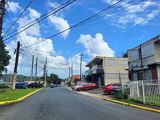
Aibonito is a barrio in the municipality of San Sebastián, Puerto Rico. Its population in 2010 was 1,972.

<span class="mw-page-title-main">Calabazas, San Sebastián, Puerto Rico</span> Barrio of Puerto Rico

Calabazas is a barrio in the municipality of San Sebastián, Puerto Rico. Its population in 2010 was 2,768.

<span class="mw-page-title-main">Candelaria, Toa Baja, Puerto Rico</span> Barrio of Puerto Rico

Candelaria is a barrio in the municipality of Toa Baja, Puerto Rico. Its population in 2010 was 23,343.

<span class="mw-page-title-main">Algarrobo, Aibonito, Puerto Rico</span> Barrio of Puerto Rico

Algarrobo is a barrio in the municipality of Aibonito, Puerto Rico. Its population in 2010 was 383.

<span class="mw-page-title-main">Cuyón, Aibonito, Puerto Rico</span> Barrio of Puerto Rico

Cuyón is a barrio in the municipality of Aibonito, Puerto Rico. Its population in 2010 was 977.

<span class="mw-page-title-main">Pasto, Aibonito, Puerto Rico</span> Barrio of Puerto Rico

Pasto is a barrio in the municipality of Aibonito, Puerto Rico. Its population in 2010 was 4,184.

<span class="mw-page-title-main">Plata, Aibonito, Puerto Rico</span> Barrio of Puerto Rico

Plata is a barrio in the municipality of Aibonito, Puerto Rico. Its population in 2010 was 1,724.

<span class="mw-page-title-main">Robles, Aibonito, Puerto Rico</span> Barrio of Puerto Rico

Robles is a barrio in the municipality of Aibonito, Puerto Rico. Its population in 2010 was 3,863.

<span class="mw-page-title-main">Villalba Abajo</span> Barrio of Villalba, Puerto Rico

Villalba is a barrio in the municipality of Villalba, Puerto Rico. Its population in 2010 was 2,880.

<span class="mw-page-title-main">Contorno, Toa Alta, Puerto Rico</span> Barrio of Puerto Rico

Contorno is a barrio in the municipality of Toa Alta, Puerto Rico. Its population in 2010 was 4,737.

<span class="mw-page-title-main">Hormigueros, Hormigueros, Puerto Rico</span> Barrio of Puerto Rico

Hormigueros is a barrio in the municipality of Hormigueros, Puerto Rico. Its population in 2010 was 4,358. There is also a barrio called Hormigueros barrio-pueblo, with the administrative center and seat of this municipality.

<span class="mw-page-title-main">Camaceyes, Aguadilla, Puerto Rico</span> Barrio of Puerto Rico

Camaceyes is a barrio in the municipality of Aguadilla, Puerto Rico. Its population in 2010 was 12,547. In Camaceyes barrio is part of the Aguadilla urban zone.

<span class="mw-page-title-main">Corrales, Aguadilla, Puerto Rico</span> Barrio of Puerto Rico

Corrales is a rural barrio in the municipality of Aguadilla, Puerto Rico. Its population in 2010 was 7,659. In Corrales barrio is Cabán, a comunidad.

<span class="mw-page-title-main">Asomante, Aguada, Puerto Rico</span> Barrio of Puerto Rico

Asomante is a barrio in the municipality of Aguada, Puerto Rico. Its population in 2010 was 3,177.

<span class="mw-page-title-main">Asomante, Aibonito, Puerto Rico</span> Barrio of Puerto Rico

Asomante is a barrio in the municipality of Aibonito, Puerto Rico. Its population in 2010 was 2,966.

<span class="mw-page-title-main">Monte Llano, Morovis, Puerto Rico</span> Barrio of Puerto Rico

Monte Llano is a barrio in the municipality of Morovis, Puerto Rico. Monte Llano has about 15 sectors and its population in 2010 was 2,948.

<span class="mw-page-title-main">San José, Quebradillas, Puerto Rico</span> Barrio of Puerto Rico

San José is a barrio in the municipality of Quebradillas, Puerto Rico. Its population in 2010 was 2,986.

References

  1. 1 2 "US Gazetteer 2019". US Census. US Government.
  2. U.S. Geological Survey Geographic Names Information System: Llanos barrio
  3. Picó, Rafael; Buitrago de Santiago, Zayda; Berrios, Hector H. Nueva geografía de Puerto Rico: física, económica, y social, por Rafael Picó. Con la colaboración de Zayda Buitrago de Santiago y Héctor H. Berrios. San Juan Editorial Universitaria, Universidad de Puerto Rico,1969.
  4. Gwillim Law (20 May 2015). Administrative Subdivisions of Countries: A Comprehensive World Reference, 1900 through 1998. McFarland. p. 300. ISBN   978-1-4766-0447-3 . Retrieved 25 December 2018.
  5. Puerto Rico: 2010 Population and Housing Unit Counts.pdf (PDF). U.S. Dept. of Commerce, Economics and Statistics Administration, U.S. Census Bureau. 2010.
  6. "Anuario del comercio, de la industria, de la magistratura y de la administración. 1881". Biblioteca Nacional de España (in Spanish). p. 1614. Retrieved 4 April 2023.
  7. Joseph Prentiss Sanger; Henry Gannett; Walter Francis Willcox (1900). Informe sobre el censo de Puerto Rico, 1899, United States. War Dept. Porto Rico Census Office (in Spanish). Imprenta del gobierno. p.  164.
  8. "Report of the Census of Porto Rico 1899". War Department Office Director Census of Porto Rico. Archived from the original on July 16, 2017. Retrieved September 21, 2017.
  9. "Table 3-Population of Municipalities: 1930 1920 and 1910" (PDF). United States Census Bureau. Archived (PDF) from the original on August 17, 2017. Retrieved September 21, 2017.
  10. "Table 4-Area and Population of Municipalities Urban and Rural: 1930 to 1950" (PDF). United States Census Bureau. Archived (PDF) from the original on August 30, 2015. Retrieved September 21, 2014.
  11. "Table 2 Population and Housing Units: 1960 to 2000" (PDF). United States Census Bureau. Archived (PDF) from the original on July 24, 2017. Retrieved September 21, 2017.
  12. Puerto Rico: 2010 Population and Housing Unit Counts.pdf (PDF). U.S. Dept. of Commerce Economics and Statistics Administration U.S. Census Bureau. 2010. Archived (PDF) from the original on 2017-02-20. Retrieved 2019-08-02.
  13. "US Census Barrio-Pueblo definition". factfinder.com. US Census. Archived from the original on 13 May 2017. Retrieved 5 January 2019.
  14. "Agencia: Oficina del Coordinador General para el Financiamiento Socioeconómico y la Autogestión (Proposed 2016 Budget)". Puerto Rico Budgets (in Spanish). Retrieved 28 June 2019.
  15. Rivera Quintero, Marcia (2014), El vuelo de la esperanza: Proyecto de las Comunidades Especiales Puerto Rico, 1997-2004 (first ed.), San Juan, Puerto Rico Fundación Sila M. Calderón, ISBN   978-0-9820806-1-0
  16. "Leyes del 2001". Lex Juris Puerto Rico (in Spanish). Retrieved 24 June 2020.
  17. "PRECINTO ELECTORAL AIBONITO 069" (PDF). Comisión Estatal de Elecciones (in Spanish). PR Government. 21 September 2019. Retrieved 2 July 2019.